State Highway 87 (Karnataka)
 87
| |
|---|---|
 | |
| Route information | |
|
Maintained by Karnataka Public Works Department, | |
| Length | 49.0 km (30.4 mi) |
| Major junctions | |
| North end | Adugodi |
| Arekere, Hulimavu, Gottigere, Bannerghatta National Park, Jigani | |
| South end | Anekal, Bangalore urban district |
| Highway system | |
Bannerghatta Road ( ಬನ್ನೇರ್ಘಟ್ಟ ರೋಡ್, commonly known as BG Road) is an Indian State Highway in Karnataka that connects Bangalore with towns of Bannerghatta, Jigani and Anekal. It has a total length of 49 kilometres (30 mi).[1] It starts as a branch from Hosur Road near the Adugodi Christian cemetery and ends at Anekal town.
Upgrading
In 2011, the Bruhat Bangalore Mahanagara Palike announced that the road would be widened in several places and underpasses and flyovers would be built at major junctions.[2]
The Government of Karnataka has also cleared the second phase of Namma Metro which proposes a third line from Gottigere to Nagavara via the Indian Institute of Management Bangalore (IIM-B). The project has been designed to significantly reduce the traffic load on Bannerghatta Road and is considered particularly important, as the area continues to develop as an urban centre (including the introduction of new apartment complexes and shopping malls). However, further clearances from the Central Government are required before the renovations can commence.
Under upgrade plans, the road will be widened to 45 metres from its present width of 20-25 metres at an estimated cost of ₹137 crore (US$19 million).[3]
Main junctions
The main junctions and traffic hotspots on this road are at Adugodi, Dairy Circle, Sagar Hospital, Gurappanapalya, Sri Jayadeva Institute of Cardiology, N. S. Palya, Bilekahalli, Arekere Gate, Hulimavu Gate, Gottigere, Bannerghatta Circle, Koppa Gate and Jigani Industrial Area. The NICE BMIC peripheral ring road cuts this road a little beyond Gottigere. In one of the first private-public partnerships in the city, South Avenue, Bannerghatta Road has been widened to four lanes by Mantri Developers, for approximately five kilometers south of Jayadeva underpass. The Diary Circle and the Jayadeva grade separators are on this road. Bannerghatta Road also has intersections with many major roads, such as Hosur Road, Outer Ring Road, and NICE Road.
Religious places
- Sri Sri Meenakshi Sundareshwara Temple
- Santhome Parish Church
- Bilal Masjid
Educational institutions

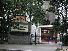
The prestigious Indian Institute of Management Bangalore located between Bilekahalli and Arekere. Christ University is located a few meters away from Dairy Circle and the School of Business Studies and Social Sciences campus is located at Hulimavu. Near south end of B.G.Road Padma Seshadri Bala Bhavan is located, Sherwood High(http://sherwoodhigh.com/) is located near the NICE road intersection. An all boys boarding school Sarala Birla Academy is also located on BG road, close to the Bannerghatta National Park
Hospitals
Major hospitals are located on this road.

- Sri Jayadeva Institute of Cardiology
- Apollo Hospitals near Arekere junction
- Fortis Healthcare (previously known as Wockhardt Hospital) near Arekere Junction
Malls
A lot of malls can be found on Banneghatta Road.
- Gopalan Mall, near Sri Jayadeva Institute of Cardiology
- Vega City Mall, near outer ring road and Bannerghatta road T Junction
- Royal Meenakshi Mall, near royal hermitage
- Shoppers Stop
- Brand Factory
References
- ↑ "Details Of State Highways". Karnataka PWD. Archived from the original on 2011-07-21. Retrieved 2012-08-19.
- ↑ Rao, Sunitha (2011-06-09). "Bannerghatta Road will be stretched to 45 metres". Times of India. Retrieved 2012-08-18.
- ↑ BharadwajBengaluru, K.V. Aditya. "Delay in TDR policy holds up work on Namma Metro". The Hindu. Retrieved 2 March 2017.