Kyburz, California
Coordinates: 38°46′29″N 120°17′49″W / 38.77472°N 120.29694°W
| Kyburz | |
|---|---|
| Unincorporated community | |
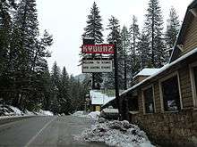 The town as seen heading eastbound on US-50 | |
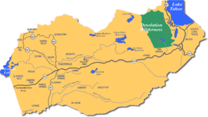 Kyburz along US-50 in a map of El Dorado County | |
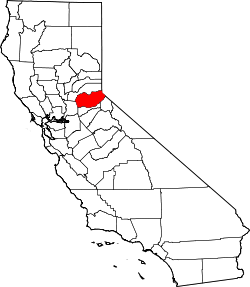
 Kyburz Location in California | |
| Coordinates: 38°46′29″N 120°17′49″W / 38.77472°N 120.29694°W | |
| Country |
|
| State | California |
| County | El Dorado |
| Elevation[1] | 1,237 m (4,058 ft) |
| Population (2000)[2] | |
| • Total | 167 |
| Time zone | UTC-8 (Pacific (PST)) |
| • Summer (DST) | UTC-7 (PDT) |
| ZIP code | 95720 |
| Area code(s) | 530 |
Kyburz (formerly, Slippery Ford and Slipperyford)[3] is a small unincorporated community in El Dorado County, California. It is located along the South Fork of the American River and U.S. Route 50, and is surrounded by the Eldorado National Forest. Its elevation is 4058 feet (1237 m) above sea level.[1]
Settlement began a mile west at Webster’s Sugar Loaf House as a remount station for the pony express on April 3, 1860.[4] The route ran through were US 50 locally is today.[5] The Slippery Ford post office opened in 1861. The name was changed to Slipperyford in 1896, and to Kyburz in 1911, by its Postmaster Albert Kyburz, in memory of his father Samuel Kyburz, who was an early California pioneer with John Sutter.[6][6] The locale was along the Lincoln Highway Sierra Nevada Southern Route by 1916.
Ski racer Spider Sabich grew up in Kyburz, where his father, Vladimir, Sr., was stationed with the California Highway Patrol. Spider and his younger brother Steve raced at the Edelweiss ski area, which closed in the 1960s, and is now known as Camp Sacramento.
Demographics
As of the 2000 Census the population was 167, although the road sign on Highway 50 stated 139 as of 2008.[2] This included 86 males and 81 females, 65 males age 18 and older, 66 females age 18 and older, 11 males age 65 or older, and 16 females age 65 or older.[7][8] The median age was 45.5, and people age 18 and older numbered 131, age 21 and over 128, and age 65 and over 27.[8]
Notes
- 1 2 U.S. Geological Survey Geographic Names Information System: Kyburz, California
- 1 2 Relocation Now, General Population, retrieved 2008-02-19
- ↑ Durham, David L. (1998). California's Geographic Names: A Gazetteer of Historic and Modern Names of the State. Clovis, Calif.: Word Dancer Press. p. 509. ISBN 1-884995-14-4.
- ↑ "CHL No. 706 Pony Express: Webster's Sugar Loaf House - El Dorado". CaliforniaHistoricalLandmarks.com. CaliforniaHistoricalLandmarks. Retrieved 6 July 2018.
the site of Webster's Sugar Loaf House, [a] well-known stopping place during the Comstock rush. Beginning in April 1860, it was used as a remount station of the Central Overland Pony Express, and in 1861 it became a horse change station for pioneer stage companies and the Overland Mail.
- ↑ "Webster's Sugar Loaf House- Overland Pony Express Route in California (No. 706 California Historical Landmark)". Sierra Nevada Geotourism. National Geographic. Retrieved 6 July 2018.
The Pony Express Trail ran through the county approximately where Highway 50 is today, from April 3, 1860 to October 26, 1861.
- 1 2 http://www.cagenweb.com/eldorado/people/biographies/samuel_kyburz.html
- ↑ Relocation Now, Gender, retrieved 2008-02-19
- 1 2 Relocation Now, Age Groups, retrieved 2008-02-19
| Wikimedia Commons has media related to Kyburz, California. |