Strathcona County
| Strathcona County | ||
|---|---|---|
| Specialized municipality | ||
| ||
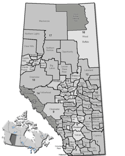 Location of Strathcona County in Alberta | ||
| Coordinates: 53°31′24″N 113°18′32″W / 53.52333°N 113.30889°WCoordinates: 53°31′24″N 113°18′32″W / 53.52333°N 113.30889°W | ||
| Country | Canada | |
| Province | Alberta | |
| Region | Edmonton Capital Region | |
| Census division | No. 11 | |
| - Municipal district | 1943 | |
| - Specialized municipality | January 1, 1996 | |
| Government[1] | ||
| • Mayor | Rod Frank | |
| • Governing body |
Strathcona County Council
| |
| • Commissioner | Rob Coon | |
| • Office location | Sherwood Park | |
| Area (2016)[2] | ||
| • Land | 1,182.78 km2 (456.67 sq mi) | |
| Population (2016)[2] | ||
| • Total | 98,044 | |
| • Density | 82.9/km2 (215/sq mi) | |
| • Municipal census (2015) | 95,597[3] | |
| Time zone | UTC-7 (MST) | |
| • Summer (DST) | UTC-6 (MDT) | |
| Website | strathcona.ca | |
Strathcona County is a specialized municipality in central Alberta, Canada between Edmonton and Elk Island National Park.
It is located in Division No. 11 and is also part of the Edmonton Census Metropolitan Area. More than half of the population lives in Sherwood Park, a large community east of Edmonton that has opted to retain hamlet status. Strathcona County was designated as a specialized municipality on January 1, 1996, in order to accommodate the specific needs of an area that includes both urban and rural territory.[4]
History
First officially recognized in 1893 by the territorial legislature (it was then part of the North West Territories) as Statute Labour District #2, Strathcona County has changed immensely since its inception. In 1913 Statute Labour District #2 was renamed to Local Improvement District #517 (Clover Bar), which then, in 1943, merged with Local Improvement District #518 (Strathcona) to become Municipal District #83 (Strathcona). By joining with local school divisions in 1962, Municipal District #83 officially became a county. County status was subsequently revoked in 1995 when the County Act was repealed by the provincial legislature, but was quickly returned in 1996 when the County of Strathcona #20 officially changed its name to Strathcona County and received Specialized Municipality status.[4]
On March 29, 2007, Strathcona County announced plans to create an entirely new urban community from scratch to complement Sherwood Park. This development is supposed to be more dense and pedestrian friendly, and could hold up to 200,000 people. However, opponents have pointed out that the development will destroy land of high agricultural value.[5]
Demographics
In the 2016 Census of Population conducted by Statistics Canada, Strathcona County recorded a population of 98,044 living in 35,567 of its 36,354 total private dwellings, a change of 6% from its 2011 population of 92,490. With a land area of 1,182.78 km2 (456.67 sq mi), it had a population density of 82.9/km2 (214.7/sq mi) in 2016.[2]
The population of Strathcona County according to its 2015 municipal census is 95,597, a change of 3.5% from its 2012 municipal census population of 92,403.[3]
In the 2011 Census, Strathcona County had a population of 92,490 living in 33,129 of its 34,136 total dwellings, a change of 12.1% from its 2006 population of 82,511. With a land area of 1,180.56 km2 (455.82 sq mi), it had a population density of 78.3/km2 (202.9/sq mi) in 2011.[6]
Geography
Major highways
Sherwood Park Freeway
Airports
Strathcona County is home to two public airports.
Cooking Lake Airport is the County's main public airport, serving 87 per cent of its public aeronautical transportation needs.[7] It is also the oldest operating public airport in all of Canada and approved for international flights under the Canada Border Services Agency CANPASS program.[8]
The Warren Thomas Aerodrome, better known as the Josephberg Airport, serves the remaining 13 per cent of the County's public aeronautical transportation needs.
Communities and localities
|
The following urban municipalities are surrounded by Strathcona County.
|
The following hamlets are located within Strathcona County.[10]
|
The following localities are located within Strathcona County.[11]
- Localities
|
|
|
|
Government
Unlike most Albertan municipal districts, where council appoints a reeve, Strathcona County elects a mayor. Rod Frank was elected in 2017,[12] replacing Roxanne Carr who was elected in 2013.
See also
References
- ↑ "Municipal Officials Search". Alberta Municipal Affairs. September 22, 2017. Retrieved September 25, 2017.
- 1 2 3 "Population and dwelling counts, for Canada, provinces and territories, and census subdivisions (municipalities), 2016 and 2011 censuses – 100% data (Alberta)". Statistics Canada. February 8, 2017. Retrieved February 8, 2017.
- 1 2 "Census: Strathcona County Historical Population". Strathcona County. September 4, 2015. Retrieved September 5, 2015.
- 1 2 Municipality Profile - Alberta Municipal Affairs
- ↑ New city rising
- ↑ "Population and dwelling counts, for Canada, provinces and territories, and census subdivisions (municipalities), 2011 and 2006 censuses (Alberta)". Statistics Canada. 2012-02-08. Retrieved 2012-02-08.
- ↑ Johannsson, Jim (August 10, 2018). "Airport continues fight on taxes". Sherwood Park News. Retrieved September 1, 2018.
- ↑ Westhaver, Eric (September 23, 2015). "Edmonton-area airport now accepting international flights". Global News. Retrieved September 1, 2018.
- ↑ "Fort Saskatchewan, City (Census Subdivision), Alberta". Statistics Canada. 2012-06-20. Retrieved 2012-08-13.
- 1 2 3 4 "Specialized and Rural Municipalities and Their Communities" (PDF). Alberta Municipal Affairs. 2012-03-01. Retrieved 2012-08-11.
- ↑ "Standard Geographical Classification (SGC) 2006, Economic Regions: 4811052 - Strathcona County, geographical codes and localities, 2006". Statistics Canada. 2010-03-05. Retrieved 2012-08-11.
- ↑ "2017 Election Results". Strathcona County. Retrieved 19 October 2017.
External links
| Wikimedia Commons has media related to Strathcona County. |
Places adjacent to Strathcona County | |
|---|---|