South Cooking Lake
| South Cooking Lake | |
|---|---|
| Hamlet | |
 Cooking Lake | |
 Location of South Cooking Lake | |
| Coordinates: 53°24′40.13″N 113°07′05.47″W / 53.4111472°N 113.1181861°W | |
| Country |
|
| Province |
|
| Region | Edmonton Region |
| Census division | 11 |
| Specialized municipality | Strathcona County |
| Settled | 1931 |
| Government | |
| • Type | Unincorporated |
| • Mayor | Rod Frank |
| • Governing body |
Strathcona County Council
|
| Elevation | 737 m (2,418 ft) |
| Population (2011)[1] | |
| • Total | 288 |
| Time zone | UTC-7 (MST) |
| • Summer (DST) | UTC-6 (MDT) |
| Postal code span | T8G |
| Area code(s) | +1-780 |
| Highways | Highway 14 |
| Website | Strathcona County |
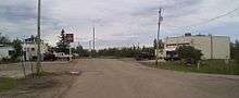
South Cooking Lake is a hamlet in Alberta, Canada within Strathcona County.[2] It is located on Highway 14, approximately 19 km (12 mi) southeast of Sherwood Park.
The Cree, Blackfoot and the Sarcee were the first to inhabit the area, and that is where the name originally came from. Cooking Lake was fished commercially until 1926. Large numbers of buffalo, lynx, fox, mink, muskrat, elk, deer, moose, wolves, coyotes, and black bears roamed the area.
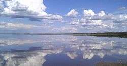
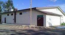
Today it is still possible to see a variety of wildlife and birds throughout the area. There is a day-use park, which is a great place for family picnics, boating, and windsurfing. There is a boat launch, walking trails, picnic sites, and waterfowl viewing areas. The community hall has been completely renovated and is available for rent.[3]
Demographics
As a designated place in the 2016 Census of Population conducted by Statistics Canada, South Cooking Lake recorded a population of 241 living in 105 of its 117 total private dwellings, a change of −16.3% from its 2011 population of 288. With a land area of 2.3 km2 (0.89 sq mi), it had a population density of 104.8/km2 (271.4/sq mi) in 2016.[4]
The population of South Cooking Lake according to Strathcona County's 2015 municipal census is 302.[5]
As a designated place in the 2011 Census, South Cooking Lake had a population of 288 living in 122 of its 140 total dwellings, a -1.4% change from its 2006 population of 292. With a land area of 2.27 km2 (0.88 sq mi), it had a population density of 126.9/km2 (328.6/sq mi) in 2011.[1]
Transportation
Edmonton/Cooking Lake Airport is located nearby and serves the community.
See also
References
- 1 2 "Population and dwelling counts, for Canada, provinces and territories, and designated places, 2011 and 2006 censuses (Alberta)". Statistics Canada. 2012-02-08. Retrieved 2012-04-07.
- ↑ Alberta Municipal Affairs (2010-04-01). "Specialized and Rural Municipalities and Their Communities" (PDF). Retrieved 2010-07-04.
- ↑ South Cooking Lake Archived 2008-05-17 at the Wayback Machine.
- ↑ "Population and dwelling counts, for Canada, provinces and territories, and designated places, 2016 and 2011 censuses – 100% data (Alberta)". Statistics Canada. February 8, 2017. Retrieved February 13, 2017.
- ↑ "Census 2015: Overall Results" (PDF). Strathcona County. p. 4. Retrieved June 1, 2016.
Coordinates: 53°24′40.13″N 113°07′05.47″W / 53.4111472°N 113.1181861°W