Sava Bohinjka
| Sava Bohinjka | |
|---|---|
 | |
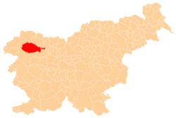
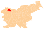
| Country | Slovenia |
| Physical characteristics | |
| River mouth |
Sava 46°20′39″N 14°09′19″E / 46.3442°N 14.1553°ECoordinates: 46°20′39″N 14°09′19″E / 46.3442°N 14.1553°E |
| Length | 41 km (25 mi) [1] |
| Basin features | |
| Progression | Sava→ Danube→ Black Sea |
| Basin size | 388 km2 (150 sq mi) [1] |
The Sava Bohinjka is a headwater of the Sava River in northwestern Slovenia. At 41 kilometres (25 mi) in length,[1] it is the shorter of the two headwaters that become the Sava River in Radovljica, the other being the 45 km (28 mi)-long Sava Dolinka.
Course
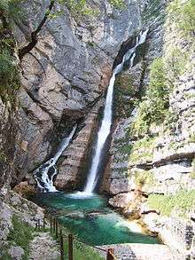
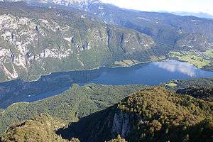
The Sava Bohinjka originates under the Komarča Crag at an elevation of 805 m (2,641 ft), from springs fed by the Triglav Lakes Valley. Until it reaches Lake Bohinj, the river is known as the Savica ('little Sava'), and features the 60 m (200 ft)-high Savica Falls (Slovene: slap Savica) at its source.[2] It then flows through the Ukanc Gorge, where the 3 MW Savica power plant is located, before flowing into Lake Bohinj, where it creates a small delta. It flows from Lake Bohinj as the Sava Bohinjka through Bohinjska Bistrica, Bohinjska Bela, and close to Lake Bled, before meeting the Sava Dolinka near Radovljica.
References
- 1 2 3 Rivers, longer than 25 km, and their catchment areas, Statistical Office of the Republic of Slovenia
- ↑ Baedeker, Karl (1879) "Terglou: The Valley of the Wocheiner Save" The Eastern Alps: Including the Bavarian Highlands, the Tyrol, Salzkammergut, Styria, and Carinthia (4th ed.) Dulau and Co., London, p. 353, OCLC 4018143
External links

- Condition of Sava Bohinjka at Sveti Janez and Bodešče - graphs, in the following order, of water level, flow and temperature data for the past 30 days (taken at Sveti Janez and Bodešče by ARSO)
Hydrography of Slovenia | ||
|---|---|---|
| Rivers |
|  |
| Streams | ||
| Waterfalls | ||
| Lakes | ||
| Wetlands | ||
| Sea | ||
| River valleys |
| |
| Canyons and gorges |
| |