Oplotniščica
| Oplotniščica | |
|---|---|
| Other name(s) | Oplotnica |
| Country | Austria, Slovenia |
| Physical characteristics | |
| River mouth |
Dravinja 46°19′22″N 15°29′28″E / 46.32278°N 15.49111°ECoordinates: 46°19′22″N 15°29′28″E / 46.32278°N 15.49111°E |
| Length | 28 km (17 mi) [1] |
| Basin features | |
| Progression | Dravinja→ Drava→ Danube→ Black Sea |
| Basin size | 86 km2 (33 sq mi) [1] |
The Oplotniščica or Oplotnica[2] is a river in Styria, Slovenia. The river is 28 kilometres (17 mi) in length.[1] Its source is on the Pohorje Massif, northeast of Mount Rogla. It passes Osankarica, Lukanja, and Cezlak, runs through Oplotnica and Tepanje, and then merges with the Dravinja near Žiče.
References
- 1 2 3 Rivers, longer than 25 km, and their catchment areas, Statistical Office of the Republic of Slovenia
- ↑ Natek, Milan. 1979. Poplavna območja v Spodnji Savinjski dolini. Geografski zbornik: Acta geographica 18 (1978): 7—91, p. 13.
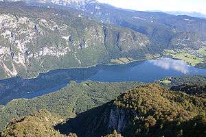
 Oplotnica Gorge


Hydrography of Slovenia | ||
|---|---|---|
| Rivers |
|  |
| Streams | ||
| Waterfalls | ||
| Lakes | ||
| Wetlands | ||
| Sea | ||
| River valleys |
| |
| Canyons and gorges |
| |
This article is issued from
Wikipedia.
The text is licensed under Creative Commons - Attribution - Sharealike.
Additional terms may apply for the media files.