Dreta
| Dreta | |
|---|---|
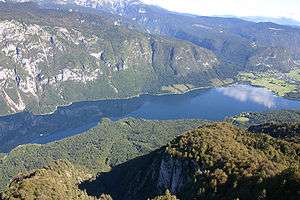
 The Dreta west of Bočna | |
| Country | Slovenia |
| Physical characteristics | |
| Main source | 1,100 m (3,600 ft) [1] |
| River mouth |
Savinja 339 m (1,112 ft) [1] 46°19′16″N 14°57′07″E / 46.3212°N 14.9519°ECoordinates: 46°19′16″N 14°57′07″E / 46.3212°N 14.9519°E |
| Length | 29 km (18 mi) [1] |
| Basin features | |
| Progression | Savinja→ Sava→ Danube→ Black Sea |
| Basin size | 126 km2 (49 sq mi) [1] |
The Dreta (pronounced [ˈdɾeːta]) is a river in Styria, northeastern Slovenia. The river is 29 km (18 mi) long.[1] Its source is near the Črnivec Pass in the Kamnik Alps. It flows through the town of Gornji Grad, Bočna, and Šmartno ob Dreti, and merges with the Savinja River in Nazarje. The Dreta Valley (Slovene: Zadrečka dolina) is named after the river.[2]
Name
The Dreta was attested in written sources in 1243 as super fluvio Driete (and as pey der Driet in 1340, Driete in 1430, and Trijet in 1524). The origin of the name is uncertain, but is likely connected with the Croatian hydronym Dretulja and the Slovak hydronym and place name Drietoma. It may be derived from the Indo-European root *dreu̯- 'to flow'.[2]
References
- 1 2 3 4 5 Rivers, longer than 25 km, and their catchment areas, Statistical Office of the Republic of Slovenia
- 1 2 Snoj, Marko. 2009. Etimološki slovar slovenskih zemljepisnih imen. Ljubljana: Modrijan and Založba ZRC, p. 126.
External links

Hydrography of Slovenia | ||
|---|---|---|
| Rivers |
|  |
| Streams | ||
| Waterfalls | ||
| Lakes | ||
| Wetlands | ||
| Sea | ||
| River valleys |
| |
| Canyons and gorges |
| |
This article is issued from
Wikipedia.
The text is licensed under Creative Commons - Attribution - Sharealike.
Additional terms may apply for the media files.