Sandakphu
| Sandakphu | |
|---|---|
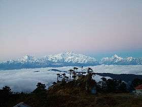 View from Sandakphu in West Bengal | |
| Highest point | |
| Elevation | 3,636 m (11,929 ft) |
| Listing | List of Indian states and territories by highest point |
| Coordinates | 27°6′21″N 88°0′6″E / 27.10583°N 88.00167°ECoordinates: 27°6′21″N 88°0′6″E / 27.10583°N 88.00167°E [1] |
| Geography | |
 Sandakphu Location of Sandakphu peak 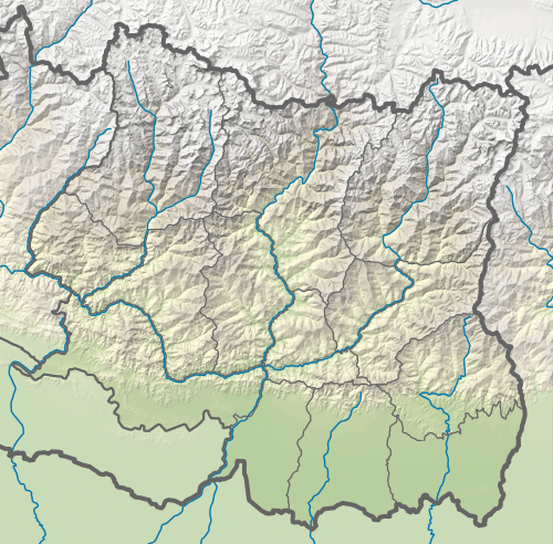 Sandakphu Sandakphu (Province No. 1) | |
| Location | Darjeeling district, West Bengal, India / Ilam district, Mechi, Nepal |
| Parent range | Singalila Ridge |
| Topo map | Google topographic map[2] |
| Climbing | |
| Easiest route | Hiking or by car |

Sandakphu or Sandakfu or Sandakpur (3636 m; 11,930 ft) is the highest peak in the district of Ilam, Nepal and West Bengal, India. It is the highest point of the Singalila Ridge in Darjeeling district on the West Bengal-Nepal border. The peak is located at the edge of the Singalila National Park and has a small village on the summit with a few hostels. Four of the five highest peaks in the world, Everest, Kangchenjunga, Lhotse and Makalu can be seen from its summit.[3] It also affords a pristine view of the entire Kangchenjunga Range.
Trekking
Nepal
The western part of Sandakphu peak is located in Sandakpur rural municipality (ward no. 2 & 4) of Ilam District of Province No. 1.
The trekking starts from Ilam Bazar via Maipokhari, Maimajhuwa, Mabu, Kala Pokhri Bikhe Bhyanjyang to Sandakpur. And also from ilam Bazar via sulubung, jamuna, hangetham (special for birds like spiny babbler, blue tit etc.), piple, kalipokhari, bikhe vanjyang to sandakpur. In this treaking route jamuna is most valuable for trekkers. There were many beautiful places like dhap pokhari, choyatar (special for red panda). There was a three jungle hile samudayik ban, choyatar samudayik ban, hangetham samudayik ban.
India
The trek along the Singalila Ridge to Sandakphu and Phalut is one of the most popular ones in the Eastern Himalayas due to the grand vistas of the Kangchenjunga range and the Everest range which can be seen from the ridge, and also for the seasonal wildflower blooms and birding. Treks begin at Manebhanjan which is 28 km (approx. 1 hour by road) from Darjeeling.[4]
Ascent
The trekking routes inside the Singalila National Park have four legs or stages.
- Manebhanjan to Meghma (2600 m): This is a 4-hour trek through the lower forest. The route goes via Chitre.
- Meghma to Gairibans (2621 m): There are two alternative trekking routes. They respectively go via Tonglu (3070 m) and Tumling (2900 m). From Tumling, a shorter trail cuts through Nepal and Jaubari (2750 m).Jaubari is ward no 07 of jamuna VDC ilam.
- Gairibans to Sandakphu (3636 m):
- Sandakphu to Phalut (3600 m): It is a one-day trek via Sabarkum (3536 m) covering 21 km.
Descent
- Retracing the way back to Manebhanjan.
- A steep descent to the village of Sirikhola on the banks of the River Sirikhola, via Gurdum (2300 m), and from there to Rimbick.
Panorama of Peaks seen from Sandakphu and Phalut[5]
Baruntse ( 7220m ), Chamlang ( 7319m ), Chomo Lonzo ( 7818m ), Lhotse ( 8516m ), Machhapuchhare ( 6993m ), Makalu ( 8462m ), Mount Everest ( 8848m ), Nuptse ( 7861m ), Kanchenjunga ( 8586m ), Talung ( 7349m ), Rathong ( 6679m ), Kabru N ( 7353m ), Koktang ( 6147m ), Simvo ( 6812m ), Frey ( 5853m ), Kabru S ( 7318m ), Kabru Dome ( 6600m ), Kabru Forked ( 6100m ), Pandim ( 6691m ), Tenchenkhang ( 6010m ), Jupono ( 5650m )
Villages At Glance: Gorkhey, Bhareng, Gairibas, Meghma, Maneybhanjyang, Rammam, Srikhola, Sepi, Molley, Gurdum [5]
Gallery
 Singalila Range and Kanchenjungha from Sandakpur
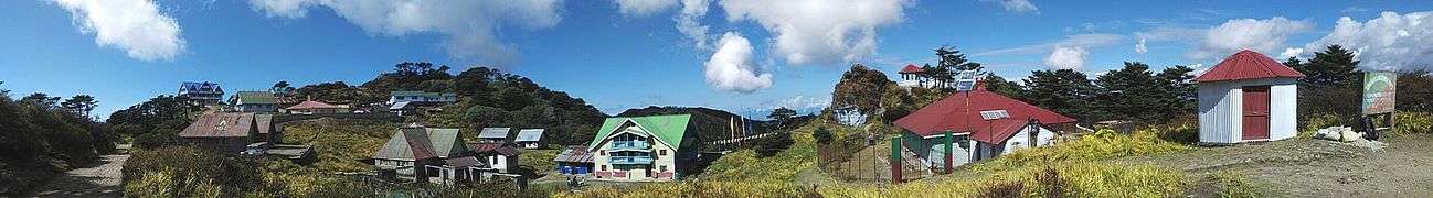 A panoramic view of Sandakpur.
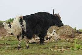 Domestic Yak
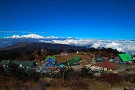 Top view of Sandakphu
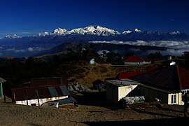
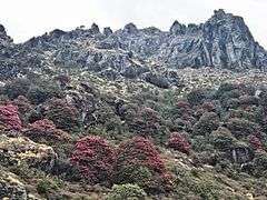 Sandakphu
References
External links
| Wikimedia Commons has media related to Sandakphu. |