San Francisquito Creek
| San Francisquito Creek (Arroyo de San Francisquito) | |
| stream | |
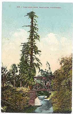 El Palo Alto and the San Francisquito Creek c. 1910 | |
| Name origin: Spanish language | |
| Country | United States |
|---|---|
| State | California |
| Region | Northwestern Santa Clara County and southeastern San Mateo County |
| Tributaries | |
| - left | Bear Creek |
| - right | Corte Madera Creek, Los Trancos Creek |
| City | Palo Alto, California |
| Source | Confluence of Bear Creek and Corte Madera Creek just below Searsville Lake (actually a reservoir) |
| - location | Jasper Ridge Biological Preserve |
| - elevation | 351 ft (107 m) |
| - coordinates | 37°24′26″N 122°14′15″W / 37.40722°N 122.23750°W [1] |
| Mouth | Southwest San Francisco Bay |
| - location | East Palo Alto, California |
| - elevation | 0 ft (0 m) |
| - coordinates | 37°27′58″N 122°06′55″W / 37.46611°N 122.11528°WCoordinates: 37°27′58″N 122°06′55″W / 37.46611°N 122.11528°W [1] |
San Francisquito Creek (Spanish for "Little San Francisco" - the "little" referring to size of the settlement compared to Mission San Francisco de Asís[2]) is a creek that flows into southwest San Francisco Bay in California, United States of America. Historically it was called the Arroyo de San Francisco by Juan Bautista de Anza in 1776.[3] San Francisquito Creek courses through the towns of Portola Valley and Woodside, as well as the cities of Menlo Park, Palo Alto, and East Palo Alto. The creek and its Los Trancos Creek tributary define the boundary between San Mateo and Santa Clara Counties.
History
The original inhabitants of the area were the Ohlone people, called by the Spaniards "Coastanoans", or Coast-dwellers. These local residents lived off the land, gathering nuts, berries and fish from both the ocean and the bay. Because of the abundance of food there was no need for them to practice agriculture. Evidences of their civilization are still being unearthed on the Filoli estate in Woodside, and along San Francisquito Creek.
In 1769, the Spanish exploration party led by Don Gaspar de Portolà camped by the creek for five nights, November 6–11, after their momentous discovery of San Francisco Bay. The Franciscan missionary Juan Crespí, a member of the expedition, noted in his diary that, "The commander decided that we should stop in this valley while the explorers went out again to acquire certain information...They were given four days to be gone". When the scouts returned, the expedition leaders met and decided to turn around and return to Monterey Bay (the original goal), which they had passed but failed to recognize as the place described by earlier maritime explorers.[4]
In 1774 Father Francisco Palou, on Captain Rivera's expedition, erected a cross near the giant creekside redwood they called "El Palo Alto", to mark the site of a proposed mission (later changed to Mission Santa Clara). The colonizing of the Peninsula began after the 1776 expedition of Juan Bautista De Anza left Monterey on the first overland expedition to San Francisco Bay, and passed across the creek on its way to establishing Mission Dolores and the Presidio of San Francisco in 1776. Although de Anza discovered Padre Palou's 1774 wooden cross, the creek's summer flow was deemed too low to support a mission.[5][6][7]
Watershed

The headwaters of the San Francisquito watershed are in the Santa Cruz Mountains above Menlo Park, around 667 meters (2,188 ft) above the Bay. The upper watershed consists of at least 22 named creeks.[8] The creek mainstem originates at the confluence of Bear Creek and Corte Madera Creek just below Searsville Lake in the Jasper Ridge Biological Preserve on lands purchased by Stanford University in 1892. The lake is formed by Searsville Dam, which was built in 1892, one year after the founding of the university itself.[9] The 65-foot-tall (20 m) and 275-foot-wide (84 m) Searsville Dam consists of a series of interlocking concrete boulders that resemble a massively steep staircase. After leasing the lake for recreational use for 50 years, the Stanford Board of Trustees closed public access to Searsville Lake in 1975. The reservoir has lost over 90% of its original water storage capacity as roughly 1.5 million cubic yards of sediment has filled it in. Searsville Dam does not provide potable water, flood control, or hydropower.[10] Although removal of the dam would double available spawning habitat on this important steelhead trout stream, Stanford's Jasper Ridge Advisory Committee in 2007 recommended that the dam not be removed and the lake dredged to maintain open water.[11] Stanford University uses water from the lake to irrigate its golf course and other athletic facilities on its campus.[12] Anti-dam proponents point to a growing trend in habitat restoration nationally with over 500 dams removed in recent years.[13]
San Francisquito Creek's mainstem begins below Searsville Lake at the confluence of Corte Madera Creek and Bear Creek. It is joined by Los Trancos Creek just north of I-280.
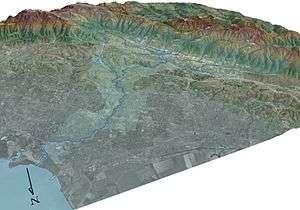
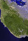
The creek runs for a length described by different authorities as from 13 to 22 kilometers (8.1 to 13.7 mi), most recently 12.5 miles (20.1 km), and after exiting the foothills near Junipero Serra Boulevard and Alpine Road, runs in an incised channel in a broad alluvial fan, before draining into the Bay south of the Dumbarton Bridge and north of the Palo Alto Flood Basin.[14] Its watershed is about 110 square kilometers (42 sq mi) in extent, including areas of San Mateo and Santa Clara counties. In one stretch it forms the boundary between the city of Palo Alto and the cities of East Palo Alto and Menlo Park, and thus between San Mateo and Santa Clara counties, reflecting the fact that it was originally used as the boundary between the lands of the Spanish Missions at San Francisco and Santa Clara. The tree from which Palo Alto takes its name, El Palo Alto, stands on the banks of the creek.
In 1857, the U.S. Coast Survey (USCS) identified 1,142 acres (462 ha) of tidal marsh at the mouth of the creek. There were also two large [63-and-118-acre (25 and 48 ha)] willow groves adjacent to the tidal marsh associated with high groundwater tables and seasonal flooding. In the late 1920s levees were constructed to re-route the creek through a new engineered channel from its former mouth, to a sharp north turn for about half a mile, then to the northeast, before exiting to the Bay. By 2004, filled areas such as the Palo Alto golf course and the Palo Alto Airport have reduced the tidal marsh to 352 acres (1.42 km2).[15]
Ecology
Salmonids in the San Francisquito Creek Watershed
San Francisquito Creek hosts the most viable remaining anadromous steelhead (Oncorhynchus mykiss irideus) population in southern San Francisco Bay streams. Because the San Francisquito Creek mainstem (and its Los Trancos Creek tributary) forms the boundary of Santa Clara County and San Mateo County, the respective county water districts were unable to agree historically on paying to channelize and concretize the creek, leaving it in a highly natural state.[16] There is a steelhead trout specimen in the California Academy of Sciences that was collected by Edward Z. Hughes in the 1890s.[17] The first President of Stanford University, David Starr Jordan, included a rendering of a "sea-run rainbow trout from San Francisquito Creek" in the Pacific Monthly in 1906.[18] Bear Creek and Los Trancos Creek and their respective tributaries support an observable spawning steelhead population that is threatened by the effects of urbanization.[19] Above the watershed's several dams native resident rainbow trout, a form of landlocked steelhead trout, persist as well.
Several lines of evidence support the historical presence of coho salmon (Oncorhynchus kisutch) in San Francisquito Creek. Archaeological remains of unspecified salmonids ("possibly coho") were reported by Gobalet in the creek.[20] Leidy concluded that coho salmon were likely present and cited that the most suitable habitat for coho salmon was in perennial, well shaded reaches of mainstem San Francisquito Creek, and several small, perennial tributaries including Los Trancos, Corte Madera, Bear, and West Union creeks.[21] In addition, three independent oral history sources indicate that coho salmon were abundant in the creek through the first half of the twentieth century.[22][23] According to local historian Dorothy Regnery's notes from her 1966 interview with Edgar H. Batchelder, who was 2 years old when his father became caretaker of Searsville dam in 1897, "When the dam was "wasting", or overflowing in the winter, salmon would swim upstream as far as the base of the dam. Using a pitchfork Mr. Batchelder would spear them to supplement the family's menu." His "favorite place to fish for trout was in the Dennis Martin Creek".[24] A second source described catching "steelhead" and silver (coho) salmon in San Francisquito Creek and the Guadalupe River watershed in the 1930s and 1940s. He said that the Guadalupe River also had runs of chinook salmon (Oncorhynchus tshawytscha) that were very large in wet years."[23] Thirdly, Dennis L. Bark, a senior fellow at the Hoover Institution, recalls playing on San Francisquito Creek around 1947: "Salmon swam up it, and in winter it was a dangerous place."[25] The historical range of coho salmon overlapped geographically with San Francisquito Creek. There is physical evidence (museum specimens) that coho salmon were historically present in other San Francisco Bay streams south of San Francisco, such as San Mateo Creek and Alameda Creek.[26] Also, the southern limit of coho salmon in coastal California streams was recently confirmed to extend through Santa Cruz County based on both archaeological evidence and historically collected specimens.[27]
Dams Impeding Salmonid Runs in the Watershed

Stanford University owns four dams which represent impassable to nearly impassable barriers to trout, and possibly, salmon spawning runs. Several of these dams were constructed to divert stream flows to Stanford's reservoirs, the Lagunita Diversion Dam, the Jasper Ridge Road Crossing, Searsville Reservoir Dam, and the Los Trancos Creek Diversion Dam. A genetics study of San Francisquito Creek steelhead in 1996 found that the fish are native and not of hatchery stock.[28] In 2006, an Aquatic Habitat Assessment and Limiting Factors Analysis commissioned by the Santa Clara Valley Water District concluded that the key factor limiting smolt production within the study area (San Francisquito Creek mainstem and Los Trancos Creek) and potentially throughout the watershed, is a lack of suitable winter refuge in deep pools and large woody debris. Secondly, outgoing salmonid migration is inhibited by seasonal drying and passage impediments.[29]
The Lagunita Diversion dam is the most significant barrier to fish passage, because it is located on the mainstem San Francisquito Creek, blocking upstream salmonid migration to all San Francisquito Creek tributaries in lower rainfall years. It is located just north of the east end of Happy Hollow Lane near Alpine Road and near the Stanford Weekend Acres neighborhood in unincorporated Menlo Park. This dam was originally constructed in 1899-1900 to divert winter flows to fill Stanford's Lake Lagunita.[28] It is located 1⁄3 mile (0.54 km) downstream of the mouth of Los Trancos Creek but stopped diverting water to fill the artificial lake when the San Francisquito Creek Pump Station (2⁄3 mile (1.1 km) further downstream) took over this task in 1998.[30] A fish ladder was constructed on the Lake Lagunita Diversion Dam in 1954, however despite re-modification it remains impassable in low rainfall years. In 2014 Our Children’s Earth Foundation sued Stanford for allegedly violating the Endangered Species Act, saying the dams obstruct steelhead trout from swimming upstream to freshwater habitats necessary in the early stages of their life cycle. They also registered concern about the Jasper Ridge Road Crossing as another barrier to fish passage. The Jasper Ridge Road Crossing is a concrete weir (low dam) built along a dirt road that crosses San Francisquito Creek shortly downstream from the confluence of Corte Madera and Bear Creeks. The Jasper Ridge Road Crossing blocks the passage of steelhead upstream and downstream during lower flow conditions that begin in the spring and may prevent smolt outmigration in late spring, as well as immigration of spawning adults in dry winters. In 2015 Stanford denied that the court had ordered them to remove the Lagunitas Diversion Dam and maintained that it had been planning to remove that dam since its 2010 Habitat Conservation Plan and had initiated the engineering and hydrology work to prepare for removal.[31] In December 2017 Stanford received a $1.2 million ecosystem and watershed restoration grant from the California Department of Fish and Wildlife which covers 30% of the costs of dam removal and riparian restoration. In March 2018 Stanford announces that it was seeking permits to begin the Lagunita Dam Diversion Project which would remove the 119-year-old dam and restore 480 feet (150 m) of the creek, improving fish passage with pools, shallows and native plants, and move the creek eastwards away from the residential area.[32] Once the Lagunita Diversion Dam is removed, removal of the Jasper Ridge Road Crossing would open 6.6 miles (10.6 km) of Bear Creek mainstem even if Searsville Dam continued to block Corte Madera Creek. In addition, removal of the Lagunita Diversion Dam would open Bear Creek's multiple tributaries, such as West Union Creek, to salmonid spawning.
Searsville Dam is located upstream of the San Francisquito Creek mainstem (formed by the confluence of Bear Creek and Corte Madera Creek) and blocks its largest tributary, Corte Madera Creek. A May 2002 steelhead trout migration study reported Searsville Dam as a complete barrier to salmonid migration, and that elimination of the Searsville dam could restore ten miles (16 km) of anadromous steelhead habitat.[28] In 2014 a systematic study of 1,400 plus dams in California identified Searsville Dam as a high-priority candidate to improve environmental flows for native fish conservation.[33]
Stanford installed a third diversion dam on Los Trancos Creek in 1929, to divert stream flows to its Felt Lake water storage reservoir. The dam, located just below the intersection of Arastradero and Alpine Roads, also blocks access of upmigrating steelhead trout to over 3 miles (4.8 km) of pristine upstream spawning grounds.[34] In 2009, Stanford University completed construction of a new fish screen and ladder as the previous fish ladder was an "Alaska Steep Pass" designed for much higher flows.[35] However, the new fish ladder does not appear to be utilized by the trout.
Other Fauna and Flora of the San Francisquito Creek Watershed
Other threatened species include two riparian fauna: the threatened California red-legged frog (Rana draytonii) and the western pond turtle (Actinemys marmorata).
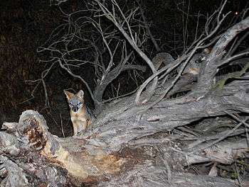
Recently, gray foxes (Urocyon cinereoargenteus) have been documented near the mouth of San Francisquito Creek (see photo) and on the Palo Alto Golf Course. Populations of gray fox have increased in the South Bay since the U.S. Fish and Wildlife Service has culled non-native red foxes (Vulpes vulpes) because the latter prey on the endangered California clapper rail (Rallus longirostris obsoletus).[36] Genetically, gray fox are the most basal of all canids.[37]
The flora of the upper watershed consists of scattered oak and madrone woodlands that are intermingled with grassland habitat, in some areas forming a savanna. A grove of upland coast redwood (Sequoia sempervirens) forest occurs along San Francisquito Creek just below Searsville Lake. Native tree species that occur in the riparian corridor include valley oak, coast live oak, willows and California buckeyes. Common native riparian shrubs include coffeeberry (Rhamnus californicus), ocean spray (Holodiscus discolor), and creeping snowberry (Symphoricarpos mollis). Within the Jasper Ridge Biological Preserve there are isolated second-generation stands of coast redwood. Other common woody species along the creek banks include the yellow-flowering box elder, big-leaved maple, willows of several species, white alder, California bay and California hazelnut.[23]
Conservation
In normal winters the creek runs sluggishly in a deep arroyo; in summer it is usually dry. However, it is capable of flooding, and the risk has become more severe as increased urbanisation along its course has increased the area of impermeable surfaces. In the 1998 El Niño storms, the creek burst its banks. The creek's levees were also damaged.
The body responsible for the conservation and management of the Mid-Peninsula watersheds, of which the creek is one, is the Santa Clara Valley Water District. However, because of the significance of the creek in a densely populated area where environmental concerns and recent flooding are both salient in the public mind, a Joint Powers Authority (JPA) has been formed to address community concerns about the management of the creek. The JPA is currently undertaking or scoping various projects for the improvement of the creek, for example the stabilisation and revegetation of its banks. The members of the JPA are the city councils of Palo Alto, Menlo Park and East Palo Alto, the Santa Clara Valley Water District, and the San Mateo County Flood Control District.
See also
References
- 1 2 U.S. Geological Survey Geographic Names Information System: San Francisquito Creek
- ↑ Bright, William (1998). 1500 California Place Names. Berkeley, California: University of California Press. p. 130. ISBN 0-520-21271-1.
- ↑ Durham, David L. (1998). Durham's Place Names of California's San Francisco Bay Area: Includes Marin, San Francisco, San Mateo, Contra Costa, Alameda, Solano & Santa Clara counties. Word Dancer Press, Sanger, California. p. 155. ISBN 978-1-884995-35-4.
- ↑ Bolton, Herbert E. (1927). Fray Juan Crespi: Missionary Explorer on the Pacific Coast, 1769-1774. HathiTrust Digital Library. pp. 233–236. Retrieved April 2014. Check date values in:
|accessdate=(help) - ↑ de Anza; Juan Bautista (1776). Diary of Juan Bautista de Anza October 23, 1775 - June 1, 1776. University of Oregon Web de Anza pages. Retrieved October 13, 2010.
- ↑ Zoeth Skinner Eldredge (1912). The Beginnings of San Francisco: From the Expedition of Anza, 1774, to the City Charter of April 15, 1850:with Biographical and Other Notes. San Francisco: Z. S. Eldredge. p. 130.
- ↑ Pamela Gullard & Nancy Lund (1989). History of Palo Alto: The Early Years'. Scottwall Associates. p. 181. ISBN 0-942087-03-8.
- ↑ Janet M. Sowers (2005). "San Francisquito Watershed and Alluvial Fan, in Creek & Watershed Map of Palo Alto & Vicinity". Oakland Museum of California. Retrieved December 29, 2009.
- ↑ Michael McCabe (June 21, 2008). "Silt-Laden Lake Offers Opportunity: Stanford may destroy dam to save habitat". San Francisco Chronicle. Retrieved January 2, 2010.
- ↑ Michael Stoecker. "Beyond Searsville Dam". Retrieved June 13, 2010.
- ↑ "Searsville Lake: Position of the Jasper Ridge Advisory Committee". Stanford University Jasper Ridge Biological Preserve. October 2007. Retrieved June 13, 2010.
- ↑ Nicholas Wenner (2010-05-26). "Habitat plan proposes Searsville dredging; removal remains unclear". The Stanford Daily. Retrieved June 13, 2010.
- ↑ Peter Fimrite (June 2, 2010). "Fight looms over removal of Searsville Dam". San Francisco Chronicle. Retrieved June 13, 2010.
- ↑ "San Francisquito Watershed, Santa Clara Valley Urban Runoff Pollution Prevention Program". Retrieved November 30, 2009.
- ↑ Hermstad, D.; Cayce, K. & Grossinger, R. (March 2009). Historical Ecology of Lower San Francisquisto Creek, Phase 1. Technical memorandum accompanying project GIS Data, Contribution No. 579. Historical Ecology Program (Report). Oakland, California: San Francisco Estuary Institute. Retrieved 7 November 2016.
- ↑ Nicolas L. Rofougaran and Herman A. Karl (2005). "San Francisquito Creek—The Problem of Science in Environmental Disputes - Joint Fact Finding as a Transdisciplinary Approach toward Environmental Policy Making; U.S. Geological Survey Professional Paper 1710". U.S. Geological Survey: 29. Retrieved August 15, 2018.
- ↑ "Oncorhynchus mykiss gairdnerii". California Academy of Sciences. Retrieved March 2, 2012.
- ↑ David Starr Jordan (1906). "The Trout and Salmon of the Pacific Coast". The Pacific Monthly: 383. Retrieved 2015-01-13.
- ↑ "California's Critical Coastal Areas:State of the CCAs Report — CCA #93 San Francisquito Creek" (PDF). June 15, 2006. Retrieved November 4, 2009.
- ↑ Kenneth W. Gobalet; Peter D. Schulz; Thomas A. Wake; Nelson Siefkin (2004). "Archaeological Perspectives on Native American Fisheries of California, with Emphasis on Steelhead and Salmon". Transactions of the American Fisheries Society. 133: 814. doi:10.1577/T02-084.1. Retrieved October 14, 2010.
- ↑ "Historical Status of Coho Salmon in Streams of the Urbanized San Francisco Estuary, California" (PDF). California Fish and Game. 2005. Retrieved October 14, 2010.
- ↑ Dorothy F. Regnery (1991). The History of Jasper Ridge- From Searsville Pioneers to Stanford Scientists. Stanford Historical Society: Centennial Operating Committee. p. 120.
- 1 2 3 Watershed Assessment Subgroup, Santa Clara Basin Watershed Management Initiative (August 2003). Volume One Unabridged Watershed Characteristics Report, Chapter 7 "Natural Setting" (PDF) (Report). Santa Clara Valley Urban Runoff Pollution Prevention Program. p. 7-xi. Archived from the original (PDF) on July 11, 2011. Retrieved October 14, 2010.
- ↑ Regnery, Dorothy (1966). "E.H. Barchelder personal interviews". Dorothy F. Regnery papers (Interview). M0479, box 6, folder 13. Department of Special Collections, Stanford University Libraries. p. 5.
- ↑ Dennis L. Bark (Fall 2010). "Growing Up on The Farm" (PDF). Sandstone & Tile: 18. Archived from the original (PDF) on September 22, 2013. Retrieved January 14, 2011.
- ↑ Robert A. Leidy; Gordon Becker; Brett N. Harvey (2005). "Historical Status of Coho Salmon in Streams of the Urbanized San Francisco Estuary, California" (PDF). California Fish and Game: 219–254. Retrieved October 21, 2010.
- ↑ Peter B. Adams; Louis W. Botsford; Kenneth W. Gobalet; Robert A. Leidy; Dennis R. McEwan; Peter B. Moyle; Jerry J. Smith; John G. Williams & Ronald M. Yoshiyama (September 2007). "Coho Salmon Are Native South of San Francisco Bay: A Reexamination of North American Coho Salmon's Southern Range Limit". Fisheries. 32: 441–451. doi:10.1577/1548-8446(2007)32[441:CSANSO]2.0.CO;2. Retrieved October 21, 2010.
- 1 2 3 Leidy, R.A.; G.S. Becker; B.N. Harvey (2005). "Historical distribution and current status of steelhead/rainbow trout (Oncorhynchus mykiss) in streams of the San Francisco Estuary, California" (PDF). Center for Ecosystem Management and Restoration, Oakland, California. Retrieved December 28, 2009.
- ↑ Jones & Stokes (2006-06-12). San Francisquito Creek Aquatic Habitat Assessment: Limiting Factors Analysis (Report). San Jose, California: Santa Clara Valley Water District. pp. 1–2. Retrieved January 15, 2011.
- ↑ Stanford University Habitat Conservation Plan - Appendix A: Steelhead Habitat Enhancement Project Description (PDF) (Report). Stanford University. 2007-01-05.
- ↑ Rhea Mahbubani (February 3, 2015). "Stanford takes steps to take down the controversial Lagunita Diversion Dam". San Jose Mercury News.
- ↑ Sue Dremann (March 2, 2018). "Stanford plans to remove Lagunita Dam". Palo Alto Online. Retrieved March 10, 2018.
- ↑ T. E. Grantham; J. H. Viers; PB Moyle (2014). "Systematic Screening of Dams for Environmental Flow Assessment and Implementation". BioScience. 64: 1006–1018. doi:10.1093/biosci/biu159. Retrieved 2014-10-27.
- ↑ Eve Mitchell (1995-09-28). "Fish ladder to help Peninsula steelhead; Seagoing trout will get access to Las Trancos Creek above Stanford University". San Francisco Chronicle. Retrieved 2011-07-30.
- ↑ Arden Pennell (2008-04-02). "Stanford plans changes to creek, Felt Lake". Palo Alto Online News. Retrieved 2010-10-14.
- ↑ Brian Popper (Summer 2006). "Not Just for the Birds – Wildlife Refuge Provides Sanctuary for Gray Fox" (PDF). Tideline. Don Edwards San Francisco Bay National Wildlife Refuge. Retrieved December 11, 2011.
- ↑ E. Geffen; A. Mercure; D.J. Girman; D.W. Macdonald; R.K. Wayne (September 1992). "Phylogenetic relationships of the fox-like canids: mitochondrial DNA restriction fragment, site and cytochrome b sequence analyses". Journal of Zoology, London. 228: 27–39. doi:10.1111/j.1469-7998.1992.tb04430.x. Retrieved April 21, 2014.
External links
- Steelhead trout spawning on San Francisquito Creek at Woodland Avenue Feb. 21, 2013
- Beyond Searsville Dam
- San Francisquito Creek - Rafting 7 miles from 280 to 101 video Dec. 23, 2014
- Santa Clara Valley Water District web site
- San Francisquito Creek Joint Powers Authority
- San Francisquito Watershed Council
- US Geological Service project on the creek
- Information about the conservation issues on the creek on the Save The Bay website
- Guide to the Creek prepared by the Oakland Museum of California
- live images of San Francisquito Creek at West Bayshore Road in Palo Alto
- current depth information for Palo Alto creeks, including San Francisquito Creek

San Mateo County, California, United States | ||
| Primary and secondary schools | ||
| Colleges and universities | ||
| Landmarks | ||
| Historic Places | ||
| Transportation | ||
| Commercial centers | ||
| Healthcare | ||
Santa Clara County, California, United States | ||
| Primary and secondary schools | ||
| Colleges and universities | ||
| Landmarks | ||
| Historic Places | ||
| Transportation | ||
| Commercial centers | ||
| Healthcare | ||
| Misc | ||