Saint-Évariste-de-Forsyth, Quebec
| Saint-Évariste-de-Forsyth | |
|---|---|
| Municipality | |
 Roman Catholic Church serving the parish of Saint-Évariste. | |
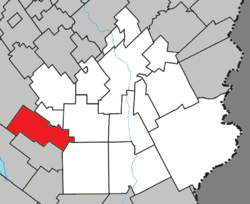 Location within Beauce-Sartigan RCM. | |
 Saint-Évariste-de-Forsyth Location in southern Quebec. | |
| Coordinates: 45°56′N 70°57′W / 45.933°N 70.950°WCoordinates: 45°56′N 70°57′W / 45.933°N 70.950°W[1] | |
| Country |
|
| Province |
|
| Region | Chaudière-Appalaches |
| RCM | Beauce-Sartigan |
| Constituted | March 1, 1870 |
| Government[2] | |
| • Mayor | Gaétan Bégin |
| • Federal riding | Beauce |
| • Prov. riding | Beauce-Sud |
| Area[2][3] | |
| • Total | 112.00 km2 (43.24 sq mi) |
| • Land | 111.22 km2 (42.94 sq mi) |
| Population (2011)[3] | |
| • Total | 525 |
| • Density | 4.7/km2 (12/sq mi) |
| • Pop 2006-2011 |
|
| • Dwellings | 310 |
| Time zone | UTC−5 (EST) |
| • Summer (DST) | UTC−4 (EDT) |
| Postal code(s) | G0M 1S0 |
| Area code(s) | 418 and 581 |
| Highways |
|
| Website |
www |
Saint-Évariste-de-Forsyth is a municipality in the Municipalité régionale de comté de Beauce-Sartigan in Quebec, Canada. It is part of the Chaudière-Appalaches region and the population is 647 at the 2006 census.
As with several other municipalities located in the Eastern Townships, Saint-Évariste-de-Forsyth derives its name from its Roman Catholic parish and its township. The parish is named after Pope Evaristus and the township after lumber baron James Bell Forsyth.
References
Places adjacent to Saint-Évariste-de-Forsyth, Quebec | ||||||||||
|---|---|---|---|---|---|---|---|---|---|---|
| ||||||||||
| Cities & Towns | |
|---|---|
| Municipalities | |
| Parishes | |
| Villages | |
| |
This article is issued from
Wikipedia.
The text is licensed under Creative Commons - Attribution - Sharealike.
Additional terms may apply for the media files.