Saint-Côme–Linière, Quebec
| Saint-Côme–Linière | |
|---|---|
| Municipality | |
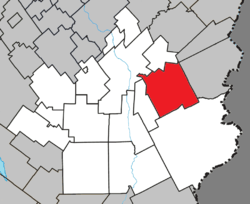 Location within Beauce-Sartigan RCM. | |
 Saint-Côme–Linière Location in southern Quebec. | |
| Coordinates: 46°04′N 70°31′W / 46.067°N 70.517°WCoordinates: 46°04′N 70°31′W / 46.067°N 70.517°W[1] | |
| Country |
|
| Province |
|
| Region | Chaudière-Appalaches |
| RCM | Beauce-Sartigan |
| Constituted | April 13, 1994 |
| Government[2] | |
| • Mayor | Gabriel Giguère |
| • Federal riding | Beauce |
| • Prov. riding | Beauce-Sud |
| Area[2][3] | |
| • Total | 152.20 km2 (58.76 sq mi) |
| • Land | 150.40 km2 (58.07 sq mi) |
| Population (2011)[3] | |
| • Total | 3,274 |
| • Density | 21.8/km2 (56/sq mi) |
| • Pop 2006-2011 |
|
| • Dwellings | 1,480 |
| Time zone | UTC−5 (EST) |
| • Summer (DST) | UTC−4 (EDT) |
| Postal code(s) | G0M 1J0 |
| Area code(s) | 418 and 581 |
| Highways |
|
| Website |
www |
Saint-Côme–Linière is a municipality in the Beauce-Sartigan Regional County Municipality in the Chaudière-Appalaches region of Quebec, Canada. The official spelling given by the Commission de toponymie uses an en dash after "Saint-Côme",[1][2] but the town's own website uses a second hyphen: Saint-Côme-Linière.[4] The population is 3,282 as of 2009.
Saint-Côme–Linière was constituted by the amalgamation of the parish municipality of Saint-Côme-de-Kennebec and the village of Linière on August 17, 1994. Saint-Côme was named after Arabian-born Christian martyr Saint Cosmas and Linière received its name from the Lord who was first granted the land and cultivated fields of flax ("Lin" in French).[1]
References
Places adjacent to Saint-Côme–Linière, Quebec | ||||||||||
|---|---|---|---|---|---|---|---|---|---|---|
| ||||||||||
| Cities & Towns | |
|---|---|
| Municipalities | |
| Parishes | |
| Villages | |
| |
This article is issued from
Wikipedia.
The text is licensed under Creative Commons - Attribution - Sharealike.
Additional terms may apply for the media files.