Saint-Philibert, Quebec
| Saint-Philibert | |
|---|---|
| Municipality | |
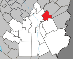 Location within Beauce-Sartigan RCM. | |
 Saint-Philibert Location in southern Quebec. | |
| Coordinates: 46°08′N 70°33′W / 46.133°N 70.550°WCoordinates: 46°08′N 70°33′W / 46.133°N 70.550°W[1] | |
| Country |
|
| Province |
|
| Region | Chaudière-Appalaches |
| RCM | Beauce-Sartigan |
| Constituted | February 25, 1921 |
| Government[2] | |
| • Mayor | Marc Nadeau |
| • Federal riding | Beauce |
| • Prov. riding | Beauce-Sud |
| Area[2][3] | |
| • Total | 56.60 km2 (21.85 sq mi) |
| • Land | 58.95 km2 (22.76 sq mi) |
|
There is an apparent contradiction between two authoritative sources | |
| Population (2011)[3] | |
| • Total | 367 |
| • Density | 6.2/km2 (16/sq mi) |
| • Pop 2006-2011 |
|
| • Dwellings | 149 |
| Time zone | UTC−5 (EST) |
| • Summer (DST) | UTC−4 (EDT) |
| Postal code(s) | G0M 1X0 |
| Area code(s) | 418 and 581 |
| Highways | No major routes |
| Website |
www |
Saint-Philibert is a municipality in the Municipalité régionale de comté de Beauce-Sartigan in Quebec, Canada. It is part of the Chaudière-Appalaches region. The population is 404 as of 2009. It is named after reverend François-Philibert Lamontagne, who promoted the parish at the time of the church construction in 1919.
A fire destroyed this same church on February 14, 2009.
References
- Commission de toponymie du Québec
- Ministère des Affaires municipales, des Régions et de l'Occupation du territoire
Places adjacent to Saint-Philibert, Quebec | ||||||||||
|---|---|---|---|---|---|---|---|---|---|---|
| ||||||||||
| Cities & Towns | |
|---|---|
| Municipalities | |
| Parishes | |
| Villages | |
| |
This article is issued from
Wikipedia.
The text is licensed under Creative Commons - Attribution - Sharealike.
Additional terms may apply for the media files.