Mixon, Texas
| Mixon, Texas | |
|---|---|
| Unincorporated community | |
 Mixon Location within the state of Texas  Mixon Mixon (the US) | |
| Coordinates: 32°5′20″N 95°12′37″W / 32.08889°N 95.21028°WCoordinates: 32°5′20″N 95°12′37″W / 32.08889°N 95.21028°W | |
| Country | United States |
| State | Texas |
| County | Cherokee |
| Elevation | 407 ft (124 m) |
| Time zone | UTC-6 (Central (CST)) |
| • Summer (DST) | UTC-5 (CDT) |
| Area code(s) | 430, 903 |
Mixon is a small unincorporated community in northern Cherokee County, Texas (USA), located between Jacksonville and Troup along Texas State Highway 135. It lies at an elevation of 407 feet (124 m).[1]
References
External links
- Mixon, TX from the Handbook of Texas Online
Municipalities and communities of Cherokee County, Texas, United States | ||
|---|---|---|
| Cities | 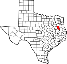 | |
| Towns | ||
| CDP | ||
| Other unincorporated communities | ||
| Ghost towns | ||
| Footnotes | ‡This populated place also has portions in an adjacent county or counties | |
This article is issued from
Wikipedia.
The text is licensed under Creative Commons - Attribution - Sharealike.
Additional terms may apply for the media files.