Rubane
| Rubane | |
|---|---|
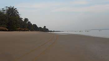 A beach on the shores of Rubane, nearby is its hotel and Ponta Anchaca | |
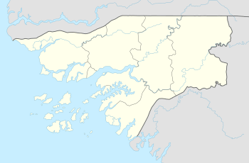 Rubane Location in Guinea-Bissau | |
| Coordinates: 11°20′8″N 15°48′41″W / 11.33556°N 15.81139°WCoordinates: 11°20′8″N 15°48′41″W / 11.33556°N 15.81139°W | |
| Country |
|
| Region | Bolama Region |
| District | Bubaque District |
| Population (2009) | |
| • Total | 165[1] |
| Time zone | UTC(UTC-0) (GMT) |
Rubane (Bidyogo: Rubani) is one of the Bijagós Islands in Guinea-Bissau, and is also the name of its main village. The island has a population of 165 (2009).[1] The area of the island is about 30-40 km², it is around 10 km long and 8 km wide. The island is hundreds of metres from Bubaque to the south. Other nearby islands are Galinhas to the northeast, the larger Roxa to the southeast and Soga to the west.
Like other islands in the archipelago, it is inhabited by the Bijagós people, which considers it a sacred island.[2]
The island is known for its wildlife and is heavily forested, on some shores has a few beaches. It forms part of the UNESCO's Bijagós Islands Biosphere Reserve.[3]
One of the geographic features in the area is Ponta Anchaca (Bidyogo: Anshaka).
Transportation
Transport between Rubane and other islands are done by boat. It is linked by ferry to Bissau which takes about 3 hours.
Economy
Agriculture as to other parts of the archipelago is practices. There is some eco-tourism. Recently a new hotel named Hotel Ponta Anchaca has been built, it is the only hotel/resort in the vicinity,
References
- 1 2 Census, Guinea-Bissau 2009 (PDF) (in Portuguese). p. 60.
- ↑ Rodrigues, Sofia (6 April 2013). "A ilha sagrada onde e proíbido derramar sangue". Público (in Portuguese). Retrieved 25 April 2017.
- ↑ Bijagós Biosphere Reserve, UNESCO, August 2011, accessed 25 April 2018
External links

Bolama (capital) | ||
| Sectors | ||
| Islands |
| |
| Parks | ||