Bissau
| Bissau | |||
|---|---|---|---|
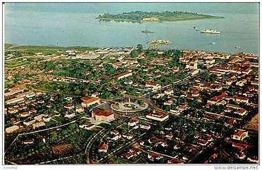
.jpg) Downtown Bissau | |||
| |||
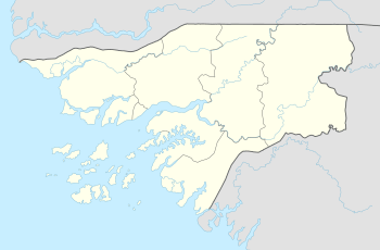 Bissau Location of Bissau in Guinea-Bissau  Bissau Bissau (Africa) | |||
| Coordinates: 11°51′N 15°34′W / 11.850°N 15.567°WCoordinates: 11°51′N 15°34′W / 11.850°N 15.567°W | |||
| Country |
| ||
| Region | Bissau Autonomous Sector | ||
| Founded | 1687 | ||
| Area | |||
| • Total | 77.5 km2 (29.9 sq mi) | ||
| Elevation | 0 m (0 ft) | ||
| Population (2015 census) | |||
| • Total | 492,004 | ||
| • Density | 5,009/km2 (12,974/sq mi) | ||
| ISO 3166 code | GW-BS | ||
| Climate | Aw | ||
Bissau is the capital city of the African Republic of Guinea-Bissau. In 2015, Bissau had a population of 492,004.[1] Bissau is located on the Geba River estuary, off the Atlantic Ocean, and is Guinea-Bissau's largest city, major port, and its administrative and military centre.
History
The city was founded in 1687 by Portugal as a fortified port and trading center. In 1942 it became the capital of Portuguese Guinea.
After the declaration of independence by the anti-colonial guerrillas of PAIGC in 1973, the capital of the de facto independent territories was declared to be Madina do Boe. Bissau remained as the capital of the Portuguese-occupied regions, and the de jure capital of all of Portuguese Guinea. When Portugal recognized the independence of Guinea-Bissau and decolonised in 1974 due to the military coup of April 25 in Lisbon, the two territories merged and Bissau became the capital of the new independent state.
Bissau was the scene of intense fighting during the beginning and end of the Guinea-Bissau Civil War in 1998 and 1999.[2]
Geography and climate
Bissau is located at 11°52' North, 15°36' West (11.86667, -15.60) , on the Geba River estuary, off the Atlantic Ocean. The land surrounding Bissau is extremely low-lying, and the river is accessible to ocean-going vessels despite its modest discharge for about 80 kilometres (50 mi) beyond the city.
Bissau has a tropical savanna climate (Köppen Aw), not quite wet enough to qualify as a tropical monsoon climate (Am) but much wetter than most climates of its type.
Almost no rain falls from December to April, but during the remaining five months of the year the city receives around 2,020 millimetres (80 in) of rain. During the wet season and even during the three months beforehand, high humidity makes heat discomfort extreme.
| Climate data for Bissau, Guinea-Bissau (1974-1994) | |||||||||||||
|---|---|---|---|---|---|---|---|---|---|---|---|---|---|
| Month | Jan | Feb | Mar | Apr | May | Jun | Jul | Aug | Sep | Oct | Nov | Dec | Year |
| Record high °C (°F) | 36.7 (98.1) |
38.3 (100.9) |
38.9 (102) |
41.1 (106) |
39.4 (102.9) |
35.6 (96.1) |
33.3 (91.9) |
32.8 (91) |
33.9 (93) |
34.4 (93.9) |
35.0 (95) |
35.6 (96.1) |
41.1 (106) |
| Average high °C (°F) | 31.1 (88) |
32.8 (91) |
33.9 (93) |
33.3 (91.9) |
32.8 (91) |
31.1 (88) |
29.4 (84.9) |
30.0 (86) |
30.0 (86) |
31.1 (88) |
31.7 (89.1) |
30.6 (87.1) |
31.5 (88.7) |
| Average low °C (°F) | 17.8 (64) |
18.3 (64.9) |
19.4 (66.9) |
20.6 (69.1) |
22.2 (72) |
22.8 (73) |
22.8 (73) |
22.8 (73) |
22.8 (73) |
22.8 (73) |
22.2 (72) |
18.9 (66) |
21.1 (70) |
| Record low °C (°F) | 12.2 (54) |
13.3 (55.9) |
15.6 (60.1) |
16.7 (62.1) |
17.2 (63) |
19.4 (66.9) |
19.4 (66.9) |
19.4 (66.9) |
19.4 (66.9) |
20.0 (68) |
15.0 (59) |
12.8 (55) |
12.2 (54) |
| Average rainfall mm (inches) | 0.5 (0.02) |
0.8 (0.031) |
0.5 (0.02) |
0.8 (0.031) |
17.3 (0.681) |
174.8 (6.882) |
472.5 (18.602) |
682.5 (26.87) |
434.9 (17.122) |
194.8 (7.669) |
41.4 (1.63) |
2.0 (0.079) |
2,022.8 (79.638) |
| Mean monthly sunshine hours | 248 | 226 | 279 | 270 | 248 | 210 | 186 | 155 | 180 | 217 | 240 | 248 | 2,707 |
| Source #1: Sistema de Clasificación Bioclimática Mundial[3] | |||||||||||||
| Source #2: World Climate Guides (sunshine only)[4] | |||||||||||||
Demographics
At the 1979 census, Bissau had a population of 109,214. By the 2015 census Bissau had a population of 492,004.[1]
Economy
Bissau is the country's largest city, major port, educational, administrative and military center. Peanuts, hardwoods, copra, palm oil, and rubber are the chief products. The airport that serves Bissau is Osvaldo Vieira International Airport.
Education
There are two Portuguese international schools in Bissau:[5]
- Escola Portuguesa da Guiné-Bissau
- Escola Portuguesa Passo a Passo
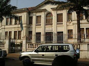
Landmarks
Attractions include the Portuguese-built Fortaleza de São José da Amura barracks from the 18th century, containing Amílcar Cabral's mausoleum, the Pidjiguiti Memorial to the dockers killed in the Bissau Dockers' Strike on August 3, 1959, the Guinea-Bissau National Arts Institute, Bissau New Stadium and local beaches.
Many buildings in the city were ruined during the Guinea-Bissau Civil War (1998–1999), including the Guinea-Bissau Presidential Palace and the Bissau French Cultural Centre (now rebuilt), and the city centre is still underdeveloped.
Gallery
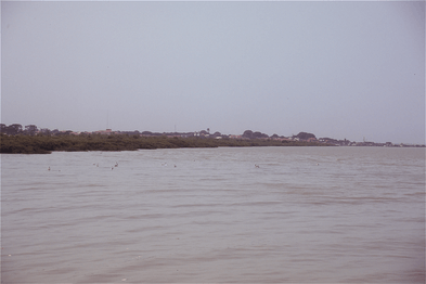 View of Bissau from Geba River
.jpg)
 Ministério da Justiça - Guinea-Bissau's Justice Ministry
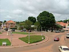 Che Guevara Square, Bissau
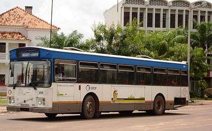 Public transport in Bissau
 A landmark monument in the city center
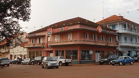 Administration building of the Portuguese energy company Galp
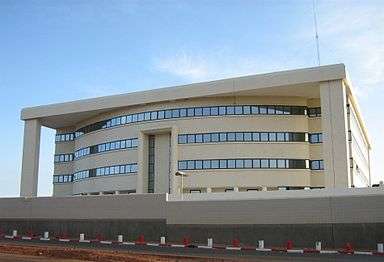 An ECOWAS branch in Bissau
 PAIGC's headquarters
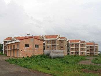 Residential area in Bissau
.jpg) Guinea-Bissau's Presidential Palace
Guinea-Bissau's Presidential Palace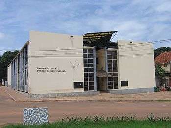 French Culture Centre in Bissau
.jpg) Solar panels on a rooftop of a building
Solar panels on a rooftop of a building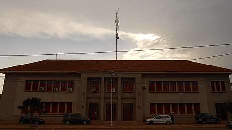 Central Post Office building
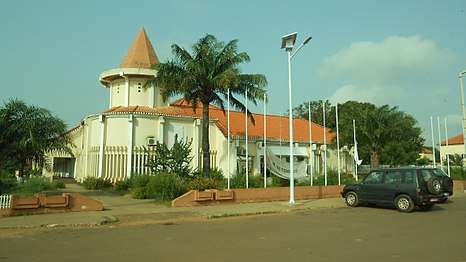 Museu Etnográfico Nacional - National Ethnographic Museum
.jpg) Combatentes da Liberdade Avenue, Bissau
Combatentes da Liberdade Avenue, Bissau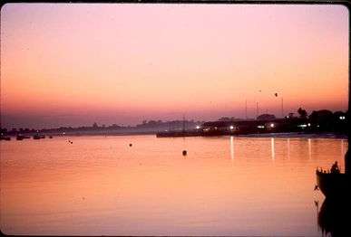 Bissau seen from Rio Geba
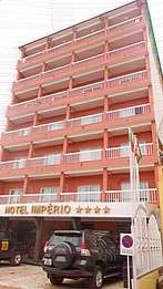 One of the hotels in the city
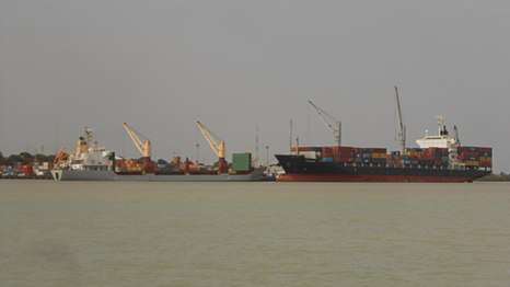
International relations
Twin towns – Sister cities
Bissau is twinned with:
References
- 1 2 "Africa by Country Internet User Stats and 2017 Population". www.internetworldstats.com.
- ↑ Uppsala Conflict Data Program Conflict Encyclopedia, Guinea Bissau: government, in depth, viewed July 12, 2013, http://www.ucdp.uu.se/gpdatabase/gpcountry.php?id=68®ionSelect=2-Southern_Africa#
- ↑ "GUINEA-BISSAU - BISSAU". Centro de Investigaciones Fitosociológicas. Retrieved 2011-10-04.
- ↑ "Bissau Climate Guide". Centro de Investigaciones Fitosociológicas. Retrieved 2011-10-04.
- ↑ "ESCOLAS COM CURRÍCULO PORTUGUÊS NA GUINÉ-BISSAU" (Archive). Direção de Serviços de Ensino e Escolas Portuguesas no Estrangeiro (DSEEPE) of the Portuguese Education Ministry. Retrieved on October 26, 2015.
- ↑ http://www.tcc.gov.tw/en/cp.aspx?n=81569D74DD82C7DB
- ↑ "Sister Cities of Ankara". www.ankara.bel.tr.
Further reading
- See also: Bibliography of the history of Bissau
- Lobban, Richard Andrew, Jr.; Mendy, Peter Karibe (1997). Historical Dictionary of the Republic of Guinea-Bissau (3rd ed.). Scarecrow Press. pp. 91–96. ISBN 0-8108-3226-7.
External links
|  | |||||||||||||||||||||||||||||||||||||||||||||||||||||||||||||||||||||||
|
| ||||||||||||||||||||||||||||||||||||||||||||||||||||||||||||||||||||||||
| ||||||||||||||||||||||||||||||||||||||||||||||||||||||||||||||||||||||||
| ||||||||||||||||||||||||||||||||||||||||||||||||||||||||||||||||||||||||
| ||||||||||||||||||||||||||||||||||||||||||||||||||||||||||||||||||||||||
| ||||||||||||||||||||||||||||||||||||||||||||||||||||||||||||||||||||||||