Rodès
| Rodès Rodés | ||
|---|---|---|
| Commune | ||
 A view within the village of Rodès | ||
| ||
 Rodès Location within Occitanie region  Rodès | ||
| Coordinates: 42°39′29″N 2°33′44″E / 42.6581°N 2.5622°ECoordinates: 42°39′29″N 2°33′44″E / 42.6581°N 2.5622°E | ||
| Country | France | |
| Region | Occitanie | |
| Department | Pyrénées-Orientales | |
| Arrondissement | Prades | |
| Canton | Le Canigou | |
| Intercommunality | Roussillon Conflent | |
| Government | ||
| • Mayor (2001–2008) | Georges Adroguer | |
| Area1 | 18.11 km2 (6.99 sq mi) | |
| Population (1999)2 | 509 | |
| • Density | 28/km2 (73/sq mi) | |
| Time zone | UTC+1 (CET) | |
| • Summer (DST) | UTC+2 (CEST) | |
| INSEE/Postal code | 66165 /66320 | |
| Elevation |
172–771 m (564–2,530 ft) (avg. 200 m or 660 ft) | |
|
1 French Land Register data, which excludes lakes, ponds, glaciers > 1 km2 (0.386 sq mi or 247 acres) and river estuaries. 2 Population without double counting: residents of multiple communes (e.g., students and military personnel) only counted once. | ||

Rodès is a commune in the Pyrénées-Orientales department in southern France.
Geography
Rodès is in the canton of Le Canigou and in the arrondissement of Prades.
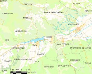
Map of Rodès and its surrounding communes
Population

Population 1962-2008
See also
References
| Wikimedia Commons has media related to Rodès. |
This article is issued from
Wikipedia.
The text is licensed under Creative Commons - Attribution - Sharealike.
Additional terms may apply for the media files.