Reliance, Delaware and Maryland
| Reliance | |
|---|---|
| Unincorporated community | |
 Reliance  Reliance  Reliance | |
| Coordinates: 38°38′07″N 75°42′23″W / 38.63528°N 75.70639°WCoordinates: 38°38′07″N 75°42′23″W / 38.63528°N 75.70639°W | |
| Country | United States |
| State | Delaware, Maryland |
| County | Sussex (DE), Caroline (MD), Dorchester (MD) |
| Elevation | 43 ft (13 m) |
| Time zone | UTC-5 (Eastern (EST)) |
| • Summer (DST) | UTC-4 (EDT) |
| Area code(s) | 302, 410, 443, and 667 |
| GNIS feature ID | 214538[1] |
Reliance is an unincorporated community located on the border of the U.S. states of Maryland and Delaware. The Maryland side of the community has portions in Caroline County and Dorchester County, while the Delaware side is located within Sussex County. Reliance is along Delaware Route 20 and Maryland Route 392 at the junction with Maryland Route 577 west of Seaford .[2] It was previously known as Johnson's Crossroads.[3][4]
Notable people
Patty Cannon (c. 1760 or 1759 or 1769 - May 11, 1829), was an illegal slave trader and the co-leader of the Cannon-Johnson Gang of Maryland-Delaware, which operated for about a decade in the early 19th century kidnapping free blacks and refugee slaves to sell into slavery in the South, which came to be known, as the Reverse Underground Railroad.
References
- ↑ "Reliance". Geographic Names Information System. United States Geological Survey.
- ↑ Delaware Department of Transportation (2008). Delaware Official Transportation Map (PDF) (Map). Dover: Delaware Department of Transportation.
- ↑ U.S. Geological Survey Geographic Names Information System: Reliance, Delaware and Maryland
- ↑ Kaminkow, Marion J. Maryland A to Z: A Topographical Dictionary. Baltimore, Maryland: Magna Carta Book Company, 1985. p285
Municipalities and communities of Caroline County, Maryland, United States | ||
|---|---|---|
| Towns | 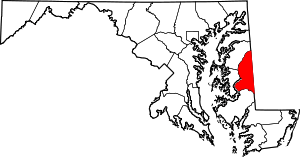 | |
| CDPs | ||
| Unincorporated communities | ||
| Footnotes | ‡This populated place also has portions in an adjacent county or counties | |
Municipalities and communities of Dorchester County, Maryland, United States | ||
|---|---|---|
| City | 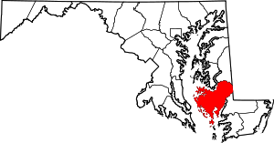 | |
| Towns | ||
| CDP | ||
| Other communities | ||
| Footnotes | ‡This populated place also has portions in an adjacent county or counties | |