Preston, Maryland
| Preston, Maryland | |
|---|---|
| Town | |
| Town of Preston | |
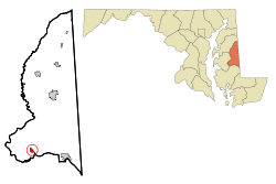 Location of Preston, Maryland | |
 Preston Location within the U.S. state of Maryland  Preston Preston (the US) | |
| Coordinates: 38°42′39″N 75°54′30″W / 38.71083°N 75.90833°WCoordinates: 38°42′39″N 75°54′30″W / 38.71083°N 75.90833°W | |
| Country |
|
| State |
|
| County |
|
| Incorporated | 1892[1] |
| Area[2] | |
| • Total | 0.57 sq mi (1.48 km2) |
| • Land | 0.57 sq mi (1.48 km2) |
| • Water | 0 sq mi (0 km2) |
| Elevation | 46 ft (14 m) |
| Population (2010)[3] | |
| • Total | 719 |
| • Estimate (2016)[4] | 706 |
| • Density | 1,300/sq mi (490/km2) |
| Time zone | UTC-5 (Eastern (EST)) |
| • Summer (DST) | UTC-4 (EDT) |
| ZIP code | 21655 |
| Area code(s) | 410 |
| FIPS code | 24-63825 |
| GNIS feature ID | 1681813 |
Preston is a town in Caroline County, Maryland. The population was 719 at the 2010 United States Census.
History
Preston is home to the Linchester Mill, c. 1682. During the Revolutionary War it supplied grain to George Washington's troops. It was listed on the National Register of Historic Places in 2009 along with the Jacob and Hannah Leverton House.[5] The town is also home to a newly renovated Underground Railway stop that was utilized by Harriet Tubman to make some of her greatest rescues. The site is located off of Grove Road.
Geography
Preston is located at 38°42′39″N 75°54′30″W / 38.71083°N 75.90833°W (38.710883, -75.908297).[6]
According to the United States Census Bureau, the town has a total area of 0.57 square miles (1.48 km2), all of it land.[2]
Climate
The climate in this area is characterized by hot, humid summers and generally mild to cool winters. According to the Köppen Climate Classification system, Preston has a humid subtropical climate, abbreviated "Cfa" on climate maps.[7]
Demographics
| Historical population | |||
|---|---|---|---|
| Census | Pop. | %± | |
| 1880 | 156 | — | |
| 1900 | 192 | — | |
| 1910 | 288 | 50.0% | |
| 1920 | 784 | 172.2% | |
| 1930 | 315 | −59.8% | |
| 1940 | 369 | 17.1% | |
| 1950 | 353 | −4.3% | |
| 1960 | 469 | 32.9% | |
| 1970 | 509 | 8.5% | |
| 1980 | 498 | −2.2% | |
| 1990 | 437 | −12.2% | |
| 2000 | 566 | 29.5% | |
| 2010 | 719 | 27.0% | |
| Est. 2016 | 706 | [4] | −1.8% |
| U.S. Decennial Census[8] | |||
2010 census
As of the census[3] of 2010, there were 719 people, 264 households, and 190 families residing in the town. The population density was 1,261.4 inhabitants per square mile (487.0/km2). There were 295 housing units at an average density of 517.5 per square mile (199.8/km2). The racial makeup of the town was 89.0% White, 6.3% African American, 0.4% Native American, 1.1% Asian, 0.4% from other races, and 2.8% from two or more races. Hispanic or Latino of any race were 1.0% of the population.
There were 264 households of which 40.2% had children under the age of 18 living with them, 56.4% were married couples living together, 8.0% had a female householder with no husband present, 7.6% had a male householder with no wife present, and 28.0% were non-families. 22.3% of all households were made up of individuals and 10.7% had someone living alone who was 65 years of age or older. The average household size was 2.72 and the average family size was 3.14.
The median age in the town was 35.2 years. 27.1% of residents were under the age of 18; 5.8% were between the ages of 18 and 24; 30.4% were from 25 to 44; 24.5% were from 45 to 64; and 12.1% were 65 years of age or older. The gender makeup of the town was 49.7% male and 50.3% female.
2000 census
As of the census[9] of 2000, there were 566 people, 225 households, and 168 families residing in the town. The population density was 1,009.2 people per square mile (390.2/km²). There were 242 housing units at an average density of 431.5 per square mile (166.9/km²). The racial makeup of the town was 92.93% White, 4.77% African American, 0.71% Native American, 1.41% Asian, 0.18% from other races.
There were 225 households out of which 32.4% had children under the age of 18 living with them, 61.8% were married couples living together, 9.8% had a female householder with no husband present, and 24.9% were non-families. 20.0% of all households were made up of individuals and 7.1% had someone living alone who was 65 years of age or older. The average household size was 2.52 and the average family size was 2.86.
In the town, the population was spread out with 25.3% under the age of 18, 4.9% from 18 to 24, 38.2% from 25 to 44, 17.1% from 45 to 64, and 14.5% who were 65 years of age or older. The median age was 36 years. For every 100 females, there were 101.4 males. For every 100 females age 18 and over, there were 93.2 males.
The median income for a household in the town was $48,125, and the median income for a family was $53,365. Males had a median income of $37,083 versus $23,182 for females. The per capita income for the town was $20,617. About 3.6% of families and 4.9% of the population were below the poverty line, including 7.9% of those under age 18 and 5.2% of those age 65 or over.
References
- ↑ "Preston". Maryland Manual. Retrieved 25 June 2017.
- 1 2 "US Gazetteer files 2010". United States Census Bureau. Archived from the original on 2012-01-24. Retrieved 2013-01-25.
- 1 2 "American FactFinder". United States Census Bureau. Retrieved 2013-01-25.
- 1 2 "Population and Housing Unit Estimates". Retrieved June 9, 2017.
- ↑ National Park Service (2009-03-13). "National Register Information System". National Register of Historic Places. National Park Service.
- ↑ "US Gazetteer files: 2010, 2000, and 1990". United States Census Bureau. 2011-02-12. Retrieved 2011-04-23.
- ↑ Climate Summary for Preston, Maryland
- ↑ "Census of Population and Housing". Census.gov. Retrieved June 4, 2015.
- ↑ "American FactFinder". United States Census Bureau. Retrieved 2008-01-31.
External links
| Wikimedia Commons has media related to Preston, Maryland. |
Municipalities and communities of Caroline County, Maryland, United States | ||
|---|---|---|
| Towns | 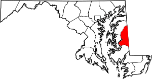 | |
| CDPs | ||
| Unincorporated communities | ||
| Footnotes | ‡This populated place also has portions in an adjacent county or counties | |