Henderson, Maryland
| Henderson, Maryland | |
|---|---|
| Town | |
 Location of Henderson, Maryland | |
 Henderson Location within the U.S. state of Maryland  Henderson Henderson (the US) | |
| Coordinates: 39°4′26″N 75°45′59″W / 39.07389°N 75.76639°WCoordinates: 39°4′26″N 75°45′59″W / 39.07389°N 75.76639°W | |
| Country |
|
| State |
|
| County |
|
| Incorporated | 1949[1] |
| Area[2] | |
| • Total | 0.13 sq mi (0.34 km2) |
| • Land | 0.13 sq mi (0.34 km2) |
| • Water | 0 sq mi (0 km2) |
| Elevation | 56 ft (17 m) |
| Population (2010)[3] | |
| • Total | 146 |
| • Estimate (2016)[4] | 145 |
| • Density | 1,100/sq mi (430/km2) |
| Time zone | UTC-5 (Eastern (EST)) |
| • Summer (DST) | UTC-4 (EDT) |
| ZIP code | 21640 |
| Area code(s) | 410 |
| FIPS code | 24-37925 |
| GNIS feature ID | 0590445 |
Henderson is a town in Caroline County, Maryland. The population was 146 at the 2010 United States Census. It was named for a stockholder of the Delaware and Chesapeake Railroad.
Athol was listed on the National Register of Historic Places in 1989.[5]
Geography
Henderson is located at 39°4′26″N 75°45′59″W / 39.07389°N 75.76639°W (39.073796, -75.766431).[6]
According to the United States Census Bureau, the town has a total area of 0.13 square miles (0.34 km2), all of it land.[2]
Demographics
| Historical population | |||
|---|---|---|---|
| Census | Pop. | %± | |
| 1880 | 52 | — | |
| 1950 | 106 | — | |
| 1960 | 129 | 21.7% | |
| 1970 | 135 | 4.7% | |
| 1980 | 156 | 15.6% | |
| 1990 | 66 | −57.7% | |
| 2000 | 118 | 78.8% | |
| 2010 | 146 | 23.7% | |
| Est. 2016 | 145 | [4] | −0.7% |
| U.S. Decennial Census[7] | |||
The median income for a household in the town was $32,500, and the median income for a family was $33,125. Males had a median income of $30,625 versus $21,875 for females. The per capita income for the town was $11,678. There were 16.1% of families and 14.2% of the population living below the poverty line, including 15.2% of under eighteens and 16.7% of those over 64.
2010 census
As of the census[3] of 2010, there were 146 people, 44 households, and 28 families residing in the town. The population density was 1,123.1 inhabitants per square mile (433.6/km2). There were 51 housing units at an average density of 392.3 per square mile (151.5/km2). The racial makeup of the town was 65.8% White, 2.1% African American, 0.7% Native American, 30.8% from other races, and 0.7% from two or more races. Hispanic or Latino of any race were 37.0% of the population.
There were 44 households of which 38.6% had children under the age of 18 living with them, 47.7% were married couples living together, 4.5% had a female householder with no husband present, 11.4% had a male householder with no wife present, and 36.4% were non-families. 22.7% of all households were made up of individuals and 6.8% had someone living alone who was 65 years of age or older. The average household size was 3.32 and the average family size was 3.64.
The median age in the town was 30 years. 23.3% of residents were under the age of 18; 13% were between the ages of 18 and 24; 34.2% were from 25 to 44; 23.9% were from 45 to 64; and 5.5% were 65 years of age or older. The gender makeup of the town was 52.7% male and 47.3% female.
References
- ↑ "Henderson". Maryland Manual. Retrieved 25 June 2017.
- 1 2 "US Gazetteer files 2010". United States Census Bureau. Archived from the original on 2012-01-24. Retrieved 2013-01-25.
- 1 2 "American FactFinder". United States Census Bureau. Retrieved 2013-01-25.
- 1 2 "Population and Housing Unit Estimates". Retrieved June 9, 2017.
- ↑ National Park Service (2008-04-15). "National Register Information System". National Register of Historic Places. National Park Service.
- ↑ "US Gazetteer files: 2010, 2000, and 1990". United States Census Bureau. 2011-02-12. Retrieved 2011-04-23.
- ↑ "Census of Population and Housing". Census.gov. Archived from the original on May 12, 2015. Retrieved June 4, 2015.
Municipalities and communities of Caroline County, Maryland, United States | ||
|---|---|---|
| Towns | 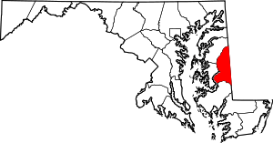 | |
| CDPs | ||
| Unincorporated communities | ||
| Footnotes | ‡This populated place also has portions in an adjacent county or counties | |