Rajarhat Upazila
| Rajarhat রাজারহাট | |
|---|---|
| Upazila | |
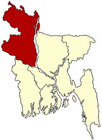
 Rajarhat Location in Bangladesh | |
| Coordinates: 25°48′N 89°33′E / 25.800°N 89.550°ECoordinates: 25°48′N 89°33′E / 25.800°N 89.550°E | |
| Country |
|
| Division | Rangpur Division |
| District | Kurigram District |
| Government | |
| • Upazila Parisad Chairman | Abul Hashem |
| • UNO | MD. Rafikul Islam |
| Area | |
| • Total | 166.23 km2 (64.18 sq mi) |
| Population (2011) | |
| • Total | 169,579 |
| • Density | 1,000/km2 (2,600/sq mi) |
| Time zone | UTC+6 (BST) |
| Postal code | 5610 |
| Website | রাজারহাট উপজেলা |
Rajarhat (Bengali: রাজারহাট) is an upazila of Kurigram District in the Division of Rangpur, Bangladesh. Since 1981 it had been a Thana and later on September 14, 1983 was turned into an upazila by the government.[1]
Geography
Rajarhat is located at 25°48′00″N 89°33′00″E / 25.8000°N 89.5500°E, which is about 10 kilometers west to the center of Kurigram district. It is surrounded by Phulbari and Lalmonirhat sadar upazilas on the north, Ulipur and Pirgachha upazilas on the south, Kurigram sadar upazila on the east, Lalmonirhat Sadar and Kaunia upazilas on the west. It has 27357 households and a total area of 166.23 km². There are two rivers namely Teesta and Dharla that passe through this upazila.
Demographics
As of the 2011 Bangladesh census, Rajarhat has a population of 192689 with a population density of 945 people per square kilometer.[2] Males constitute 50.52% of the population, and females 49.48%. Upazila's adult (over 18) population is 72315. The average literacy rate of the people is 40.66% with 46.62% of male and 34.65% of female being literate.[1]
Points of interest
- Sindurmati Dighi
- Chandamari Mosque
- Pangeshwari Temple
- Gharialdanga Zamindar Bari
- Panga Rajbari
- Two cannons ascribed to Fate Khan and Kalu Khan (Panga Rajbari)
- Shiva Mandir at Koteshwar
Administration
Rajarhat has 7 Unions, 110 Mauzas/Mahallas, and 180 villages. The unions are:[1]
- Rajarhat
- Chakirpasha (Chakirpashar)
- Nazimkhan
- Biddanand (Bidyananda)
- Umarmajid (Omar Majid)
- Sinai (Chhinai)
- Gharialdanga
Chakirpasha is the largest among all these unions. Similar to other upazilas in the country, Upazila Parisad headed by an Upazila Chairman who is elected in a direct vote of the people is the highest form of local government in Rajarhat upazila.
Education
- Literacy Rate: 57%
- Number of Colleges: 4
- Number of High Schools: 34
- Number of Madrasas: 45
- Number of Primary Schools (government run): 49
- Number of Primary Schools (private): 67
Notable residents
- Raufun Basunia (Late leader of anti dictatorship movement)
See also
References
- 1 2 3 Md. Kamal Hossain (2012), "Rajarhat Upazila", in Sirajul Islam and Ahmed A. Jamal, Banglapedia: National Encyclopedia of Bangladesh (Second ed.), Asiatic Society of Bangladesh
- ↑ "এক নজরে রাজারহাট উপজেলা". kurigram.gov.bd.
| Upazila/Thana: | ||
|---|---|---|