Boda Upazila
| Boda বোদা | |
|---|---|
| Upazila | |
 Boda Location in Bangladesh | |
| Coordinates: 26°11′55″N 88°33′20″E / 26.19861°N 88.55556°ECoordinates: 26°11′55″N 88°33′20″E / 26.19861°N 88.55556°E | |
| Country | Bangladesh |
| Division | Rangpur Division |
| District | Panchagarh District |
| Area | |
| • Total | 349.47 km2 (134.93 sq mi) |
| Population (1991) | |
| • Total | 168,258 |
| • Density | 480/km2 (1,200/sq mi) |
| Time zone | UTC+6 (BST) |
| Website | Official Map of Boda |
Boda (Bengali: বোদা) is an Upazila of Panchagarh District in the Division of Rangpur, Bangladesh.[1] Boda is the largest upazila in Panchagarh. It is named Boda because the big Badeshwari Temple is there.
Geography
Boda is located at 26°12′30″N 88°33′35″E / 26.2083°N 88.5597°E . It has 33535 households and total area 349.47 km².
Demographics
As of the 1991 Bangladesh census, Boda has a population of 168258. Males constitute 51.22% of the population, and females 48.78%. This Upazila's eighteen up population is 83118. Boda has an average literacy rate of 29.4% (7+ years), and the national average of 32.4% literate.[2]
Administration
Boda Upazila is divided into one municipality and 10 union parishads: Benghari Banagram, Boda, Boroshoshi, Chandanbari, Jholaishalshiri, Kajoldighikaligonj, Mareabamonhat, Moidandighi, Pachpir, and Sakoa. The union parishads are subdivided into 174 mauzas and 239 villages.
See also
References
- ↑ Md. Ahsan Habib (2012). "Boda Upazila". In Sirajul Islam and Ahmed A. Jamal. Banglapedia: National Encyclopedia of Bangladesh (Second ed.). Asiatic Society of Bangladesh.
- ↑ "Population Census Wing, BBS". Archived from the original on 2005-03-27. Retrieved November 10, 2006.
| Upazila/Thana: | ||
|---|---|---|
Capital: Rangpur | ||
| Dinajpur District | 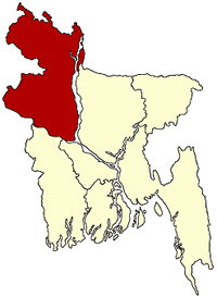 | |
| Gaibandha District | ||
| Kurigram District | ||
| Lalmonirhat District | ||
| Nilphamari District | ||
| Panchagarh District | ||
| Rangpur District | ||
| Thakurgaon District | ||