Patgram Upazila
| Patgram পাটগ্রাম | |
|---|---|
| Upazila | |
 Patgram Location in Bangladesh | |
| Coordinates: 26°21′N 89°01′E / 26.350°N 89.017°ECoordinates: 26°21′N 89°01′E / 26.350°N 89.017°E | |
| Country |
|
| Division | Rangpur Division |
| District | Lalmonirhat District |
| Area | |
| • Total | 261.51 km2 (100.97 sq mi) |
| Population (1991) | |
| • Total | 155,913 |
| • Density | 600/km2 (1,500/sq mi) |
| Time zone | UTC+6 (BST) |
| Website | Official website of Patgram |
Patgram (Bengali: পাটগ্রাম) is an Upazila of Lalmonirhat District[1] in the Division of Rangpur, Bangladesh.it is a class upazila in Bangladesh.
Geography
Patgram is located at 26°21′N 89°01′E / 26.350°N 89.017°E. It has 30271 households and total area 261.51 km².
Demographics
As of the 1991 Bangladesh census, Patgram has a population of 155913. Males constitute 51.52% of the population, and females 48.48%. This Upazila's eighteen up population is 75134. Patgram has an average literacy rate of 25.2% (7+ years), and the national average of 32.4% literate.[2]
Administration
Patgram has one pourasova and 8 Unions/Wards, 76 Mauzas/Mahallas, and 56 villages. Those unions are Patgram, Jagatber, Kuchlibari, Dhagram, Jongra, Baura, Sreerampur, Burimari.
Transportation
Patgram is well connected with Capital city Dhaka by Road & Train.
See also
References
- ↑ Benu Begum Bijli (2012). "Patgram Upazila". In Sirajul Islam and Ahmed A. Jamal. Banglapedia: National Encyclopedia of Bangladesh (Second ed.). Asiatic Society of Bangladesh.
- ↑ "Population Census Wing, BBS". Archived from the original on 2005-03-27. Retrieved 2006-11-10.
| Upazila/Thana: | ||
|---|---|---|
Capital: Rangpur | ||
| Dinajpur District | 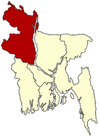 | |
| Gaibandha District | ||
| Kurigram District | ||
| Lalmonirhat District | ||
| Nilphamari District | ||
| Panchagarh District | ||
| Rangpur District | ||
| Thakurgaon District | ||
| Wikimedia Commons has media related to Patgram Upazila. |