Char Rajibpur Upazila
| Char Rajibpur চর রাজিবপুর | |
|---|---|
| Upazila | |
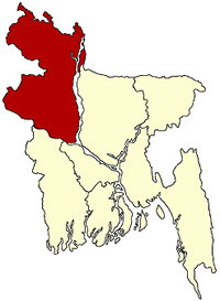
 Char Rajibpur Location in Bangladesh | |
| Coordinates: 25°24′N 89°41.5′E / 25.400°N 89.6917°ECoordinates: 25°24′N 89°41.5′E / 25.400°N 89.6917°E | |
| Country |
|
| Division | Rangpur Division |
| District | Kurigram District |
| Area | |
| • Total | 111.03 km2 (42.87 sq mi) |
| Population (1991) | |
| • Total | 58,049 |
| • Density | 520/km2 (1,400/sq mi) |
| Time zone | UTC+6 (BST) |
| Website |
charrajibpur |
Char Rajibpur (Bengali: চর রাজিবপুর) is an Upazila of Kurigram District in the Division of Rangpur, Bangladesh.[1]
Geography
Char Rajibpur is located at 25°24′00″N 89°41′30″E / 25.4000°N 89.6917°E. It has 11,124 households and a total area 111.03 km².
Demographics
As of the 1991 Bangladesh census, Char Rajibpur has a population of 58,049, with 27,533 over the age of 18. Males constitute 49.54% of the population, and females 50.46%. Char Rajibpur has an average literacy rate of 16.4% (7+ years), compared to the national average of 32.4% literate.[2]
Technology
In Rajibpur Upazila, some private and government organizations provide computer and information technology support. Now in the public IT assisted by Rajibpur.com, Rajibpur news, Upazila Toto Kendo
Administration
Char Rajibpur has 3 Unions/Wards, 26 Mauzas/Mahallas, and 72 villages.
See also
References
- ↑ Md Kamal Hossain (2012), "Char Rajibpur Upazila", in Sirajul Islam and Ahmed A. Jamal, Banglapedia: National Encyclopedia of Bangladesh (Second ed.), Asiatic Society of Bangladesh
- ↑ "Population Census Wing, BBS". Archived from the original on 2005-03-27. Retrieved November 10, 2006.
| Upazila/Thana: | ||
|---|---|---|