Pol-e Alam
| Pol-e Alam پل علم | |
|---|---|
| City | |
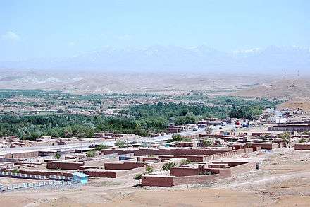 Pol-e Alam in 2007 | |
 Pol-e Alam | |
| Coordinates: 33°58′51″N 69°02′06″E / 33.98083°N 69.03500°ECoordinates: 33°58′51″N 69°02′06″E / 33.98083°N 69.03500°E | |
| Country |
|
| Province | Logar |
| Elevation | 1,922 m (6,306 ft) |
| Population (2015) | |
| • Total | 22,914[1] |
| Time zone | UTC+4:30 |
Pol-e Alam (Pashto/Persian: پل علم) is the provincial capital of Logar Province, Afghanistan as well as of Puli Alam District. The population of Pol-e Alam is estimated to be around 108,000, which is composed of ethnic Pashtuns and Tajiks. The city of Pol-e Alam has a population of 22,914 (in 2015).[2] it has 4 districts and a total land area of 3,752 Hectares.[3] The total number of dwellings in this city are 2,546.[4]
Pol-e Alam has undergone massive reconstruction work after the fall of Taliban government.
A provincial reconstruction team PRT Logar of the Czech Republic was based in Pol-e Alam.
Climate
With a cold and temperate climate, Pol-e Alam features a warm-summer humid continental climate (Dsa) under the Köppen climate classification. It has warm, dry summers and cold, snowy winters. The average temperature in Pol-e Alam is 11.0 °C, while the annual precipitation averages 291 mm.
July is the hottest month of the year with an average temperature of 24.7 °C. The coldest month January has an average temperature of -6.8 °C.
| Climate data for Pol-e Alam | |||||||||||||
|---|---|---|---|---|---|---|---|---|---|---|---|---|---|
| Month | Jan | Feb | Mar | Apr | May | Jun | Jul | Aug | Sep | Oct | Nov | Dec | Year |
| Average high °C (°F) | −0.4 (31.3) |
6.9 (44.4) |
10.9 (51.6) |
18.6 (65.5) |
23.1 (73.6) |
30.9 (87.6) |
32.8 (91) |
32.2 (90) |
27.8 (82) |
20.4 (68.7) |
13.4 (56.1) |
5.5 (41.9) |
18.5 (65.3) |
| Daily mean °C (°F) | −6.8 (19.8) |
0.8 (33.4) |
5.0 (41) |
12.1 (53.8) |
15.3 (59.5) |
22.3 (72.1) |
24.7 (76.5) |
23.8 (74.8) |
18.7 (65.7) |
11.6 (52.9) |
5.5 (41.9) |
−1.3 (29.7) |
11 (51.8) |
| Average low °C (°F) | −13.2 (8.2) |
−5.3 (22.5) |
−0.9 (30.4) |
5.6 (42.1) |
7.6 (45.7) |
13.8 (56.8) |
16.6 (61.9) |
15.5 (59.9) |
9.7 (49.5) |
2.8 (37) |
−2.3 (27.9) |
−8.1 (17.4) |
3.5 (38.3) |
| Source: Climate-Data.org[5] | |||||||||||||
Land use
Pol-e Alam is an urban village in eastern Afghanistan.[6] Agriculture is the dominant land use, accounting for 49% of total land. Only 19% of land is classified as built-up, but of this area, 48% is vacant plots.[7] In Districts 1-3, the majority of the dwellings are regular houses.[8]
References
- ↑ "The State of Afghan Cities report 2015".
- ↑ "The State of Afghan Cities report2015".
- ↑ "The State of Afghan Cities report 2015".
- ↑ "The State of Afghan Cities report2015".
- ↑ "Climate: Pul-i-Alam - Climate-Data.org". Retrieved 9 September 2016.
- ↑ "The State of Afghan Cities report 2015".
- ↑ "The State of Afghan Cities report 2015".
- ↑ "The State of Afghan Cities report 2015".
External links