Khas Kunar District
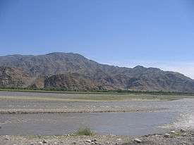
Kunar River in the Bar Kashkot village, Kuz Kunar District, Nangarhar
Khas Kunar or Sarkani(sarkano) District (Pashto: خاص کونړ ولسوالۍ, Persian: ولسوالی خاص کنر) is the largest district in the Kunar Province, Afghanistan. It is situated in the southern part of the province and borders Nangarhar Province to the south and Pakistan to the east. The Kunar River passes north through the district and irrigates the surrounding land. The population is 31,000 (2006). The district center, Khas Kunar village is located at 34°38′45″N 70°54′03″E / 34.6458°N 70.9008°E at 749 m altitude. Most of the houses were destroyed during the wars and the drought also has seriously affected the lands far from the Kunar River.
Villages of Khas Kunar
- Tannar
- Arazi
- Upper Arazi
- Koligram
- Khyber khowar
- Chara gai
- Camp
- Miagano Kelai
- Zargaran
- Lottan
- Shalai
- Mangwaal
- Chancharr
- Pashad
- Adargam
- kotki( kotkai)
External links
This article is issued from
Wikipedia.
The text is licensed under Creative Commons - Attribution - Sharealike.
Additional terms may apply for the media files.