Princessville, New Jersey
| Princessville, New Jersey | |
|---|---|
| Unincorporated community | |
 The Princessville Cemetery, with graves dating from 1843-1921 | |
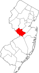
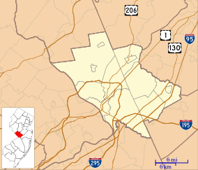 Princessville, New Jersey Location of Princessville in Mercer County Inset: Location of county within the state of New Jersey  Princessville, New Jersey Princessville, New Jersey (New Jersey)  Princessville, New Jersey Princessville, New Jersey (the US) | |
| Coordinates: 40°17′33″N 74°42′28″W / 40.29250°N 74.70778°WCoordinates: 40°17′33″N 74°42′28″W / 40.29250°N 74.70778°W | |
| Country |
|
| State |
|
| County | Mercer |
| Township | Lawrence |
| Elevation[1] | 82 ft (25 m) |
| GNIS feature ID | 879489[1] |
Princessville is an unincorporated community located within Lawrence Township in Mercer County, New Jersey, United States.[2] It was home to the Colonial era Princessville Inn, formerly listed on the National Register of Historic Places, which burned down in 1982. A cemetery still exists on Princeton Pike that dates to 1843 when the inn donated land for a Methodist Episcopal congregation. The church relocated in 1890 and was replaced by one built by local African-American families, which was destroyed by a Hurricane in 1950. The Baker-Brearley House, a National Register of Historic Places listed home that houses the Lawrence Historical Society, is located down a driveway past the cemetery.[3] The area immediately to the south is occupied by a corporate office park adjacent to the interchange between Princeton Pike and Interstate 95. The area to the north is largely rural.
References
- 1 2 "Princessville". Geographic Names Information System. United States Geological Survey.
- ↑ Locality Search, State of New Jersey. Accessed January 9, 2015.
- ↑ Halvorsen, John. "Cemeteries of Lawrence" (PDF). Lawrence Historical Society.
| Wikimedia Commons has media related to Princessville Cemetery. |