Millstone, Mercer County, New Jersey
| Millstone, New Jersey | |
|---|---|
| Unincorporated community | |
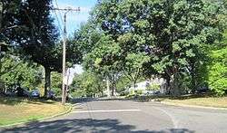 Looking into Millstone along Rocky Brook Road from Old Cranbury Road | |
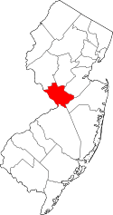
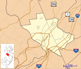 Millstone, New Jersey Location of Millstone in Mercer County Inset: Location of county within the state of New Jersey  Millstone, New Jersey Millstone, New Jersey (New Jersey)  Millstone, New Jersey Millstone, New Jersey (the US) | |
| Coordinates: 40°17′17″N 74°31′54″W / 40.28806°N 74.53167°WCoordinates: 40°17′17″N 74°31′54″W / 40.28806°N 74.53167°W | |
| Country |
|
| State |
|
| County | Mercer |
| Township | East Windsor |
| Elevation[1] | 102 ft (31 m) |
| GNIS feature ID | 883458[1] |
Millstone is an unincorporated community located within East Windsor Township in Mercer County, New Jersey, United States.[2] Located in the northern portion of the township near Old Cranbury Road, U.S. Route 130, and New Jersey Route 133, it is a planned community constructed in the 1960s.[3][4][5]
References
- 1 2 "Millstone". Geographic Names Information System. United States Geological Survey.
- ↑ Locality Search, State of New Jersey. Accessed January 9, 2015.
- ↑ "Aerial view of Millstone, 1963". Historic Aerials. 1963. Retrieved August 15, 2015.
- ↑ "Aerial view of Millstone, 1969". Historic Aerials. 1969. Retrieved August 15, 2015.
- ↑ Google (August 15, 2015). "Aerial view of Millstone" (Map). Google Maps. Google. Retrieved August 15, 2015.
This article is issued from
Wikipedia.
The text is licensed under Creative Commons - Attribution - Sharealike.
Additional terms may apply for the media files.