Mercerville, New Jersey
| Mercerville, New Jersey | |
|---|---|
| Census-designated place | |
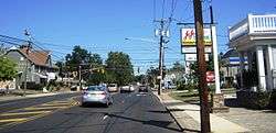 The Five Points intersection | |
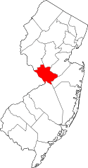
 Location in Mercer County and the state of New Jersey. | |
 Mercerville, New Jersey Location in Mercer County and the state of New Jersey.  Mercerville, New Jersey Mercerville, New Jersey (the US) | |
| Coordinates: 40°14′09″N 74°41′32″W / 40.235832°N 74.692254°WCoordinates: 40°14′09″N 74°41′32″W / 40.235832°N 74.692254°W | |
| Country |
|
| State |
|
| County | Mercer |
| Township | Hamilton |
| Area[1] | |
| • Total | 3.730 sq mi (9.659 km2) |
| • Land | 3.687 sq mi (9.549 km2) |
| • Water | 0.043 sq mi (0.111 km2) 1.14% |
| Elevation[2] | 98 ft (30 m) |
| Population (2010 Census)[3] | |
| • Total | 13,230 |
| • Density | 3,588.5/sq mi (1,385.5/km2) |
| Time zone | UTC-5 (Eastern (EST)) |
| • Summer (DST) | UTC-4 (Eastern (EDT)) |
| ZIP code | 08619 - Trenton[4] |
| FIPS code | 3445480[1][5] |
| GNIS feature ID | 02389472[1][6] |
Mercerville is an unincorporated community and census-designated place (CDP) located within Hamilton Township, in Mercer County, New Jersey, United States.[7] As of the 2010 United States Census, the CDP's population was 13,230.[3] Until after the 2000 Census, the area was part of the Mercerville-Hamilton Square CDP. For the 2010 Census it was split into two CDPs, Mercerville and Hamilton Square.[8]
History
Many historical markers in Mercerville detail the path of the Continental Army under the command of George Washington through the area during the American Revolutionary War. Several are related to their night march from the Second Battle of Trenton to the Battle of Princeton.
Originally called "Sandtown," Mercerville is named after General Hugh Mercer, who died on January 12, 1777 due to wounds incurred at the Battle of Princeton. Hamilton Square was renamed after Alexander Hamilton, during a wave of anti-British sentiment at the time of the War of 1812. It previously had been called Nottingham after the British town.[9]
Historic places
- Isaac Watson House was built in 1708 on a bluff overlooking Watson's Creek; the property totaled 800 acres (3.2 km2). Located at 151 Westcott Avenue, it is the oldest house in Mercer County. The house serves as the Headquarters of the New Jersey State Society DAR. The house is on the National Register of Historic Places (NRHP).
- John Abbott II House was built in 1730 by John Abbott. It is located at 2200 Kuser Rd. on the North side of Crosswicks Creek in nearby Veterans Park. The house is noted as having been used as a secret repository for funds hidden from British as they advanced on Trenton in 1776. The funds were stored by John Abbott II for state treasurer Samuel Tucker inside a tub containing broken crockery. In 1969 the house was to be razed to the ground but was saved by the Hamilton Township Historical Society. The house is listed on the National Register.
- Isaac Pearson House was built in 1733. Isaac Pearson was elected several times to the state assembly, served on the General Committee of Correspondence appointed by the Provincial Assembly on July 21, 1774, and the first Committee of Safety in October 1775. Pearson was killed by robbers, or was suspected as having collaborated with the British and killed by Continentals. This house is listed on the New Jersey Register of Historic Places.
Geography
According to the United States Census Bureau, the CDP had a total area of 3.730 square miles (9.659 km2), including 3.687 square miles (9.549 km2) of land and 0.043 square miles (0.111 km2) of water (1.14%).[1][10]
The main intersection in Mercerville is known as Five Points. It the junction of (starting north and heading clockwise): Quaker Bridge Road (County Route 533), Edinburg Road (CR 535), Nottingham Way (CR 618), White Horse-Mercerville Road (CR 533), and Nottingham Way (CR 535). In addition, New Jersey Route 33 runs east and west to the south of this intersection. Except for Notthingham Way east of Five Points, the preceding roads contain most of Mercervile's commercial businesses.[11]
Demographics
As of the 2010 United States Census, there were 13,230 people, 5,028 households, and 3,605 families residing in the CDP. The population density was 3,588.5 per square mile (1,385.5/km2). There were 5,246 housing units at an average density of 1,422.9 per square mile (549.4/km2). The racial makeup of the CDP was 88.81% (11,749) White, 3.98% (527) Black or African American, 0.22% (29) Native American, 3.67% (486) Asian, 0.04% (5) Pacific Islander, 1.90% (252) from other races, and 1.38% (182) from two or more races. Hispanic or Latino of any race were 6.86% (907) of the population.[3]
There were 5,028 households out of which 28.9% had children under the age of 18 living with them, 57.8% were married couples living together, 10.1% had a female householder with no husband present, and 28.3% were non-families. 22.9% of all households were made up of individuals, and 11.2% had someone living alone who was 65 years of age or older. The average household size was 2.58 and the average family size was 3.06.[3]
In the CDP, the population was spread out with 20.7% under the age of 18, 7.0% from 18 to 24, 25.0% from 25 to 44, 29.6% from 45 to 64, and 17.7% who were 65 years of age or older. The median age was 43.1 years. For every 100 females there were 92.9 males. For every 100 females ages 18 and older there were 90.1 males.[3]
Education
Most high school students in Mercerville attend Nottingham High School (New Jersey).
References
- 1 2 3 4 Gazetteer of New Jersey Places, United States Census Bureau. Accessed July 21, 2016.
- ↑ U.S. Geological Survey Geographic Names Information System: Mercerville Census Designated Place, Geographic Names Information System. Accessed November 21, 2012.
- 1 2 3 4 5 DP-1 - Profile of General Population and Housing Characteristics: 2010 Demographic Profile Data for Mercerville CDP, New Jersey, United States Census Bureau. Accessed November 21, 2012.
- ↑ Look Up a ZIP Code for Mercerville, NJ, United States Postal Service. Accessed November 21, 2012.
- ↑ American FactFinder, United States Census Bureau. Accessed September 4, 2014.
- ↑ US Board on Geographic Names, United States Geological Survey. Accessed September 4, 2014.
- ↑ Locality Search, State of New Jersey. Accessed April 19, 2015.
- ↑ New Jersey: 2010 - Population and Housing Unit Counts - 2010 Census of Population and Housing (CPH-2-32), P. III-4. United States Census Bureau, August 2012. Accessed November 20, 2012. "Mercer County—Name Changes: Robbinsville township name changed from Washington; New CDPs: Groveville (formed from part of deleted Yardville-Groveville CDP and additional area), Hamilton Square (formed from part of deleted Mercerville-Hamilton Square CDP and additional area), Mercerville (formed from part of deleted Mercerville-Hamilton Square CDP), Robbinsville, and Yardville (formed from part of deleted Yardville-Groveville CDP and additional area)"
- ↑ History of Hamilton Township, Hamilton Township Historical Society, 1999.
- ↑ US Gazetteer files: 2010, 2000, and 1990, United States Census Bureau. Accessed September 4, 2014.
- ↑ Google (September 12, 2015). "Aerial view of Mercerville" (Map). Google Maps. Google. Retrieved September 12, 2015.
| Wikimedia Commons has media related to Mercerville, New Jersey. |