Coopers Corner, New Jersey
| Coopers Corner, New Jersey | |
|---|---|
| Unincorporated community | |
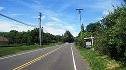 Approaching Coopers Corners from the east along CR 518 | |
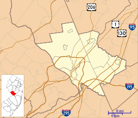 Coopers Corner, New Jersey Location of Coopers Corner in Mercer County Inset: Location of county within the state of New Jersey  Coopers Corner, New Jersey Coopers Corner, New Jersey (New Jersey)  Coopers Corner, New Jersey Coopers Corner, New Jersey (the US) | |
| Coordinates: 40°22′19″N 74°50′53″W / 40.37194°N 74.84806°WCoordinates: 40°22′19″N 74°50′53″W / 40.37194°N 74.84806°W | |
| Country |
|
| State |
|
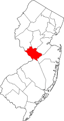
| County | Mercer |
| Township | Hopewell |
| Elevation[1] | 354 ft (108 m) |
| GNIS feature ID | 875643[1] |
Coopers Corner is an unincorporated community located within Hopewell Township in Mercer County, New Jersey, United States.[2] The settlement is centered about the intersection of County Routes 518 and 579.[3]
References
- 1 2 "Coopers Corner". Geographic Names Information System. United States Geological Survey.
- ↑ Google (January 9, 2015). "Coopers Corner, New Jersey" (Map). Google Maps. Google. Retrieved January 9, 2015.
- ↑ Google (June 13, 2015). "Aerial view of Coopers Corners" (Map). Google Maps. Google.
This article is issued from
Wikipedia.
The text is licensed under Creative Commons - Attribution - Sharealike.
Additional terms may apply for the media files.