Poncey-sur-l'Ignon
| Poncey-sur-l'Ignon | |
|---|---|
| Commune | |
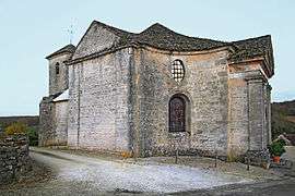 The church in Poncey-sur-l'Ignon | |
 Poncey-sur-l'Ignon Location within Bourgogne-Franche-Comté region  Poncey-sur-l'Ignon | |
| Coordinates: 47°29′43″N 4°45′43″E / 47.4953°N 4.7619°E / 47.4953; 4.7619Coordinates: 47°29′43″N 4°45′43″E / 47.4953°N 4.7619°E / 47.4953; 4.7619 | |
| Country | France |
| Region | Bourgogne-Franche-Comté |
| Department | Côte-d'Or |
| Arrondissement | Dijon |
| Canton | Is-sur-Tille |
| Government | |
| • Mayor (2008–2014) | Philippe Gamin |
| Area1 | 16.35 km2 (6.31 sq mi) |
| Population (2008)2 | 85 |
| • Density | 5.2/km2 (13/sq mi) |
| Time zone | UTC+1 (CET) |
| • Summer (DST) | UTC+2 (CEST) |
| INSEE/Postal code | 21494 /21440 |
| Elevation |
383–529 m (1,257–1,736 ft) (avg. 430 m or 1,410 ft) |
|
1 French Land Register data, which excludes lakes, ponds, glaciers > 1 km2 (0.386 sq mi or 247 acres) and river estuaries. 2 Population without double counting: residents of multiple communes (e.g., students and military personnel) only counted once. | |
Poncey-sur-l'Ignon is a commune in the Côte-d'Or department in eastern France.
Population
| Historical population | ||
|---|---|---|
| Year | Pop. | ±% |
| 1962 | 100 | — |
| 1968 | 122 | +22.0% |
| 1975 | 105 | −13.9% |
| 1982 | 107 | +1.9% |
| 1990 | 66 | −38.3% |
| 1999 | 81 | +22.7% |
| 2008 | 85 | +4.9% |
See also
References
| Wikimedia Commons has media related to Poncey-sur-l'Ignon. |
This article is issued from
Wikipedia.
The text is licensed under Creative Commons - Attribution - Sharealike.
Additional terms may apply for the media files.