Épernay-sous-Gevrey
| Épernay-sous-Gevrey | |
|---|---|
| Commune | |
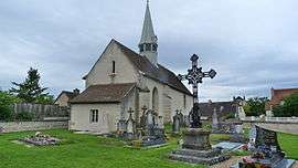 The church in Épernay-sous-Gevrey | |
 Épernay-sous-Gevrey Location within Bourgogne-Franche-Comté region  Épernay-sous-Gevrey | |
| Coordinates: 47°10′52″N 5°02′03″E / 47.1811°N 5.0342°E / 47.1811; 5.0342Coordinates: 47°10′52″N 5°02′03″E / 47.1811°N 5.0342°E / 47.1811; 5.0342 | |
| Country | France |
| Region | Bourgogne-Franche-Comté |
| Department | Côte-d'Or |
| Arrondissement | Beaune |
| Canton | Nuits-Saint-Georges |
| Intercommunality | Sud Dijonnais |
| Government | |
| • Mayor (2008–2014) | Jean-François Armbruster |
| Area1 | 5.47 km2 (2.11 sq mi) |
| Population (2008)2 | 173 |
| • Density | 32/km2 (82/sq mi) |
| Time zone | UTC+1 (CET) |
| • Summer (DST) | UTC+2 (CEST) |
| INSEE/Postal code | 21246 /21220 |
| Elevation | 205–230 m (673–755 ft) |
|
1 French Land Register data, which excludes lakes, ponds, glaciers > 1 km2 (0.386 sq mi or 247 acres) and river estuaries. 2 Population without double counting: residents of multiple communes (e.g., students and military personnel) only counted once. | |
Épernay-sous-Gevrey is a commune in the Côte-d'Or department in eastern France.
Population
| Historical population | ||
|---|---|---|
| Year | Pop. | ±% |
| 1962 | 70 | — |
| 1968 | 78 | +11.4% |
| 1975 | 89 | +14.1% |
| 1982 | 116 | +30.3% |
| 1990 | 127 | +9.5% |
| 1999 | 162 | +27.6% |
| 2008 | 173 | +6.8% |
See also
References
| Wikimedia Commons has media related to Épernay-sous-Gevrey. |
This article is issued from
Wikipedia.
The text is licensed under Creative Commons - Attribution - Sharealike.
Additional terms may apply for the media files.