Corcelles-lès-Cîteaux
| Corcelles-lès-Cîteaux | ||
|---|---|---|
| Commune | ||
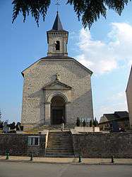 The church in Corcelles-lès-Cîteaux | ||
| ||
 Corcelles-lès-Cîteaux Location within Bourgogne-Franche-Comté region  Corcelles-lès-Cîteaux | ||
| Coordinates: 47°10′22″N 5°04′58″E / 47.1728°N 5.0828°ECoordinates: 47°10′22″N 5°04′58″E / 47.1728°N 5.0828°E | ||
| Country | France | |
| Region | Bourgogne-Franche-Comté | |
| Department | Côte-d'Or | |
| Arrondissement | Beaune | |
| Canton | Nuits-Saint-Georges | |
| Intercommunality | Sud Dijonnais | |
| Government | ||
| • Mayor (2008–2020) | Jérôme Fontaine | |
| Area1 | 6.75 km2 (2.61 sq mi) | |
| Population (2008)2 | 828 | |
| • Density | 120/km2 (320/sq mi) | |
| Time zone | UTC+1 (CET) | |
| • Summer (DST) | UTC+2 (CEST) | |
| INSEE/Postal code | 21191 /21910 | |
| Elevation | 199–227 m (653–745 ft) | |
|
1 French Land Register data, which excludes lakes, ponds, glaciers > 1 km2 (0.386 sq mi or 247 acres) and river estuaries. 2 Population without double counting: residents of multiple communes (e.g., students and military personnel) only counted once. | ||
.svg.png)
Corcelles-lès-Cîteaux is a commune in the Côte-d'Or department in eastern France.
Population
| Historical population | ||
|---|---|---|
| Year | Pop. | ±% |
| 1962 | 172 | — |
| 1968 | 178 | +3.5% |
| 1975 | 262 | +47.2% |
| 1982 | 456 | +74.0% |
| 1990 | 525 | +15.1% |
| 1999 | 720 | +37.1% |
| 2008 | 828 | +15.0% |
History
The commune is located 18 km south of Dijon. It held several names throughout its history: Corcellae (in 871), Curcella (between 1100 and 1110), Curcellae (in 1163), Corcellae in Silva (throughout the 13th century), Corcellae in Nemore (in 1212), Corcellae aux Bois (in 1217), Corclles le bois lez Citeaux (in 1375),Courcelles le bois les Cisteulx (in 1544), Courcelles les Bois (in 1637), Corcelles lez Citeaux (in 1645) and Corcelles au Bois (under the first Republic).[1]
See also
References
- ↑ "Présentation - Mairie de Corcelles-lès-Cîteaux". www.corcelles-les-citeaux.fr (in French). Retrieved 2017-06-05.
| Wikimedia Commons has media related to Corcelles-lès-Cîteaux. |
This article is issued from
Wikipedia.
The text is licensed under Creative Commons - Attribution - Sharealike.
Additional terms may apply for the media files.