Montagny-lès-Seurre
| Montagny-lès-Seurre | |
|---|---|
| Commune | |
 The church in Montagny-lès-Seurre | |
 Montagny-lès-Seurre Location within Bourgogne-Franche-Comté region  Montagny-lès-Seurre | |
| Coordinates: 47°01′27″N 5°15′16″E / 47.0242°N 5.2544°ECoordinates: 47°01′27″N 5°15′16″E / 47.0242°N 5.2544°E | |
| Country | France |
| Region | Bourgogne-Franche-Comté |
| Department | Côte-d'Or |
| Arrondissement | Beaune |
| Canton | Brazey-en-Plaine |
| Intercommunality | Rives de Saône |
| Government | |
| • Mayor (2008–2014) | Bernard Thomassin |
| Area1 | 7.16 km2 (2.76 sq mi) |
| Population (2008)2 | 107 |
| • Density | 15/km2 (39/sq mi) |
| Time zone | UTC+1 (CET) |
| • Summer (DST) | UTC+2 (CEST) |
| INSEE/Postal code | 21424 /21250 |
| Elevation |
181–193 m (594–633 ft) (avg. 187 m or 614 ft) |
|
1 French Land Register data, which excludes lakes, ponds, glaciers > 1 km2 (0.386 sq mi or 247 acres) and river estuaries. 2 Population without double counting: residents of multiple communes (e.g., students and military personnel) only counted once. | |
Montagny-lès-Seurre is a commune in the Côte-d'Or department in eastern France.
Population
| Historical population | ||
|---|---|---|
| Year | Pop. | ±% |
| 1962 | 109 | — |
| 1968 | 111 | +1.8% |
| 1975 | 112 | +0.9% |
| 1982 | 107 | −4.5% |
| 1990 | 119 | +11.2% |
| 1999 | 112 | −5.9% |
| 2008 | 107 | −4.5% |
See also
References
Gallery
 City Council
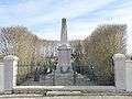 First World War Memorial
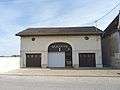
 The old school
 Rue de l'Église
| Wikimedia Commons has media related to Montagny-lès-Seurre. |
This article is issued from
Wikipedia.
The text is licensed under Creative Commons - Attribution - Sharealike.
Additional terms may apply for the media files.