Pelham, New York
| Pelham | |
|---|---|
| Town | |
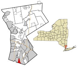 Location of Pelham, New York | |
| Coordinates: 40°54′38″N 73°48′27″W / 40.91056°N 73.80750°W | |
| Country | United States |
| State | New York |
| County | Westchester |
| Incorporated | 1788 |
| Government[1][2] | |
| • Town Supervisor | Peter DiPaola (R) (2016) |
| • Town Clerk | Michael Recca (R) (2017) |
| Area[3] | |
| • Total | 2.22 sq mi (5.74 km2) |
| • Land | 2.17 sq mi (5.63 km2) |
| • Water | 0.05 sq mi (0.12 km2) 2.27% |
| Elevation | 63.1 ft (19.2 m) |
| Population (2010) | |
| • Total | 12,396 |
| • Estimate (2016)[4] | 12,585 |
| • Density | 5,794.20/sq mi (2,237.22/km2) |
| Time zone | Eastern |
| ZIP code | 10803 |
| Area code(s) | 914 |
| FIPS code | 36-119-57012 |
| Website | http://www.townofpelham.com/ |
Pelham /pɛləm/ is a suburban town in Westchester County, New York, approximately 14 miles northeast of Midtown Manhattan. As of the 2010 census, it had a population of 12,396.[5] Historically, Pelham was composed of five villages and became known as "the Pelhams". Pelham currently contains two independently incorporated villages: the Villages of Pelham and Pelham Manor,[1] Approximately 28 minutes away from Grand Central Terminal by the Metro-North train, Pelham is home to many New York City commuters and has an active social community for its residents. Notably, the Whitestone Bridge is approximately 8.5 miles (14 km) south of the town and can be reached in 10–15 minutes without traffic. It is also 13 miles (21 km) northeast of LaGuardia Airport, which can be reached in 20–25 minutes without traffic and John F. Kennedy International Airport, the city's main international airport, is 19.5 miles (31 km) south of the town.
Geography
According to the United States Census Bureau, the town has a total area of 2.4 square miles (6.2 km2). It is directly north of the New York City borough of the Bronx and borders Eastchester, New Rochelle and Mount Vernon.
Bronx Manor
Pelham is also associated with a small portion of the borough of the Bronx, commonly called "Bronx Manor", named for the borough and the village of Pelham Manor. As of the 2010 census, this small area consists of 1,444 residents living on nine residential streets: Split Rock Road, Lincoln Avenue, Ropes Avenue, McOwen Avenue, Hutchinson Avenue, Flint Avenue, Hollers Avenue, Boston Road, Pelham Bay Park West, and Good Place.
This location is technically located in the Bronx, and properties are taxed accordingly at Bronx rates. Bronx Manor residents have a New York City address with a Westchester telephone area code and exchange (914-738), and Pelham ZIP code (10803). Residents of Bronx Manor are eligible for political jobs for which a New York City residence is required. Bronx Manor is served by the Bx16 route of the New York City Transit Authority.
Students residing in Bronx Manor are zoned for Pelham/Westchester public schools, per a 1948 contract between New York City and Westchester County. Bronx Manor includes Glover Field, the playing grounds for the athletic teams of Pelham public schools. Bronx Manor is served by the fire and police departments of Pelham. As of 2016, it has been nine years (2007) since a Bronx Manor home has been placed on the market for sale.
History
In 1654, Thomas Pell bought the area within the present-day town from the Siwanoy Indians. He named his manor "Pelham" in honor of his tutor, Pelham Burton.[6]
Pelham was incorporated as a part of the Bronx in 1788. It included all of City Island and present-day Pelham Bay Park east of the Hutchinson River. In 1889, the town was incorporated at its current boundaries. In 1891, the village of Pelham Manor incorporated. In 1896, the village of North Pelham and the village of Pelham incorporated. In 1975, the villages of North Pelham and Pelham merged, forming the present village of Pelham.[6] The Village of Pelham and the Village of Pelham Manor share several services such as school and recreational activities. There is a grassroots movement to continue the consolidation of services in order to reduce taxes.
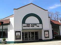
The Pelham Picture House was added to the National Register of Historic Places in 2010.[7]

St. Catharine's Catholic Church
St. Catharine's was originally a mission church of St Gabriel's parish in New Rochelle. In July 1896 a frame church was built in the newly incorporated village of Pelham on land donated by Mr. and Mrs. Patrick Farrell. In December 1897 St. Catharine's became a separate parish with Rev. Francis P. McNichol as first pastor. A school was established in 1904, staffed by the Sisters of St. Francis. At the end of the school year in 1983 St. Catharine's School closed bringing to an end 75 years of Catholic education in the parish. The school building was converted to a Parish Center to provide space for Religious Education classes, parish activities and groups to meet.[8] A new church was dedicated in 1909.[9]
In 1936 W. T. Grant, who owned a chain of five-and-ten cent stores, gave property in Pelham Manor to St. Catharine’s to serve as a separate “mission”. The mission evolved to become Our Lady of Perpetual Help parish, with its own church building. In 2014 it was announced that the two parishes would merge, with the newer, larger Our Lady of Perpetual Help building designated as the parish church. However, St. Catharine’s Church in the Village of Pelham was retained as a worship center.[10]
Demographics
| Historical population | |||
|---|---|---|---|
| Census | Pop. | %± | |
| 1790 | 199 | — | |
| 1820 | 283 | — | |
| 1830 | 334 | 18.0% | |
| 1840 | 789 | 136.2% | |
| 1850 | 577 | −26.9% | |
| 1860 | 1,025 | 77.6% | |
| 1870 | 1,790 | 74.6% | |
| 1880 | 2,540 | 41.9% | |
| 1890 | 3,941 | 55.2% | |
| 1900 | 1,571 | −60.1% | |
| 1910 | 2,998 | 90.8% | |
| 1920 | 5,195 | 73.3% | |
| 1930 | 11,851 | 128.1% | |
| 1940 | 12,272 | 3.6% | |
| 1950 | 12,195 | −0.6% | |
| 1960 | 13,404 | 9.9% | |
| 1970 | 13,933 | 3.9% | |
| 1980 | 12,978 | −6.9% | |
| 1990 | 11,903 | −8.3% | |
| 2000 | 11,866 | −0.3% | |
| 2010 | 12,396 | 4.5% | |
| Est. 2016 | 12,585 | [4] | 1.5% |
| U.S. Decennial Census[11] | |||
As of the census[12] of 2000, there were 12,107 people, 4,149 households and 3,190 families residing in the town. The population density was 5,523.4 people per square mile (2,130.9/km²). There were 4,246 housing units at an average density of 1,976.4 per square mile (762.5/km²). The racial makeup of the town was 87.33% White, 4.57% Black or African American, 0.08% Native American, 3.96% Asian, 1.82% from other races and 2.23% from two or more races. Hispanic or Latino of any race were 6.02% of the population.
There were 4,149 households out of which 41.3% had children under the age of 18 living with them, 64.4% were married couples living together, 9.7% had a female householder with no husband present and 23.1% were non-families. 19.4% of all households were made up of individuals and 8.3% had someone living alone who was 65 years of age or older. The average household size was 2.86 and the average family size was 3.31.
In the town, the population was spread out with 28.6% under the age of 18, 5.1% from 18 to 24, 28.3% from 25 to 44, 25.1% from 45 to 64 and 12.9% who were 65 years of age or older. The median age was 38 years. For every 100 females, there were 93.4 males. For every 100 females age 18 and over, there were 86.9 males.
The median income for a household in the town was $91,810 and the median income for a family was $112,339.[13] Males had a median income of $74,760 versus $46,086 for females. The per capita income for the town was $51,548. About 2.2% of families and 3.7% of the population were below the poverty line, including 4.3% of those under age 18 and 3.2% of those age 65 or over.
Climate
| Climate data for Pelham, NY | |||||||||||||
|---|---|---|---|---|---|---|---|---|---|---|---|---|---|
| Month | Jan | Feb | Mar | Apr | May | Jun | Jul | Aug | Sep | Oct | Nov | Dec | Year |
| Record high °F (°C) | 73 (23) |
75 (24) |
86 (30) |
96 (36) |
97 (36) |
99 (37) |
104 (40) |
102 (39) |
101 (38) |
89 (32) |
82 (28) |
77 (25) |
104 (40) |
| Average high °F (°C) | 39.2 (4) |
42.9 (6.1) |
51.4 (10.8) |
62.6 (17) |
73.8 (23.2) |
81.6 (27.6) |
86.0 (30) |
83.9 (28.8) |
76.1 (24.5) |
65.4 (18.6) |
55.1 (12.8) |
43.8 (6.6) |
63.5 (17.5) |
| Average low °F (°C) | 20.1 (−6.6) |
22.3 (−5.4) |
29.1 (−1.6) |
38.4 (3.6) |
47.2 (8.4) |
56.8 (13.8) |
62.3 (16.8) |
60.8 (16) |
53.0 (11.7) |
41.2 (5.1) |
34.6 (1.4) |
25.6 (−3.6) |
41 (5) |
| Record low °F (°C) | −10 (−23) |
−5 (−21) |
2 (−17) |
17 (−8) |
29 (−2) |
38 (3) |
49 (9) |
44 (7) |
34 (1) |
27 (−3) |
12 (−11) |
−4 (−20) |
−10 (−23) |
| Average precipitation inches (mm) | 3.56 (90.4) |
2.84 (72.1) |
4.07 (103.4) |
4.16 (105.7) |
4.33 (110) |
3.44 (87.4) |
4.20 (106.7) |
3.93 (99.8) |
4.37 (111) |
3.67 (93.2) |
4.09 (103.9) |
3.80 (96.5) |
46.46 (1,180.1) |
| Average snowfall inches (cm) | 9.8 (24.9) |
10.9 (27.7) |
6.8 (17.3) |
1.4 (3.6) |
.2 (0.5) |
0 (0) |
0 (0) |
0 (0) |
0 (0) |
.1 (0.3) |
.8 (2) |
8.6 (21.8) |
38.6 (98) |
| Average rainy days (≥ 0.01 in) | 8.5 | 8.1 | 9.3 | 9.8 | 10.9 | 9.3 | 9.0 | 8.7 | 7.6 | 6.7 | 9.2 | 9.4 | 113.4 |
| Source #1: Weatherbase [14] | |||||||||||||
| Source #2: Homefacts (precipitation only) [15] The Weather Channel (extremes) [16] | |||||||||||||
Education
Pelham is home to four elementary schools[17] (two located in each village), one middle school, and one high school. The elementary schools are Hutchinson, Colonial, Siwanoy, and Prospect Hill. Pelham Middle School and Pelham Memorial High School gather students for all of Pelham. These are all part of the Pelham Union Free School District. There are also several private and religious based schools.[17] Since 1948, New York City has paid the district to educate children who live in a small strip of land between Pelham and Pelham Bay Park that is part of the Bronx due to a boundary error, as doing so is less expensive than sending school buses there.[18]
Fire Department
The Village of Pelham Fire Department has 10 firefighters and 5 Lieutenants using one Fire Station. The fleet has two Engines, one Ladder, one Utility Unit, and a Command Vehicle. The Pelham Fire Department responds to approximately 800 emergency calls annually.
Transportation
Trains
On Amtrak, Pelham is located closest to the New Rochelle, New York stop ("NRO"), on the Northeast Corridor Line. On Metro-North Railroad, the Pelham station stop is within Fare Zone 12 on the New Haven Line. Pelham is also about 28 minutes from Grand Central Station, Manhattan, New York.
Economy
Major employers in Pelham include Pico Electronics, Barksdale Home Care Services Corp., Pelham Public Schools, the New York Athletic Club, and the De Cicco & Sons grocery.[19] Other companies based in Pelham include Archie Comics.
Notable people
- Lyman Walbridge, first center for the New York Giants football team
- Charles Lewis Bowman, noted Pelham architect, designed nine homes in the early 20th century[20]
- Liborio Bellomo, acting boss of the Genovese crime family
- Clinton Roosevelt, politician and inventor
- Michael Schwerner, a civil rights worker murdered by the Ku Klux Klan while helping African-Americans register to vote in Mississippi
- Joseph Cross, Hollywood actor, starred in films such as Jack Frost, Milk, and Lincoln
- Nick Bollettieri, notable American tennis coach.
- Antonio Ciacca, jazz pianist, composer and conductor.
- Tony DeMeo, retired college football coach, author and motivational speaker
- Felix Cavaliere, musician
- Mary Lorson, musician
- Gene Stone, writer and editor
- Gary Scott, baseball player
- Nina Marie Danielle (Model) Play Boy Playmate of the year 2018
Image gallery
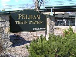 Pelham Train Station, also in the village.
 Daronco Town House
 Pelham Town Hall
References
- 1 2 "Town of Pelham". Retrieved 2009-05-01.
- ↑ http://www.townofpelham.com/government_supervisor.htm
- ↑ "2016 U.S. Gazetteer Files". United States Census Bureau. Retrieved Jul 5, 2017.
- 1 2 "Population and Housing Unit Estimates". Retrieved June 9, 2017.
- ↑ "Profile of General Population and Housing Characteristics: 2010 Demographic Profile Data (DP-1): Pelham town, Westchester County, New York". U.S. Census Bureau, American Factfinder. Retrieved November 15, 2011.
- 1 2 Bell, Blake (2008). "Town of Pelham History". Town of Pelham. Retrieved 2009-05-01.
- ↑ National Park Service (2010-07-09). "National Register Information System". National Register of Historic Places. National Park Service.
- ↑ ""Parish History", Our Lady of Perpetual Help-St. Catherine Parish". Archived from the original on 2016-12-02. Retrieved 2016-12-01.
- ↑ Lafort, Remigius. The Catholic Church in the United States of America, Vol. 3: The Province of Baltimore and the Province of New York, Section 1: Comprising the Archdiocese of New York and the Diocese of Brooklyn, Buffalo and Ogdensburg Together with some Supplementary Articles. (New York City: The Catholic Editing Company, 1914), p.423
- ↑ "St. Catharine’s Merging into Our Lady of Perpetual Help But Remaining Open for Masses and Sacraments", The Pelhams-PLUS, November 5, 2014
- ↑ "Census of Population and Housing". Census.gov. Archived from the original on May 12, 2015. Retrieved June 4, 2015.
- ↑ "American FactFinder". United States Census Bureau. Archived from the original on 2013-09-11. Retrieved 2008-01-31.
- ↑ http://www.city-data.com/city/Pelham-New-York.html
- ↑ "Historical Weather for New York, United States of America - Travel, Vacation and Reference Information". Canty and Associates LLC. Retrieved 2012-06-11.
- ↑ "Pelham Westchester County New York average temperature, sunshine and precipitation data". Homefacts.com. Retrieved 2012-06-11.
- ↑ "Monthly Averages for Pelham, NY (10803)". The Weather Channel. June 2012. Retrieved 2012-06-11.
- 1 2 "Community-Schools". Retrieved 2009-05-01.
- ↑ Gross, Jane (1997-05-06). "A Tiny Strip of New York That Feels Like the Suburbs". The New York Times. Retrieved June 9, 2012.
- ↑ Search Results - Pelham, New York - ReferenceUSA Current Businesses
- ↑ Archived December 16, 2010, at the Wayback Machine.
External links
| Wikimedia Commons has media related to Pelham, New York. |
- Town of Pelham official website
- Pelham Union Free School District
- Historic Pelham, website by Town Historian
- Historic Pelham, blog by Town Historian
Places adjacent to Pelham, New York | |
|---|---|
Municipalities and communities of Westchester County, New York, United States | ||
|---|---|---|
| Cities | 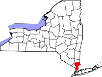 | |
| Towns | ||
| Villages | ||
| CDPs | ||
| Other hamlets | ||
| Footnotes | ‡This populated place also has portions in an adjacent county or counties | |
Coordinates: 40°54′38″N 73°48′27″W / 40.91056°N 73.80750°W