Příštpo
| Příštpo | |
|---|---|
| Municipality | |
 | |
 Příštpo | |
| Coordinates: 49°4′22″N 15°56′0″E / 49.07278°N 15.93333°ECoordinates: 49°4′22″N 15°56′0″E / 49.07278°N 15.93333°E | |
| Country |
|
| Region | Vysočina |
| District | Třebíč |
| Area | |
| • Total | 14.41 km2 (5.56 sq mi) |
| Elevation | 413 m (1,355 ft) |
| Population (2005) | |
| • Total | 273 |
| • Density | 19/km2 (49/sq mi) |
| Postal code | 675 51 |
| Website | http://www.pristpo.eu |
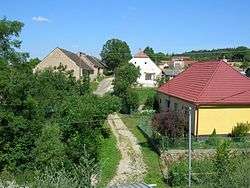
Příštpo is a village and municipality (obec) in Třebíč District in the Vysočina Region of the Czech Republic.
The municipality covers an area of 14.41 square kilometres (5.56 sq mi), and has a population of 273 (as at 2005).
Příštpo lies approximately 17 kilometres (11 mi) south of Třebíč, 44 km (27 mi) south-east of Jihlava, and 157 km (98 mi) south-east of Prague.
References
| Wikimedia Commons has media related to Příštpo. |
This article is issued from
Wikipedia.
The text is licensed under Creative Commons - Attribution - Sharealike.
Additional terms may apply for the media files.