Hodov
| Hodov | |
|---|---|
| Municipality | |
 | |
 Hodov | |
| Coordinates: 49°17′38″N 15°59′5″E / 49.29389°N 15.98472°ECoordinates: 49°17′38″N 15°59′5″E / 49.29389°N 15.98472°E | |
| Country |
|
| Region | Vysočina |
| District | Třebíč |
| Area | |
| • Total | 10.20 km2 (3.94 sq mi) |
| Elevation | 500 m (1,600 ft) |
| Population (2005) | |
| • Total | 295 |
| • Density | 29/km2 (75/sq mi) |
| Postal code | 675 04 |
| Website | http://www.hodov.cz |
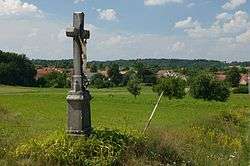
Hodov is a village and municipality (obec) in Třebíč District in the Vysočina Region of the Czech Republic.
The municipality covers an area of 10.20 square kilometres (3.94 sq mi), and has a population of 295 (as at 2005).
Hodov lies approximately 12 kilometres (7 mi) north-east of Třebíč, 31 km (19 mi) east of Jihlava, and 143 km (89 mi) south-east of Prague.
References
| Wikimedia Commons has media related to Hodov. |
This article is issued from
Wikipedia.
The text is licensed under Creative Commons - Attribution - Sharealike.
Additional terms may apply for the media files.