Horní Vilémovice
| Horní Vilémovice | |
|---|---|
| Municipality | |
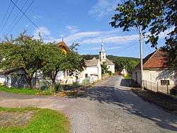 Center of the village. Protestant church in the background. | |
 Horní Vilémovice | |
| Coordinates: 49°17′27″N 15°52′59″E / 49.29083°N 15.88306°ECoordinates: 49°17′27″N 15°52′59″E / 49.29083°N 15.88306°E | |
| Country |
|
| Region | Vysočina |
| District | Třebíč |
| Area | |
| • Total | 9.76 km2 (3.77 sq mi) |
| Elevation | 590 m (1,940 ft) |
| Population (2005) | |
| • Total | 79 |
| • Density | 8.1/km2 (21/sq mi) |
| Postal code | 675 07 |
| Website | https://web.archive.org/web/20080309154446/http://www.hornivilemovice.cz/cz/index.php?x=00 |
Horní Vilémovice (German: Ober Willimowitz) is a village and municipality (obec) in Třebíč District in the Vysočina Region of the Czech Republic.
The municipality covers an area of 9.76 square kilometres (3.77 sq mi), and has a population of 79 (as at 2005).
Horní Vilémovice lies approximately 8 kilometres (5 mi) north of Třebíč, 25 km (16 mi) south-east of Jihlava, and 138 km (86 mi) south-east of Prague.
References
| Wikimedia Commons has media related to Horní Vilémovice. |
This article is issued from
Wikipedia.
The text is licensed under Creative Commons - Attribution - Sharealike.
Additional terms may apply for the media files.