Ortaköy, Uludere
| Ortaköy Ārosh | |
|---|---|
| Village | |
 The mountainous landscape. | |
 Ortaköy Location in Turkey | |
| Coordinates: 37°19′41″N 43°16′00″E / 37.32806°N 43.26667°ECoordinates: 37°19′41″N 43°16′00″E / 37.32806°N 43.26667°E | |
| Country |
|
| Province | Şırnak |
| District | Uludere |
| Government | |
| • Mayor | Zeynep Üren (BDP) |
| Elevation | 1,402 m (4,600 ft) |
| Population (2013) | |
| • Total | 3,000 |
| Time zone | UTC+2 (EET) |
| • Summer (DST) | UTC+3 (EEST) |
| Postal code | 73 600 |
| Area code(s) | 0482 |
| Licence plate | 47 |
Ortaköy is a village in the district of Uludere in Şırnak province, Turkey.[1] Ortaköy is 55 kilometres (34 mi) away from the district of Uludere and it is located in southeastern Turkey, just on the western border of the Hakkari province.
History
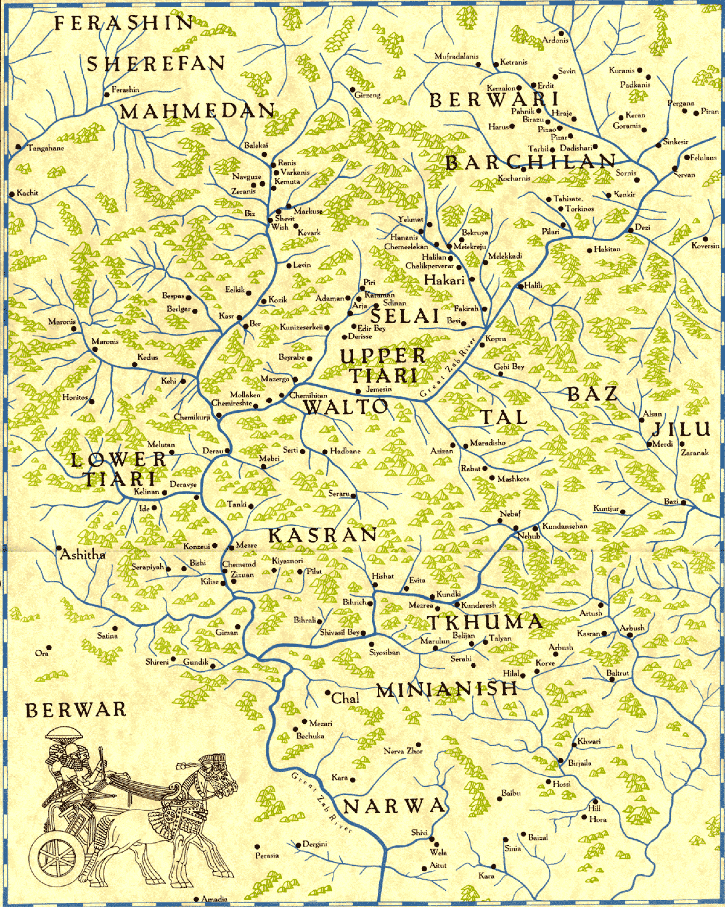
The village used to be an ancient Assyrian tribe, part of Assyria, called Ārosh Taxtayta (Lower Arosh) within the historical Assyrian district of Tyari and was populated by Assyrian people up until Seyfo in 1914.[2] The Assyrian village Ārosh Alayta (Upper Arosh), now named Yukariarus, in Hakkari, is less than 1 kilometre (0.62 mi) away, closely bordering the province of Sirnak. Halmon is around 4 kilometres (2.5 mi) to the northeast in Andaç and Gérāmon to the northwest, just right next to Halmon. Assyrian inhabitants of these proximate villages have ever since intermixed.[3]
Geography
Rather close to the border of Northern Iraq and within the upper reaches of Mesopotamia, the village is situated in a precipitous highland on a valley and is surrounded by mountains. The area's vegetation is Mediterranean forests, woodlands, and scrub. Summers are hot and dry with temperatures around 33 °C and winters are cold and wet, hovering around 4 °C. Snowfall is common in the cool months.
Economy
The economy of the village is based on livestock and beekeeping.
Infrastructure
There is a primary school in the village. The village has drinking water network but there is no sewer network. There is no PTT branch and agency. There is no health clinic. There is electricity and fixed telephone ADSL internet infrastructure in the village.
Population
| Population by years | |
|---|---|
| 2013 | 3,000 |
| 2007 | 1,082 |
| 2000 | 1,023 |
| 1997 | 734 |
See also
- Andaç, Uludere, the area that used to be Halmon and Geramon
- Tkhuma, another Assyrian village in Tyari (Hakkari province)
- Jilu, an Assyrian tribe in Hakkari
- Baz, an Assyrian tribe in Hakkari
- Çığlı, Çukurca, an area that used to be Ashita
- Nochiya tribe (Beyyurdu and Öveç, Şemdinli) in Hakkari
References
- ↑ "[YerelNET] ORTAKÖY KÖYÜ". www.yerelnet.org.tr. Retrieved 2018-02-13.
- ↑ http://www.aina.org/maps/chevalier/chevalier8.htm
- ↑ "Assyrian villages in Hakkari Assyrian villages in Hakkari".
