Oley Township, Berks County, Pennsylvania
| Oley Township | |
|---|---|
| Township | |
 A farm in Oley Township | |
 Oley Township Location of Oley Township in Pennsylvania  Oley Township Oley Township (the US) | |
| Coordinates: 40°23′00″N 75°46′15″W / 40.38333°N 75.77083°WCoordinates: 40°23′00″N 75°46′15″W / 40.38333°N 75.77083°W | |
| Country | United States |
| State | Pennsylvania |
| County | Berks |
| Area[1] | |
| • Total | 24.09 sq mi (62.39 km2) |
| • Land | 23.88 sq mi (61.84 km2) |
| • Water | 0.21 sq mi (0.54 km2) |
| Elevation | 371 ft (113 m) |
| Population (2010) | |
| • Total | 3,620 |
| • Estimate (2016)[2] | 3,740 |
| • Density | 156.63/sq mi (60.48/km2) |
| Time zone | UTC-5 (EST) |
| • Summer (DST) | UTC-4 (EDT) |
| Area code(s) | 610 |
| FIPS code | 42-011-56672 |
| Website | |
|
Oley Township Historic District | |
| Location | PA 73, Oley Township, Pennsylvania |
| Coordinates | 40°22′7″N 75°46′17″W / 40.36861°N 75.77139°W |
| Area | 15,065 acres (6,097 ha) |
| Architect | Multiple |
| Architectural style | Late Victorian, Georgian, Germanic style |
| NRHP reference # | [3] |
| Added to NRHP | March 11, 1983 |
Oley Township is a township in Berks County, Pennsylvania, United States. As of the 2010 census, the township had a population of 3,620. Oley Township was originally formed in 1740 as a part of Philadelphia County, before Berks County was formed in 1752. The entire township was listed as a historic district by the National Register of Historic Places in 1983.[4] Daniel Boone was born in Oley Township November 2, 1734.[5]
Geography
According to the United States Census Bureau, the township has a total area of 24.2 square miles (62.7 km²). 24.2 square miles (62.7 km²) of it is land, and none of the area is covered with water. It is drained by the Schuylkill River via its tributaries of the Manatawny Creek and Monocacy Creek. Its villages include Limekiln (also in Exeter Township), Oley, Oley Furnace, Pleasantville, Spangsville, and Yellow House (also in Amity Township).
Adjacent townships
- Rockland Township (north)
- Pike Township (northeast)
- Earl Township (east)
- Amity Township (southeast)
- Exeter Township (southwest)
- Alsace Township (west)
- Ruscombmanor Township (northwest)
Demographics
As of the census[6] of 2000, there were 3,583 people, 1,382 households, and 1,029 families residing in the township. The population density was 148.1 people per square mile (57.2/km²). There were 1,425 housing units at an average density of 58.9/sq mi (22.7/km²).
The racial makeup of the township was 98.66% White, 0.14% African American, 0.03% Native American, 0.28% Asian, 0.20% from other races, and 0.70% from two or more races. Hispanic or Latino of any race were 0.98% of the population.
There were 1,382 households, out of which 33.1% had children under the age of 18 living with them, 62.8% were married couples living together, 7.5% had a female householder with no husband present, and 25.5% were non-families. 19.8% of all households were made up of individuals, and 8.0% had someone living alone who was 65 years of age or older. The average household size was 2.58 and the average family size was 3.00.
In the township the population was spread out, with 23.7% under the age of 18, 6.9% from 18 to 24, 30.8% from 25 to 44, 24.4% from 45 to 64, and 14.2% who were 65 years of age or older. The median age was 39 years. For every 100 females, there were 99.6 males. For every 100 females age 18 and over, there were 96.8 males.
| Historical population | |||
|---|---|---|---|
| Census | Pop. | %± | |
| 1980 | 3,024 | — | |
| 1990 | 3,362 | 11.2% | |
| 2000 | 3,583 | 6.6% | |
| 2010 | 3,620 | 1.0% | |
| Est. 2016 | 3,740 | [2] | 3.3% |
| Source: US Census Bureau | |||
The median income for a household in the township was $52,151, and the median income for a family was $58,045. Males had a median income of $40,882 versus $27,795 for females. The per capita income for the township was $21,565. About 0.9% of families and 2.0% of the population were below the poverty line, including none of those under age 18 and 4.8% of those age 65 or over.
Gallery
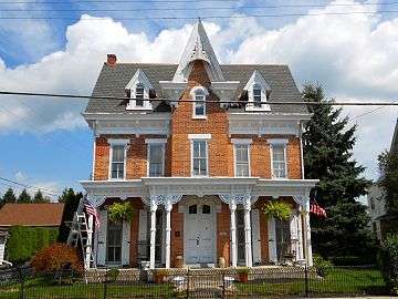 House on Main Street in Oley Village
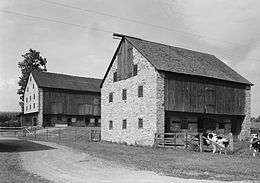
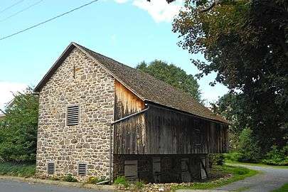 Barn on Main Street in Oley Village
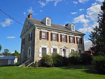
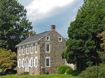 Milloth House in Oley Village
See also
References
| Wikimedia Commons has media related to Oley Township, Berks County, Pennsylvania. |
- ↑ "2016 U.S. Gazetteer Files". United States Census Bureau. Retrieved Aug 13, 2017.
- 1 2 "Population and Housing Unit Estimates". Retrieved June 9, 2017.
- ↑ National Park Service (2009-03-13). "National Register Information System". National Register of Historic Places. National Park Service.
- ↑ Phoebe L. Hopkins, 1982, NRHP Nomination Form for Oley Township Historic District Enter "public" for ID and "public" for password to access the site.
- ↑ Bruce, H. Addington, Daniel Boone and the Wilderness Road, New York: Macmillan, 1911, p. 6
- ↑ "American FactFinder". United States Census Bureau. Retrieved 2008-01-31.
External links
- Township website
- Map of Oley Township Historic District
- Historic American Building Survey, Oley vicinity
- Historic American Building Survey, Pleasantville vicinity
| Topics |   | |
|---|---|---|
| Lists by county |
| |
| Lists by city | ||
| Other lists | ||
| ||