| [3] |
Name on the Register |
Image |
Date listed[4] |
Location |
City or town |
Description |
|---|
| 1 |
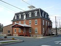
Allegheny Aqueduct |
|
February 23, 1984
(#84003105) |
Pennsylvania Route 724 and Allegheny Creek at Gibraltar
40°17′10″N 75°53′13″W / 40.286111°N 75.886944°W / 40.286111; -75.886944 (Allegheny Aqueduct) |
Robeson Township |
|
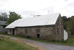
| 2 |
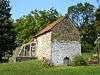
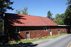
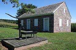
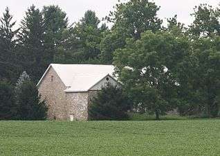
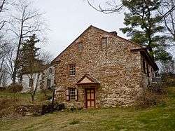
Alleghany Mennonite Meetinghouse |
|
June 6, 2009
(#09000384) |
39 Horning Road
40°14′07″N 75°58′17″W / 40.235278°N 75.971389°W / 40.235278; -75.971389 (Alleghany Mennonite Meetinghouse) |
Brecknock Township |
|
| 3 |
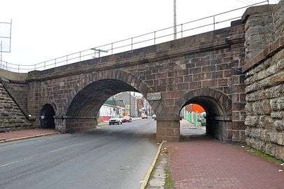
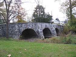
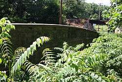
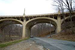
Askew Bridge |
|
March 1, 1973
(#73001590) |
North 6th Street near Woodward Street
40°20′37″N 75°55′34″W / 40.343611°N 75.926111°W / 40.343611; -75.926111 (Askew Bridge) |
Reading |
|
| 4 |
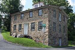
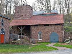
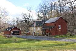
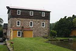
Bahr Mill Complex |
|
November 8, 1990
(#90001611) |
Ironstone Drive
40°20′19″N 75°39′31″W / 40.338611°N 75.658611°W / 40.338611; -75.658611 (Bahr Mill Complex) |
Colebrookdale Township |
|
| 5 |
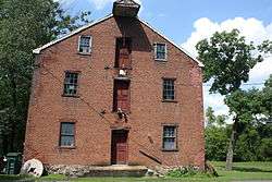
Barto Bridge |
|
June 22, 1988
(#88000790) |
Legislative Route 284 over a tributary of Perkiomen Creek near Bally
40°23′46″N 75°36′31″W / 40.396111°N 75.608611°W / 40.396111; -75.608611 (Barto Bridge) |
Washington Township |
|
| 6 |
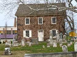
Belleman's Union Church |
|
December 4, 1973
(#73001589) |
Southwest of Centerport off Bellemans Church Road
40°27′31″N 76°01′52″W / 40.458611°N 76.031111°W / 40.458611; -76.031111 (Belleman's Union Church) |
Centre Township |
Old church built 1814 still standing supported 2 congregations. New church built 1924. |
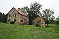
| 7 |
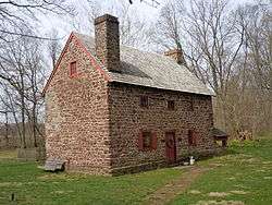
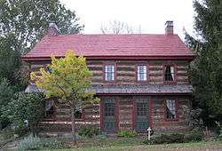
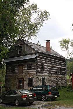
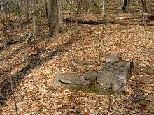
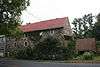
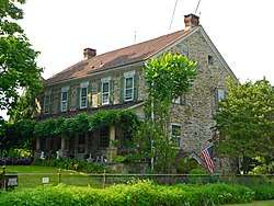
Daniel Berk Log House |
|
December 16, 1977
(#77001122) |
South of Albany on Maiden Creek
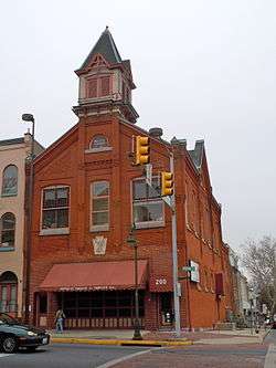
40°36′16″N 75°52′19″W / 40.604556°N 75.871889°W / 40.604556; -75.871889 (Daniel Berk Log House) |
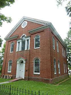
Albany Township |
|
| 8 |
Berkley Historic District |
|
August 22, 2002
(#02000892) |
Section of Snyder Road between Pennsylvania Route 61 and Berkley Road
40°25′39″N 75°56′16″W / 40.42763°N 75.93782°W / 40.42763; -75.93782 (Berkley Historic District) |
Ontelaunee Township |
|
| 9 |
Bethel A.M.E. Church |
|
September 7, 1979
(#79002167) |
119 North 10th Street
40°20′15″N 75°55′05″W / 40.3375°N 75.918056°W / 40.3375; -75.918056 (Bethel A.M.E. Church) |
Reading |
|
| 10 |
John Bishop House |
|
June 27, 1985
(#85001390) |
Perkiomen Avenue east of Reading
40°18′02″N 75°50′56″W / 40.300556°N 75.848889°W / 40.300556; -75.848889 (John Bishop House) |
Exeter Township |
|
| 11 |
Daniel Boone Homestead Site and Bertolet Cabin |
|
March 24, 1972
(#72001090) |
2 miles (3.2 km) north of Birdsboro
40°17′37″N 75°48′13″W / 40.293611°N 75.803611°W / 40.293611; -75.803611 (Daniel Boone Homestead Site and Bertolet Cabin) |
Albany Township |
|
| 12 |
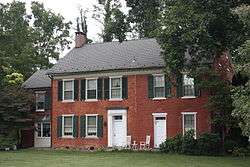
Boonecroft |
|
July 26, 1982
(#82003758) |
Oley Line Road near Limekiln
40°19′56″N 75°48′10″W / 40.332222°N 75.802778°W / 40.332222; -75.802778 (Boonecroft) |
Exeter Township |
|
| 13 |
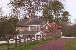
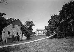
Borneman Mill |
|
November 8, 1990
(#90001612) |
Off Pennsylvania Route 100 southwest of Clayton
40°24′57″N 75°34′39″W / 40.415833°N 75.5775°W / 40.415833; -75.5775 (Borneman Mill) |
Washington Township |
|
| 14 |
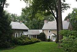
Boyer-Mertz Farm |
|
September 9, 1992
(#92000937) |
Junction of Noble Street and Bastian Road
40°29′50″N 75°45′59″W / 40.497222°N 75.766389°W / 40.497222; -75.766389 (Boyer-Mertz Farm) |
Maxatawny Township |
|
| 15 |
Bridge in Albany Township |
|
June 22, 1988
(#88000769) |
Legislative Route 06173 over Maiden Creek
40°38′07″N 75°51′21″W / 40.635278°N 75.855833°W / 40.635278; -75.855833 (Bridge in Albany Township) |
Albany Township |
|
| 16 |
Brobst Mill |
|
November 8, 1990
(#90001613) |
Off Township 814 on Pine Creek
40°37′23″N 75°53′50″W / 40.623056°N 75.897222°W / 40.623056; -75.897222 (Brobst Mill) |
Albany Township |
|
| 17 |
Philip Christman House |
|
March 7, 1973
(#73001588) |
1 mile (1.6 km) southeast of Bally at the Berks
40°24′00″N 75°34′13″W / 40.4°N 75.570278°W / 40.4; -75.570278 (Philip Christman House) |
Washington Township |
|
| 18 |
City Hall |
|
April 13, 1982
(#82003760) |
8th and Washington Streets
40°20′16″N 75°55′18″W / 40.337778°N 75.921667°W / 40.337778; -75.921667 (City Hall) |
Reading |
|
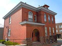
| 19 |
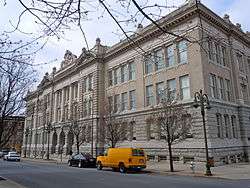
Cotton and Maple Streets School |
|
July 17, 1986
(#86001676) |
Cotton and Maple Streets
40°19′42″N 75°55′05″W / 40.328333°N 75.918056°W / 40.328333; -75.918056 (Cotton and Maple Streets School) |
Reading |
|
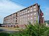
| 20 |
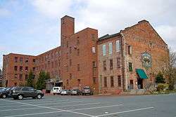
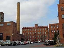
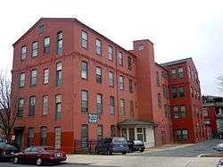
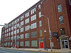
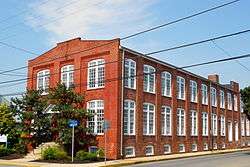
Curtis and Jones Company Shoe Factory |
|
April 28, 2014
(#14000182) |
702 North 8th Street
40°20′47″N 75°55′20″W / 40.346314°N 75.922159°W / 40.346314; -75.922159 (Curtis and Jones Company Shoe Factory) |
Reading |
|
| 21 |
Dale Furnace and Forge Historic District |
|
September 6, 1991
(#91001134) |
Forgedale Road northwest of Bally
40°25′21″N 75°37′01″W / 40.4225°N 75.616944°W / 40.4225; -75.616944 (Dale Furnace and Forge Historic District) |
Washington Township |
|
| 22 |
Dauberville Bridge |
|
June 22, 1988
(#88000788) |
Belleman's Church Road over the Schuylkill River at Dauberville
40°27′25″N 75°58′37″W / 40.456944°N 75.976944°W / 40.456944; -75.976944 (Dauberville Bridge) |
Centre and Ontelaunee Townships |
|
| 23 |
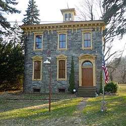
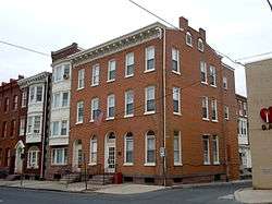
Davies House |
|
November 14, 1982
(#82001530) |
Berkley Road in Berkley
40°25′39″N 75°56′06″W / 40.4275°N 75.935°W / 40.4275; -75.935 (Davies House) |
Ontelaunee Township |
|
| 24 |
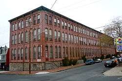
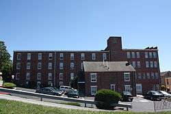
H.K. Deisher Knitting Mill |
|
September 5, 1985
(#85001963) |
56 Noble Street
40°30′58″N 75°46′36″W / 40.516111°N 75.776667°W / 40.516111; -75.776667 (H.K. Deisher Knitting Mill) |
Kutztown |
|
| 25 |
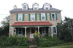
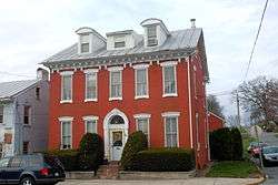
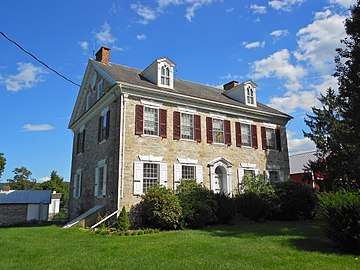
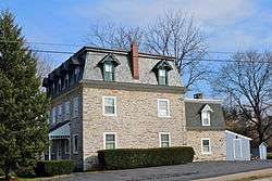
George Douglass House |
|
June 25, 2009
(#09000462) |
19 Old Philadelphia Pike
40°15′15″N 75°43′34″W / 40.254167°N 75.726111°W / 40.254167; -75.726111 (George Douglass House) |
Amity Township |
|
| 26 |
Dreibelbis Mill |
|
November 8, 1990
(#90001614) |
Junction of Dreibelbis Mill and Bellevue Roads
40°30′22″N 75°57′23″W / 40.506111°N 75.956389°W / 40.506111; -75.956389 (Dreibelbis Mill) |
Perry Township |
|
| 27 |
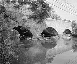
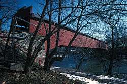
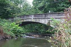
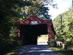
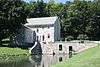
Dreibelbis Station Bridge |
|
February 23, 1981
(#81000530) |
South of Lenhartsville on Township 745
40°33′17″N 75°52′48″W / 40.554722°N 75.88°W / 40.554722; -75.88 (Dreibelbis Station Bridge) |
Greenwich Township |
|
| 28 |
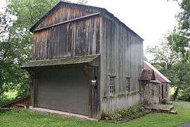
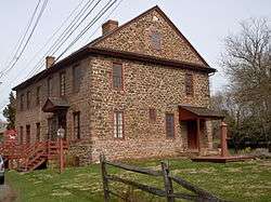
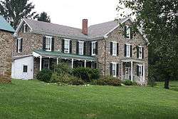
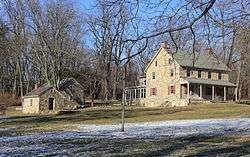
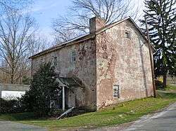
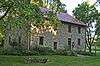
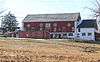
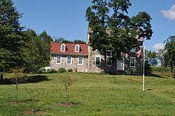
Joel Dreibelbis Farm |
|
October 30, 1989
(#89001820) |
Pennsylvania Route 143 near Virginville
40°31′07″N 75°52′27″W / 40.5185°N 75.874028°W / 40.5185; -75.874028 (Joel Dreibelbis Farm) |
Richmond Township |
|
| 29 |
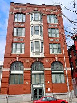
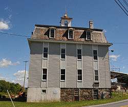
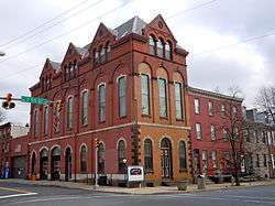
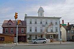
First National Bank in Fleetwood |
|
May 20, 2005
(#05000449) |
Main and Franklin Street
40°27′20″N 75°49′06″W / 40.455556°N 75.818333°W / 40.455556; -75.818333 (First National Bank in Fleetwood) |
Fleetwood |
|
| 30 |
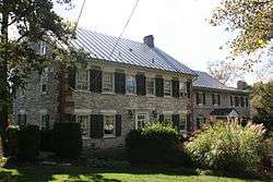
Henry Fisher House |
|
June 4, 1973
(#73001591) |
About 1.25 miles (2.01 km) north of Yellow House on Pennsylvania Route 662
40°20′27″N 75°45′40″W / 40.340833°N 75.761111°W / 40.340833; -75.761111 (Henry Fisher House) |
Oley Township |
|
| 31 |
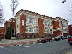
Charles S. Foos Elementary School |
|
November 10, 1983
(#83004191) |
Douglass and Weiser Streets
40°20′52″N 75°56′18″W / 40.347778°N 75.938333°W / 40.347778; -75.938333 (Charles S. Foos Elementary School) |
Reading |
|
| 32 |
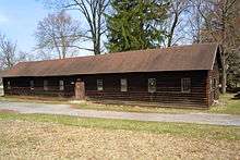
French Creek State Park: Six Penny Day Use District |
|
February 11, 1987
(#87000054) |
7 miles (11 km) northeast of Morgantown on Pennsylvania Route 345
40°14′00″N 75°47′42″W / 40.233333°N 75.795°W / 40.233333; -75.795 (French Creek State Park: Six Penny Day Use District) |
Union Township |
|
| 33 |
French Creek State Park: Organized Group Camp 4 District |
|
February 12, 1987
(#87000104) |
7 miles (11 km) northeast of Morgantown on Pennsylvania Route 345
40°11′58″N 75°47′43″W / 40.199444°N 75.795278°W / 40.199444; -75.795278 (French Creek State Park: Organized Group Camp 4 District) |
Union Township |
|
| 34 |
John Gehman Farm |
|
May 7, 1992
(#92000398) |
Township Road north of Harlem
40°28′08″N 75°35′09″W / 40.468889°N 75.585833°W / 40.468889; -75.585833 (John Gehman Farm) |
Hereford Township |
|
| 35 |
Geiger Mill |
|
November 8, 1990
(#90001738) |
Junction of Mill Road and Hay Creek Road in Geiger
40°12′00″N 75°50′15″W / 40.2°N 75.8375°W / 40.2; -75.8375 (Geiger Mill) |
Robeson Township |
|
| 36 |
Grand View Dairy Farm |
|
July 29, 1992
(#92000933) |
Preston Road south of Wernersville
40°18′42″N 76°04′56″W / 40.311722°N 76.082222°W / 40.311722; -76.082222 (Grand View Dairy Farm) |
South Heidelberg Township |
|
| 37 |
Greisemer's Mill Bridge |
|
February 23, 1981
(#81000532) |
Northwest of Boyerstown on Township 579
40°21′46″N 75°44′18″W / 40.362778°N 75.738333°W / 40.362778; -75.738333 (Greisemer's Mill Bridge) |
Oley Township |
|
| 38 |
Griesemer-Brown Mill Complex |
|
November 8, 1990
(#90001616) |
Brown's Mill Road at Monocacy Creek
40°18′08″N 75°46′57″W / 40.302222°N 75.7825°W / 40.302222; -75.7825 (Griesemer-Brown Mill Complex) |
Amity Township |
|
| 39 |
Grimshaw Silk Mill |
|
January 31, 1985
(#85000176) |
1200 North 1100 Street
40°21′10″N 75°54′58″W / 40.352778°N 75.916111°W / 40.352778; -75.916111 (Grimshaw Silk Mill) |
Reading |
|
| 40 |
Gruber Wagon Works |
|
June 2, 1972
(#72001092) |
West of Reading off Pennsylvania Route 183 in Tulpehocken Creek Park
40°22′13″N 75°58′45″W / 40.370278°N 75.979167°W / 40.370278; -75.979167 (Gruber Wagon Works) |
Bern Township |
|
| 41 |
Guldin Mill |
|
November 8, 1990
(#90001617) |
Off Pennsylvania Route 73 southeast of junction with U.S. Route 222
40°26′08″N 75°52′42″W / 40.435556°N 75.878333°W / 40.435556; -75.878333 (Guldin Mill) |
Maidencreek Township |
|
| 42 |
Hain Mill |
|
November 8, 1990
(#90001618) |
Junction of Hain Mill Road and Township 495
40°21′16″N 76°04′58″W / 40.354444°N 76.082778°W / 40.354444; -76.082778 (Hain Mill) |
Lower Heidelberg Township |
|
| 43 |
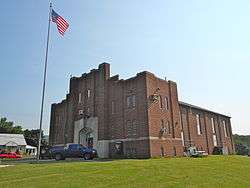
Hamburg Armory |
|
May 9, 1991
(#91000511) |
North 5th Street, south of Interstate 78
40°33′41″N 75°58′49″W / 40.561389°N 75.980278°W / 40.561389; -75.980278 (Hamburg Armory) |
Hamburg |
|
| 44 |
Hamburg Historic District |
|
June 28, 2010
(#10000398) |
Roughly bounded by Franklin, Windsor, Walnut and Second Sts., Quince, Primrose, Peach and Plum Alleys and Mill Creek
40°33′20″N 75°58′55″W / 40.555556°N 75.981944°W / 40.555556; -75.981944 (Hamburg Historic District) |
Hamburg |
|
| 45 |
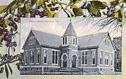
Hamburg Public Library |
|
November 3, 1988
(#88002369) |
35 North 3rd Street
40°33′21″N 75°59′04″W / 40.555833°N 75.984444°W / 40.555833; -75.984444 (Hamburg Public Library) |
Hamburg |
|
| 46 |
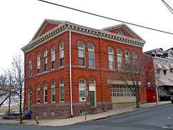
Hampden Firehouse |
|
April 13, 1982
(#82003761) |
1101 Greenwich Street
40°20′39″N 75°54′57″W / 40.344167°N 75.915833°W / 40.344167; -75.915833 (Hampden Firehouse) |
Reading |
|
| 47 |
Hartman Cider Press |
|
January 7, 1988
(#87002205) |
Keim Road, 1.1 miles (1.8 km) west of Lobachsville
40°24′39″N 75°44′58″W / 40.410833°N 75.749444°W / 40.410833; -75.749444 (Hartman Cider Press) |
Pike Township |
|
| 48 |
Hendel Brothers, Sons and Company Hat Factory |
|
November 20, 1979
(#79002168) |
517-539 South 5th Street
40°19′32″N 75°55′35″W / 40.325556°N 75.926389°W / 40.325556; -75.926389 (Hendel Brothers, Sons and Company Hat Factory) |
Reading |
|
| 49 |
Hopewell Furnace National Historic Site |
|
October 15, 1966
(#66000645) |
5 miles (8.0 km) south of Birdsboro
40°12′20″N 75°46′06″W / 40.205556°N 75.768333°W / 40.205556; -75.768333 (Hopewell Furnace National Historic Site) |
Union Township |
Extends into Chester County |
| 50 |
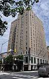
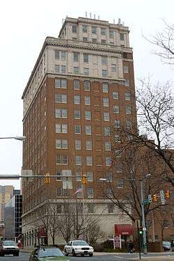
Hotel Abraham Lincoln |
|
December 21, 2017
(#100001908) |
100 N. 5th St.
40°20′14″N 75°55′40″W / 40.337190°N 75.927841°W / 40.337190; -75.927841 (Hotel Abraham Lincoln) |
Reading |
|
| 51 |
Hottenstein Mansion |
|
June 22, 1972
(#72001091) |
2 miles (3.2 km) east of Kutztown on U.S. Route 222
40°32′06″N 75°44′36″W / 40.535°N 75.743333°W / 40.535; -75.743333 (Hottenstein Mansion) |
Maxatawny Township |
|
| 52 |
Hunter's Mill Complex |
|
December 22, 1988
(#88003045) |
Forgedale Road
40°25′41″N 75°37′15″W / 40.428056°N 75.620833°W / 40.428056; -75.620833 (Hunter's Mill Complex) |
Hereford Township |
|
| 53 |
Ironstone Bridge |
|
June 22, 1988
(#88000789) |
Farmington Avenue over Ironstone Creek
40°19′12″N 75°39′08″W / 40.32°N 75.652222°W / 40.32; -75.652222 (Ironstone Bridge) |
Douglass Township |
|
| 54 |
Joanna Furnace Complex |
|
April 23, 1980
(#80003426) |
North of Morgantown on Pennsylvania Route 10
40°11′28″N 75°53′22″W / 40.191111°N 75.889444°W / 40.191111; -75.889444 (Joanna Furnace Complex) |
Robeson Township |
|
| 55 |
Nicholas Johnson Mill |
|
November 8, 1990
(#90001619) |
Mill Crest Road
40°20′58″N 75°37′12″W / 40.349444°N 75.62°W / 40.349444; -75.62 (Nicholas Johnson Mill) |
Colebrookdale Township |
|
| 56 |
Kauffman Mill |
|
November 8, 1990
(#90001620) |
Junction of Mill and Mill Hill Roads
40°31′30″N 76°03′47″W / 40.525°N 76.063056°W / 40.525; -76.063056 (Kauffman Mill) |
Upper Bern Township |
|
| 57 |
Keim Homestead |
|
May 1, 1974
(#74001752) |
West of Lobachsville
40°24′35″N 75°44′54″W / 40.409722°N 75.748333°W / 40.409722; -75.748333 (Keim Homestead) |
Pike Township |
|
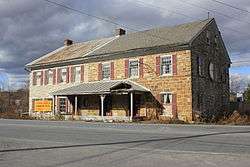
| 58 |
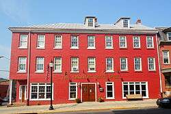
Kemp's Hotel |
|
December 19, 1978
(#78002344) |
East of Kutztown on U.S. Route 222
40°31′48″N 75°45′48″W / 40.53°N 75.763333°W / 40.53; -75.763333 (Kemp's Hotel) |
Maxatawny Township |
|
| 59 |
Keystone Hook and Ladder Company |
|
October 31, 1985
(#85003447) |
2nd and Penn Streets
40°20′06″N 75°56′01″W / 40.335°N 75.933611°W / 40.335; -75.933611 (Keystone Hook and Ladder Company) |
Reading |
|
| 60 |
Kissling Farm |
|
July 29, 1992
(#92000934) |
Brownsville Road east of Robesonia
40°22′03″N 76°06′05″W / 40.3675°N 76.101389°W / 40.3675; -76.101389 (Kissling Farm) |
Heidelberg Township |
|
| 61 |
Knabb-Bieber Mill |
|
November 8, 1990
(#90001621) |
Bieber Mill Road at Monocacy Creek
40°21′33″N 75°48′38″W / 40.359167°N 75.810556°W / 40.359167; -75.810556 (Knabb-Bieber Mill) |
Oley Township |
|
| 62 |
Knorr-Bare Farm |
|
July 29, 1992
(#92000935) |
4995 Penn Avenue
40°19′23″N 76°03′43″W / 40.323056°N 76.061944°W / 40.323056; -76.061944 (Knorr-Bare Farm) |
Lower Heidelberg Township |
|
| 63 |
Kutz Mill |
|
November 8, 1990
(#90001622) |
Kutz Mill Road at Sacony Creek
40°32′03″N 75°48′20″W / 40.534167°N 75.805556°W / 40.534167; -75.805556 (Kutz Mill) |
Greenwich Township |
|
| 64 |
Kutz's Mill Bridge |
|
February 23, 1981
(#81000531) |
Northwest of Kutztown on Township 798
40°32′04″N 75°48′21″W / 40.534444°N 75.805833°W / 40.534444; -75.805833 (Kutz's Mill Bridge) |
Greenwich Township |
|
| 65 |
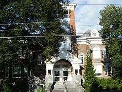
Kutztown 1892 Public School Building |
|
June 27, 1980
(#80003425) |
Whiteoak Street and Normal Avenue
40°30′47″N 75°46′34″W / 40.513056°N 75.776111°W / 40.513056; -75.776111 (Kutztown 1892 Public School Building) |
Kutztown |
|
| 66 |
Leesport Lock House |
|
June 9, 1977
(#77001123) |
Wall Street
40°26′48″N 75°58′04″W / 40.446667°N 75.967778°W / 40.446667; -75.967778 (Leesport Lock House) |
Leesport |
|
| 67 |
Jacob Leiby Farm |
|
July 29, 1992
(#92000936) |
Pennsylvania Route 143
40°32′05″N 75°52′40″W / 40.534722°N 75.877778°W / 40.534722; -75.877778 (Jacob Leiby Farm) |
Perry Township |
|
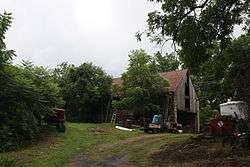
| 68 |
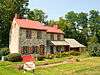
Lenhart Farm |
|
September 18, 1978
(#78002345) |
Junction of U.S. Route 22 and Pennsylvania Route 143
40°34′33″N 75°53′18″W / 40.575833°N 75.888333°W / 40.575833; -75.888333 (Lenhart Farm) |
Lenhartsville |
|
| 69 |
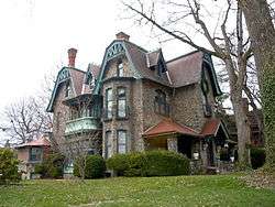
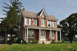
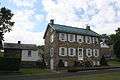
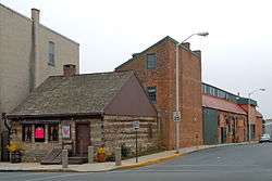
Lerch Tavern |
|
September 12, 1979
(#79002171) |
182-184 West Penn Avenue
40°19′47″N 76°05′03″W / 40.329722°N 76.084167°W / 40.329722; -76.084167 (Lerch Tavern) |
Wernersville |
|
| 70 |
Levan Farm |
|
December 19, 1978
(#78002348) |
Pennsylvania Route 562
40°19′12″N 75°51′34″W / 40.320028°N 75.859556°W / 40.320028; -75.859556 (Levan Farm) |
Exeter Township |
|
| 71 |
Liberty Fire Company No. 5 |
|
January 18, 1985
(#85000112) |
501 South 5th Street
40°19′39″N 75°55′36″W / 40.3275°N 75.926667°W / 40.3275; -75.926667 (Liberty Fire Company No. 5) |
Reading |
|
| 72 |
Mordecai Lincoln House |
|
November 3, 1988
(#88002370) |
Lincoln Road in Lorane
40°16′53″N 75°50′02″W / 40.281389°N 75.833889°W / 40.281389; -75.833889 (Mordecai Lincoln House) |
Exeter Township |
|
| 73 |
Lindbergh Viaduct |
|
June 22, 1988
(#88000792) |
Mineral Spring Road over Mineral Spring Creek
40°19′52″N 75°54′00″W / 40.331111°N 75.9°W / 40.331111; -75.9 (Lindbergh Viaduct) |
Reading |
|
| 74 |
Livingood House-Stryker Hospital |
|
November 7, 1996
(#96001195) |
417-419 Walnut Street
40°20′14″N 75°55′45″W / 40.337222°N 75.929167°W / 40.337222; -75.929167 (Livingood House-Stryker Hospital) |
Reading |
|
| 75 |
Log House, Hiester House and Market Annex |
|
November 20, 1979
(#79002169) |
30 South 4th Street
40°20′03″N 75°55′49″W / 40.334167°N 75.930278°W / 40.334167; -75.930278 (Log House, Hiester House and Market Annex) |
Reading |
|
| 76 |
Long-Hawerter Mill |
|
November 8, 1990
(#90001623) |
Longsdale Road at Little Lehigh Creek
40°29′21″N 75°39′50″W / 40.489167°N 75.663889°W / 40.489167; -75.663889 (Long-Hawerter Mill) |
Longswamp Township |
|
| 77 |
John F. Lutz Furniture Co. & Funerary |
|
February 16, 1996
(#96000085) |
3559 and 3561 St. Lawrence Avenue
40°19′33″N 75°51′51″W / 40.325833°N 75.864167°W / 40.325833; -75.864167 (John F. Lutz Furniture Co. & Funerary) |
St. Lawrence |
|
| 78 |
Mary Ann Furnace Historic District |
|
September 6, 1991
(#91001141) |
Centennial Road southeast of Longswamp
40°29′05″N 75°38′54″W / 40.484722°N 75.648333°W / 40.484722; -75.648333 (Mary Ann Furnace Historic District) |
Longswamp Township |
|
| 79 |
Meinig Glove Factory-E. Richard Meinig Co. |
|
August 30, 1985
(#85001896) |
621-641 McKnight Street
40°20′44″N 75°56′13″W / 40.345556°N 75.936944°W / 40.345556; -75.936944 (Meinig Glove Factory-E. Richard Meinig Co.) |
Reading |
|
| 80 |
Merit Underwear Company |
|
June 28, 1996
(#96000711) |
43 East Noble Avenue
40°30′06″N 75°58′06″W / 40.501667°N 75.968333°W / 40.501667; -75.968333 (Merit Underwear Company) |
Shoemakersville |
|
| 81 |
Merkel Mill |
|
November 8, 1990
(#90001625) |
Dreibelbis Station Road at Maiden Creek
40°34′13″N 75°52′49″W / 40.570278°N 75.880278°W / 40.570278; -75.880278 (Merkel Mill) |
Greenwich Township |
|
| 82 |
Merkel Mill Complex |
|
November 8, 1990
(#90001626) |
Junction of Pennsylvania Routes 662 and 143 near Moselem Springs
40°30′02″N 75°51′03″W / 40.500556°N 75.850833°W / 40.500556; -75.850833 (Merkel Mill Complex) |
Richmond Township |
|
| 83 |
Metropolitan Edison Building |
|
October 28, 1983
(#83004192) |
412 Washington Street
40°20′11″N 75°55′46″W / 40.336389°N 75.929444°W / 40.336389; -75.929444 (Metropolitan Edison Building) |
Reading |
|
| 84 |
Mill at Lobachsville |
|
November 8, 1990
(#90001624) |
Mill Road at Pine Creek
40°24′43″N 75°43′51″W / 40.411944°N 75.730833°W / 40.411944; -75.730833 (Mill at Lobachsville) |
Pike Township |
|
| 85 |
Mill Tract Farm |
|
September 22, 1977
(#77001124) |
Northeast of Stonersville on Mill Road
40°19′30″N 75°47′26″W / 40.325°N 75.790556°W / 40.325; -75.790556 (Mill Tract Farm) |
Exeter Township |
|
| 86 |
Morgantown Historic District |
|
November 7, 1995
(#95001255) |
Roughly the area surrounding Main Street between Walnut and Washington Streets in Morgantown
40°09′20″N 75°53′25″W / 40.155556°N 75.890278°W / 40.155556; -75.890278 (Morgantown Historic District) |
Caernarvon Township |
|
| 87 |
Moselem Farms Mill |
|
November 8, 1990
(#90001627) |
Junction of Pennsylvania Route 662 and Forge Road
40°30′08″N 75°52′47″W / 40.502222°N 75.879722°W / 40.502222; -75.879722 (Moselem Farms Mill) |
Richmond Township |
|
| 88 |
John Nicholas and Elizabeth Moyer House |
|
May 2, 2001
(#01000459) |
152 Hetrick Road
40°25′29″N 76°10′34″W / 40.424722°N 76.176111°W / 40.424722; -76.176111 (John Nicholas and Elizabeth Moyer House) |
Jefferson Township |
|
| 89 |
Old Dry Road |
|
January 23, 1978
(#78002349) |
3 miles (4.8 km) northwest of Wernersville on Highland Road
40°22′26″N 76°03′30″W / 40.373889°N 76.058333°W / 40.373889; -76.058333 (Old Dry Road) |
Lower Heidelberg Township |
|
| 90 |
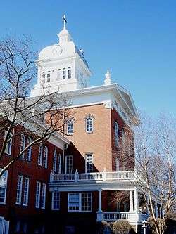
Old Main at the Lutheran Home at Topton |
|
January 28, 2015
(#14000183) |
1 S. Home Ave.
40°29′40″N 75°41′56″W / 40.4945°N 75.6988°W / 40.4945; -75.6988 (Old Main at the Lutheran Home at Topton) |
Longswamp Township |
|
| 91 |
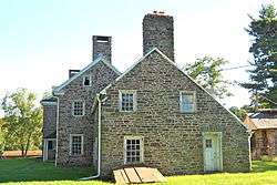
Old Swede's House |
|
January 21, 1974
(#74001751) |
Old Philadelphia Pike in Douglassville
40°15′12″N 75°43′42″W / 40.253333°N 75.728333°W / 40.253333; -75.728333 (Old Swede's House) |
Amity Township |
|
| 92 |
Old St. Gabriel's Episcopal Church |
|
March 8, 1978
(#78002343) |
U.S. Route 422 in Douglassville
40°15′26″N 75°43′45″W / 40.257222°N 75.729167°W / 40.257222; -75.729167 (Old St. Gabriel's Episcopal Church) |
Amity Township |
|
| 93 |
Oley Township Historic District |
|
March 11, 1983
(#83002218) |
Pennsylvania Route 73
40°22′07″N 75°46′17″W / 40.368611°N 75.771389°W / 40.368611; -75.771389 (Oley Township Historic District) |
Oley Township |
Includes the entire township |
| 94 |
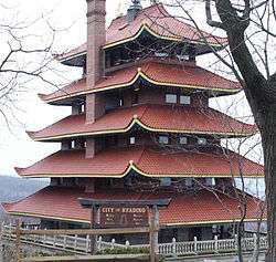
Pagoda |
|
November 7, 1972
(#72001093) |
Mount Penn, at the junction of Duryea Drive and Skyline Boulevard
40°20′09″N 75°54′22″W / 40.335833°N 75.906111°W / 40.335833; -75.906111 (Pagoda) |
Reading |
|
| 95 |
Pine Forge Mansion and Industrial Site |
|
March 18, 2004
(#04000191) |
Pine Forge Road and Douglass Drive, Pine Forge
40°17′02″N 75°42′19″W / 40.283889°N 75.705278°W / 40.283889; -75.705278 (Pine Forge Mansion and Industrial Site) |
Douglass Township |
|
| 96 |
Pleasantville Bridge |
|
February 23, 1981
(#81000533) |
South of Mantawny on Township 916
40°22′44″N 75°44′21″W / 40.378889°N 75.739167°W / 40.378889; -75.739167 (Pleasantville Bridge) |
Oley Township |
|
| 97 |
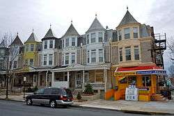
Queen Anne Historic District |
|
November 12, 2004
(#04001227) |
Roughly bounded by Robeson Street, North 3rd Street, railroad tracks, and Clinton Street
40°20′55″N 75°56′13″W / 40.348611°N 75.936944°W / 40.348611; -75.936944 (Queen Anne Historic District) |
Reading |
|
| 98 |
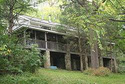
Reading Country Club |
|
May 31, 2018
(#100002521) |
5311 Perkiomen Ave
40°18′12″N 75°50′57″W / 40.3032°N 75.8491°W / 40.3032; -75.8491 (Reading Country Club) |
Exeter Township |
|
| 99 |
Reading Hardware Company |
|
June 13, 1997
(#97000516) |
Roughly bounded by Willow, South 6th, and Canal Streets, and alleyway
40°19′32″N 75°55′38″W / 40.325556°N 75.927222°W / 40.325556; -75.927222 (Reading Hardware Company) |
Reading |
|
| 100 |
Reading Hardware Company Butt Works |
|
November 20, 1979
(#79002170) |
537 Willow Street
40°19′29″N 75°55′33″W / 40.324722°N 75.925833°W / 40.324722; -75.925833 (Reading Hardware Company Butt Works) |
Reading |
|
| 101 |
Reading Knitting Mills |
|
April 13, 1982
(#82003762) |
350 Elm Street
40°20′23″N 75°55′49″W / 40.339722°N 75.930278°W / 40.339722; -75.930278 (Reading Knitting Mills) |
Reading |
|
| 102 |
Red Men Hall |
|
July 27, 2000
(#00000843) |
831-833 Walnut Street
40°20′21″N 75°55′21″W / 40.339167°N 75.9225°W / 40.339167; -75.9225 (Red Men Hall) |
Reading |
Now known as Century Hall Apartments. |
| 103 |
Reiff Farm |
|
February 25, 1982
(#82003759) |
Southwest of Oley on Township 454
40°22′55″N 75°48′30″W / 40.381944°N 75.808333°W / 40.381944; -75.808333 (Reiff Farm) |
Oley Township |
|
| 104 |
Rhoads-Lorah House and Barn |
|
March 29, 2007
(#07000216) |
1832 Old Swede Road
40°19′03″N 75°45′14″W / 40.3175°N 75.753889°W / 40.3175; -75.753889 (Rhoads-Lorah House and Barn) |
Amity Township |
|
| 105 |
Ridgewood Farm |
|
May 7, 1992
(#92000399) |
Junction of Pennsylvania Route 724 and Interstate 176
40°17′43″N 75°53′50″W / 40.295278°N 75.897222°W / 40.295278; -75.897222 (Ridgewood Farm) |
Cumru Township |
|
| 106 |
Rieser Mill |
|
November 8, 1990
(#90001628) |
Junction of Grange and Cross Keys Roads
40°25′55″N 75°58′37″W / 40.431827°N 75.976812°W / 40.431827; -75.976812 (Rieser Mill) |
Bern Township |
|
| 107 |
Rieser-Shoemaker Farm |
|
July 29, 1992
(#92000939) |
Cross Keys Road
40°25′51″N 75°58′25″W / 40.430833°N 75.973611°W / 40.430833; -75.973611 (Rieser-Shoemaker Farm) |
Bern Township |
|
| 108 |
Robesonia Furnace Historic District |
|
September 6, 1991
(#91001128) |
Furnace, South Church and Freeman Streets and Mountain and East Meadow Avenues
40°20′34″N 76°08′26″W / 40.342778°N 76.140556°W / 40.342778; -76.140556 (Robesonia Furnace Historic District) |
Robesonia |
|
| 109 |
S Bridge |
|
June 22, 1988
(#88000794) |
Legislative Route 06024 over Tulpehocken Creek west of Womelsdorf
40°22′25″N 76°13′07″W / 40.373611°N 76.218611°W / 40.373611; -76.218611 (S Bridge) |
Marion Township |
Demolished 2011. |
| 110 |
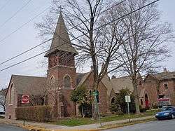
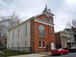
St. Michael's Protestant Episcopal Church, Parish House and Rectory |
|
December 20, 1982
(#82001531) |
Mill and Church Streets
40°15′54″N 75°48′26″W / 40.265°N 75.807222°W / 40.265; -75.807222 (St. Michael's Protestant Episcopal Church, Parish House and Rectory) |
Birdsboro |
|
| 111 |
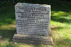
Sally Ann Furnace Complex |
|
August 17, 1976
(#76001604) |
Southwest of Topton
40°28′19″N 75°43′22″W / 40.471944°N 75.722778°W / 40.471944; -75.722778 (Sally Ann Furnace Complex) |
Rockland Township |
|
| 112 |
Schaumboch's Tavern |
|
November 20, 1979
(#79002166) |
Northwest of Hamburg on Hawk Mountain Road
40°38′00″N 75°58′52″W / 40.633333°N 75.981111°W / 40.633333; -75.981111 (Schaumboch's Tavern) |
Albany Township |
|
| 113 |
Christian Schlegel Farm |
|
July 29, 1992
(#92000938) |
Fleetwood-Lyons Road
40°27′32″N 75°49′19″W / 40.458889°N 75.821944°W / 40.458889; -75.821944 (Christian Schlegel Farm) |
Richmond Township |
|
| 114 |
Seyfert Mill |
|
November 8, 1990
(#90001629) |
Junction of Old U.S. Route 22 and Campsite Road
40°30′35″N 76°07′34″W / 40.509722°N 76.126111°W / 40.509722; -76.126111 (Seyfert Mill) |
Upper Tulpehocken Township |
|
| 115 |
Siegfried's Dale Farm |
|
May 10, 1984
(#84003115) |
Siegfried's Road
40°32′58″N 75°43′23″W / 40.549444°N 75.723056°W / 40.549444; -75.723056 (Siegfried's Dale Farm) |
Maxatawny Township |
|
| 116 |
Snyder Mill |
|
November 8, 1990
(#90001630) |
Oley Line Road at Monocacy Creek
40°20′12″N 75°48′18″W / 40.336667°N 75.805°W / 40.336667; -75.805 (Snyder Mill) |
Exeter Township |
|
| 117 |
Spannuth Mill |
|
November 8, 1990
(#90001631) |
Junction of Frystown and Crosskill Creek Roads
40°26′51″N 76°21′17″W / 40.4475°N 76.354722°W / 40.4475; -76.354722 (Spannuth Mill) |
Bethel Township |
|
| 118 |
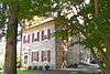
Peter Spicker House |
|
April 22, 1983
(#83002217) |
150 Main Street in Stouchsburg
40°22′52″N 76°14′13″W / 40.381111°N 76.236944°W / 40.381111; -76.236944 (Peter Spicker House) |
Marion Township |
|
| 119 |
Stein Mill |
|
November 8, 1990
(#90001632) |
Pennsylvania Route 737 at Mill Creek
40°33′11″N 75°48′12″W / 40.553056°N 75.803333°W / 40.553056; -75.803333 (Stein Mill) |
Greenwich Township |
|
| 120 |
Stirling |
|
April 17, 1980
(#80003427) |
1120 Centre Avenue
40°21′09″N 75°56′03″W / 40.3525°N 75.934167°W / 40.3525; -75.934167 (Stirling) |
Reading |
|
| 121 |
Stouchsburg Historic District |
|
January 8, 1985
(#85000071) |
12 to 153 Main Street and Water Street in Stouchsburg
40°22′46″N 76°13′52″W / 40.379444°N 76.231111°W / 40.379444; -76.231111 (Stouchsburg Historic District) |
Marion Township |
|
| 122 |
Stupp-Oxenrider Farm |
|
July 29, 1992
(#92000932) |
Dundore Road northwest of Robesonia
40°22′56″N 76°09′27″W / 40.382222°N 76.1575°W / 40.382222; -76.1575 (Stupp-Oxenrider Farm) |
North Heidelberg Township |
|
| 123 |
Thompson Mill |
|
November 8, 1990
(#90001633) |
Golf Course Road at Seidel Creek
40°16′38″N 75°51′48″W / 40.277222°N 75.863333°W / 40.277222; -75.863333 (Thompson Mill) |
Robeson Township |
|
| 124 |
Trexler Historic District |
|
September 7, 2001
(#01000957) |
375-424 Old Philadelphia Pike
40°38′09″N 75°51′12″W / 40.635833°N 75.853333°W / 40.635833; -75.853333 (Trexler Historic District) |
Albany Township |
|
| 125 |
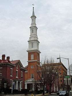
Trinity Lutheran Church |
|
June 7, 1976
(#76001603) |
6th and Washington Streets
40°20′13″N 75°55′35″W / 40.336944°N 75.926389°W / 40.336944; -75.926389 (Trinity Lutheran Church) |
Reading |
|
| 126 |
Tulpehocken Creek Historic District |
|
March 28, 1985
(#85000672) |
Tulpehocken and Mill Creeks from the Berks-Lebanon county line to the Blue Marsh Dam between Millardsville and Bernville
40°23′13″N 76°11′21″W / 40.386944°N 76.189167°W / 40.386944; -76.189167 (Tulpehocken Creek Historic District) |
Marion, North Heidelberg, and Lower Heidelberg Townships |
|
| 127 |
Virginville Historic District |
|
September 28, 2000
(#00001123) |
Main, 2nd, 1st, and Front Streets and Chapel Drive in Virginville
40°31′24″N 75°52′14″W / 40.523333°N 75.870556°W / 40.523333; -75.870556 (Virginville Historic District) |
Richmond Township |
|
| 128 |
Peter Wanner Mansion |
|
November 5, 1987
(#87001950) |
1401 Walnut Street
40°20′18″N 75°54′27″W / 40.338333°N 75.9075°W / 40.338333; -75.9075 (Peter Wanner Mansion) |
Reading |
|
| 129 |
Weidner Mill |
|
November 8, 1990
(#90001634) |
Blacksmith Road at Manatawny Creek
40°18′18″N 75°43′37″W / 40.305°N 75.726944°W / 40.305; -75.726944 (Weidner Mill) |
Amity Township |
|
| 130 |
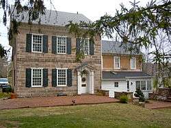
Conrad Weiser House |
|
October 15, 1966
(#66000646) |
2 miles (3.2 km) east of Womelsdorf
40°21′33″N 76°10′26″W / 40.359167°N 76.173889°W / 40.359167; -76.173889 (Conrad Weiser House) |
Heidelberg Township |
|
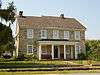
| 131 |
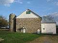
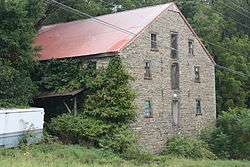
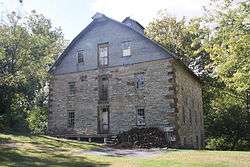
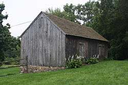
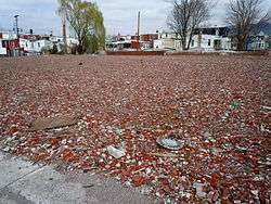
Wertz Mill |
|
November 8, 1990
(#90001635) |
60 Werner Street
40°19′41″N 76°04′47″W / 40.328056°N 76.079722°W / 40.328056; -76.079722 (Wertz Mill) |
Wernersville |
|
| 132 |
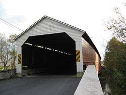
Wertz's Covered Bridge |
|
November 17, 1978
(#78002347) |
Northwest of Reading on Township 921
40°22′07″N 75°58′44″W / 40.368611°N 75.978889°W / 40.368611; -75.978889 (Wertz's Covered Bridge) |
Bern and Spring Townships |
|
| 133 |
White Horse Tavern |
|
April 21, 1975
(#75001618) |
509 Old Philadelphia Pike in Douglassville
40°15′13″N 75°43′31″W / 40.253611°N 75.725278°W / 40.253611; -75.725278 (White Horse Tavern) |
Amity Township |
|
| 134 |
Wilhelm Mansion and Carriage House |
|
March 1, 1982
(#82003763) |
730 Centre Avenue
40°20′47″N 75°55′52″W / 40.346389°N 75.931111°W / 40.346389; -75.931111 (Wilhelm Mansion and Carriage House) |
Reading |
|
| 135 |
Thomas A. Willson and Co. |
|
May 24, 2006
(#06000428) |
201 Washington Street
40°20′20″N 75°56′09″W / 40.338889°N 75.935833°W / 40.338889; -75.935833 (Thomas A. Willson and Co.) |
Reading |
|
| 136 |
Womelsdorf Historic District |
|
March 10, 1982
(#82003764) |
Roughly bounded by Water, 4th, Franklin and Jefferson Streets
40°21′47″N 76°11′13″W / 40.363056°N 76.186944°W / 40.363056; -76.186944 (Womelsdorf Historic District) |
Womelsdorf |
|
| 137 |
Yoder Mill |
|
November 8, 1990
(#90001636) |
Yoder Road at Oysterville Creek
40°23′48″N 75°43′14″W / 40.396667°N 75.720556°W / 40.396667; -75.720556 (Yoder Mill) |
Pike Township |
|
.jpg)
.jpg)
%2C_Lenhartsville_vicinity%2C_(Berks_County%2C_Pennsylvania).jpg)

.jpg)
.jpg)

_WERNERSVILLE%2C_BERKS_COUNTY.jpg)