Krumsville, Pennsylvania
| Krumsville, Pennsylvania | |
|---|---|
| Unincorporated community | |
.jpg) Krumsville Inn | |
 Krumsville  Krumsville | |
| Coordinates: 40°34′43″N 75°47′50″W / 40.57861°N 75.79722°WCoordinates: 40°34′43″N 75°47′50″W / 40.57861°N 75.79722°W | |
| Country | United States |
| State | Pennsylvania |
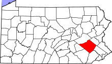
| County | Berks |
| Township | Greenwich |
| Elevation | 755 ft (230 m) |
| Time zone | UTC-5 (Eastern (EST)) |
| • Summer (DST) | UTC-4 (EDT) |
| ZIP code | 19534 |
| Area code(s) | 610 and 484 |
| GNIS feature ID | 1178696[1] |
Krumsville is an unincorporated community in Berks County, Pennsylvania. It is located at the intersection of Pennsylvania Route 737 and Old U.S. Route 22. The interchange with Interstate 78 is being redesigned and 737 now crosses 78 on a new bridge. Important buildings in the area include the Greenwich-Lenhartsville Elementary School, Krumsville Hotel, Mt. Zion's Church (Home to Boy Scout Troop 104), and Dietrich's Meats.
Less than half a mile down Old 22 is the town of Grimville. It is a smaller town than Krumsville, and is often considered to be a part of the Krumsville area. Thus, the two towns are sometimes confused with each other.
See also

References
This article is issued from
Wikipedia.
The text is licensed under Creative Commons - Attribution - Sharealike.
Additional terms may apply for the media files.