Bethel Township, Berks County, Pennsylvania
| Bethel Township, Berks County, Pennsylvania | |
|---|---|
| Township | |
 Round Top Valley Farm in Bethel Township | |
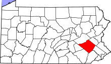
 Bethel Township Location of Bethel Township in Pennsylvania  Bethel Township Bethel Township (the US) | |
| Coordinates: 40°30′03″N 76°22′35″W / 40.50083°N 76.37639°WCoordinates: 40°30′03″N 76°22′35″W / 40.50083°N 76.37639°W | |
| Country | United States |
| State | Pennsylvania |
| County | Berks |
| Area[1] | |
| • Total | 42.33 sq mi (109.64 km2) |
| • Land | 42.22 sq mi (109.34 km2) |
| • Water | 0.12 sq mi (0.30 km2) |
| Elevation | 741 ft (226 m) |
| Population (2010) | |
| • Total | 4,112 |
| • Estimate (2016)[2] | 4,121 |
| • Density | 97.62/sq mi (37.69/km2) |
| Time zone | UTC-5 (EST) |
| • Summer (DST) | UTC-4 (EDT) |
| Area code(s) | 610, 717 |
| FIPS code | 42-011-06008 |
Bethel Township is a township in Berks County, Pennsylvania, United States. The population was 4,112 at the 2010 census.
History
Spannuth Mill was listed on the National Register of Historic Places in 1990.[3]
Geography
According to the United States Census Bureau, the township has a total area of 42.2 square miles (109 km2), of which, 42.2 square miles (109 km2) is land and 0.04 square miles (0.10 km2) (0.05%) is water. It is drained by the Little Swatara Creek into the Swatara Creek and the Susquehanna River. Its natural northern boundary is Blue Mountain. Its villages include Bethel, Crosskill Mills (also in Tulpehocken Township,) Frystown, Grimes, Meckville, and Schubert.
Adjacent townships
- Upper Tulpehocken Township (east)
- Tulpehocken Township (south)
- Bethel Township, Lebanon County (west)
- Pine Grove Township, Schuylkill County (northwest)
- Washington Township, Schuylkill County (north)
- Wayne Township, Schuylkill County (northeast)
Demographics
As of the census[4] of 2000, there were 4,166 people, 1,466 households, and 1,150 families residing in the township. The population density was 98.7 people per square mile (38.1/km²). There were 1,551 housing units at an average density of 36.7/sq mi (14.2/km²). The racial makeup of the township was 97.36% White, 0.55% African American, 0.10% Native American, 0.65% Asian, 0.77% from other races, and 0.58% from two or more races. Hispanic or Latino people of any race were 1.56% of the population.
There were 1,466 households, out of which 35.1% had children under the age of 18 living with them, 68.1% were married couples living together, 5.9% had a female householder with no husband present, and 21.5% were non-families. 17.6% of all households were made up of individuals, and 6.5% had someone living alone who was 65 years of age or older. The average household size was 2.84 and the average family size was 3.22.
In the township the population was spread out, with 27.2% under the age of 18, 7.5% from 18 to 24, 30.1% from 25 to 44, 24.6% from 45 to 64, and 10.6% who were 65 years of age or older. The median age was 36 years. For every 100 females, there were 105.9 males. For every 100 females age 18 and over, there were 104.4 males.
| Historical population | |||
|---|---|---|---|
| Census | Pop. | %± | |
| 1980 | 3,312 | — | |
| 1990 | 3,576 | 8.0% | |
| 2000 | 4,166 | 16.5% | |
| 2010 | 4,112 | −1.3% | |
| Est. 2016 | 4,121 | [2] | 0.2% |
| Source: US Census Bureau | |||
The median income for a household in the township was $47,015, and the median income for a family was $52,115. Males had a median income of $32,439 versus $23,929 for females. The per capita income for the township was $18,116. About 4.1% of families and 6.5% of the population were below the poverty line, including 9.4% of those under age 18 and 6.7% of those age 65 or over.
Transportation
Bethel Township's main west-to-east route is Interstate 78/U.S. Route 22, which interchanges with the north-to-south Pennsylvania Route 645, Pennsylvania Route 501, Pennsylvania Route 419, and Pennsylvania Route 183.
References
- ↑ "2016 U.S. Gazetteer Files". United States Census Bureau. Retrieved Aug 13, 2017.
- 1 2 "Population and Housing Unit Estimates". Retrieved June 9, 2017.
- ↑ National Park Service (2010-07-09). "National Register Information System". National Register of Historic Places. National Park Service.
- ↑ "American FactFinder". United States Census Bureau. Archived from the original on 2013-09-11. Retrieved 2008-01-31.