Heidelberg Township, Berks County, Pennsylvania
| Heidelberg Township | |
|---|---|
| Township | |
 | |
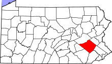
 Heidelberg Township Location of Heidelberg Township in Pennsylvania  Heidelberg Township Heidelberg Township (the US) | |
| Coordinates: 40°22′36″N 76°07′59″W / 40.37667°N 76.13306°WCoordinates: 40°22′36″N 76°07′59″W / 40.37667°N 76.13306°W | |
| Country | United States |
| State | Pennsylvania |
| County | Berks |
| Founded | 1734 |
| Area[1] | |
| • Total | 14.30 sq mi (37.04 km2) |
| • Land | 14.24 sq mi (36.88 km2) |
| • Water | 0.06 sq mi (0.16 km2) |
| Elevation | 492 ft (150 m) |
| Population (2010) | |
| • Total | 1,724 |
| • Estimate (2016)[2] | 1,737 |
| • Density | 121.97/sq mi (47.09/km2) |
| Time zone | UTC-5 (EST) |
| • Summer (DST) | UTC-4 (EDT) |
| Area code(s) | 610 |
| FIPS code | 42-011-33600 |
| Website |
www |
Heidelberg Township is a township in Berks County, Pennsylvania, United States. The population was 1,724 at the 2010 census.
History
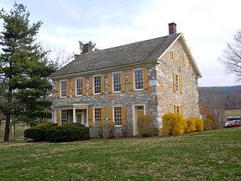
The Kissling Farm and Conrad Weiser House are listed on the National Register of Historic Places.[3]
Geography
According to the United States Census Bureau, the township has a total area of 14.3 square miles (37 km2), of which, 14.3 square miles (37 km2) of it is land and 0.07% is water.
Adjacent townships
- Marion Township (west)
- North Heidelberg Township (north)
- Lower Heidelberg Township (east)
- South Heidelberg Township (southeast)
- Millcreek Township, Lebanon County (southwest)
Adjacent boroughs
- Robesonia (surrounded)
- Womelsdorf (west)
Demographics
As of the census[4] of 2000, there were 1,636 people, 587 households, and 464 families residing in the township. The population density was 114.1 people per square mile (44.0/km²). There were 613 housing units at an average density of 42.8/sq mi (16.5/km²). The racial makeup of the township was 94.25% White, 2.57% African American, 0.79% Asian, 1.77% from other races, and 0.61% from two or more races. Hispanic or Latino of any race were 1.65% of the population.
There were 587 households, out of which 31.5% had children under the age of 18 living with them, 71.7% were married couples living together, 4.8% had a female householder with no husband present, and 20.8% were non-families. 17.5% of all households were made up of individuals, and 8.3% had someone living alone who was 65 years of age or older. The average household size was 2.63 and the average family size was 2.99.
| Historical population | |||
|---|---|---|---|
| Census | Pop. | %± | |
| 1980 | 1,561 | — | |
| 1990 | 1,513 | −3.1% | |
| 2000 | 1,636 | 8.1% | |
| 2010 | 1,724 | 5.4% | |
| Est. 2016 | 1,737 | [2] | 0.8% |
| Source: US Census Bureau | |||
In the township the population was spread out, with 27.9% under the age of 18, 5.1% from 18 to 24, 27.2% from 25 to 44, 27.0% from 45 to 64, and 12.8% who were 65 years of age or older. The median age was 39 years. For every 100 females, there were 97.1 males. For every 100 females age 18 and over, there were 98.0 males.
The median income for a household in the township was $51,641, and the median income for a family was $57,422. Males had a median income of $37,105 versus $27,315 for females. The per capita income for the township was $22,291. About 2.6% of families and 5.0% of the population were below the poverty line, including 8.6% of those under age 18 and 4.2% of those age 65 or over.
Gallery
- Historic Conrad Weiser Homestead near Womelsdorf.
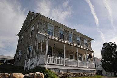 Historic Kissling Farm on Brownsville Rd.
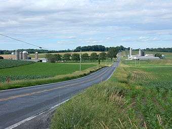 Bernville Rd. in Heidelberg Twp.
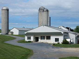 Farm on Bernville Rd.
References
- ↑ "2016 U.S. Gazetteer Files". United States Census Bureau. Retrieved Aug 13, 2017.
- 1 2 "Population and Housing Unit Estimates". Retrieved June 9, 2017.
- ↑ National Park Service (2010-07-09). "National Register Information System". National Register of Historic Places. National Park Service.
- ↑ "American FactFinder". United States Census Bureau. Retrieved 2008-01-31.
| Wikimedia Commons has media related to Heidelberg Township, Berks County, Pennsylvania. |