| [2] |
Name on the Register |
Image |
Date listed[3] |
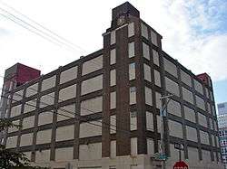
Location |
Neighborhood[4] |
Description |
|---|
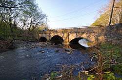
| 1 |
Adams Avenue Bridge in Philadelphia |
|
June 22, 1988
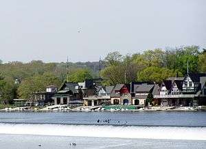
(#88000851) |
Adams Avenue over Tacony Creek
40°02′31″N 75°06′48″W / 40.0419°N 75.1133°W / 40.0419; -75.1133 (Adams Avenue Bridge in Philadelphia) |
Olney |
Extends into Northeast Philadelphia |
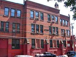
| 2 |
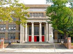
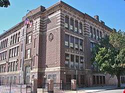
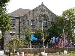
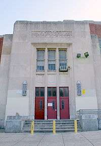
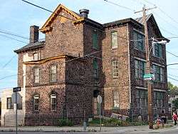
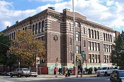
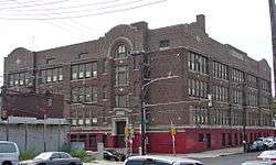
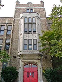
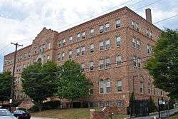
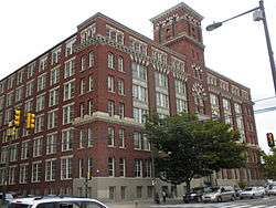
William Adamson School |
|
November 18, 1988
(#88002224) |
2637-2647 North 4th Street
39°59′28″N 75°08′17″W / 39.9911°N 75.1381°W / 39.9911; -75.1381 (William Adamson School) |
West Kensington |
Built 1879-80, designed by Addison Hutton[5] |
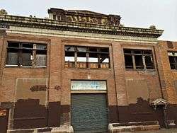
| 3 |
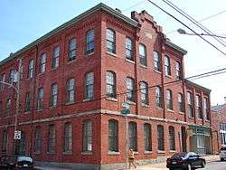
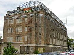
Ajax Metal Company Plant |
|
July 30, 2014
(#14000470) |
46 Richmond St.
39°57′59″N 75°08′10″W / 39.9664°N 75.1362°W / 39.9664; -75.1362 (Ajax Metal Company Plant) |
|
|
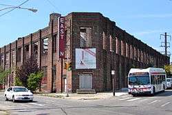
| 4 |
American Railway Express Company Garage |
|
August 2, 2006
(#06000664) |
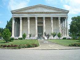
3002-3028 Cecil B. Moore Avenue
39°59′02″N 75°11′03″W / 39.9839°N 75.1842°W / 39.9839; -75.1842 (American Railway Express Company Garage) |
Strawberry Mansion |
|
| 5 |
Alexander Dallas Bache School |
|
December 4, 1986
(#86003262) |
801 North 22nd Street
39°58′12″N 75°10′26″W / 39.97°N 75.1739°W / 39.97; -75.1739 (Alexander Dallas Bache School) |
Fairmount |
|
| 6 |
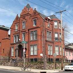
Matthew Baird Mansion |
|
December 29, 1983
(#83004241) |
814 North Broad Street
39°58′07″N 75°09′37″W / 39.9686°N 75.1603°W / 39.9686; -75.1603 (Matthew Baird Mansion) |
Francisville |
(1863-64). |
| 7 |
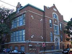
Clara Barton School |
|
November 18, 1988
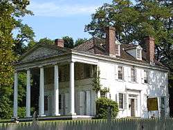
(#88002242) |
300 East Wyoming Avenue
40°01′13″N 75°07′10″W / 40.0203°N 75.1194°W / 40.0203; -75.1194 (Clara Barton School) |
North Hunting Park |
|
| 8 |
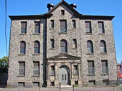
Bergdoll Mansion |
|
November 7, 1976
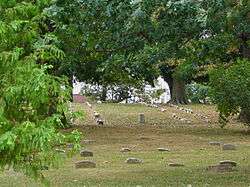
(#76001660) |
2201-2205 Green Street
39°57′56″N 75°10′28″W / 39.9656°N 75.1744°W / 39.9656; -75.1744 (Bergdoll Mansion) |
Spring Garden |
James H. Windrim, architect (1885-89). |
| 9 |
Louis Bergdoll House |
|
January 3, 1985
(#85000038) |
929 North 29th Street
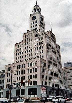
39°58′26″N 75°11′02″W / 39.9739°N 75.1839°W / 39.9739; -75.1839 (Louis Bergdoll House) |
Brewerytown |
Otto Charles Wolf, architect (1885). |
| 10 |
Biberman Building |
|
September 14, 2007
(#07000951) |
611-619 North 15th Street
39°57′53″N 75°09′46″W / 39.9647°N 75.1628°W / 39.9647; -75.1628 (Biberman Building) |
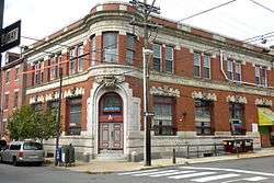
Spring Garden |
|
| 11 |
Gen. David B. Birney School |
|
November 18, 1988
(#88002246) |
900 West Lindley Street
40°01′45″N 75°08′20″W / 40.0292°N 75.1389°W / 40.0292; -75.1389 (Gen. David B. Birney School) |
Logan |
|
| 12 |
Boat House Row |
|
February 27, 1987
(#87000821) |
1-15 East River Drive
39°58′14″N 75°11′14″W / 39.9706°N 75.1872°W / 39.9706; -75.1872 (Boat House Row) |
Fairmount Park |
|
| 13 |
Daniel Boone School |
|
December 4, 1986
(#86003265) |
Hancock and Wildey Streets
39°58′03″N 75°08′14″W / 39.9675°N 75.1372°W / 39.9675; -75.1372 (Daniel Boone School) |
Northern Liberties |
|
| 14 |
Brewerytown Historic District |
|
March 1, 1991
(#91000096) |
Roughly bounded by 30th St., Girard Ave., 32nd St. and Glenwood Ave.
39°58′34″N 75°11′12″W / 39.9761°N 75.1867°W / 39.9761; -75.1867 (Brewerytown Historic District) |
Brewerytown |
|
| 15 |
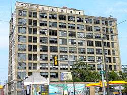
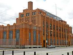
Edward G. Budd Manufacturing Company |
|
December 27, 2007
(#07001328) |
2450 West Hunting Park Ave.
40°00′32″N 75°10′08″W / 40.0089°N 75.1689°W / 40.0089; -75.1689 (Edward G. Budd Manufacturing Company) |
Hunting Park Industrial Area |
|
| 16 |
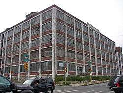
Buick Motor Company Building |
|
April 26, 2018
(#100002372) |
2917-2937 N. 16 St.
39°59′54″N 75°09′25″W / 39.9982°N 75.1569°W / 39.9982; -75.1569 (Buick Motor Company Building) |
|
|
| 17 |
Burk Brothers and Company |
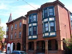
|
November 14, 1985
(#85003493) |
913-916 North Third St.
39°57′54″N 75°08′31″W / 39.965°N 75.1419°W / 39.965; -75.1419 (Burk Brothers and Company) |
Northern Liberties |
|
| 18 |
Callowhill Industrial Historic District |
|
June 28, 2010
(#10000403) |
Roughly bounded by Pearl St., North Broad St., Hamilton St., and the Reading Railroad Viaduct
39°57′35″N 75°09′43″W / 39.9597°N 75.1619°W / 39.9597; -75.1619 (Callowhill Industrial Historic District) |
Callowhill |
|
| 19 |
Central High School |
|
December 4, 1986
(#86003267) |
Olney and Ogontz Avenues
40°02′14″N 75°08′58″W / 40.0372°N 75.1494°W / 40.0372; -75.1494 (Central High School) |
Ogontz |
Irwin T. Catharine, architect (1937-39). |
| 20 |
George Chandler School |
|
November 18, 1988
(#88002255) |
1050 East Montgomery St.
39°58′12″N 75°07′37″W / 39.97°N 75.1269°W / 39.97; -75.1269 (George Chandler School) |
Fishtown |
|
| 21 |
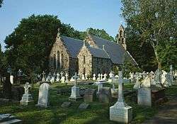
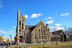
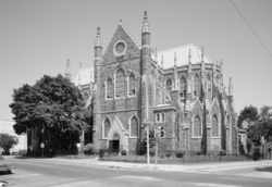
Church of St. James the Less |
|
November 20, 1974
(#74001801) |
Hunting Park Ave. and Clearfield St.
40°00′13″N 75°10′57″W / 40.0036°N 75.1825°W / 40.0036; -75.1825 (Church of St. James the Less) |
Allegheny West |
George Gordon Place & John E. Carver, architects (1846). |
| 22 |
City Park Brewery |
|
July 18, 1980
(#80003609) |
Roughly bounded by Pennsylvania Ave., 28th, 30th, and Poplar Sts.
39°58′19″N 75°11′03″W / 39.9719°N 75.1842°W / 39.9719; -75.1842 (City Park Brewery) |
Fairmount |
|
| 23 |
Class and Nachod Brewery |
|
July 31, 2003
(#03000724) |
1801-1823 North 10th St.
39°58′47″N 75°09′01″W / 39.9797°N 75.1503°W / 39.9797; -75.1503 (Class and Nachod Brewery) |
Templetown |
|
| 24 |
The Cliffs |
|
March 16, 1972
(#72001147) |
East Fairmount Park near 33rd St.
39°58′46″N 75°11′39″W / 39.9794°N 75.1942°W / 39.9794; -75.1942 (The Cliffs) |
Fairmount Park |
|
| 25 |
John Coltrane House |
|
January 20, 1999
(#99000628) |
1511 North 33rd St.
39°58′49″N 75°11′21″W / 39.9803°N 75.1892°W / 39.9803; -75.1892 (John Coltrane House) |
Strawberry Mansion |
|
| 26 |
Jay Cooke Junior High School |
|
November 18, 1988
(#88002259) |
4735 Old York Road
40°01′32″N 75°08′47″W / 40.0256°N 75.1464°W / 40.0256; -75.1464 (Jay Cooke Junior High School) |
Logan |
|
| 27 |
Lydia Darrah School |
|
December 4, 1986
(#86003269) |
708-732 North 17th St.
39°58′05″N 75°09′58″W / 39.9681°N 75.1661°W / 39.9681; -75.1661 (Lydia Darrah School) |
Francisville |
|
| 28 |
Murrell Dobbins Vocational School |
|
November 18, 1988
(#88002263) |
2100 Lehigh Ave.
39°59′43″N 75°10′02″W / 39.9953°N 75.1672°W / 39.9953; -75.1672 (Murrell Dobbins Vocational School) |
South Lehigh |
|
| 29 |
Dobson Mills |
|
July 28, 1988
(#88001214) |
4001-4041 Ridge Ave.; 3502-3530 Scott's Lane
40°00′28″N 75°11′14″W / 40.0078°N 75.1872°W / 40.0078; -75.1872 (Dobson Mills) |
Hunting Park Industrial Area |
|
| 30 |
Dropsie University Complex |
|
January 17, 1975
(#75001661) |
Broad and York Sts.
39°59′21″N 75°09′18″W / 39.9892°N 75.155°W / 39.9892; -75.155 (Dropsie University Complex) |
Templetown |
|
| 31 |
Drueding Brothers Company Building |
|
December 12, 2012
(#12001043) |
437-441 W. Master St.
39°58′22″N 75°08′39″W / 39.97277°N 75.14415°W / 39.97277; -75.14415 (Drueding Brothers Company Building) |
Olde Kensington |
|
| 32 |
Paul Lawrence Dunbar School |
|
December 4, 1986
(#86003274) |
Twelfth St. above Columbia Ave.
39°58′43″N 75°09′17″W / 39.9786°N 75.1547°W / 39.9786; -75.1547 (Paul Lawrence Dunbar School) |
Templetown |
|
| 33 |
Thomas Eakins House |
|
October 15, 1966
(#66000679) |
1729 Mount Vernon Place
39°57′56″N 75°10′02″W / 39.9656°N 75.1672°W / 39.9656; -75.1672 (Thomas Eakins House) |
Spring Garden |
|
| 34 |
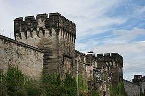
Eastern State Penitentiary |
|
October 15, 1966
(#66000680) |
21st St. and Fairmount Ave.
39°58′05″N 75°10′23″W / 39.9681°N 75.1731°W / 39.9681; -75.1731 (Eastern State Penitentiary) |
Fairmount |
John Haviland, architect (1821-29). |
| 35 |
James Elverson, Jr. School |
|
November 18, 1988
(#88002231) |
1300 Susquehanna Ave.
39°59′09″N 75°09′16″W / 39.9858°N 75.1544°W / 39.9858; -75.1544 (James Elverson, Jr. School) |
Templetown |
|
| 36 |
The Elverson Building |
|
July 15, 1996
(#96000716) |
400-440 North Broad St.
39°57′36″N 75°09′44″W / 39.96°N 75.1622°W / 39.96; -75.1622 (The Elverson Building) |
Callowhill |
Rankin, Kellogg & Crane, architects (1923-24). |
| 37 |
Fair Hill Burial Ground |
|
August 7, 1998
(#98000900) |
Roughly along Germantown and Indiana Aves., 9th, and Cambria Sts.
39°59′49″N 75°08′46″W / 39.9969°N 75.1461°W / 39.9969; -75.1461 (Fair Hill Burial Ground) |
Fairhill |
|
| 38 |
Fairmount Avenue Historic District |
|
February 20, 2002
(#02000066) |
Fairmount Ave. and Melon, North, 15th, 16th, and 17th Sts.
39°58′00″N 75°09′44″W / 39.9667°N 75.1622°W / 39.9667; -75.1622 (Fairmount Avenue Historic District) |
Spring Garden |
|
| 39 |
Fairmount Park |
|
February 7, 1972
(#72001151) |
Both banks of the Schuylkill River and Wissahickon Creek, from Spring Garden St. to Northwestern Ave.
39°58′58″N 75°11′50″W / 39.9828°N 75.1972°W / 39.9828; -75.1972 (Fairmount Park) |
Fairmount Park |
Extends into Northwest and West Philadelphia |
| 40 |
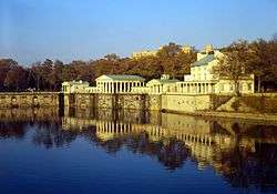
Fairmount Water Works |
|
May 11, 1976
(#76001662) |
Eastern banks of the Schuylkill River
39°57′59″N 75°11′09″W / 39.9664°N 75.1858°W / 39.9664; -75.1858 (Fairmount Water Works) |
Fairmount Park |
Frederick Graff, et al., architects (1812-22). |
| 41 |
David Farragut School |
|
December 4, 1986
(#86003280) |
Hancock and Cumberland Sts.
39°59′16″N 75°08′08″W / 39.9878°N 75.1356°W / 39.9878; -75.1356 (David Farragut School) |
West Kensington |
|
| 42 |
Feltonville School No. 2 |
|
November 18, 1988
(#88002269) |
4901 Rising Sun Ave.
40°01′29″N 75°07′21″W / 40.0247°N 75.1225°W / 40.0247; -75.1225 (Feltonville School No. 2) |
Feltonville |
|
| 43 |
Joseph C. Ferguson School |
|
November 18, 1988
(#88002270) |
2000-2046 North 7th St.
39°58′55″N 75°08′48″W / 39.9819°N 75.1467°W / 39.9819; -75.1467 (Joseph C. Ferguson School) |
Templetown |
|
| 44 |
Fidelity Mutual Life Insurance Company Building |
|
July 2, 1973
(#73001662) |
Fairmount and Pennsylvania Aves.
39°58′03″N 75°10′47″W / 39.9675°N 75.1797°W / 39.9675; -75.1797 (Fidelity Mutual Life Insurance Company Building) |
Fairmount |
Zantzinger, Borie and Medary, architects (1927). |
| 45 |
Thomas K. Finletter School |
|
November 18, 1988
(#88002271) |
6101 North Front St.
40°02′37″N 75°07′10″W / 40.0436°N 75.1194°W / 40.0436; -75.1194 (Thomas K. Finletter School) |
Olney |
|
| 46 |
Thomas Fitzsimons Junior High School |
|
November 18, 1988
(#88002272) |
2601 West Cumberland St.
39°59′38″N 75°10′30″W / 39.9939°N 75.1749°W / 39.9939; -75.1749 (Thomas Fitzsimons Junior High School) |
Strawberry Mansion |
|
| 47 |
Helen Fleischer Vocational School |
|
December 4, 1986
(#86003282) |
13th and Brandywine Sts.
39°57′46″N 75°09′33″W / 39.9629°N 75.1593°W / 39.9629; -75.1593 (Helen Fleischer Vocational School) |
Callowhill |
|
| 48 |
Edwin Forrest House |
|
January 13, 1972
(#72001152) |
1346 North Broad St.
39°58′28″N 75°09′33″W / 39.9744°N 75.1592°W / 39.9744; -75.1592 (Edwin Forrest House) |
Cabot |
Also listed as the Philadelphia School of Design for Women |
| 49 |
Friends Housing Cooperative |
|
October 13, 2015
(#15000735) |
Bounded by Fairmount Ave., 8th, Franklin & Brown Sts.
39°57′54″N 75°09′03″W / 39.9649°N 75.1507°W / 39.9649; -75.1507 (Friends Housing Cooperative) |
|
|
| 50 |
Founder's Hall, Girard College |
|
August 4, 1969
(#69000158) |
Corinthian St. and Girard Ave.
39°58′26″N 75°10′12″W / 39.9739°N 75.17°W / 39.9739; -75.17 (Founder's Hall, Girard College) |
Girard College |
Thomas Ustick Walter, architect (1833-48). |
| 51 |
Henry S. Frank Memorial Synagogue |
|
July 12, 1983
(#83002267) |
Old York and West Tabor Roads
40°02′14″N 75°08′38″W / 40.0371°N 75.1438°W / 40.0371; -75.1438 (Henry S. Frank Memorial Synagogue) |
Logan |
|
| 52 |
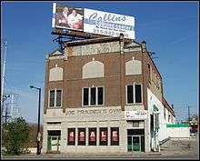
Joe Frazier's Gym |
|
April 30, 2013
(#13000257) |
2917 N. Broad Street
39°59′51″N 75°09′11″W / 39.997444°N 75.153069°W / 39.997444; -75.153069 (Joe Frazier's Gym) |
North Central |
|
| 53 |
General Electric Switchgear Plant |
|
October 31, 1985
(#85003470) |
Seventh and Willow Sts.
39°57′32″N 75°09′00″W / 39.9589°N 75.15°W / 39.9589; -75.15 (General Electric Switchgear Plant) |
Callowhill |
|
| 54 |
German Society of Pennsylvania |
|
October 31, 1985
(#92000947) |
611 Spring Garden St.
39°57′39″N 75°09′00″W / 39.960833°N 75.150000°W / 39.960833; -75.150000 (German Society of Pennsylvania) |
Northern Liberties |
|
| 55 |
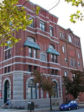
Germantown Junction Station |
|
July 8, 1999
(#92000940) |
2900 North Broad St.
39°59′50″N 75°08′16″W / 39.9972°N 75.1378°W / 39.9972; -75.1378 (Germantown Junction Station) |
North Central |
Theophilus P. Chandler, Jr., architect (1896-1901). |
| 56 |
Elizabeth Duane Gillespie Junior High School |
|
April 10, 1989
(#88002275) |
3901-3961 North 18th St.
40°00′48″N 75°09′22″W / 40.0132°N 75.156°W / 40.0132; -75.156 (Elizabeth Duane Gillespie Junior High School) |
Nicetown–Tioga |
|
| 57 |
Girard Avenue Historic District |
|
October 31, 1985
(#85003427) |
1415-2028 Girard Avenue and 1700 block of Thompson Street
39°58′21″N 75°09′36″W / 39.9725°N 75.16°W / 39.9725; -75.16 (Girard Avenue Historic District) |
Cabot |
|
| 58 |
Girard Avenue West Historic District |
|
March 8, 2011
(#10001032) |
West Girard Avenue, between North Taney and North 29th Streets
39°58′28″N 75°10′52″W / 39.974444°N 75.181111°W / 39.974444; -75.181111 (Girard Avenue West Historic District) |
Brewerytown |
|
| 59 |
Girard College Complex |
|
October 29, 1974
(#74001802) |
Bounded by Poplar St., Girard, West College, South College, and Ridge Aves.
39°58′25″N 75°09′22″W / 39.9736°N 75.1561°W / 39.9736; -75.1561 (Girard College Complex) |
Girard College |
|
| 60 |
Goodman Brothers and Hinlein Company |
|
March 7, 1985
(#85000469) |
1238 Callowhill St.
39°57′33″N 75°09′35″W / 39.9592°N 75.1597°W / 39.9592; -75.1597 (Goodman Brothers and Hinlein Company) |
Callowhill |
|
| 61 |
Gotham Silk Hosiery Company |
|
April 17, 2018
(#100002342) |
2000-2034 N 2nd St.
39°58′51″N 75°08′14″W / 39.980757°N 75.137149°W / 39.980757; -75.137149 (Gotham Silk Hosiery Company) |
West Kensington |
|
| 62 |
Graham and Laird, Schober and Mitchell Factories |
|
July 7, 1978
(#78002448) |
19th St. between Hamilton and Buttonwood Sts.
39°57′44″N 75°10′11″W / 39.9622°N 75.1697°W / 39.9622; -75.1697 (Graham and Laird, Schober and Mitchell Factories) |
Franklintown |
Site now a parking lot. |
| 63 |
Simon Gratz High School |
|
April 10, 1989
(#88002276) |
3901-3961 North 18th St.
40°00′50″N 75°09′21″W / 40.014°N 75.1558°W / 40.014; -75.1558 (Simon Gratz High School) |
Nicetown–Tioga |
|
| 64 |
Harrington Machine Shop |
|
May 6, 1983
(#83002270) |
1640-1666 Callowhill St.
39°57′36″N 75°10′00″W / 39.96°N 75.1667°W / 39.96; -75.1667 (Harrington Machine Shop) |
Franklintown |
|
| 65 |
William H. Harrison School |
|
November 18, 1988
(#88002278) |
1012-1020 West Thompson St.
39°58′21″N 75°09′13″W / 39.9724°N 75.1535°W / 39.9724; -75.1535 (William H. Harrison School) |
Yorktown |
|
| 66 |
Hatfield House |
|
March 16, 1972
(#72001157) |
33rd St. near Girard Avenue
39°58′33″N 75°11′18″W / 39.9759°N 75.1883°W / 39.9759; -75.1883 (Hatfield House) |
Fairmount Park |
|
| 67 |
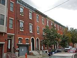
Houses at 1907-1951 N. 32nd St. |
|
January 11, 1994
(#93001472) |
1907-1951 North 32nd St.
39°59′10″N 75°11′09″W / 39.9861°N 75.1857°W / 39.9861; -75.1857 (Houses at 1907-1951 N. 32nd St.) |
Strawberry Mansion |
|
| 68 |
Julia Ward Howe School |
|
November 18, 1988
(#88002284) |
1301-1331 Grange St.
40°02′29″N 75°08′32″W / 40.0414°N 75.1422°W / 40.0414; -75.1422 (Julia Ward Howe School) |
Fern Rock |
|
| 69 |
Integrity Title Insurance, Trust and Safe Deposit Company |
|
November 14, 1982
(#82001548) |
4th and Green Sts.
39°57′42″N 75°08′42″W / 39.9617°N 75.145°W / 39.9617; -75.145 (Integrity Title Insurance, Trust and Safe Deposit Company) |
Northern Liberties |
|
| 70 |
International Harvester Company Building-Philadelphia Branch House |
|
April 26, 2018
(#100002370) |
2903-2909 N. 16th St.
39°59′52″N 75°09′25″W / 39.9977°N 75.1570°W / 39.9977; -75.1570 (International Harvester Company Building-Philadelphia Branch House) |
|
|
| 71 |
Thomas Jefferson School |
|
November 18, 1988
(#88002280) |
1101-1125 North 4th St.
39°58′05″N 75°08′36″W / 39.9681°N 75.1433°W / 39.9681; -75.1433 (Thomas Jefferson School) |
Northern Liberties |
|
| 72 |
Harry C. Kahn and Son Warehouse |
|
April 10, 2017
(#100000857) |
3101-27 W. Glenwood Ave.
39°58′50″N 75°11′10″W / 39.980566°N 75.185984°W / 39.980566; -75.185984 (Harry C. Kahn and Son Warehouse) |
|
|
| 73 |
Kensington Branch of the Philadelphia YWCA |
|
March 9, 1990
(#90000415) |
174 West Allegheny Ave.
39°59′56″N 75°07′57″W / 39.9988°N 75.1325°W / 39.9988; -75.1325 (Kensington Branch of the Philadelphia YWCA) |
West Kensington |
|
| 74 |
John L. Kinsey School |
|
December 4, 1986
(#86003297) |
65th Ave. and Limekiln Pike
40°03′13″N 75°09′09″W / 40.0536°N 75.1525°W / 40.0536; -75.1525 (John L. Kinsey School) |
West Oak Lane |
|
| 75 |
Laurel Hill Cemetery |
|
October 28, 1977
(#77001185) |
3822 Ridge Ave.
40°00′15″N 75°11′19″W / 40.0042°N 75.1886°W / 40.0042; -75.1886 (Laurel Hill Cemetery) |
Fairmount Park |
|
| 76 |
Logan Demonstration School |
|
November 18, 1988
(#88002293) |
5000 North 17th St.
40°01′52″N 75°09′06″W / 40.0311°N 75.1518°W / 40.0311; -75.1518 (Logan Demonstration School) |
Logan |
|
| 77 |
Lorraine Apartments |
|
November 27, 2002
(#02001427) |
699 North Broad St.
39°58′00″N 75°09′37″W / 39.9667°N 75.1603°W / 39.9667; -75.1603 (Lorraine Apartments) |
Poplar |
Willis G. Hale, architect (1892-1893). |
| 78 |
James Russell Lowell School |
|
November 18, 1988
(#88002295) |
5801-5851 North 5th St.
40°02′27″N 75°07′44″W / 40.0408°N 75.1289°W / 40.0408; -75.1289 (James Russell Lowell School) |
Olney |
|
| 79 |
Lower North Philadelphia Speculative Housing Historic District |
|
March 12, 1999
(#99000325) |
Roughly bounded by North 15th St., Sydenham St., North 16th St., Montgomery Ave., North 19th St., Jefferson St., and Willington St.
39°58′47″N 75°09′41″W / 39.9797°N 75.1614°W / 39.9797; -75.1614 (Lower North Philadelphia Speculative Housing Historic District) |
North Central |
|
| 80 |
James R. Ludlow School |
|
November 18, 1988
(#88002296) |
1323-1345 North 6th St.
39°58′21″N 75°08′45″W / 39.9725°N 75.1458°W / 39.9725; -75.1458 (James R. Ludlow School) |
Yorktown |
|
| 81 |
Martin Orthopedic School |
|
December 4, 1986
(#86003300) |
800 North 22nd St.
39°58′12″N 75°10′27″W / 39.9701°N 75.1742°W / 39.9701; -75.1742 (Martin Orthopedic School) |
Fairmount |
|
| 82 |
Alexander K. McClure School |
|
November 18, 1988
(#88002300) |
4139 North 6th St.
40°00′54″N 75°08′15″W / 40.015°N 75.1375°W / 40.015; -75.1375 (Alexander K. McClure School) |
Hunting Park |
|
| 83 |
McDowell Memorial Presbyterian Church |
|
September 18, 2013
(#13000744) |
2040 Cecil B. Moore Avenue
39°58′48″N 75°10′09″W / 39.979911°N 75.169093°W / 39.979911; -75.169093 (McDowell Memorial Presbyterian Church) |
North Central |
|
| 84 |
George Meade School |
|
December 4, 1986
(#86003305) |
1801 Oxford St.
39°58′42″N 75°09′54″W / 39.9783°N 75.1649°W / 39.9783; -75.1649 (George Meade School) |
North Central |
|
| 85 |
A. Mecky Company Building |
|
May 8, 2017
(#100000977) |
1705 W. Allegheny Ave.
40°00′08″N 75°09′29″W / 40.002229°N 75.157972°W / 40.002229; -75.157972 (A. Mecky Company Building) |
|
|
| 86 |
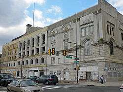
Metropolitan Opera House |
|
February 1, 1972
(#72001163) |
858 North Broad St.
39°58′12″N 75°09′36″W / 39.9699°N 75.1601°W / 39.9699; -75.1601 (Metropolitan Opera House) |
Francisville |
|
| 87 |
Middishade Clothing Factory |
|
January 6, 1987
(#86003579) |
1600 Callowhill St.
39°57′36″N 75°09′55″W / 39.96°N 75.1653°W / 39.96; -75.1653 (Middishade Clothing Factory) |
Franklintown |
|
| 88 |
Mifflin School |
|
December 4, 1986
(#86003308) |
808-818 North 3rd St.
39°57′49″N 75°08′35″W / 39.9636°N 75.1431°W / 39.9636; -75.1431 (Mifflin School) |
Northern Liberties |
|
| 89 |
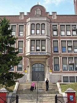
Andrew J. Morrison School |
|
November 18, 1988
(#88002302) |
300 Duncannon St.
40°01′46″N 75°07′46″W / 40.0294°N 75.1294°W / 40.0294; -75.1294 (Andrew J. Morrison School) |
Olney |
|
| 90 |
Most Precious Blood Roman Catholic Church, Rectory and Parochial School |
|
January 22, 1992
(#91002008) |
2800-2818 Diamond St.
39°59′14″N 75°10′47″W / 39.9872°N 75.1796°W / 39.9872; -75.1796 (Most Precious Blood Roman Catholic Church, Rectory and Parochial School) |
Strawberry Mansion |
|
| 91 |
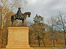
Mount Pleasant |
|
October 15, 1966
(#66000685) |
East Reservoir Drive
39°59′00″N 75°12′00″W / 39.9834°N 75.1999°W / 39.9834; -75.1999 (Mount Pleasant) |
Fairmount Park |
|
| 92 |
Muhlenberg School |
|
November 18, 1988
(#88002247) |
1640 Master St.
39°58′30″N 75°09′49″W / 39.975°N 75.1635°W / 39.975; -75.1635 (Muhlenberg School) |
Cabot |
|
| 93 |
Simon Muhr Work Training School |
|
December 1, 1986
(#86003310) |
12th St. and Allegheny Ave.
40°00′03″N 75°08′55″W / 40.0008°N 75.1486°W / 40.0008; -75.1486 (Simon Muhr Work Training School) |
Nicetown–Tioga |
|
| 94 |
Mulford Building |
|
August 20, 2004
(#04000882) |
640 North Broad St.
39°57′54″N 75°09′40″W / 39.965°N 75.1611°W / 39.965; -75.1611 (Mulford Building) |
Spring Garden |
|
| 95 |
N. Snellenburg Company Department Store Warehouse |
|
July 31, 2003
(#03000725) |
1825-1851 North 10th St.
39°58′49″N 75°09′00″W / 39.9803°N 75.15°W / 39.9803; -75.15 (N. Snellenburg Company Department Store Warehouse) |
Templetown |
|
| 96 |
National Bank of North Philadelphia |
|
May 20, 1985
(#85001131) |
3701 North Broad St.
40°00′36″N 75°09′03″W / 40.01°N 75.1508°W / 40.01; -75.1508 (National Bank of North Philadelphia) |
Nicetown–Tioga |
|
| 97 |
North Broad Street Mansion District |
|
March 29, 1985
(#85000674) |
Roughly bounded by Broad, Jefferson, Willington, and Oxford Sts.
39°58′37″N 75°09′38″W / 39.9769°N 75.1606°W / 39.9769; -75.1606 (North Broad Street Mansion District) |
Templetown |
|
| 98 |
North Broad Street Station, Reading Company |
|
March 28, 1996
(#96000325) |
2601 North Broad St.
39°59′33″N 75°09′16″W / 39.9924°N 75.1544°W / 39.9924; -75.1544 (North Broad Street Station, Reading Company) |
Templetown |
|
| 99 |
Northeast Manual Training School |
|
December 4, 1986
(#86003279) |
701 Lehigh Ave.
39°59′35″N 75°08′40″W / 39.9931°N 75.1444°W / 39.9931; -75.1444 (Northeast Manual Training School) |
Fairhill |
Burned then demolished in 2011.[6] |
| 100 |
Northern Liberties Historic District |
|
October 31, 1985
(#85003471) |
Roughly bounded by Brown, Boone and Galloway, Green and Wallace, and 5th and 6th Sts.
39°57′57″N 75°08′48″W / 39.9658°N 75.1467°W / 39.9658; -75.1467 (Northern Liberties Historic District) |
Northern Liberties |
|
| 101 |
Northern National Bank |
|
June 27, 1985
(#85001388) |
2300 Germantown Ave.
39°59′12″N 75°08′43″W / 39.9867°N 75.1454°W / 39.9867; -75.1454 (Northern National Bank) |
Hartranft |
|
| 102 |
Northern Saving Fund and Safe Deposit Company |
|
September 28, 1977
(#77001187) |
600 Spring Garden St.
39°57′40″N 75°08′55″W / 39.9611°N 75.1486°W / 39.9611; -75.1486 (Northern Saving Fund and Safe Deposit Company) |
Callowhill |
|
| 103 |
Ogontz Hall |
|
November 14, 1991
(#91001708) |
7175-7165 Ogontz Ave.
40°03′51″N 75°09′09″W / 40.0642°N 75.1525°W / 40.0642; -75.1525 (Ogontz Hall) |
West Oak Lane |
|
| 104 |
Olney Elementary School |
|
December 4, 1986
(#86003311) |
Tabor Road and Water St.
40°01′52″N 75°07′14″W / 40.0311°N 75.1206°W / 40.0311; -75.1206 (Olney Elementary School) |
Olney |
|
| 105 |
Olney High School |
|
December 4, 1986
(#86003312) |
Duncannon and Front Sts.
40°01′44″N 75°07′25″W / 40.0289°N 75.1237°W / 40.0289; -75.1237 (Olney High School) |
Olney |
|
| 106 |
Henry F. Ortlieb Company Bottling House |
|
August 5, 2014
(#14000475) |
829-51 N. American St.
39°57′49″N 75°08′30″W / 39.9635°N 75.1418°W / 39.9635; -75.1418 (Henry F. Ortlieb Company Bottling House) |
|
|
| 107 |
Park Towne Place |
|
December 15, 2011
(#11000926) |
2200 Park Towne Place
39°57′40″N 75°10′39″W / 39.961062°N 75.177524°W / 39.961062; -75.177524 (Park Towne Place) |
Logan Square |
|
| 108 |
Charles Willson Peale House |
|
October 15, 1966
(#66000687) |
2100 Clarkson Ave.
40°02′17″N 75°09′20″W / 40.0381°N 75.1556°W / 40.0381; -75.1556 (Charles Willson Peale House) |
Logan |
|
| 109 |
William Penn High School for Girls |
|
December 1, 1986
(#86003316) |
1501 Wallace St.
39°57′54″N 75°09′47″W / 39.965°N 75.1631°W / 39.965; -75.1631 (William Penn High School for Girls) |
Spring Garden |
|
| 110 |
Joseph Pennell School |
|
November 18, 1988
(#88002309) |
1800-1856 Nedro Ave.
40°02′37″N 75°09′03″W / 40.0435°N 75.1507°W / 40.0435; -75.1507 (Joseph Pennell School) |
Belfield |
|
| 111 |
Pennsylvania State Office Building |
|
January 7, 2010
(#09001216) |
1400 Spring Garden St.
39°57′43″N 75°09′44″W / 39.962000°N 75.162222°W / 39.962000; -75.162222 (Pennsylvania State Office Building) |
Hahnemann |
|
| 112 |
Samuel W. Pennypacker School |
|
November 18, 1988
(#88002314) |
1800-1850 East Washington Lane
40°03′55″N 75°09′32″W / 40.0653°N 75.1589°W / 40.0653; -75.1589 (Samuel W. Pennypacker School) |
West Oak Lane |
|
| 113 |
Philadelphia High School for Girls |
|
December 4, 1986
(#86003302) |
17th and Spring Garden Sts.
39°57′48″N 75°09′57″W / 39.9633°N 75.1657°W / 39.9633; -75.1657 (Philadelphia High School for Girls) |
Spring Garden |
|
| 114 |
Philadelphia National Cemetery |
|
July 24, 1997
(#97000775) |
Haines St. and Limekiln Road
40°03′31″N 75°09′18″W / 40.0586°N 75.1549°W / 40.0586; -75.1549 (Philadelphia National Cemetery) |
West Oak Lane |
|
| 115 |
Philadelphia School of Design for Women |
|
November 4, 1993
(#93001608) |
1346 North Broad St.
39°58′28″N 75°09′33″W / 39.9744°N 75.1592°W / 39.9744; -75.1592 (Philadelphia School of Design for Women) |
Cabot |
Also listed as the Edwin Forrest House. The school merged into the Moore College of Art and Design. |
| 116 |
Philadelphia Wholesale Drug Company Building |
|
September 5, 1990
(#90001410) |
513-525 North Tenth St.
39°57′41″N 75°09′21″W / 39.9614°N 75.1558°W / 39.9614; -75.1558 (Philadelphia Wholesale Drug Company Building) |
Callowhill |
|
| 117 |
Plaza Apartments |
|
February 15, 2005
(#05000063) |
1719-1725 North 33rd St., 3226-3228 Clifford St.
39°58′59″N 75°11′18″W / 39.9831°N 75.1883°W / 39.9831; -75.1883 (Plaza Apartments) |
Strawberry Mansion |
|
| 118 |
Edgar Allan Poe House, National Historic Site |
|
October 15, 1966
(#66000689) |
530-532 North Seventh St.
39°57′43″N 75°09′00″W / 39.962°N 75.1499°W / 39.962; -75.1499 (Edgar Allan Poe House, National Historic Site) |
Callowhill |
|
| 119 |
Progress Lighting Manufacturing Company |
|
August 29, 2016
(#16000572) |
1401-1409 Germantown Ave.
39°58′22″N 75°08′29″W / 39.972657°N 75.141446°W / 39.972657; -75.141446 (Progress Lighting Manufacturing Company) |
|
|
| 120 |
Quaker City Dye Works |
|
December 12, 2012
(#12001044) |
100-118 W. Oxford St.
39°58′26″N 75°08′06″W / 39.97389°N 75.13497°W / 39.97389; -75.13497 (Quaker City Dye Works) |
West Kensington |
|
| 121 |
Randolph House |
|
March 24, 1972
(#72001169) |
Edgeley Drive
39°59′29″N 75°11′42″W / 39.9914°N 75.1949°W / 39.9914; -75.1949 (Randolph House) |
Fairmount Park |
|
| 122 |
Reading Company Grain Elevator |
|
March 10, 1982
(#82003813) |
411 North 20th St.
39°57′41″N 75°10′16″W / 39.9614°N 75.1711°W / 39.9614; -75.1711 (Reading Company Grain Elevator) |
Logan Square |
|
| 123 |
Gen. John F. Reynolds School |
|
November 18, 1988
(#88002315) |
2300 Jefferson St.
39°58′41″N 75°10′29″W / 39.9781°N 75.1746°W / 39.9781; -75.1746 (Gen. John F. Reynolds School) |
North Central |
|
| 124 |
Ridge Avenue Farmers' Market |
|
March 5, 1984
(#84003547) |
1810 Ridge Ave.
39°58′19″N 75°09′59″W / 39.9719°N 75.1664°W / 39.9719; -75.1664 (Ridge Avenue Farmers' Market) |
Francisville |
|
| 125 |
Rodeph Shalom Synagogue |
|
August 7, 2007
(#07000797) |
607-615 North Broad St.
39°57′50″N 75°09′39″W / 39.9639°N 75.1608°W / 39.9639; -75.1608 (Rodeph Shalom Synagogue) |
Poplar |
|
| 126 |
William Rowen School |
|
November 18, 1988
(#88002318) |
6801 North 19th St.
40°03′31″N 75°08′55″W / 40.0586°N 75.1486°W / 40.0586; -75.1486 (William Rowen School) |
West Oak Lane |
|
| 127 |
St. John's Church |
|
February 24, 1983
(#83002278) |
220-230 Brown St.
39°57′47″N 75°08′32″W / 39.9631°N 75.1422°W / 39.9631; -75.1422 (St. John's Church) |
Northern Liberties |
|
| 128 |
St. Joseph's House for Homeless Industrious Boys |
|
October 24, 1996
(#96001204) |
1511 and 1515-1527 Allegheny Ave.
40°00′08″N 75°09′20″W / 40.0022°N 75.1556°W / 40.0022; -75.1556 (St. Joseph's House for Homeless Industrious Boys) |
Nicetown–Tioga |
|
| 129 |
Frank C. Scherer Wagon Works |
|
December 26, 1985
(#85003160) |
801 North 27th St.
39°58′14″N 75°10′52″W / 39.9706°N 75.1811°W / 39.9706; -75.1811 (Frank C. Scherer Wagon Works) |
Fairmount |
|
| 130 |
Edwin J. Schoettle Company Building |
|
December 29, 2014
(#14001105) |
533 North 11th St.
39°57′45″N 75°09′21″W / 39.9625°N 75.1559°W / 39.9625; -75.1559 (Edwin J. Schoettle Company Building) |
Poplar |
|
| 131 |
Smaltz Building |
|
July 27, 2005
(#05000759) |
315 North 12th St.
39°57′30″N 75°09′29″W / 39.9582°N 75.1581°W / 39.9582; -75.1581 (Smaltz Building) |
Callowhill |
|
| 132 |
Snellenburg's Clothing Factory |
|
September 2, 1986
(#86001842) |
642 North Broad St.
39°57′56″N 75°09′40″W / 39.9656°N 75.1611°W / 39.9656; -75.1611 (Snellenburg's Clothing Factory) |
Spring Garden |
|
| 133 |
George W. South Memorial Protestant Episcopal Church of the Advocate |
|
February 8, 1980
(#80003620) |
18th and Diamond Sts.
39°59′09″N 75°09′49″W / 39.9858°N 75.1636°W / 39.9858; -75.1636 (George W. South Memorial Protestant Episcopal Church of the Advocate) |
North Central |
Charles Marquedant Burns, architect (1887-97). |
| 134 |
Special Troops Armory |
|
November 14, 1991
(#91001702) |
5350 Ogontz Ave.
40°02′07″N 75°09′03″W / 40.0354°N 75.1508°W / 40.0354; -75.1508 (Special Troops Armory) |
Ogontz |
|
| 135 |
Spring Garden District |
|
December 21, 1978
(#78002455) |
Roughly bounded by Fairmount Ave. and 15th, 24th, Mount Vernon, and Spring Garden Sts.; also Fairmount Ave. and Mt. Vernon, 15th, and 19th Sts.
39°57′58″N 75°10′11″W / 39.9661°N 75.1697°W / 39.9661; -75.1697 (Spring Garden District) |
Spring Garden |
Second set of boundaries represents a boundary increase of September 12, 1983 |
| 136 |
Spring Garden School No. 1 |
|
December 4, 1986
(#86003332) |
12th and Ogden Sts.
39°58′07″N 75°09′21″W / 39.9685°N 75.1558°W / 39.9685; -75.1558 (Spring Garden School No. 1) |
Poplar |
|
| 137 |
Spring Garden School No. 2 |
|
December 4, 1986
(#86003333) |
12th and Melon Sts.
39°57′54″N 75°09′22″W / 39.965°N 75.1561°W / 39.965; -75.1561 (Spring Garden School No. 2) |
Poplar |
|
| 138 |
M. Hall Stanton Public School |
|
September 25, 2018
(#100002987) |
2539 N 16th St.
39°59′31″N 75°09′30″W / 39.9920°N 75.1583°W / 39.9920; -75.1583 (M. Hall Stanton Public School) |
|
|
| 139 |
Steel Heddle Manufacturing Company Complex |
|
June 28, 2010
(#10000404) |
2100 West Allegheny Ave.
40°00′10″N 75°09′54″W / 40.0028°N 75.165°W / 40.0028; -75.165 (Steel Heddle Manufacturing Company Complex) |
Allegheny West |
|
| 140 |
Stenton |
|
October 15, 1966
(#66000690) |
18th and Courtland Streets
40°01′29″N 75°09′13″W / 40.0247°N 75.1536°W / 40.0247; -75.1536 (Stenton) |
Logan |
|
| 141 |
Thaddeus Stevens School of Observation |
|
December 4, 1986
(#86003335) |
1301 Spring Garden St.
39°57′45″N 75°09′37″W / 39.9626°N 75.1603°W / 39.9626; -75.1603 (Thaddeus Stevens School of Observation) |
Poplar |
|
| 142 |
Suffolk Manor Apartments |
|
December 20, 2002
(#02001567) |
1414-1450 Clearview St.
40°02′26″N 75°08′45″W / 40.0406°N 75.1458°W / 40.0406; -75.1458 (Suffolk Manor Apartments) |
Ogontz |
|
| 143 |
Henry O. Tanner House |
|
May 11, 1976
(#76001672) |
2908 West Diamond St.
39°59′16″N 75°10′52″W / 39.9878°N 75.1811°W / 39.9878; -75.1811 (Henry O. Tanner House) |
Strawberry Mansion |
|
| 144 |
Tasty Baking Company Building |
|
September 8, 2011
(#11000648) |
2801 West Hunting Park Avenue
40°00′25″N 75°10′31″W / 40.007083°N 75.175278°W / 40.007083; -75.175278 (Tasty Baking Company Building) |
Hunting Park Industrial Area |
|
| 145 |
Bayard Taylor School |
|
November 18, 1988
(#88002329) |
3614-3630 North Randolph St.
40°00′26″N 75°08′18″W / 40.0071°N 75.1382°W / 40.0071; -75.1382 (Bayard Taylor School) |
Hunting Park |
|
| 146 |
Terminal Commerce Building |
|
October 24, 1996
(#96001203) |
401 North Broad St.
39°57′36″N 75°09′41″W / 39.9599°N 75.1615°W / 39.9599; -75.1615 (Terminal Commerce Building) |
Callowhill |
|
| 147 |
Thirty-third Street Bridge in Philadelphia |
|
June 22, 1988
(#88000847) |
33rd St. above Master St.
39°58′43″N 75°11′23″W / 39.9785°N 75.1896°W / 39.9785; -75.1896 (Thirty-third Street Bridge in Philadelphia) |
Brewerytown |
|
| 148 |
Union Methodist Episcopal Church |
|
October 15, 1980
(#80003622) |
2019 West Diamond St.
39°59′11″N 75°10′01″W / 39.9863°N 75.1669°W / 39.9863; -75.1669 (Union Methodist Episcopal Church) |
North Central |
|
| 149 |
Uptown Theater and Office Building |
|
July 22, 1982
(#82003817) |
2240-2248 North Broad St.
39°59′15″N 75°09′22″W / 39.9874°N 75.1561°W / 39.9874; -75.1561 (Uptown Theater and Office Building) |
Templetown |
Magaziner, Eberhard & Harris, architects (1929). |
| 150 |
Roberts Vaux Junior High School |
|
November 18, 1988
(#88002332) |
2300-2344 West Master St.
39°58′35″N 75°10′27″W / 39.9763°N 75.1742°W / 39.9763; -75.1742 (Roberts Vaux Junior High School) |
North Central |
|
| 151 |
Wagner Free Institute of Science |
|
May 17, 1989
(#89000361) |
17th St. and Montgomery Ave.
39°58′50″N 75°09′46″W / 39.9806°N 75.1628°W / 39.9806; -75.1628 (Wagner Free Institute of Science) |
North Central |
John McArthur, Jr., architect (1859-65). |
| 152 |
Gen. Louis Wagner Junior High School |
|
December 4, 1986
(#86003340) |
17th St. and Chelten Ave.
40°03′06″N 75°08′52″W / 40.0517°N 75.1478°W / 40.0517; -75.1478 (Gen. Louis Wagner Junior High School) |
West Oak Lane |
|
| 153 |
Rudolph Walton School |
|
December 4, 1986
(#86003341) |
2601-2631 North 28th St.
39°59′43″N 75°10′36″W / 39.9953°N 75.1767°W / 39.9953; -75.1767 (Rudolph Walton School) |
Strawberry Mansion |
|
| 154 |
West Diamond Street Townhouse Historic District |
|
February 21, 1991
(#91000097) |
3008-3146, 3011-3215 Diamond St.
39°59′18″N 75°11′02″W / 39.9883°N 75.1839°W / 39.9883; -75.1839 (West Diamond Street Townhouse Historic District) |
Strawberry Mansion |
|
| 155 |
John Greenleaf Whittier School |
|
November 18, 1988
(#88002334) |
2600 Clearfield St.
40°00′09″N 75°10′26″W / 40.0025°N 75.1739°W / 40.0025; -75.1739 (John Greenleaf Whittier School) |
Allegheny West |
|
| 156 |
Wills Hospital |
|
July 12, 1984
(#84003582) |
1601 Spring Garden St.
39°57′48″N 75°09′54″W / 39.9632°N 75.165°W / 39.9632; -75.165 (Wills Hospital) |
Spring Garden |
John T. Windrim, architect (1931-32). |
| 157 |
Mary Channing Wister School |
|
November 18, 1988
(#88002333) |
843-855 North 8th St.
39°58′01″N 75°09′02″W / 39.9669°N 75.1506°W / 39.9669; -75.1506 (Mary Channing Wister School) |
Poplar |
|
| 158 |
Woodford |
|
December 24, 1967
(#67000021) |
Dauphin and 33rd Sts.
39°59′33″N 75°11′18″W / 39.9925°N 75.1883°W / 39.9925; -75.1883 (Woodford) |
Fairmount Park |
|
| 159 |
Richardson L. Wright School |
|
December 4, 1986
(#86003348) |
1101 Venango St.
40°00′25″N 75°08′46″W / 40.0069°N 75.1461°W / 40.0069; -75.1461 (Richardson L. Wright School) |
Nicetown–Tioga |
Lloyd Titus, architect. Built 1905.
Destroyed before 2008. |
| 160 |
Wyoming Central Office of the Bell Telephone Company |
|
May 11, 2015
(#15000219) |
4900 N. Broad St.
40°01′40″N 75°08′51″W / 40.0279°N 75.1474°W / 40.0279; -75.1474 (Wyoming Central Office of the Bell Telephone Company) |
|
|
| 161 |
Yorktown Historic District |
|
December 12, 2012
(#12001046) |
Roughly bounded by Cecil B. Moore Ave., N. 10th, W. Oxford, N. 11th, W. Stiles, W. Flora, & N. 13th St.
39°58′31″N 75°09′13″W / 39.9752°N 75.1537°W / 39.9752; -75.1537 (Yorktown Historic District) |
Ludlow |
Low rise, urban redevelopment 1959-69[7] |
.jpg)

.jpg)

_elevation%2C_oblique_-_North_Philadelphia_Station.jpg)

.jpg)
.jpg)