| [3] |
Name on the Register[4] |
Image |
Date listed[5] |
Location |
City or town |
Description |
|---|
| 1 |
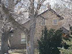
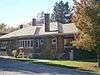
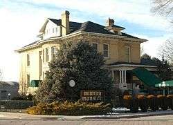
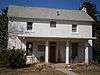
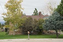
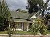
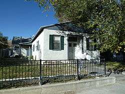
J. R. Allen House |
|
August 28, 1980
(#80003912) |
1047 E. 13200 South
40°30′44″N 111°51′41″W / 40.512222°N 111.861389°W / 40.512222; -111.861389 (J. R. Allen House) |
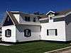
Draper |
|
| 2 |
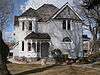
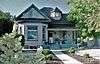
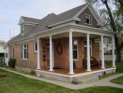
Allsop-Jensen House |
|
August 8, 1996
(#96000885) |
8829 S. 400 East
40°35′28″N 111°52′42″W / 40.591111°N 111.878333°W / 40.591111; -111.878333 (Allsop-Jensen House) |
Sandy |
|
| 3 |
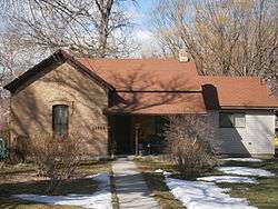
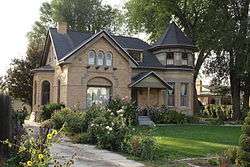
Dyre and Maria Amundsen House |
|
April 6, 2015
(#15000131) |
307 E. Winchester St.
40°38′00″N 111°52′54″W / 40.633262°N 111.881581°W / 40.633262; -111.881581 (Dyre and Maria Amundsen House) |
Murray |
|
| 4 |
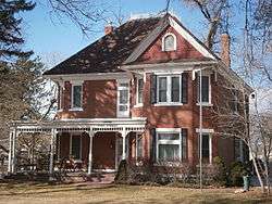
Thomas and Beda Anderberg House |
|
December 30, 2004
(#04001420) |
28 E. Pioneer Ave. (8530 South)
40°35′46″N 111°53′24″W / 40.59625°N 111.89°W / 40.59625; -111.89 (Thomas and Beda Anderberg House) |
Sandy |
|
| 5 |
Alfred C. and Annie L. Olsen Anderson House |
|
December 9, 1999
(#99001556) |
8850 S. 60 East
40°35′27″N 111°53′17″W / 40.590833°N 111.888056°W / 40.590833; -111.888056 (Alfred C. and Annie L. Olsen Anderson House) |
Sandy |
|
| 6 |
Charles M. and Fannie M. Allsop Anderson House |
|
December 9, 1999
(#99001558) |
498 E. Locust St.
40°35′24″N 111°52′43″W / 40.59°N 111.878611°W / 40.59; -111.878611 (Charles M. and Fannie M. Allsop Anderson House) |
Sandy |
|
| 7 |
Frederick C. and Anna Anderson House |
|
July 9, 1997
(#97000641) |
8650 S. Center St.
40°35′38″N 111°53′06″W / 40.593889°N 111.885°W / 40.593889; -111.885 (Frederick C. and Anna Anderson House) |
Sandy |
|
| 8 |
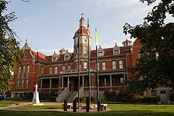
John A. Anderson House |
|
August 28, 1992
(#92001066) |
510 E. 8800 South
40°35′29″N 111°52′34″W / 40.591389°N 111.876111°W / 40.591389; -111.876111 (John A. Anderson House) |
Sandy |
|
| 9 |
Y. Martin and Hannah Nelson Anderson House |
|
December 9, 1999
(#99001549) |
8832 S. 90 East
40°35′28″N 111°53′11″W / 40.591111°N 111.886389°W / 40.591111; -111.886389 (Y. Martin and Hannah Nelson Anderson House) |
Sandy |
|
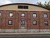
| 10 |
Nathaniel Baldwin House |
|
May 9, 1985
(#85000963) |
2374 E. Evergreen Ave.
40°41′47″N 111°49′20″W / 40.696389°N 111.822222°W / 40.696389; -111.822222 (Nathaniel Baldwin House) |
Millcreek |
|
| 11 |
Bateman Agriculture and Development Company |
|
August 8, 1996
(#96000888) |
198 E. 8760 South
40°35′31″N 111°53′00″W / 40.591944°N 111.883333°W / 40.591944; -111.883333 (Bateman Agriculture and Development Company) |
Sandy |
|
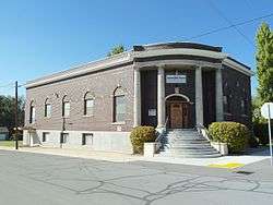
| 12 |
Reid Beck House |
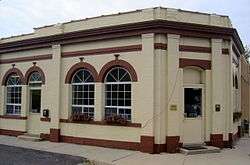
|
January 27, 2012
(#11001067) |
12542 S. 900 East
40°31′22″N 111°52′01″W / 40.522819°N 111.866903°W / 40.522819; -111.866903 (Reid Beck House) |
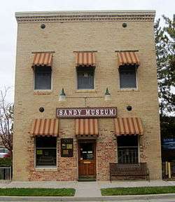
Draper |
part of the Draper, Utah Multiple Property Submission |
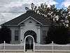
| 13 |
Amanda Conk Best House |
|
December 4, 2008
(#08001154) |
3622 S. 1100 East
40°41′33″N 111°51′36″W / 40.6925°N 111.86°W / 40.6925; -111.86 (Amanda Conk Best House) |
Millcreek |
|
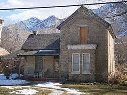
| 14 |
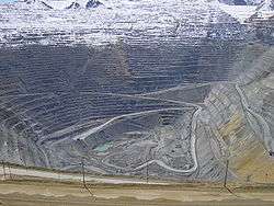
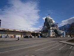
Bingham Canyon Open Pit Copper Mine |
|
November 13, 1966
(#66000736) |
16 miles (26 km) southwest of Salt Lake City on State Route 48
40°31′21″N 112°09′07″W / 40.5225°N 112.151944°W / 40.5225; -112.151944 (Bingham Canyon Open Pit Copper Mine) |
Copperton |
|
| 15 |
Ernie and Irmgard Bourne House |
|
June 28, 2016
(#16000418) |
3460 E. Ranch View Dr.
40°40′45″N 111°47′49″W / 40.679185°N 111.796808°W / 40.679185; -111.796808 (Ernie and Irmgard Bourne House) |
Millcreek |
|
| 16 |
Rawsel and Jane Bradford House |
|
January 7, 2015
(#14001137) |
570 E. 4800 South
40°39′55″N 111°52′29″W / 40.6654°N 111.8747°W / 40.6654; -111.8747 (Rawsel and Jane Bradford House) |
Murray |
|
| 17 |
Brady-Brady House |
|
December 30, 2004
(#04001419) |
8395 S. 1000 East
40°35′56″N 111°51′42″W / 40.598889°N 111.861667°W / 40.598889; -111.861667 (Brady-Brady House) |
Sandy |
|
| 18 |
Brinton-Dahl House |
|
February 14, 1980
(#80003917) |
1501 E. Spring Lane
40°39′28″N 111°50′47″W / 40.657778°N 111.846389°W / 40.657778; -111.846389 (Brinton-Dahl House) |
Holladay |
|
| 19 |
David B. Brinton House |
|
May 22, 1978
(#78002665) |
1981 E. Murray–Holladay Road
40°39′58″N 111°50′03″W / 40.666111°N 111.834167°W / 40.666111; -111.834167 (David B. Brinton House) |
Holladay |
|
| 20 |
Harold W. and Evelyn Burton House |
|
August 7, 2017
(#100001440) |
2195 E. Walker Ln.
40°39′10″N 111°49′46″W / 40.652909°N 111.829353°W / 40.652909; -111.829353 (Harold W. and Evelyn Burton House) |
Holladay |
|
| 21 |
Butler-Wallin House |
|
June 10, 2005
(#05000593) |
1045 E. 4500 South
40°40′29″N 111°51′38″W / 40.674722°N 111.860556°W / 40.674722; -111.860556 (Butler-Wallin House) |
Millcreek |
|
| 22 |
John P. Cahoon House |
|
March 3, 1983
(#83003186) |
4872 S. Poplar St.
40°39′56″N 111°53′22″W / 40.665556°N 111.889444°W / 40.665556; -111.889444 (John P. Cahoon House) |
Murray |
|
| 23 |
Santa Anna Casto House |
|
February 3, 1983
(#83004422) |
Approximately 4555 S. Holladay Blvd.
40°40′18″N 111°49′39″W / 40.671667°N 111.8275°W / 40.671667; -111.8275 (Santa Anna Casto House) |
Holladay |
Originally located at 2731 E. Casto Ln., moved in 2002 to 2210 E. Murray-Holladay Rd., moved again on Oct 20, 2012 |
| 24 |
Morton A. Cheesman House |
|
July 23, 1982
(#82004137) |
2320 E. Walker Ln.
40°38′56″N 111°49′19″W / 40.648889°N 111.821944°W / 40.648889; -111.821944 (Morton A. Cheesman House) |
Holladay |
|
| 25 |
William Christopherson House |
|
December 9, 1999
(#99001554) |
8847 S. 360 East
40°35′27″N 111°52′46″W / 40.590833°N 111.879444°W / 40.590833; -111.879444 (William Christopherson House) |
Sandy |
|
| 26 |
Copperton Community Methodist Church |
|
February 21, 2007
(#07000080) |
410 E. Hillcrest St.
40°33′45″N 112°05′46″W / 40.5625°N 112.096111°W / 40.5625; -112.096111 (Copperton Community Methodist Church) |
Copperton |
|
| 27 |
Copperton Historic District |
|
August 14, 1986
(#86002642) |
Roughly bounded by State Route 48, 5 East, Hillcrest, and 2 West Sts.
40°33′56″N 112°05′55″W / 40.565556°N 112.098611°W / 40.565556; -112.098611 (Copperton Historic District) |
Copperton |
|
| 28 |
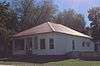
Crescent Elementary School |
|
November 22, 2000
(#00001303) |
11020 S. State St.
40°33′05″N 111°53′27″W / 40.551389°N 111.890833°W / 40.551389; -111.890833 (Crescent Elementary School) |
Sandy |
|
| 29 |
Crossgrove House |
|
January 27, 2012
(#11001068) |
12736 S. Boulter St.
40°31′14″N 111°50′57″W / 40.520661°N 111.849164°W / 40.520661; -111.849164 (Crossgrove House) |
Draper |
part of the Draper, Utah Multiple Property Submission |
| 30 |
Arthur and Ellen Cushing House |
|
November 6, 2000
(#00001304) |
123 E. Pioneer Ave. (8530 South)
40°35′48″N 111°53′09″W / 40.596667°N 111.885833°W / 40.596667; -111.885833 (Arthur and Ellen Cushing House) |
Sandy |
|
| 31 |
Ernest and Sadie Cushing House |
|
August 8, 1996
(#96000887) |
60 E. Pioneer Ave. (8530 South)
40°35′46″N 111°53′19″W / 40.596111°N 111.888611°W / 40.596111; -111.888611 (Ernest and Sadie Cushing House) |
Sandy |
|
| 32 |
James and Maria Long Cushing House |
|
December 9, 1999
(#99001546) |
68 E. Pioneer Ave. (8530 South)
40°35′46″N 111°53′18″W / 40.596111°N 111.888333°W / 40.596111; -111.888333 (James and Maria Long Cushing House) |
Sandy |
|
| 33 |
Emma Olive Dobbs House |
|
August 8, 1996
(#96000889) |
578 E. 8885 South
40°35′31″N 111°52′25″W / 40.591944°N 111.873611°W / 40.591944; -111.873611 (Emma Olive Dobbs House) |
Sandy |
|
| 34 |
Hannah Nash Dowding House |
|
November 6, 2000
(#00001305) |
8830 S. 60 East
40°35′28″N 111°53′21″W / 40.591111°N 111.889167°W / 40.591111; -111.889167 (Hannah Nash Dowding House) |
Sandy |
|
| 35 |
Dowding-Rasmussen House |
|
November 6, 2000
(#00001306) |
98 E. Main St. (8720 South)
40°35′35″N 111°53′20″W / 40.593056°N 111.888889°W / 40.593056; -111.888889 (Dowding-Rasmussen House) |
Sandy |
|
| 36 |
Draper Park School |
|
May 7, 1980
(#80003913) |
12441 S. 900 East
40°31′29″N 111°51′53″W / 40.524722°N 111.864722°W / 40.524722; -111.864722 (Draper Park School) |
Draper |
|
| 37 |
Draper Poultrymen and Egg Producers' Plant |
|
May 6, 2004
(#04000403) |
1071 E. Pioneer Rd. (12400 South)
40°31′33″N 111°51′42″W / 40.525833°N 111.861667°W / 40.525833; -111.861667 (Draper Poultrymen and Egg Producers' Plant) |
Draper |
|
| 38 |
Draper-Steadman House |
|
August 21, 1992
(#92001057) |
13518 S. 1700 West
40°30′19″N 111°56′18″W / 40.505278°N 111.938333°W / 40.505278; -111.938333 (Draper-Steadman House) |
Riverton |
|
| 39 |
Emigration Canyon |
|
October 15, 1966
(#66000737) |
Eastern edge of Salt Lake City on former State Route 65
40°45′03″N 111°49′04″W / 40.750833°N 111.817778°W / 40.750833; -111.817778 (Emigration Canyon) |
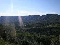
Emigration Canyon |
|
| 40 |
Empress Theatre |
|
May 9, 1985
(#85000962) |
9104 W. 2700 South (Main Street)
40°42′40″N 112°06′27″W / 40.711111°N 112.1075°W / 40.711111; -112.1075 (Empress Theatre) |
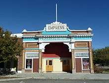
Magna |
|
| 41 |
Evergreen Avenue Historic District |
|
February 14, 2007
(#07000081) |
Roughly bounded by Evergreen Ave., 2300 East, 3300 South, and 2700 East
40°41′55″N 111°49′10″W / 40.698567°N 111.819481°W / 40.698567; -111.819481 (Evergreen Avenue Historic District) |
Millcreek |
|
| 42 |
Benjamin and Jane Cook Farrer House |
|
August 28, 1992
(#92001065) |
530 E. 8800 South
40°35′29″N 111°52′32″W / 40.591389°N 111.875556°W / 40.591389; -111.875556 (Benjamin and Jane Cook Farrer House) |
Sandy |
|
| 43 |
John William Farrer House |
|
August 28, 1992
(#92001064) |
39 E. Pioneer Ave. (8530 South)
40°35′47″N 111°53′19″W / 40.596389°N 111.888611°W / 40.596389; -111.888611 (John William Farrer House) |
Sandy |
|
| 44 |
Fish-Baughman House |
|
June 28, 2016
(#16000420) |
3436 E. Ranch View Dr.
40°40′45″N 111°47′50″W / 40.679274°N 111.797222°W / 40.679274; -111.797222 (Fish-Baughman House) |
Millcreek |
|
| 45 |
Fitzgerald House |
|
January 5, 2017
(#16000679) |
12934 S. Fort St.
40°30′59″N 111°51′55″W / 40.516456°N 111.865259°W / 40.516456; -111.865259 (Fitzgerald House) |
Draper |
|
| 46 |
Perry and Agnes Wadsworth Fitzgerald House |
|
May 6, 2004
(#04000404) |
1160 E. Pioneer Rd. (12400 South)
40°31′30″N 111°51′22″W / 40.525°N 111.856111°W / 40.525; -111.856111 (Perry and Agnes Wadsworth Fitzgerald House) |
Draper |
|
| 47 |
Gardner Mill |
|
September 29, 1982
(#82004153) |
1050 W. 7800 South
40°36′33″N 111°55′21″W / 40.609167°N 111.9225°W / 40.609167; -111.9225 (Gardner Mill) |
West Jordan |
|
| 48 |
Archibald R. and Violet Clark Gardner House |
|
July 9, 1997
(#97000642) |
31 E. Pioneer Ave. (8530 South)
40°35′48″N 111°53′16″W / 40.596667°N 111.887778°W / 40.596667; -111.887778 (Archibald R. and Violet Clark Gardner House) |
Sandy |
|
| 49 |
Robert Gardner Jr. House |
|
January 18, 2018
(#100001441) |
1475 E. Murphy's Ln.
40°41′34″N 111°50′57″W / 40.692814°N 111.849209°W / 40.692814; -111.849209 (Robert Gardner Jr. House) |
Millcreek |
|
| 50 |
Garside-McMullin House |
|
December 17, 1982
(#82004852) |
10481 S. 1300 West
40°33′38″N 111°55′46″W / 40.560556°N 111.929444°W / 40.560556; -111.929444 (Garside-McMullin House) |
South Jordan |
|
| 51 |
Granite Hydroelectric Power Plant Historic District |
|
April 20, 1989
(#89000283) |
State Route 190 (previously State Route 152)
40°37′09″N 111°46′53″W / 40.619167°N 111.781389°W / 40.619167; -111.781389 (Granite Hydroelectric Power Plant Historic District) |
Cottonwood Heights |
|
| 52 |
Granite LDS Ward Chapel-Avard Fairbanks Studio |
|
December 30, 2005
(#05000364) |
9800 S. 3100 East
40°34′25″N 111°48′16″W / 40.573611°N 111.804444°W / 40.573611; -111.804444 (Granite LDS Ward Chapel-Avard Fairbanks Studio) |
Sandy |
|
| 53 |
Granite Paper Mill |
|
April 16, 1971
(#71000848) |
6900 S. Big Cottonwood Canyon Rd.
40°37′37″N 111°47′57″W / 40.626944°N 111.799167°W / 40.626944; -111.799167 (Granite Paper Mill) |
Cottonwood Heights |
|
| 54 |
Riley H. and Sarah Ann Russell Graves House |
|
December 9, 1999
(#99001559) |
8585 S. 100 East
40°35′44″N 111°52′56″W / 40.595556°N 111.882222°W / 40.595556; -111.882222 (Riley H. and Sarah Ann Russell Graves House) |
Sandy |
|
| 55 |
Alvin and Annie Green House |
|
April 6, 2000
(#00000356) |
8400 Danish Rd.
40°35′55″N 111°48′04″W / 40.598611°N 111.801111°W / 40.598611; -111.801111 (Alvin and Annie Green House) |
Cottonwood Heights |
|
| 56 |
Orlando H. and Emma H. Hardcastle House |
|
December 9, 1999
(#99001560) |
8751 S. 40 East
40°35′33″N 111°53′18″W / 40.5925°N 111.888333°W / 40.5925; -111.888333 (Orlando H. and Emma H. Hardcastle House) |
Sandy |
|
| 57 |
Hawarden |
|
February 14, 1980
(#80003924) |
4396 S. 3200 West
40°40′30″N 111°58′05″W / 40.675119°N 111.967975°W / 40.675119; -111.967975 (Hawarden) |
West Valley City |
|
| 58 |
Anders Hintze House |
|
February 1, 1983
(#83004424) |
4249 S. 2300 East
40°40′48″N 111°49′25″W / 40.68°N 111.823611°W / 40.68; -111.823611 (Anders Hintze House) |
Holladay |
|
| 59 |
Edward and Irene Hobbs House |
|
July 23, 2018
(#100002702) |
487 E Vine St.
40°39′36″N 111°52′40″W / 40.6601°N 111.8777°W / 40.6601; -111.8777 (Edward and Irene Hobbs House) |
Murray |
|
| 60 |
Abba R. Holman Block |
|
August 28, 1992
(#92001063) |
142 E. Main St. (8720 South)
40°35′34″N 111°53′06″W / 40.592778°N 111.885°W / 40.592778; -111.885 (Abba R. Holman Block) |
Sandy |
|
| 61 |
Samuel and Geneva Holt Farmstead |
|
September 7, 2001
(#01000963) |
10317 S. 1300 West
40°33′50″N 111°55′34″W / 40.563889°N 111.926111°W / 40.563889; -111.926111 (Samuel and Geneva Holt Farmstead) |
South Jordan |
|
| 62 |
Iris Theater, Apartments and Commercial Building |
|
September 7, 2001
(#01000959) |
4861 S. State St.
40°39′58″N 111°53′13″W / 40.666111°N 111.886944°W / 40.666111; -111.886944 (Iris Theater, Apartments and Commercial Building) |
Murray |
|
| 63 |
Hyrum and Selma Erickson Jacobson House |
|
December 9, 1999
(#99001550) |
8908 S. 220 East
40°35′24″N 111°53′00″W / 40.59°N 111.883333°W / 40.59; -111.883333 (Hyrum and Selma Erickson Jacobson House) |
Sandy |
|
| 64 |
Amos and Ida Jensen House |
|
November 6, 2000
(#00001307) |
387 E. 8800 South
40°35′31″N 111°52′43″W / 40.591944°N 111.878611°W / 40.591944; -111.878611 (Amos and Ida Jensen House) |
Sandy |
|
| 65 |
James B. and Ellen May Cushing Jensen House |
|
July 9, 1997
(#97000635) |
95 E. Pioneer Ave. (8530 South)
40°35′48″N 111°53′10″W / 40.596667°N 111.886111°W / 40.596667; -111.886111 (James B. and Ellen May Cushing Jensen House) |
Sandy |
|
| 66 |
Joseph F. and Isabelle Jensen House |
|
June 11, 1998
(#98000640) |
428 E. 8800 South
40°35′31″N 111°52′44″W / 40.591944°N 111.878889°W / 40.591944; -111.878889 (Joseph F. and Isabelle Jensen House) |
Sandy |
|
| 67 |
Michael Jensen House |
|
December 9, 1999
(#99001557) |
565 E. 8800 South
40°35′30″N 111°52′32″W / 40.591667°N 111.875556°W / 40.591667; -111.875556 (Michael Jensen House) |
Sandy |
|
| 68 |
Jensen-Clark House |
|
November 6, 2000
(#00001298) |
32 E. Main St. (8720 South)
40°35′35″N 111°53′22″W / 40.593056°N 111.889444°W / 40.593056; -111.889444 (Jensen-Clark House) |
Sandy |
|
| 69 |
Jensen-Jensen House |
|
November 6, 2000
(#00001299) |
55 E. Pioneer Ave. (8530 South)
40°35′48″N 111°53′19″W / 40.596667°N 111.888611°W / 40.596667; -111.888611 (Jensen-Jensen House) |
Sandy |
|
| 70 |
David and Hattie S. Rasmuson Johnson House |
|
December 9, 1999
(#99001553) |
8649 S. 90 East
40°35′39″N 111°53′11″W / 40.594167°N 111.886389°W / 40.594167; -111.886389 (David and Hattie S. Rasmuson Johnson House) |
Sandy |
|
| 71 |
John A. and Annie C. Olsen Johnson House |
|
December 9, 1999
(#99001547) |
21 E. Pioneer Ave. (8530 South)
40°35′48″N 111°53′20″W / 40.596667°N 111.888889°W / 40.596667; -111.888889 (John A. and Annie C. Olsen Johnson House) |
Sandy |
|
| 72 |
Jordan School District Administration Building |
|
April 1, 1985
(#85000810) |
9361 S. 400 East
40°34′53″N 111°52′51″W / 40.581389°N 111.880833°W / 40.581389; -111.880833 (Jordan School District Administration Building) |
Sandy |
|
| 73 |
Kearns-St. Ann's Orphanage |
|
October 3, 1980
(#80003925) |
430 E. 2100 South
40°43′30″N 111°52′41″W / 40.725°N 111.878056°W / 40.725; -111.878056 (Kearns-St. Ann's Orphanage) |
South Salt Lake |
|
| 74 |
William D. Kuhre House |
|
July 6, 1987
(#87001175) |
8586 S. 150 East
40°35′44″N 111°53′07″W / 40.595556°N 111.885278°W / 40.595556; -111.885278 (William D. Kuhre House) |
Sandy |
|
| 75 |
Little Dell Station |
|
August 12, 1971
(#71000850) |
East of Salt Lake City in Mountain Dell Canyon, near the junction of State Route 65 and the road to Emigration Canyon (see Utah State Route 239 (1947-1969))
40°46′40″N 111°41′09″W / 40.777778°N 111.685833°W / 40.777778; -111.685833 (Little Dell Station) |
Wasatch-Cache National Forest |
|
| 76 |
William and Annie Livingston House |
|
October 16, 2002
(#02001182) |
2491 E. Valley View Ave.
40°39′51″N 111°49′07″W / 40.664167°N 111.818611°W / 40.664167; -111.818611 (William and Annie Livingston House) |
Holladay |
|
| 77 |
Albert and Celestine Mabey House |
|
August 27, 2013
(#13000641) |
10201 S. 1300 West
40°33′58″N 111°55′43″W / 40.566014°N 111.928625°W / 40.566014; -111.928625 (Albert and Celestine Mabey House) |
South Jordan |
Part of the South Jordan, Utah MPS |
| 78 |
Magna Community Baptist Church |
|
June 5, 1986
(#86001233) |
2916 S. 8900 West
40°42′26″N 112°06′13″W / 40.707222°N 112.103611°W / 40.707222; -112.103611 (Magna Community Baptist Church) |
Magna |
|
| 79 |
Anne P. Marriott House |
|
November 6, 2000
(#00001300) |
8543 S. 100 East
40°35′46″N 111°53′14″W / 40.596111°N 111.887222°W / 40.596111; -111.887222 (Anne P. Marriott House) |
Sandy |
|
| 80 |
John and Mary Mattson House |
|
August 8, 1996
(#96000886) |
239 E. Main St. (8720 South)
40°35′36″N 111°52′56″W / 40.593333°N 111.882222°W / 40.593333; -111.882222 (John and Mary Mattson House) |
Sandy |
|
| 81 |
David McDonald House |
|
May 29, 1980
(#80003927) |
4659 S. Highland Dr.
40°40′10″N 111°50′20″W / 40.669444°N 111.838889°W / 40.669444; -111.838889 (David McDonald House) |
Holladay |
|
| 82 |
William McLachlan Farmhouse |
|
February 14, 1980
(#80003928) |
4499 S. 3200 West
40°40′23″N 111°57′58″W / 40.673056°N 111.966111°W / 40.673056; -111.966111 (William McLachlan Farmhouse) |
West Valley City |
|
| 83 |
Benjamin and Olivia Meek House |
|
November 29, 2001
(#01001282) |
12782 S. Fort St.
40°31′09″N 111°51′52″W / 40.519167°N 111.864444°W / 40.519167; -111.864444 (Benjamin and Olivia Meek House) |
Draper |
|
| 84 |
Joseph E. and Mina W. Mickelsen House |
|
May 6, 2004
(#04000405) |
782 E. Pioneer Rd. (12400 South)
40°31′30″N 111°52′09″W / 40.525°N 111.869167°W / 40.525; -111.869167 (Joseph E. and Mina W. Mickelsen House) |
Draper |
|
| 85 |
S.J. Mickelsen Hardware Store and Lumber Yard |
|
May 6, 2004
(#04000406) |
12580-12582 S. Fort St.
40°31′22″N 111°51′51″W / 40.522778°N 111.864167°W / 40.522778; -111.864167 (S.J. Mickelsen Hardware Store and Lumber Yard) |
Draper |
|
| 86 |
Hyrum and Mary A. Terry Peterson Mickelson House |
|
December 9, 1999
(#99001551) |
8850 S. 120 East
40°35′26″N 111°53′09″W / 40.590556°N 111.885833°W / 40.590556; -111.885833 (Hyrum and Mary A. Terry Peterson Mickelson House) |
Sandy |
|
| 87 |
Midvale City Hall |
|
April 7, 1994
(#94000293) |
695 W. Center St.
40°36′37″N 111°54′33″W / 40.610278°N 111.909167°W / 40.610278; -111.909167 (Midvale City Hall) |
Midvale |
Now the Midvale Community Building, used as an auditorium |
| 88 |
Mountain Dell Dam |
|
June 20, 1980
(#80003930) |
East of Salt Lake City on Interstate 80
40°45′06″N 111°43′12″W / 40.751667°N 111.72°W / 40.751667; -111.72 (Mountain Dell Dam) |
Wasatch-Cache National Forest |
A multiple arch with buttress dam of reinforced concrete in Parley's Canyon constructed between 1914 and 1925 |
| 89 |
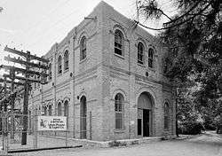
Murray City Diesel Power Plant |
|
January 7, 2015
(#14001139) |
157 W. 4800 South
40°40′03″N 111°53′43″W / 40.6675°N 111.8953°W / 40.6675; -111.8953 (Murray City Diesel Power Plant) |
Murray |
|
| 90 |
Murray Downtown Historic District |
|
September 26, 2006
(#06000928) |
Roughly bounded by 4800 South, Poplar St., Vine St., and Center St.
40°40′04″N 111°53′18″W / 40.667778°N 111.888333°W / 40.667778; -111.888333 (Murray Downtown Historic District) |
Murray |
|
| 91 |
Murray Downtown Residential Historic District |
|
January 26, 2005
(#04001566) |
Roughly bounded by 4800 South, Clark St., Vine St., and Center St.
40°39′53″N 111°52′59″W / 40.664722°N 111.883056°W / 40.664722; -111.883056 (Murray Downtown Residential Historic District) |
Murray |
|
| 92 |
Murray Hillside Historic District |
|
October 15, 2014
(#14000863) |
Roughly bounded by 5300 South, Kenwood Dr., 5600 South & 235 East
40°39′10″N 111°52′54″W / 40.6528°N 111.8816°W / 40.6528; -111.8816 (Murray Hillside Historic District) |
Murray |
|
| 93 |
Murray LDS Second Ward Meetinghouse |
|
May 8, 2001
(#01000475) |
5056 S. Commerce Dr. (300 West)
40°39′43″N 111°53′55″W / 40.661944°N 111.898611°W / 40.661944; -111.898611 (Murray LDS Second Ward Meetinghouse) |
Murray |
|
| 94 |
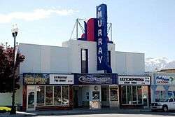
Murray Theater |
|
May 8, 2001
(#01000476) |
4961 S. State St.
40°39′50″N 111°53′17″W / 40.663889°N 111.888056°W / 40.663889; -111.888056 (Murray Theater) |
Murray |
|
| 95 |
August M. and Mabel Jensen Nelson House |
|
July 9, 1997
(#97000643) |
427 E. 8800 South
40°35′31″N 111°52′39″W / 40.591944°N 111.8775°W / 40.591944; -111.8775 (August M. and Mabel Jensen Nelson House) |
Sandy |
|
| 96 |
Nels A. Nelson House |
|
August 28, 1992
(#92001062) |
8840 S. 90 East
40°35′26″N 111°53′10″W / 40.590556°N 111.886111°W / 40.590556; -111.886111 (Nels A. Nelson House) |
Sandy |
|
| 97 |
Oakwood |
|
November 16, 1979
(#79002503) |
2610 E. Evergreen Ave.
40°41′47″N 111°48′57″W / 40.696389°N 111.815833°W / 40.696389; -111.815833 (Oakwood) |
Millcreek |
|
| 98 |
John and Elizabeth Brown Oldham House |
|
July 9, 1997
(#97000636) |
511 E. 8800 South
40°35′31″N 111°52′32″W / 40.591944°N 111.875556°W / 40.591944; -111.875556 (John and Elizabeth Brown Oldham House) |
Sandy |
|
| 99 |
Orton-Malstrom House |
|
July 9, 1997
(#97000640) |
9325 S. 700 East
40°34′55″N 111°52′15″W / 40.581944°N 111.870833°W / 40.581944; -111.870833 (Orton-Malstrom House) |
Sandy |
|
| 100 |
John Thomas and Myrtle Bodell Ostler House |
|
December 9, 1999
(#99001552) |
589 E. 8800 South
40°35′31″N 111°52′31″W / 40.591944°N 111.875278°W / 40.591944; -111.875278 (John Thomas and Myrtle Bodell Ostler House) |
Sandy |
|
| 101 |
Mary Ellen Parmley House |
|
November 6, 2000
(#00001301) |
8850 S. 220 East
40°35′29″N 111°53′40″W / 40.591389°N 111.894444°W / 40.591389; -111.894444 (Mary Ellen Parmley House) |
Sandy |
|
| 102 |
Charles Peterson House |
|
August 28, 1992
(#92001061) |
82 E. 8880 South
40°35′30″N 111°53′13″W / 40.591667°N 111.886944°W / 40.591667; -111.886944 (Charles Peterson House) |
Sandy |
|
| 103 |
Peter and Ingrid C. Larson Pierson House |
|
December 9, 1999
(#99001548) |
31 E. 8680 South
40°35′38″N 111°53′19″W / 40.593889°N 111.888611°W / 40.593889; -111.888611 (Peter and Ingrid C. Larson Pierson House) |
Sandy |
|
| 104 |
Edward Pugh House |
|
August 31, 1978
(#78002680) |
1299 E. 4500 South
40°40′28″N 111°51′13″W / 40.674444°N 111.853611°W / 40.674444; -111.853611 (Edward Pugh House) |
Millcreek |
|
| 105 |
Riverton Elementary School |
|
August 8, 1996
(#96000872) |
12830 S. Redwood Rd.
40°31′06″N 111°56′22″W / 40.518333°N 111.939444°W / 40.518333; -111.939444 (Riverton Elementary School) |
Riverton |
Now houses the Riverton City Office |
| 106 |
Riverton Historic District |
|
January 21, 2004
(#03001484) |
Roughly 12300 S. Redwood Rd. to 12600 S. Redwood Rd.
40°31′39″N 111°56′17″W / 40.5275°N 111.938056°W / 40.5275; -111.938056 (Riverton Historic District) |
Riverton |
|
| 107 |
Ross Hame |
|
July 23, 2018
(#100002703) |
4769 S Holladay Blvd.
40°39′58″N 111°49′18″W / 40.6660°N 111.8218°W / 40.6660; -111.8218 (Ross Hame) |
Holladay |
|
| 108 |
Salt Lake County Library |
|
July 26, 1982
(#82004129) |
665 W. Center St.
40°36′37″N 111°54′28″W / 40.610278°N 111.907778°W / 40.610278; -111.907778 (Salt Lake County Library) |
Midvale |
Now the Midvale city hall |
| 109 |
Sandy City Bank |
|
July 9, 1997
(#97000637) |
212 E. Main St. (8720 South)
40°35′33″N 111°52′55″W / 40.5925°N 111.881944°W / 40.5925; -111.881944 (Sandy City Bank) |
Sandy |
|
| 110 |
Sandy Co-Op Block |
|
August 28, 1992
(#92001060) |
8744 S. Center St. (150 East)
40°35′33″N 111°53′05″W / 40.5925°N 111.884722°W / 40.5925; -111.884722 (Sandy Co-Op Block) |
Sandy |
|
| 111 |
Sandy Historic District |
|
April 20, 2007
(#07000084) |
Roughly bounded by State St., 9000 South, 700 East, and Pioneer Ave. (8530 South)
40°35′34″N 111°52′51″W / 40.592819°N 111.880819°W / 40.592819; -111.880819 (Sandy Historic District) |
Sandy |
|
| 112 |
Sandy LDS Stake Recreational Hall |
|
November 6, 2000
(#00001316) |
295 E. 8800 South
40°35′32″N 111°52′51″W / 40.592222°N 111.880833°W / 40.592222; -111.880833 (Sandy LDS Stake Recreational Hall) |
Sandy |
|
| 113 |
Sandy Second Ward Chapel |
|
July 9, 1997
(#97000638) |
8630 S. 60 East
40°35′41″N 111°53′20″W / 40.594722°N 111.888889°W / 40.594722; -111.888889 (Sandy Second Ward Chapel) |
Sandy |
|
| 114 |
Sandy Tithing Office |
|
January 25, 1985
(#85000279) |
8845 S. 280 East
40°35′27″N 111°52′53″W / 40.590833°N 111.881389°W / 40.590833; -111.881389 (Sandy Tithing Office) |
Sandy |
|
| 115 |
Joseph M. and Celestia Smith House |
|
April 7, 1994
(#94000291) |
12357 S. Relation St. (1565 East)
40°31′31″N 111°50′46″W / 40.525278°N 111.846111°W / 40.525278; -111.846111 (Joseph M. and Celestia Smith House) |
Draper |
|
| 116 |
Lauritz H. and Emma Smith House |
|
February 1, 2006
(#05001633) |
12423 S. Relation St.
40°31′32″N 111°50′48″W / 40.525556°N 111.846667°W / 40.525556; -111.846667 (Lauritz H. and Emma Smith House) |
Draper |
|
| 117 |
Lauritz Smith House |
|
June 24, 1983
(#83003179) |
1350 E. Pioneer Rd. (12400 South)
40°31′29″N 111°51′02″W / 40.524722°N 111.850556°W / 40.524722; -111.850556 (Lauritz Smith House) |
Draper |
|
| 118 |
Mary Smith House |
|
April 15, 1994
(#94000292) |
12544 S. Relation St. (1565 East)
40°31′24″N 111°50′49″W / 40.523333°N 111.846944°W / 40.523333; -111.846944 (Mary Smith House) |
Draper |
|
| 119 |
Stairs Station Hydroelectric Power Plant Historic District |
|
April 20, 1989
(#89000284) |
State Route 190 (former State Route 152)
40°37′31″N 111°44′39″W / 40.62517°N 111.74414°W / 40.62517; -111.74414 (Stairs Station Hydroelectric Power Plant Historic District) |
Big Cottonwood Canyon |
|
| 120 |
Roberta Sugden House |
|
March 22, 2016
(#16000124) |
1810 E. Orchard Dr.
40°41′25″N 111°50′24″W / 40.690357°N 111.840086°W / 40.690357; -111.840086 (Roberta Sugden House) |
Millcreek |
|
| 121 |
Niels and Mary Ann Fitzgerald Thompson House |
|
July 9, 1997
(#97000639) |
485 E. 8800 South
40°35′31″N 111°52′36″W / 40.591944°N 111.876667°W / 40.591944; -111.876667 (Niels and Mary Ann Fitzgerald Thompson House) |
Sandy |
|
| 122 |
Utah Copper Company Mine Superintendent's House |
|
October 31, 1985
(#85003422) |
104 E. State Highway
40°33′56″N 112°05′53″W / 40.565556°N 112.098056°W / 40.565556; -112.098056 (Utah Copper Company Mine Superintendent's House) |
Copperton |
|
| 123 |
Louis E. and Florence Jensen Van Dam House |
|
December 9, 1999
(#99001555) |
407 E. 8800 South
40°35′31″N 111°52′43″W / 40.591944°N 111.878611°W / 40.591944; -111.878611 (Louis E. and Florence Jensen Van Dam House) |
Sandy |
|
| 124 |
William Tyler and Amorilla Gammet Vincent House |
|
July 9, 1997
(#97000644) |
92 E. Pioneer Ave. (8530 South)
40°35′45″N 111°53′11″W / 40.595833°N 111.886389°W / 40.595833; -111.886389 (William Tyler and Amorilla Gammet Vincent House) |
Sandy |
|
| 125 |
Glen M. and Roxie Walbeck House |
|
February 1, 2006
(#05001630) |
12875 S. Boulter St.
40°31′04″N 111°50′55″W / 40.5178°N 111.84855°W / 40.5178; -111.84855 (Glen M. and Roxie Walbeck House) |
Draper |
|
| 126 |
Wesley and Frances Walton House |
|
August 4, 1995
(#95000983) |
5197 S. Wesley Rd.
40°39′24″N 111°51′26″W / 40.656667°N 111.857222°W / 40.656667; -111.857222 (Wesley and Frances Walton House) |
Murray |
|
| 127 |
Warenski-Duvall Commercial Building and Apartments |
|
May 19, 2000
(#00000521) |
4867 S. State St.
40°39′57″N 111°53′12″W / 40.665833°N 111.886667°W / 40.665833; -111.886667 (Warenski-Duvall Commercial Building and Apartments) |
Murray |
|
| 128 |
Wasatch Mountain Club Lodge |
|
November 10, 1980
(#80003935) |
Southeast of Salt Lake City
40°35′45″N 111°35′01″W / 40.595833°N 111.583611°W / 40.595833; -111.583611 (Wasatch Mountain Club Lodge) |
Brighton |
|
| 129 |
West Jordan Ward Meetinghouse |
|
April 14, 1995
(#95000415) |
1140 W. 7800 South
40°36′28″N 111°55′27″W / 40.607778°N 111.924167°W / 40.607778; -111.924167 (West Jordan Ward Meetinghouse) |
West Jordan |
|
| 130 |
Henry J. Wheeler Farm |
|
May 4, 1976
(#76001832) |
6343 S. 900 East
40°38′03″N 111°51′42″W / 40.634167°N 111.861667°W / 40.634167; -111.861667 (Henry J. Wheeler Farm) |
Murray |
|
| 131 |
William W. and Christene Wilson House |
|
December 30, 2004
(#04001421) |
113 E. 8680 South
40°35′45″N 111°53′16″W / 40.595833°N 111.887778°W / 40.595833; -111.887778 (William W. and Christene Wilson House) |
Sandy |
|

.jpg)