| [3] |
Name on the Register[4] |
Image |
Date listed[5] |
Location |
City or town |
Description |
|---|
| 1 |
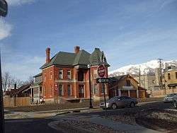
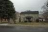
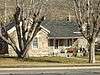
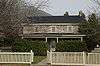
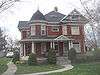
Joseph Adams House |
|
February 17, 1978
(#78002655) |
300 N. Adamswood Rd.
41°03′55″N 111°56′42″W / 41.065278°N 111.945°W / 41.065278; -111.945 (Joseph Adams House) |
Layton |
|
| 2 |
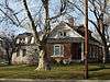
James and Hannah Atkinson House |
|
July 15, 1999
(#99000847) |
1510 S. 1100 West
40°52′29″N 111°54′40″W / 40.874722°N 111.911111°W / 40.874722; -111.911111 (James and Hannah Atkinson House) |
Woods Cross |
|
| 3 |
Barnard-Garn-Barber House |
|
November 17, 1997
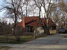
(#97001309) |
1198 N. Main St.
40°55′54″N 111°52′43″W / 40.931667°N 111.878611°W / 40.931667; -111.878611 (Barnard-Garn-Barber House) |
Centerville |
|
| 4 |
John George Moroni Barnes House |
|
February 11, 1982
(#82004120) |
42 W. Center St.
41°02′07″N 111°56′20″W / 41.035278°N 111.938889°W / 41.035278; -111.938889 (John George Moroni Barnes House) |
Kaysville |
|
| 5 |
John R. Barnes House |
|
July 23, 1982
(#82004121) |
10 S. 100 West
41°02′05″N 111°56′23″W / 41.034722°N 111.939722°W / 41.034722; -111.939722 (John R. Barnes House) |
Kaysville |
|
| 6 |
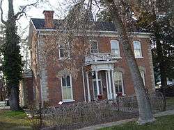
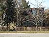
Henry Blood House |
|
April 29, 1980
(#80003897) |
95 S. 300 West
41°02′01″N 111°56′35″W / 41.033611°N 111.943056°W / 41.033611; -111.943056 (Henry Blood House) |
Kaysville |
Home of Henry H. Blood, former Governor of Utah. |
| 7 |
Bountiful Historic District |
|
October 26, 2005
(#05001194) |
Roughly bounded by 200 W., 500 S., 400 E., and 400 N.
40°53′21″N 111°52′42″W / 40.889167°N 111.878333°W / 40.889167; -111.878333 (Bountiful Historic District) |
Bountiful |
|
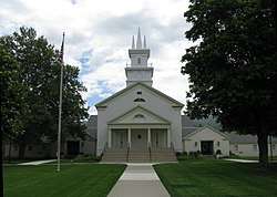
| 8 |
Bountiful Tabernacle |
|
January 1, 1976
(#76001813) |
Main and Center Sts.
40°53′21″N 111°52′43″W / 40.889167°N 111.878611°W / 40.889167; -111.878611 (Bountiful Tabernacle) |
Bountiful |
|
| 9 |
Thomas and Margaret Brandon House |
|
November 17, 1997
(#97001310) |
185 E. Center St.
40°55′06″N 111°52′34″W / 40.918333°N 111.876111°W / 40.918333; -111.876111 (Thomas and Margaret Brandon House) |
Centerville |
|
| 10 |
William Capener House |
|
January 5, 1984
(#84002172) |
252 N. 400 East
40°55′12″N 111°52′16″W / 40.92°N 111.871111°W / 40.92; -111.871111 (William Capener House) |
Centerville |
|
| 11 |
Clark Lane Historic District |
|
October 7, 1994
(#94001208) |
207-399 W. State and 33 N. 200 West
40°58′50″N 111°53′36″W / 40.980556°N 111.893333°W / 40.980556; -111.893333 (Clark Lane Historic District) |
Farmington |
|
| 12 |
Osmyn and Emily Deuel House |
|
November 17, 1997
(#97001311) |
271 S. 200 East
40°54′53″N 111°52′31″W / 40.914722°N 111.875278°W / 40.914722; -111.875278 (Osmyn and Emily Deuel House) |
Centerville |
|
| 13 |
John, Harriet, and Eliza Jennett Duncan House |
|
November 17, 1997
(#97001312) |
445 N. 400 East
40°55′19″N 111°52′21″W / 40.921944°N 111.8725°W / 40.921944; -111.8725 (John, Harriet, and Eliza Jennett Duncan House) |
Centerville |
|
| 14 |
James and Jane Eldredge House |
|
June 10, 2005
(#05000595) |
564 W. 400 North
40°53′40″N 111°53′35″W / 40.894444°N 111.893056°W / 40.894444; -111.893056 (James and Jane Eldredge House) |
West Bountiful |
|
| 15 |
Farmer's Union Building |
|
November 30, 1978
(#78002656) |
12 S. Main St.
41°03′38″N 111°57′54″W / 41.060556°N 111.965°W / 41.060556; -111.965 (Farmer's Union Building) |
Layton |
|
| 16 |
Farmington Main Street Historic District |
|
October 20, 2011
(#11000756) |
Approximately Main St. from 200 South to 600 North, along 600 North to Park Lane and 100 North from Main St to 100 West
40°58′50″N 111°53′15″W / 40.980556°N 111.8875°W / 40.980556; -111.8875 (Farmington Main Street Historic District) |
Farmington |
|
| 17 |
Farmington Tithing Office |
|
March 28, 1985
(#85000686) |
110 N. Main St.
40°58′56″N 111°53′14″W / 40.982361°N 111.887222°W / 40.982361; -111.887222 (Farmington Tithing Office) |
Farmington |
|
| 18 |
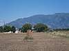
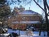
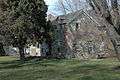
Fielding Garr Ranch |
|
January 21, 1983
(#83004402) |
Off State Route 127
40°55′31″N 112°09′59″W / 40.925278°N 112.166389°W / 40.925278; -112.166389 (Fielding Garr Ranch) |
Antelope Island |
|
| 19 |
First National Bank of Layton |
|
April 5, 2006
(#06000232) |
50 W. Gentile St.
41°03′38″N 111°57′57″W / 41.060556°N 111.965833°W / 41.060556; -111.965833 (First National Bank of Layton) |
Layton |
|
| 20 |
Joseph N. and Algie Ford House |
|
November 18, 2005
(#05001289) |
1394 N. Main St.
40°56′12″N 111°52′39″W / 40.936667°N 111.8775°W / 40.936667; -111.8775 (Joseph N. and Algie Ford House) |
Centerville |
|
| 21 |
Ford-Rigby House |
|
November 17, 1997
(#97001313) |
1592 N. Main St.
40°56′27″N 111°52′47″W / 40.940833°N 111.879722°W / 40.940833; -111.879722 (Ford-Rigby House) |
Centerville |
|
| 22 |
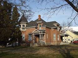
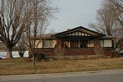
James Green House |
|
February 11, 1982
(#82004118) |
206 N. 100 East
40°53′30″N 111°52′38″W / 40.891667°N 111.877222°W / 40.891667; -111.877222 (James Green House) |
Bountiful |
|
| 23 |
Hector C. Haight House |
|
May 17, 1985
(#85001141) |
208 N. Main St.
40°59′03″N 111°53′11″W / 40.984167°N 111.886389°W / 40.984167; -111.886389 (Hector C. Haight House) |
Farmington |
|
| 24 |
Thomas and Caroline Harris House |
|
June 11, 1998
(#98000639) |
275 S. 200 East
40°54′54″N 111°52′30″W / 40.915°N 111.875°W / 40.915; -111.875 (Thomas and Caroline Harris House) |
Centerville |
|
| 25 |
Harris-Tingey House |
|
November 17, 1997
(#97001314) |
269 E. Center St.
40°55′03″N 111°52′28″W / 40.9175°N 111.874444°W / 40.9175; -111.874444 (Harris-Tingey House) |
Centerville |
|
| 26 |
Joseph and Ann Hill Cabin |
|
December 4, 2015
(#15000130) |
2133 W. 1000 South
41°02′44″N 112°00′22″W / 41.045632°N 112.006086°W / 41.045632; -112.006086 (Joseph and Ann Hill Cabin) |
Layton |
|
| 27 |
Holland-Smith-Brown House |
|
November 17, 1997
(#97001315) |
19 S. 200 East
40°55′01″N 111°52′31″W / 40.916944°N 111.875278°W / 40.916944; -111.875278 (Holland-Smith-Brown House) |
Centerville |
|
| 28 |
Kilbourn-Leak House |
|
November 17, 1997
(#97001316) |
170 N. 200 East
40°55′10″N 111°52′31″W / 40.919444°N 111.875278°W / 40.919444; -111.875278 (Kilbourn-Leak House) |
Centerville |
|
| 29 |
George Quincy Knowlton House |
|
April 17, 1995
(#95000416) |
93 E. 400 North
40°59′14″N 111°53′09″W / 40.987361°N 111.885833°W / 40.987361; -111.885833 (George Quincy Knowlton House) |
Farmington |
|
| 30 |
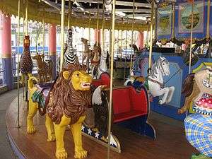
Lagoon Carousel |
|
October 24, 2012
(#12000883) |
375 N. Lagoon Dr.
40°59′05″N 111°53′38″W / 40.984830°N 111.893870°W / 40.984830; -111.893870 (Lagoon Carousel) |
Farmington |
Built in 1913, this hand carved Herschell-Spillman carousel has been at Lagoon Amusement Park since 1918. |
| 31 |
Lagoon Flying Scooter |
|
October 24, 2012
(#12000884) |
375 N. Lagoon Dr.
40°59′13″N 111°53′36″W / 40.987070°N 111.893300°W / 40.987070; -111.893300 (Lagoon Flying Scooter) |
Farmington |
A Bisch-Rocco Amusement Company Flying Scooters ride at Lagoon Amusement Park. Installed in 1941, it is currently known as the Flying Aces. |
| 32 |
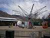
Lagoon Roller Coaster |
|
October 24, 2012
(#12000885) |
375 N. Lagoon Dr.
40°59′05″N 111°53′42″W / 40.984861°N 111.895137°W / 40.984861; -111.895137 (Lagoon Roller Coaster) |
Farmington |
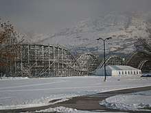
The 7th oldest roller coaster in the world, at Lagoon Amusement Park since 1921 |
| 33 |
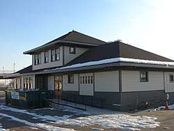
Layton Oregon Short Line Railroad Station |
|
January 18, 2018
(#100001979) |
200 S Main St.
41°03′24″N 111°57′52″W / 41.056770°N 111.964582°W / 41.056770; -111.964582 (Layton Oregon Short Line Railroad Station) |
Layton |
Railroad station built along side the Oregon Short Line Railroad tracks in 1912. Used by the railroad until the 1960s, and later sold then moved 1,200 feet to the south. The building has housed several businesses since it was vacated by the railroad. |
| 34 |
George W. Layton House |
|
July 23, 1982
(#82004122) |
2767 W. Gentile St.
41°03′36″N 112°00′50″W / 41.06°N 112.013889°W / 41.06; -112.013889 (George W. Layton House) |
Layton |
|
| 35 |
John Henry Layton House |
|
February 11, 1982
(#82004123) |
683 W. Gentile St.
41°03′36″N 111°58′39″W / 41.06°N 111.9775°W / 41.06; -111.9775 (John Henry Layton House) |
Layton |
|
| 36 |
Mills-Hancock House |
|
February 21, 2007
(#07000077) |
571 S. 400 West
40°55′06″N 111°52′52″W / 40.918333°N 111.881111°W / 40.918333; -111.881111 (Mills-Hancock House) |
Centerville |
|
| 37 |
Nathan and Rebecca Cherry and Eliza Ford Porter Farmstead |
|
November 17, 1997
(#97001317) |
370 W. 400 South
40°54′48″N 111°53′05″W / 40.913333°N 111.884722°W / 40.913333; -111.884722 (Nathan and Rebecca Cherry and Eliza Ford Porter Farmstead) |
Centerville |
|
| 38 |
Nathan T. and Anna Porter House |
|
January 21, 2004
(#03001482) |
224 S. 210 West
40°54′55″N 111°52′55″W / 40.915278°N 111.881944°W / 40.915278; -111.881944 (Nathan T. and Anna Porter House) |
Centerville |
|
| 39 |
Melvin Harley Randall House |
|
June 20, 1980
(#80003896) |
390 E. Porter Lane
40°54′46″N 111°52′19″W / 40.912778°N 111.871944°W / 40.912778; -111.871944 (Melvin Harley Randall House) |
Centerville |
|
| 40 |
Rich-Steeper House |
|
November 17, 1997
(#97001318) |
415 S. Main St.
40°54′46″N 111°52′42″W / 40.912778°N 111.878333°W / 40.912778; -111.878333 (Rich-Steeper House) |
Centerville |
|
| 41 |
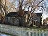
Richards House |
|
December 23, 1977
(#77001303) |
386 N. 100 East
40°59′12″N 111°53′02″W / 40.986667°N 111.883889°W / 40.986667; -111.883889 (Richards House) |
Farmington |
|
| 42 |
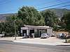
Ron's Phillips 66 Service Station |
|
March 26, 2018
(#100002273) |
278 N Main St.
40°55′12″N 111°52′44″W / 40.920081°N 111.878964°W / 40.920081; -111.878964 (Ron's Phillips 66 Service Station) |
Centerville |
|
| 43 |
Salt Lake South East and North West Base Monuments (Salt Lake Base Line) |
|
January 18, 2018
(#100001980) |
1002 S. 3200 West & 209 S. 4500 West
41°04′29″N 112°01′34″W / 41.074823°N 112.026024°W / 41.074823; -112.026024 (Salt Lake South East and North West Base Monuments (Salt Lake Base Line)) |
Layton and West Point |
|
| 44 |
B.H., Louisa Smith and Cecilia Dibble Roberts House |
|
November 17, 1997
(#97001319) |
315 S. 300 East
40°54′51″N 111°52′21″W / 40.914167°N 111.8725°W / 40.914167; -111.8725 (B.H., Louisa Smith and Cecilia Dibble Roberts House) |
Centerville |
Home of B. H. Roberts |
| 45 |
Thomas J. and Amanda N. Smith House |
|
February 2, 2006
(#05001632) |
472 N. Main St.
41°02′35″N 111°56′48″W / 41.043056°N 111.946667°W / 41.043056; -111.946667 (Thomas J. and Amanda N. Smith House) |
Kaysville |
|
| 46 |
Smith-Larsen House |
|
November 17, 1997
(#97001320) |
280 E. Center St.
40°54′59″N 111°52′27″W / 40.916389°N 111.874167°W / 40.916389; -111.874167 (Smith-Larsen House) |
Centerville |
|
| 47 |
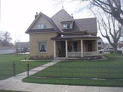
Smoot Dairy Farmhouse |
|
March 22, 2016
(#16000123) |
1697 N. Main St.
40°56′31″N 111°52′49″W / 40.941956°N 111.880220°W / 40.941956; -111.880220 (Smoot Dairy Farmhouse) |
Centerville |
|
| 48 |
Stayner-Steed House |
|
August 2, 1999
(#99000846) |
79 S. 100 East
40°58′45″N 111°53′04″W / 40.979167°N 111.884444°W / 40.979167; -111.884444 (Stayner-Steed House) |
Farmington |
|
| 49 |
LeConte Stewart House |
|
June 28, 1996
(#96000721) |
172 W. 100 South
41°02′03″N 111°56′28″W / 41.034167°N 111.941111°W / 41.034167; -111.941111 (LeConte Stewart House) |
Kaysville |
|
| 50 |
William Henry and Mary Streeper House |
|
November 17, 1997
(#97001321) |
1020 N. Main St.
40°55′46″N 111°52′50″W / 40.929444°N 111.880556°W / 40.929444; -111.880556 (William Henry and Mary Streeper House) |
Centerville |
|
| 51 |
John W., Janet (Nettie), and May Rich Taylor House |
|
October 30, 1997
(#97001325) |
49 E. 500 North
40°59′19″N 111°53′11″W / 40.988611°N 111.886389°W / 40.988611; -111.886389 (John W., Janet (Nettie), and May Rich Taylor House) |
Farmington |
|
| 52 |
Thurston-Chase Cabin |
|
November 17, 1997
(#97001322) |
975 N. Main St.
40°55′43″N 111°52′45″W / 40.928611°N 111.879167°W / 40.928611; -111.879167 (Thurston-Chase Cabin) |
Centerville |
|
| 53 |
Thomas Tingey House |
|
July 28, 1983
(#83004401) |
20 N. 300 East
40°55′03″N 111°52′23″W / 40.9175°N 111.873056°W / 40.9175; -111.873056 (Thomas Tingey House) |
Centerville |
|
| 54 |
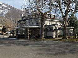
VanFleet Hotel |
|
December 19, 1991
(#91001819) |
88 E. State St.
40°58′48″N 111°53′05″W / 40.98°N 111.884722°W / 40.98; -111.884722 (VanFleet Hotel) |
Farmington |
|
| 55 |
Franklin and Amelia Walton House |
|
November 17, 1997
(#97001323) |
96 W. 280 South
40°54′53″N 111°52′50″W / 40.914722°N 111.880556°W / 40.914722; -111.880556 (Franklin and Amelia Walton House) |
Centerville |
|
| 56 |
John and Sarah Jane Wayman House |
|
January 7, 2015
(#14001136) |
240 E. 300 South
40°54′53″N 111°52′27″W / 40.9148°N 111.8741°W / 40.9148; -111.8741 (John and Sarah Jane Wayman House) |
Centerville |
|
| 57 |
West Bountiful Historic District |
|
June 18, 2004
(#03000158) |
800 West (Onion St.) from 400 North to roughly 1350 North (both sides)
40°53′51″N 111°54′05″W / 40.8975°N 111.901389°W / 40.8975; -111.901389 (West Bountiful Historic District) |
West Bountiful |
|
| 58 |
Thomas and Elizabeth Mills Whitaker House |
|
March 28, 1996
(#96000316) |
168 N. Main St.
40°55′08″N 111°52′43″W / 40.918889°N 111.878611°W / 40.918889; -111.878611 (Thomas and Elizabeth Mills Whitaker House) |
Centerville |
|
| 59 |
James D. Wilcox House |
|
November 26, 1985
(#85003051) |
93 E. 100 North
40°58′56″N 111°53′05″W / 40.982222°N 111.884722°W / 40.982222; -111.884722 (James D. Wilcox House) |
Farmington |
|