| [3] |
Name on the Register[4] |
Image |
Date listed[5] |
Location |
City or town |
Description |
|---|
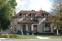
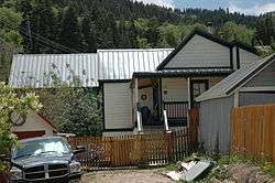
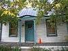
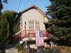
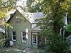
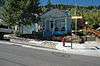
| 1 |
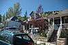
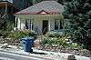
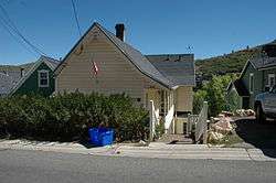
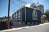
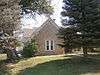
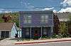
Thomas L. Allen House |
|
July 23, 1982
(#82004161) |
98 N. Main St.
40°55′08″N 111°23′55″W / 40.918889°N 111.398611°W / 40.918889; -111.398611 (Thomas L. Allen House) |
Coalville |
|
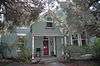
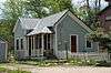
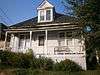
| 2 |
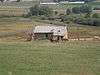
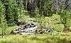
Archie Creek Camp |
|
January 5, 2016
(#15000958) |
Western side of Archie Creek[6]
40°56′52″N 110°34′18″W / 40.947778°N 110.571667°W / 40.947778; -110.571667 (Archie Creek Camp) |
Wasatch National Forest |
|
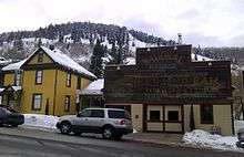
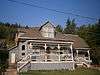
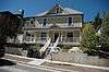
| 3 |
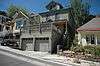
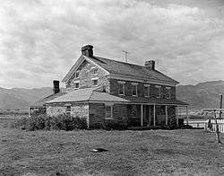
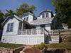
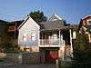
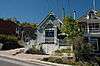
William Austin House |
|
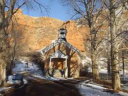
July 11, 1984
(#84002226) |
247 Ontario Ave.
40°38′32″N 111°29′32″W / 40.642222°N 111.492222°W / 40.642222; -111.492222 (William Austin House) |
Park City |
|
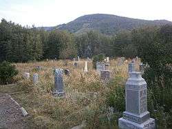
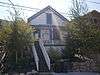
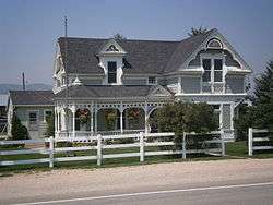
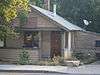
| 4 |
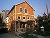
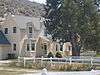
Dr. William Bardsley House |
|
May 26, 1994
(#94000531) |
517 Park Ave.
40°38′39″N 111°29′47″W / 40.644167°N 111.496389°W / 40.644167; -111.496389 (Dr. William Bardsley House) |
Park City |
|
| 5 |
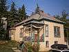
Charles Barnes House |
|
July 12, 1984
(#84002230) |
413 Ontario Ave.
40°38′38″N 111°29′34″W / 40.643889°N 111.492778°W / 40.643889; -111.492778 (Charles Barnes House) |
Park City |
|
| 6 |
Richard Barrett House |
|
July 11, 1984
(#84002238) |
36 Prospect Ave.
40°38′21″N 111°29′35″W / 40.639167°N 111.493056°W / 40.639167; -111.493056 (Richard Barrett House) |
Park City |
|
| 7 |
George J. Barry House |
|
July 12, 1984
(#84002239) |
250 Grant Ave.
40°38′31″N 111°29′36″W / 40.641944°N 111.493333°W / 40.641944; -111.493333 (George J. Barry House) |
Park City |
|
| 8 |
Thomas and Jane Beech House |
|
September 7, 2001
(#01000958) |
47 W. 50 South
40°54′53″N 111°23′53″W / 40.914722°N 111.398056°W / 40.914722; -111.398056 (Thomas and Jane Beech House) |
Coalville |
|
| 9 |
Ellsworth J. Beggs House |
|
July 11, 1984
(#84002240) |
703 Park Ave.
40°38′48″N 111°29′52″W / 40.646667°N 111.497778°W / 40.646667; -111.497778 (Ellsworth J. Beggs House) |
Park City |
|
| 10 |
Annie Birch House |
|
October 22, 1984
(#84000163) |
Approximately 900 S. West Hoytsville Rd., off I-80
40°53′12″N 111°23′59″W / 40.886667°N 111.399722°W / 40.886667; -111.399722 (Annie Birch House) |
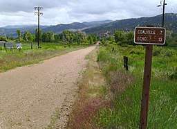
Hoytsville |
|
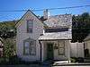
| 11 |
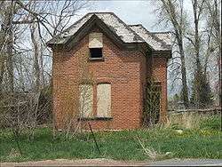
Bogan Boarding House |
|
October 22, 1984
(#84000154) |
221 Main St.
40°38′29″N 111°29′37″W / 40.641389°N 111.493611°W / 40.641389; -111.493611 (Bogan Boarding House) |
Park City |
|
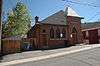
| 12 |
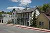
Boyden Block |
|
February 6, 2009
(#09000019) |
2 S. Main St.
40°54′59″N 111°23′55″W / 40.91648°N 111.39861°W / 40.91648; -111.39861 (Boyden Block) |
Coalville |
|
| 13 |
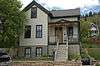
John Boyden House |
|
February 11, 1982
(#82004162) |
47 W. Center St.
40°54′53″N 111°23′53″W / 40.914722°N 111.398056°W / 40.914722; -111.398056 (John Boyden House) |
Coalville |
|
| 14 |
Otis L. Brown House |
|
July 11, 1984
(#84002241) |
713 Woodside Ave.
40°38′47″N 111°29′54″W / 40.646389°N 111.498333°W / 40.646389; -111.498333 (Otis L. Brown House) |
Park City |
|
| 15 |
John W. Buck House |
|
July 12, 1984
(#84002242) |
1110 Woodside Ave.
40°39′01″N 111°30′04″W / 40.650278°N 111.501111°W / 40.650278; -111.501111 (John W. Buck House) |
Park City |
|
| 16 |
William Campbell House |
|
July 11, 1984
(#84002243) |
164 Norfolk Ave.
40°38′26″N 111°29′43″W / 40.640556°N 111.495278°W / 40.640556; -111.495278 (William Campbell House) |
Park City |
|
| 17 |
Benedictus Carling House |
|
July 12, 1984
(#84002244) |
660 Rossie Hill Dr.
40°38′40″N 111°29′16″W / 40.644444°N 111.487778°W / 40.644444; -111.487778 (Benedictus Carling House) |
Park City |
|
| 18 |
James Cassidy House |
|
July 11, 1984
(#84002245) |
33 King Rd.
40°38′22″N 111°29′39″W / 40.639444°N 111.494167°W / 40.639444; -111.494167 (James Cassidy House) |
Park City |
|
| 19 |
James Cavanaugh House |
|
July 12, 1984
(#84002246) |
564 Woodside Ave.
40°38′41″N 111°29′49″W / 40.644722°N 111.496944°W / 40.644722; -111.496944 (James Cavanaugh House) |
Park City |
|
| 20 |
Peter Clark House |
|
July 11, 1984
(#84002247) |
1135 Park Ave.
40°39′02″N 111°30′04″W / 40.650556°N 111.501111°W / 40.650556; -111.501111 (Peter Clark House) |
Park City |
|
| 21 |
David F. and Elizabeth Condon House |
|
July 12, 1984
(#84002248) |
1304 Park Ave.
40°39′10″N 111°30′08″W / 40.652778°N 111.502222°W / 40.652778; -111.502222 (David F. and Elizabeth Condon House) |
Park City |
|
| 22 |
John F. Cunningham House |
|
July 11, 1984
(#84002249) |
606 Park Ave.
40°38′45″N 111°29′48″W / 40.645833°N 111.496667°W / 40.645833; -111.496667 (John F. Cunningham House) |
Park City |
|
| 23 |
John Diem House |
|
October 22, 1984
(#84000155) |
401 Park Ave.
40°38′35″N 111°29′44″W / 40.643056°N 111.495556°W / 40.643056; -111.495556 (John Diem House) |
Park City |
|
| 24 |
Doggy Door Tie Cutter Cabin |
|
July 18, 2014
(#14000431) |
Address restricted[7]
|
Wasatch National Forest |
|
| 25 |
John Doyle House |
|
February 6, 1986
(#86000162) |
339 Park Ave.
40°38′32″N 111°29′35″W / 40.642222°N 111.493056°W / 40.642222; -111.493056 (John Doyle House) |
Park City |
|
| 26 |
Durkin Boarding House |
|
July 12, 1984
(#84002253) |
176 Main St.
40°38′27″N 111°29′35″W / 40.640833°N 111.493056°W / 40.640833; -111.493056 (Durkin Boarding House) |
Park City |
|
| 27 |
Joseph Durkin House |
|
July 11, 1984
(#84002262) |
22 Prospect Ave.
40°38′22″N 111°29′34″W / 40.639444°N 111.492778°W / 40.639444; -111.492778 (Joseph Durkin House) |
Park City |
|
| 28 |
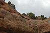
Echo Canyon Breastworks |
|
October 27, 1988
(#88001942) |
Address Restricted[7]
|
Echo |
|
| 29 |
Echo Church and School |
|
January 5, 1989
(#88003000) |
Temple Ln.
40°58′43″N 111°26′25″W / 40.978611°N 111.440278°W / 40.978611; -111.440278 (Echo Church and School) |
Echo |
|
| 30 |
Echo Post Office |
|
August 14, 2003
(#03000159) |
3455 S. Echo Rd.
40°58′49″N 111°26′37″W / 40.980278°N 111.443611°W / 40.980278; -111.443611 (Echo Post Office) |
Echo |
|
| 31 |
Echo School |
|
August 1, 1997
(#97000805) |
3441 S. Echo Rd.
40°58′43″N 111°26′37″W / 40.978611°N 111.443611°W / 40.978611; -111.443611 (Echo School) |
Echo |
|
| 32 |
Ecker Hill Ski Jump |
|
June 4, 1986
(#86001251) |
Off I-80
40°44′38″N 111°34′36″W / 40.743889°N 111.576667°W / 40.743889; -111.576667 (Ecker Hill Ski Jump) |
Snyderville |
|
| 33 |
Peter Farthelos House |
|
July 12, 1984
(#84002267) |
1150 Park Ave.
40°39′03″N 111°30′03″W / 40.650833°N 111.500833°W / 40.650833; -111.500833 (Peter Farthelos House) |
Park City |
|
| 34 |
Mike Frkovich House |
|
July 12, 1984
(#84002270) |
162 Daly Ave.
40°38′16″N 111°29′42″W / 40.637778°N 111.495°W / 40.637778; -111.495 (Mike Frkovich House) |
Park City |
|
| 35 |
Glenwood Cemetery |
|
May 1, 1996
(#96000436) |
Silver King Dr., approximately 0.5 miles (0.80 km) north of Park City Ski Resort
40°39′16″N 111°30′40″W / 40.654444°N 111.511111°W / 40.654444; -111.511111 (Glenwood Cemetery) |
Park City |
|
| 36 |
Levins D. Gray House |
|
July 12, 1984
(#84002272) |
355 Ontario Ave.
40°38′37″N 111°29′33″W / 40.643611°N 111.4925°W / 40.643611; -111.4925 (Levins D. Gray House) |
Park City |
|
| 37 |
John Grix Cabin |
|
March 8, 1997
(#97000226) |
0.25 miles (0.40 km) west of State Route 150, approximately 20 miles (32 km) northeast of Kamas
40°40′49″N 110°57′35″W / 40.680278°N 110.959722°W / 40.680278; -110.959722 (John Grix Cabin) |
Kamas |
|
| 38 |
Frank Hansen House |
|
July 12, 1984
(#84002274) |
1025 Park Ave.
40°38′57″N 111°30′01″W / 40.649167°N 111.500278°W / 40.649167; -111.500278 (Frank Hansen House) |
Park City |
|
| 39 |
Joseph D. Harris House |
|
July 12, 1984
(#84002277) |
959 Park Ave.
40°38′56″N 111°29′59″W / 40.648889°N 111.499722°W / 40.648889; -111.499722 (Joseph D. Harris House) |
Park City |
|
| 40 |
William H. Harris House |
|
July 12, 1984
(#84002279) |
39 King Rd.
40°38′22″N 111°29′37″W / 40.639444°N 111.493611°W / 40.639444; -111.493611 (William H. Harris House) |
Park City |
|
| 41 |
Harry W. Haumann House |
|
July 12, 1984
(#84002281) |
939 Empire Ave.
40°38′52″N 111°30′04″W / 40.647778°N 111.501111°W / 40.647778; -111.501111 (Harry W. Haumann House) |
Park City |
|
| 42 |
Verner O. Hewlett Ranch House |
|
May 23, 1985
(#85001133) |
Off State Route 35
40°33′16″N 111°09′48″W / 40.554444°N 111.163333°W / 40.554444; -111.163333 (Verner O. Hewlett Ranch House) |
Woodland |
|
| 43 |
Henry M. Hinsdill House |
|
July 12, 1984
(#84002283) |
662 Norfolk Ave.
40°38′46″N 111°29′55″W / 40.646111°N 111.498611°W / 40.646111; -111.498611 (Henry M. Hinsdill House) |
Park City |
|
| 44 |
Samuel Holman House |
|
July 12, 1984
(#84002290) |
307 Norfolk Ave.
40°38′30″N 111°29′47″W / 40.641667°N 111.496389°W / 40.641667; -111.496389 (Samuel Holman House) |
Park City |
|
| 45 |
House at 62 Daly Avenue |
|
July 12, 1984
(#84002304) |
62 Daly Ave.
40°38′20″N 111°29′39″W / 40.638889°N 111.494167°W / 40.638889; -111.494167 (House at 62 Daly Avenue) |
Park City |
|
| 46 |
House at 555 Deer Valley Road |
|
July 12, 1984
(#84002299) |
555 Deer Valley Rd.
40°38′44″N 111°29′24″W / 40.645556°N 111.49°W / 40.645556; -111.49 (House at 555 Deer Valley Road) |
Park City |
|
| 47 |
House at 577 Deer Valley Road |
|
July 12, 1984
(#84002301) |
577 Deer Valley Rd.
40°38′44″N 111°29′23″W / 40.645556°N 111.489722°W / 40.645556; -111.489722 (House at 577 Deer Valley Road) |
Park City |
|
| 48 |
House at 1101 Norfolk Avenue |
|
July 12, 1984
(#84002294) |
1101 Norfolk Ave.
40°38′58″N 111°30′10″W / 40.649306°N 111.502639°W / 40.649306; -111.502639 (House at 1101 Norfolk Avenue) |
Park City |
|
| 49 |
House at 343 Park Avenue |
|
July 12, 1984
(#84002297) |
343 Park Ave.
40°38′33″N 111°29′43″W / 40.6425°N 111.495278°W / 40.6425; -111.495278 (House at 343 Park Avenue) |
Park City |
|
| 50 |
House at 463 Park Ave. |
|
May 28, 1999
(#99000620) |
463 Park Ave.
40°38′34″N 111°29′45″W / 40.642778°N 111.495833°W / 40.642778; -111.495833 (House at 463 Park Ave.) |
Park City |
|
| 51 |
House at 101 Prospect |
|
October 22, 1984
(#84000156) |
101 Prospect Ave.
40°38′17″N 111°29′34″W / 40.638056°N 111.492778°W / 40.638056; -111.492778 (House at 101 Prospect) |
Park City |
|
| 52 |
House at 622 Rossie Hill Drive |
|
July 12, 1984
(#84002308) |
622 Rossie Hill Dr.
40°38′41″N 111°29′18″W / 40.644722°N 111.488333°W / 40.644722; -111.488333 (House at 622 Rossie Hill Drive) |
Park City |
|
| 53 |
Howe Flume Historic District |
|
December 12, 1978
(#78002695) |
Northeast of Oakley in Wasatch National Forest
40°49′50″N 110°49′58″W / 40.830556°N 110.832778°W / 40.830556; -110.832778 (Howe Flume Historic District) |
Oakley |
|
| 54 |
Samuel P. Hoyt House |
|
April 19, 1982
(#82004163) |
285 Hoyt Ln.
40°52′18″N 111°23′04″W / 40.871667°N 111.384444°W / 40.871667; -111.384444 (Samuel P. Hoyt House) |
Hoytsville |
|
| 55 |
IOOF Relief Home |
|
July 12, 1984
(#84002311) |
232 Woodside Ave.
40°38′27″N 111°29′41″W / 40.640833°N 111.494722°W / 40.640833; -111.494722 (IOOF Relief Home) |
Park City |
|
| 56 |
Joseph J. Jenkins House |
|
July 12, 1984
(#84002315) |
27 Prospect Ave.
40°38′19″N 111°29′34″W / 40.638611°N 111.492778°W / 40.638611; -111.492778 (Joseph J. Jenkins House) |
Park City |
|
| 57 |
Carl G. Johnson House |
|
April 12, 1984
(#84002318) |
147 Grant Ave.
40°38′29″N 111°29′34″W / 40.641389°N 111.492778°W / 40.641389; -111.492778 (Carl G. Johnson House) |
Park City |
|
| 58 |
Elizabeth M. Jones House |
|
July 12, 1984
(#84002322) |
412 Marsac Ave.
40°38′38″N 111°29′35″W / 40.643889°N 111.493056°W / 40.643889; -111.493056 (Elizabeth M. Jones House) |
Park City |
|
| 59 |
Kimball Stage Stop |
|
April 16, 1971
(#71000855) |
318 Bitner Rd.
40°43′24″N 111°31′02″W / 40.72346°N 111.51726°W / 40.72346; -111.51726 (Kimball Stage Stop) |
Park City |
|
| 60 |
Burt Kimball House |
|
July 12, 1984
(#84002325) |
817 Park Ave.
40°38′51″N 111°29′55″W / 40.6475°N 111.498611°W / 40.6475; -111.498611 (Burt Kimball House) |
Park City |
|
| 61 |
Ernest Lynn Kimball House |
|
July 12, 1984
(#84002329) |
911 Empire Ave.
40°38′50″N 111°30′03″W / 40.647222°N 111.500833°W / 40.647222; -111.500833 (Ernest Lynn Kimball House) |
Park City |
|
| 62 |
LDS Park City Meetinghouse |
|
May 22, 1978
(#78002696) |
424 Park Ave.
40°38′35″N 111°29′43″W / 40.643056°N 111.495278°W / 40.643056; -111.495278 (LDS Park City Meetinghouse) |
Park City |
|
| 63 |
Alfred Lindorff House |
|
July 12, 1984
(#84002331) |
40 Sampson Ave.
40°38′25″N 111°29′45″W / 40.640278°N 111.495833°W / 40.640278; -111.495833 (Alfred Lindorff House) |
Park City |
|
| 64 |
Oscar F. Lyons House |
|
July 14, 1983
(#83003192) |
5412 N. Wooden Shoe Rd.
40°43′24″N 111°20′25″W / 40.723472°N 111.340139°W / 40.723472; -111.340139 (Oscar F. Lyons House) |
Peoa |
|
| 65 |
Marsac Elementary School |
|
April 1, 1985
(#85000815) |
431 Marsac Ave.
40°38′39″N 111°29′38″W / 40.644167°N 111.493889°W / 40.644167; -111.493889 (Marsac Elementary School) |
Park City |
|
| 66 |
John Maycock Cabin |
|
March 11, 2005
(#05000187) |
Approximately 20 miles (32 km) northeast of Kamas and 0.5 miles (0.80 km) west of State Route 150 in the Wasatch-Cache National Forest
40°40′50″N 110°57′27″W / 40.680556°N 110.9575°W / 40.680556; -110.9575 (John Maycock Cabin) |
Kamas |
|
| 67 |
William and Elizabeth McMichael House |
|
December 31, 1998
(#98001576) |
1259 S. West Hoytsville Rd.
40°51′49″N 111°23′50″W / 40.863611°N 111.397222°W / 40.863611; -111.397222 (William and Elizabeth McMichael House) |
Hoytsville |
|
| 68 |
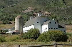
McPolin Farmstead |
|
August 14, 2003
(#03000155) |
3000 N. State Route 224
40°40′38″N 111°31′36″W / 40.677222°N 111.526667°W / 40.677222; -111.526667 (McPolin Farmstead) |
Park City |
|
| 69 |
Charles Meadowcroft House |
|
July 12, 1984
(#84002333) |
951 Woodside Ave.
40°38′55″N 111°30′00″W / 40.648611°N 111.5°W / 40.648611; -111.5 (Charles Meadowcroft House) |
Park City |
|
| 70 |
Byron T. Mitchell House |
|
May 18, 1984
(#84002336) |
State Route 32 and State Route 35
40°36′39″N 111°16′48″W / 40.610833°N 111.28°W / 40.610833; -111.28 (Byron T. Mitchell House) |
Francis |
|
| 71 |
Jesse Morgan House |
|
July 12, 1984
(#84002338) |
1027 Woodside Ave.
40°38′57″N 111°30′03″W / 40.649167°N 111.500833°W / 40.649167; -111.500833 (Jesse Morgan House) |
Park City |
|
| 72 |
Jack M. Murdock House |
|
July 12, 1984
(#84002340) |
652 Rossie Hill Dr.
40°38′41″N 111°29′17″W / 40.644722°N 111.488056°W / 40.644722; -111.488056 (Jack M. Murdock House) |
Park City |
|
| 73 |
George Murray House |
|
July 12, 1984
(#84002343) |
44 Chambers Ave.
40°38′21″N 111°29′32″W / 40.639167°N 111.492222°W / 40.639167; -111.492222 (George Murray House) |
Park City |
|
| 74 |
William and Martha Myrick House |
|
March 9, 1982
(#82004164) |
1715 N. SR-32
40°40′10″N 111°16′52″W / 40.669583°N 111.281111°W / 40.669583; -111.281111 (William and Martha Myrick House) |
Marion |
|
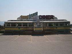
| 75 |
O'Mahony Dining Car No. 1107 |
|
August 21, 2009
(#09000639) |
981 W. Weber Canyon Rd.
40°42′59″N 111°18′00″W / 40.716381°N 111.299889°W / 40.716381; -111.299889 (O'Mahony Dining Car No. 1107) |
Oakley |
|
| 76 |
Park City Community Church |
|
November 25, 1980
(#80003970) |
402 Park Ave.
40°38′35″N 111°29′42″W / 40.643056°N 111.495°W / 40.643056; -111.495 (Park City Community Church) |
Park City |
|
| 77 |
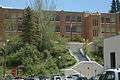
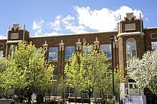
Park City High School |
|
January 5, 2016
(#15000959) |
1255 Park Ave.
40°39′01″N 111°30′09″W / 40.650278°N 111.5025°W / 40.650278; -111.5025 (Park City High School) |
Park City |
1928 building that now houses the city library |
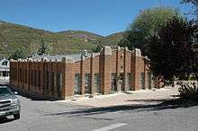
| 78 |
Park City High School Mechanical Arts Building |
|
November 7, 1996
(#96001324) |
1167 Woodside Ave.
40°39′01″N 111°30′09″W / 40.650278°N 111.5025°W / 40.650278; -111.5025 (Park City High School Mechanical Arts Building) |
Park City |
|
| 79 |
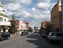
Park City Main Street Historic District |
|
March 26, 1979
(#79002511) |
Main St.
40°38′41″N 111°29′44″W / 40.644722°N 111.495556°W / 40.644722; -111.495556 (Park City Main Street Historic District) |
Park City |
|
| 80 |
Park City Miner's Hospital |
|
December 8, 1978
(#78002697) |
1354 Park Ave.
40°39′12″N 111°30′12″W / 40.653333°N 111.503333°W / 40.653333; -111.503333 (Park City Miner's Hospital) |
Park City |
|
| 81 |
LaPage H. Raddon House |
|
July 12, 1984
(#84002345) |
817 Woodside Ave.
40°38′50″N 111°29′56″W / 40.647222°N 111.498889°W / 40.647222; -111.498889 (LaPage H. Raddon House) |
Park City |
|
| 82 |
Samuel L. Raddon House |
|
July 12, 1984
(#84002349) |
325 Park Ave.
40°38′32″N 111°29′42″W / 40.642222°N 111.495°W / 40.642222; -111.495 (Samuel L. Raddon House) |
Park City |
|
| 83 |
Jacob F. Richardson House |
|
July 12, 1984
(#84002354) |
245 Park Ave.
40°38′28″N 111°29′40″W / 40.641111°N 111.494444°W / 40.641111; -111.494444 (Jacob F. Richardson House) |
Park City |
|
| 84 |
John H. and Margaretta Rogers House |
|
April 14, 1988
(#88000386) |
455 Park Ave.
40°38′38″N 111°29′46″W / 40.643889°N 111.496111°W / 40.643889; -111.496111 (John H. and Margaretta Rogers House) |
Park City |
|
| 85 |
Nicholas Rowe House |
|
October 22, 1984
(#84000158) |
150 Main St.
40°38′26″N 111°29′36″W / 40.640556°N 111.493333°W / 40.640556; -111.493333 (Nicholas Rowe House) |
Park City |
|
| 86 |
St. John's Swedish Lutheran Church |
|
February 12, 1999
(#99000217) |
323 Park Ave.
40°38′29″N 111°29′41″W / 40.641389°N 111.494722°W / 40.641389; -111.494722 (St. John's Swedish Lutheran Church) |
Park City |
|
| 87 |
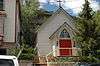
St. Luke's Episcopal Church |
|
November 28, 1980
(#80003971) |
525 Park Ave.
40°38′39″N 111°29′47″W / 40.644167°N 111.496389°W / 40.644167; -111.496389 (St. Luke's Episcopal Church) |
Park City |
|
| 88 |
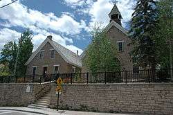
St. Mary of the Assumption Church and School |
|
January 25, 1979
(#79002512) |
121 Park Ave.
40°38′24″N 111°29′38″W / 40.64°N 111.493889°W / 40.64; -111.493889 (St. Mary of the Assumption Church and School) |
Park City |
|
| 89 |
Wilson I. Snyder House |
|
July 12, 1984
(#84002356) |
1010 Woodside Ave.
40°38′58″N 111°30′01″W / 40.649444°N 111.500278°W / 40.649444; -111.500278 (Wilson I. Snyder House) |
Park City |
|
| 90 |
Eugene Streeter House |
|
July 12, 1984
(#84002357) |
335 Ontario Ave.
40°38′35″N 111°29′33″W / 40.643056°N 111.4925°W / 40.643056; -111.4925 (Eugene Streeter House) |
Park City |
|
| 91 |
James R. and Mary E. Sullivan House |
|
July 12, 1984
(#84002360) |
146 Main St.
40°38′25″N 111°29′36″W / 40.640278°N 111.493333°W / 40.640278; -111.493333 (James R. and Mary E. Sullivan House) |
Park City |
|
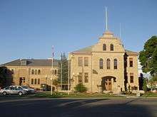
| 92 |
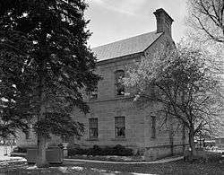
Summit County Courthouse |
|
December 15, 1978
(#78002694) |
54 N. Main St.
40°55′05″N 111°23′53″W / 40.918056°N 111.398056°W / 40.918056; -111.398056 (Summit County Courthouse) |
Coalville |
|
| 93 |
Ephraim D. and William D. Sutton House |
|
July 12, 1984
(#84002362) |
713 Norfolk Ave.
40°38′47″N 111°29′57″W / 40.646389°N 111.499167°W / 40.646389; -111.499167 (Ephraim D. and William D. Sutton House) |
Park City |
|
| 94 |
Milton and Minerva Thomas House |
|
July 12, 1984
(#84002363) |
445 Park Ave.
40°38′37″N 111°29′45″W / 40.643611°N 111.495833°W / 40.643611; -111.495833 (Milton and Minerva Thomas House) |
Park City |
|
| 95 |
William Tretheway House |
|
July 12, 1984
(#84002364) |
335 Woodside Ave.
40°38′33″N 111°29′46″W / 40.6425°N 111.496111°W / 40.6425; -111.496111 (William Tretheway House) |
Park City |
|
| 96 |
Union Pacific Park City Branch Railroad Grade |
|
April 25, 1996
(#96000413) |
Railroad grade parallel to I-80 from Echo to Park City
40°47′21″N 111°26′28″W / 40.789167°N 111.441111°W / 40.789167; -111.441111 (Union Pacific Park City Branch Railroad Grade) |
Echo |
|
| 97 |
Matthew Urie House |
|
July 12, 1984
(#84002366) |
157 Park Ave.
40°38′26″N 111°29′40″W / 40.640556°N 111.494444°W / 40.640556; -111.494444 (Matthew Urie House) |
Park City |
|
| 98 |
Samuel D. Walker House |
|
July 12, 1984
(#84002368) |
1119 Park Ave.
40°39′01″N 111°30′04″W / 40.650278°N 111.501111°W / 40.650278; -111.501111 (Samuel D. Walker House) |
Park City |
|
| 99 |
Washington School |
|
December 8, 1978
(#78002699) |
541 Park Ave.
40°38′40″N 111°29′49″W / 40.644444°N 111.496944°W / 40.644444; -111.496944 (Washington School) |
Park City |
|
| 100 |
Irinda Watson House |
|
July 12, 1984
(#84002370) |
610 Park Ave.
40°38′45″N 111°29′48″W / 40.645833°N 111.496667°W / 40.645833; -111.496667 (Irinda Watson House) |
Park City |
|
| 101 |
Patrick B. Watson House |
|
May 16, 2002
(#02000504) |
962 Norfolk Ave.
40°38′55″N 111°30′02″W / 40.648611°N 111.500556°W / 40.648611; -111.500556 (Patrick B. Watson House) |
Park City |
|
| 102 |
John C. Weeter House |
|
January 21, 2004
(#84004002) |
843 Norfolk Ave.
40°38′51″N 111°30′00″W / 40.6475°N 111.5°W / 40.6475; -111.5 (John C. Weeter House) |
Park City |
|
| 103 |
Welch-Sherman House |
|
July 12, 1984
(#84002372) |
59 Prospect Ave.
40°38′19″N 111°29′34″W / 40.638611°N 111.492778°W / 40.638611; -111.492778 (Welch-Sherman House) |
Park City |
|
| 104 |
Hannah Wells House |
|
July 12, 1984
(#84002375) |
1103 Woodside Ave.
40°39′00″N 111°30′05″W / 40.65°N 111.501389°W / 40.65; -111.501389 (Hannah Wells House) |
Park City |
|
| 105 |
Charles C. Whitehead House |
|
October 22, 1984
(#84000160) |
937 Park Ave.
40°38′54″N 111°29′58″W / 40.648333°N 111.499444°W / 40.648333; -111.499444 (Charles C. Whitehead House) |
Park City |
|
| 106 |
Walter and Ann Wilcocks House |
|
July 12, 1984
(#84002378) |
363 Park Ave.
40°38′34″N 111°29′44″W / 40.642778°N 111.495556°W / 40.642778; -111.495556 (Walter and Ann Wilcocks House) |
Park City |
|
| 107 |
Wilkinson-Hawkinson House |
|
July 12, 1984
(#84002418) |
39 Sampson Ave.
40°38′24″N 111°29′43″W / 40.64°N 111.495278°W / 40.64; -111.495278 (Wilkinson-Hawkinson House) |
Park City |
|
| 108 |
Nathaniel J. Williams House |
|
July 12, 1984
(#84002419) |
945 Norfolk Ave.
40°38′53″N 111°30′02″W / 40.648056°N 111.500556°W / 40.648056; -111.500556 (Nathaniel J. Williams House) |
Park City |
|
| 109 |
Reese Williams House |
|
July 12, 1984
(#84002420) |
421 Park Ave.
40°38′36″N 111°29′45″W / 40.643333°N 111.495833°W / 40.643333; -111.495833 (Reese Williams House) |
Park City |
|
| 110 |
Joseph S. Willis House |
|
July 12, 1984
(#84002421) |
1062 Park Ave.
40°39′N 111°30′W / 40.65°N 111.5°W / 40.65; -111.5 (Joseph S. Willis House) |
Park City |
|
| 111 |
Wilson-Shields House |
|
July 12, 1984
(#84002422) |
139 Park Ave.
40°38′26″N 111°29′39″W / 40.640556°N 111.494167°W / 40.640556; -111.494167 (Wilson-Shields House) |
Park City |
|