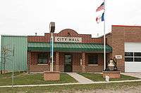
Oxford, Iowa
| Oxford, Iowa | |
|---|---|
| City | |
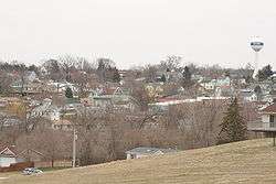 View of Oxford from 295th St | |
 Location of Oxford, Iowa | |
| Coordinates: 41°43′22″N 91°47′23″W / 41.72278°N 91.78972°WCoordinates: 41°43′22″N 91°47′23″W / 41.72278°N 91.78972°W | |
| Country |
|
| State |
|
| County | Johnson |
| Area[1] | |
| • Total | 0.91 sq mi (2.36 km2) |
| • Land | 0.91 sq mi (2.36 km2) |
| • Water | 0 sq mi (0 km2) |
| Elevation | 751 ft (229 m) |
| Population (2010)[2] | |
| • Total | 807 |
| • Estimate (2016)[3] | 811 |
| • Density | 887/sq mi (342.4/km2) |
| Time zone | UTC-6 (Central (CST)) |
| • Summer (DST) | UTC-5 (CDT) |
| ZIP code | 52322 |
| Area code(s) | 319 |
| FIPS code | 19-60645 |
| GNIS feature ID | 0459975 |
Oxford is a city in Johnson County, Iowa, United States. It is part of the Iowa City, Iowa Metropolitan Statistical Area. The population was 807 at the 2010 census.
History
Oxford was platted in 1868.[4] It is named from Oxford Township, which takes its name from Oxford, New York.[5]
Geography
Oxford is located at 41°43′22″N 91°47′23″W / 41.72278°N 91.78972°W (41.722645, -91.789841).[6]
According to the United States Census Bureau, the city has a total area of 0.91 square miles (2.36 km2), all of it land.[1]
Demographics
| Wikimedia Commons has media related to Oxford, Iowa. |
| Historical populations | ||
|---|---|---|
| Year | Pop. | ±% |
| 1880 | 560 | — |
| 1890 | 515 | −8.0% |
| 1900 | 664 | +28.9% |
| 1910 | 614 | −7.5% |
| 1920 | 580 | −5.5% |
| 1930 | 521 | −10.2% |
| 1940 | 542 | +4.0% |
| 1950 | 543 | +0.2% |
| 1960 | 633 | +16.6% |
| 1970 | 666 | +5.2% |
| 1980 | 676 | +1.5% |
| 1990 | 663 | −1.9% |
| 2000 | 705 | +6.3% |
| 2010 | 807 | +14.5% |
| 2016 | 811 | +0.5% |
| Source:"American FactFinder". United States Census Bureau.
and Iowa Data Center Source: | ||
2010 census
As of the census[2] of 2010, there were 807 people, 336 households, and 216 families residing in the city. The population density was 886.8 inhabitants per square mile (342.4/km2). There were 350 housing units at an average density of 384.6 per square mile (148.5/km2). The racial makeup of the city was 92.9% White, 3.3% African American, 1.5% Asian, 0.1% from other races, and 2.1% from two or more races. Hispanic or Latino of any race were 2.4% of the population.
There were 336 households of which 34.5% had children under the age of 18 living with them, 45.5% were married couples living together, 14.6% had a female householder with no husband present, 4.2% had a male householder with no wife present, and 35.7% were non-families. 30.1% of all households were made up of individuals and 11.6% had someone living alone who was 65 years of age or older. The average household size was 2.40 and the average family size was 2.99.
The median age in the city was 35.5 years. 28.4% of residents were under the age of 18; 6.4% were between the ages of 18 and 24; 27.2% were from 25 to 44; 26.4% were from 45 to 64; and 11.5% were 65 years of age or older. The gender makeup of the city was 48.2% male and 51.8% female.
2000 census
As of the census[8] of 2000, there were 705 people, 279 households, and 189 families residing in the city. The population density was 1,346.3 people per square mile (523.5/km²). There were 286 housing units at an average density of 546.2 per square mile (212.4/km²). The racial makeup of the city was 98.44% White, 0.14% Native American, 0.71% Asian, and 0.71% from two or more races. Hispanic or Latino of any race were 0.14% of the population.
There were 279 households out of which 34.1% had children under the age of 18 living with them, 54.8% were married couples living together, 8.6% had a female householder with no husband present, and 31.9% were non-families. 28.0% of all households were made up of individuals and 10.0% had someone living alone who was 65 years of age or older. The average household size was 2.53 and the average family size was 3.09.
In the city, the population was spread out with 27.8% under the age of 18, 7.5% from 18 to 24, 30.9% from 25 to 44, 22.1% from 45 to 64, and 11.6% who were 65 years of age or older. The median age was 36 years. For every 100 females, there were 98.0 males. For every 100 females age 18 and over, there were 93.5 males.
The median income for a household in the city was $37,292, and the median income for a family was $48,750. Males had a median income of $31,029 versus $27,500 for females. The per capita income for the city was $18,335. About 3.2% of families and 3.6% of the population were below the poverty line, including none of those under age 18 and 5.3% of those age 65 or over.
Education
Clear Creek-Amana School District operates public schools serving the community. Clear Creek Elementary School is in Oxford, and Clear Creek Amana Middle School and Clear Creek Amana High School are in Tiffin.
The Oxford Project
The Oxford Project is a book capturing the stories of 100 Oxford residents along with photographs of them taken 20 years apart. Photographer Peter Feldstein (himself an Oxford resident) took photographs of all but 3 of his neighbors during 1984. In 2005 & 2006 he returned with writer Stephen G. Bloom to take updated photos and interview as many of those original residents as possible.[9][10]
References
- 1 2 "US Gazetteer files 2010". United States Census Bureau. Archived from the original on 2012-01-24. Retrieved 2012-05-11.
- 1 2 "American FactFinder". United States Census Bureau. Retrieved 2012-05-11.
- ↑ "Population and Housing Unit Estimates". Retrieved June 9, 2017.
- ↑ History of Johnson County, Iowa, Containing a History of the County, and Its Townships, Cities and Villages from 1836 to 1882. 1883. p. 741.
- ↑ Aurner, Clarence Ray (1912). Leading Events in Johnson County, Iowa, History, Volume 1. Western Historical Press. pp. 162–163.
- ↑ "US Gazetteer files: 2010, 2000, and 1990". United States Census Bureau. 2011-02-12. Retrieved 2011-04-23.
- ↑ "Census of Population and Housing". Census.gov. Retrieved June 4, 2015.
- ↑ "American FactFinder". United States Census Bureau. Retrieved 2008-01-31.
- ↑ Rosecrans Baldwin (2008-09-22). "The Oxford Project". The Morning News. Retrieved 2009-04-18.
- ↑ Wayne Drash (2008-10-07). "Photo project gives voice to 'backbone of America'". CNN. Retrieved 2009-04-18.
External links
- City website City of Oxford, Iowa web site
Municipalities and communities of Johnson County, Iowa, United States | ||
|---|---|---|
| Cities | ||
| Townships | ||
| CDP | ||
| Other unincorporated communities | ||
| Ghost town | ||
| Footnotes | ‡This populated place also has portions in an adjacent county or counties | |