Bonnerdale, Arkansas
| Bonnerdale, Arkansas | |
|---|---|
| Unincorporated community | |
 Bonnerdale  Bonnerdale | |
| Coordinates: 34°23′05″N 93°22′55″W / 34.38472°N 93.38194°WCoordinates: 34°23′05″N 93°22′55″W / 34.38472°N 93.38194°W | |
| Country | United States |
| State | Arkansas |
| County | Hot Spring |
| Elevation | 653 ft (199 m) |
| Time zone | UTC-6 (Central (CST)) |
| • Summer (DST) | UTC-5 (CDT) |
| ZIP code | 71933 |
| Area code(s) | 870 |
| GNIS feature ID | 70762[1] |
Bonnerdale is an unincorporated community in Hot Spring County, Arkansas, United States. Bonnerdale is located on U.S. Route 70 in far western Hot Spring County, 10.5 miles (16.9 km) east-northeast of Glenwood.[2] Bonnerdale has a post office with ZIP code 71933.[3]
Education
Public education for elementary and secondary school students is provided by the Lake Hamilton Public Schools and Centerpoint Public Schools, which leads to graduation from Lake Hamilton High School or Centerpoint High School.
References
- ↑ U.S. Geological Survey Geographic Names Information System: Bonnerdale, Arkansas
- ↑ Hot Spring County, Arkansas General Highway Map (PDF) (Map). Arkansas State Highway and Transportation Department. 2007. Retrieved 2011-05-11.
- ↑ ZIP Code Lookup Archived September 14, 2012, at the Wayback Machine.
Municipalities and communities of Hot Spring County, Arkansas, United States | ||
|---|---|---|
| Cities | 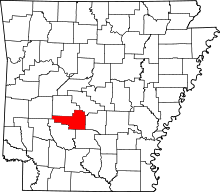 | |
| Towns | ||
| Census-designated place | ||
| Unincorporated communities |
| |
| Townships |
| |
| Ghost towns |
| |
This article is issued from
Wikipedia.
The text is licensed under Creative Commons - Attribution - Sharealike.
Additional terms may apply for the media files.