National Register of Historic Places listings in Columbus, Ohio

Location of Columbus in Ohio
There are 333 properties and districts listed on the National Register of Historic Places in Franklin County, Ohio, including 3 National Historic Landmarks. The city of Columbus is the location of 160 of these properties and districts, including all of the National Historic Landmarks; they are listed here, while the remaining properties and districts are listed separately. Another 2 properties were once listed but have been removed.
Latitude and longitude coordinates are provided for many National Register properties and districts; these locations may be seen together in an online map.[1]
- This National Park Service list is complete through NPS recent listings posted October 11, 2018.[2]
Current listings
| [3] | Name on the Register[4] | Image | Date listed[5] | Location | Description |
|---|---|---|---|---|---|
| 1 | American Insurance Union Citadel |  |
March 21, 1975 (#75001398) |
34 and 50 W. Broad St. 39°57′44″N 83°00′07″W / 39.962222°N 83.001944°W |
Now known as the LeVeque Tower and Palace Theatre |
| 2 | Athletic Club of Columbus | 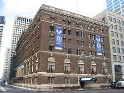 |
September 29, 2011 (#11000711) |
136 E. Broad St. 39°57′46″N 82°59′49″W / 39.962778°N 82.996944°W |
|
| 3 | Berry Brothers Bolt Works | 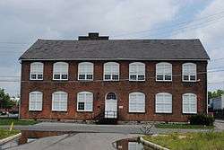 |
February 19, 1988 (#88000051) |
350 E. 1st Ave. 39°58′50″N 82°59′42″W / 39.980556°N 82.995°W |
|
| 4 | Richard Berry, Jr., House | 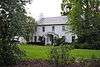 |
July 27, 2005 (#05000754) |
324 E. North Broadway 40°01′54″N 83°00′24″W / 40.031667°N 83.006667°W |
|
| 5 | Born Capital Brewery Bottling Works | 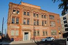 |
June 18, 2009 (#09000442) |
570 S. Front St. 39°57′01″N 83°00′00″W / 39.950183°N 82.999867°W |
|
| 6 | Bradford Shoe Company Building |  |
July 22, 1994 (#94000772) |
232 Neilston 39°58′04″N 82°59′41″W / 39.967778°N 82.994722°W |
|
| 7 | Broad Street Apartments |  |
December 16, 1986 (#86003404) |
880-886 E. Broad St. 39°57′54″N 82°58′38″W / 39.965°N 82.977222°W |
|
| 8 | Broad Street Christian Church |  |
December 16, 1986 (#86003448) |
1051 E. Broad St. 39°57′54″N 82°58′22″W / 39.965°N 82.972778°W |
|
| 9 | Broad Street United Methodist Church |  |
November 26, 1980 (#80002997) |
501 E. Broad St. 39°57′48″N 82°59′15″W / 39.963333°N 82.9875°W |
|
| 10 | Buckeye State Building and Loan Company Building | 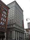 |
October 13, 2004 (#04001145) |
36-42 E. Gay St. 39°57′50″N 83°00′00″W / 39.964°N 83.0°W |
|
| 11 | Budd Dairy Company | _(32103922226).jpg) |
February 14, 2017 (#100000664) |
1086 N. 4th St. 39°59′07″N 82°59′56″W / 39.985278°N 82.998889°W |
|
| 12 | Cambridge Arms | 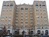 |
December 18, 2003 (#86003412) |
926 E. Broad St. 39°57′55″N 82°58′34″W / 39.965278°N 82.976111°W |
Was briefly listed on the Register in 1986, but was removed in 1987 due to owner objection. |
| 13 | Camp Chase Site | 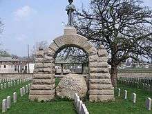 |
April 11, 1973 (#73001434) |
2900 Sullivant Ave. 39°56′38″N 83°04′33″W / 39.943889°N 83.075833°W |
|
| 14 | Campbell Mound | 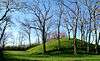 |
November 10, 1970 (#70000490) |
McKinley Ave. 39°59′24″N 83°04′51″W / 39.99°N 83.080833°W |
|
| 15 | Central Assurance Company | 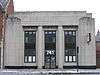 |
December 19, 1986 (#86003421) |
741 E. Broad St. 39°57′51″N 82°58′52″W / 39.964167°N 82.981111°W |
|
| 16 | Central Building of the Columbus Young Men's Christian Association | 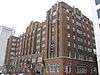 |
May 6, 1993 (#93000402) |
40 W. Long St. 39°57′54″N 83°00′09″W / 39.965°N 83.0025°W |
|
| 17 | Central High School | 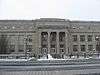 |
March 7, 1985 (#85000484) |
75 S. Washington Boulevard 39°57′35″N 83°00′23″W / 39.959722°N 83.006389°W |
Now houses COSI (Center of Science & Industry) |
| 18 | Central Ohio Lunatic Asylum |  |
April 24, 1986 (#86000851) |
1960 W. Broad St. 39°57′30″N 83°03′20″W / 39.958333°N 83.055556°W |
Dwmolished in 1991 |
| 19 | Coe Mound | 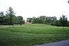 |
July 18, 1974 (#74001486) |
West of High Street[6] 40°01′30″N 83°01′16″W / 40.025000°N 83.021111°W |
|
| 20 | Truman and Sylvia Bull Coe House | 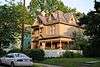 |
May 10, 2006 (#06000361) |
75 E. Lakeview Ave. 40°01′37″N 83°00′43″W / 40.026944°N 83.011944°W |
|
| 21 | Columbia Building | 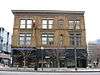 |
August 12, 1983 (#83001967) |
161-167 N. High St. 39°57′57″N 83°00′06″W / 39.965833°N 83.001667°W |
|
| 22 | Columbus Country Club Mound | 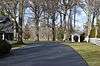 |
February 15, 1974 (#74001487) |
4831 E. Broad St.[6] 39°58′09″N 82°51′41″W / 39.969167°N 82.861389°W |
|
| 23 | Columbus Gallery of Fine Arts | 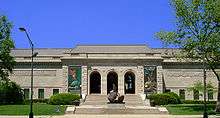 |
March 19, 1992 (#92000173) |
480 E. Broad St. 39°57′51″N 82°59′16″W / 39.964167°N 82.987778°W |
|
| 24 | Columbus Near East Side District | %2C_Columbus%2C_Franklin_County%2C_OH_HABS_OHIO%2C25-COLB%2C15-2.tif.jpg) |
May 19, 1978 (#78002063) |
Roughly bounded by Parsons Ave., Broad and Main Sts., and the railroad tracks; also 43-125 Parsons Ave., including 684 Oak St. and 690 Franklin Ave. 39°57′43″N 82°57′53″W / 39.961944°N 82.964722°W |
Second set of addresses represents a boundary increase of December 9, 1983, the Columbus Near East Side Historic District-Parsons Avenue |
| 25 | Columbus Savings and Trust Building | 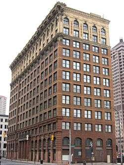 |
September 15, 1977 (#77001060) |
8 E. Long St. 39°57′55″N 83°00′03″W / 39.965278°N 83.000833°W |
|
| 26 | Columbus Transfer Company Warehouse | 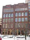 |
February 24, 1983 (#83001966) |
55 Nationwide Boulevard 39°58′08″N 83°00′00″W / 39.968889°N 83.000000°W |
|
| 27 | Anson Davis House | 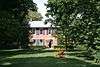 |
July 7, 1975 (#75001402) |
4900 Hayden Run Rd. 40°03′57″N 83°07′23″W / 40.065833°N 83.123056°W |
|
| 28 | Anson Davis Springhouse |  |
April 11, 1979 (#79002907) |
4900 Hayden Run Rd. 40°03′57″N 83°07′23″W / 40.065972°N 83.123056°W |
|
| 29 | Del Monte Apartments |  |
December 13, 2016 (#16000846) |
341-345 S. 3rd St. 39°57′19″N 82°59′49″W / 39.955272°N 82.996944°W |
|
| 30 | Elam Drake House |  |
April 6, 1978 (#78002064) |
2738 Ole Country Lane 40°00′15″N 82°55′15″W / 40.004167°N 82.920833°W |
|
| 31 | East Broad Street Commercial Building |  |
December 16, 1986 (#86003424) |
747, 749, and 751 E. Broad St. 39°57′51″N 82°58′51″W / 39.964167°N 82.980833°W |
|
| 32 | East Broad Street Historic District |  |
March 17, 1987 (#86003393) |
Along E. Broad St. between Monypenny and Ohio Aves. 39°58′01″N 82°57′39″W / 39.966944°N 82.960833°W |
|
| 33 | East Broad Street Presbyterian Church | 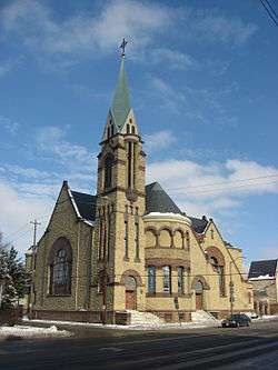 |
March 17, 1987 (#86003397) |
760 E. Broad St. 39°57′53″N 82°58′48″W / 39.964722°N 82.98°W |
|
| 34 | East North Broadway Historic District | 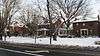 |
July 8, 2010 (#10000454) |
E. North Broadway roughly between Broadway Place and N. Broadway Lane 40°01′53″N 83°00′25″W / 40.031389°N 83.006944°W |
|
| 35 | East Town Street Historic District | 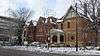 |
July 30, 1976 (#76001425) |
Roughly bounded by Grant and Franklin Aves., Lester Dr., and E. Rich St. 39°57′34″N 82°59′16″W / 39.959444°N 82.987778°W |
|
| 36 | The Edna | 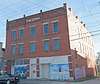 |
February 21, 2017 (#100000665) |
877-881 E. Long St. 39°58′03″N 82°58′40″W / 39.967500°N 82.977778°W |
|
| 37 | Engine House No. 6 | 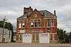 |
September 2, 2016 (#16000595) |
540 W. Broad St. 39°57′38″N 83°00′52″W / 39.960550°N 83.014450°W |
|
| 38 | Engine House No. 16 | 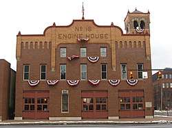 |
May 11, 1995 (#95000580) |
260 N. 4th St. 39°58′06″N 82°59′49″W / 39.968333°N 82.996944°W |
|
| 39 | Felton School | 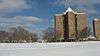 |
May 31, 1984 (#84003677) |
Leonard Ave. at N. Monroe St. 39°58′32″N 82°58′42″W / 39.975556°N 82.978333°W |
Demolished |
| 40 | Fifth Avenue and North High Historic District | 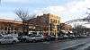 |
April 19, 1990 (#90000584) |
N. High St. roughly between 4th Ave. and Clark Pl. 39°59′13″N 83°00′18″W / 39.986944°N 83.005°W |
|
| 41 | Fort Hayes |  |
January 26, 1970 (#70000491) |
Columbus Ave. and Interstate 71 39°58′26″N 82°59′18″W / 39.973889°N 82.988333°W |
|
| 42 | Franklin Park Conservatory | 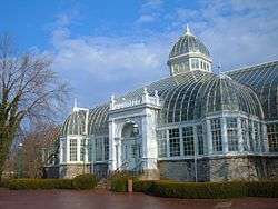 |
January 18, 1974 (#74001489) |
1547 E. Broad St. 39°57′57″N 82°57′11″W / 39.965833°N 82.953056°W |
|
| 43 | Franklin Park Medical Center |  |
November 4, 2016 (#16000754) |
1829 E. Long St. 39°58′07″N 82°57′08″W / 39.968713°N 82.952321°W |
|
| 44 | Franklinton Apartments at Broad and Hawkes |  |
April 22, 2005 (#05000028) |
949-957 W. Broad St., 13-23 Hawkes Ave. 39°57′32″N 83°01′34″W / 39.958889°N 83.026111°W |
|
| 45 | Franklinton Apartments at State and May | 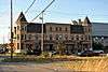 |
April 22, 2005 (#05000027) |
494-504 State St., 74-82 S. May Ave. 39°57′31″N 83°00′50″W / 39.958611°N 83.013889°W |
|
| 46 | Franklinton Post Office | 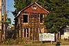 |
March 20, 1973 (#73001435) |
72 S. Gift St. 39°57′34″N 83°00′56″W / 39.959444°N 83.015556°W |
|
| 47 | Gaetz Music House | 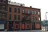 |
December 3, 2014 (#14000995) |
49-53 W. Long St. 39°57′52″N 83°00′10″W / 39.964583°N 83.002778°W |
|
| 48 | Garfield-Broad Apartments | 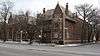 |
December 16, 1986 (#86003427) |
775 E. Broad St. 39°57′53″N 82°58′41″W / 39.964722°N 82.978056°W |
|
| 49 | German Village | 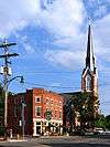 |
December 30, 1974 (#74001490) |
Roughly bounded by Livingston Ave., Pear Alley, Nursery Lane, Blackberry Alley, and Lathrop St.; also Briggs between E. Beck and Sycamore, S. 9th between E. Blenkner and Sycamore 39°56′45″N 82°59′34″W / 39.945833°N 82.992778°W |
Second set of boundaries represents a boundary increase of November 28, 1980 |
| 50 | Glen Echo Historic District | 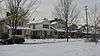 |
October 24, 1997 (#97001241) |
Roughly bounded by Glen Echo Ravine, the former Big Four railroad tracks, Indianola Ave., and Hudson St. 40°01′01″N 82°59′59″W / 40.016944°N 82.999722°W |
|
| 51 | H.C. Godman Co. Building | June 14, 2018 (#100002552) |
35 N 4th St. 39°57′49″N 82°59′47″W / 39.9636°N 82.9964°W |
||
| 52 | A.B. Graham House | 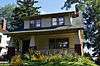 |
June 5, 2015 (#15000323) |
159 Clinton Heights Ave. 40°01′48″N 83°00′39″W / 40.030000°N 83.010833°W |
|
| 53 | Great Southern Hotel and Theatre | 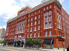 |
December 2, 1982 (#82001458) |
S. High and E. Main Sts. 39°57′21″N 82°59′57″W / 39.955833°N 82.999167°W |
|
| 54 | Griswold Memorial Young Women's Christian Association | 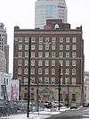 |
July 22, 1993 (#93000671) |
65 S. 4th St. 39°57′39″N 82°59′47″W / 39.960833°N 82.996389°W |
|
| 55 | Gilbert H. Hamilton House | 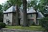 |
December 16, 1992 (#89000175) |
290 Cliffside Dr. 40°01′08″N 83°00′16″W / 40.018750°N 83.004444°W |
|
| 56 | Hamilton Park Historic District | 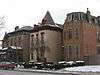 |
July 28, 1983 (#83001968) |
Broad and Long Sts. 39°57′57″N 82°58′53″W / 39.965833°N 82.981389°W |
|
| 57 | The Hamlet | 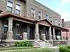 |
February 23, 2015 (#15000040) |
138-166 E. 5th and 1193-1195 Hamlet Sts. 39°59′15″N 83°00′03″W / 39.987500°N 83.000833°W |
|
| 58 | Hanford Village George Washington Carver Addition Historic District |  |
December 24, 2013 (#13000980) |
1918-1939 and 2012-2030 Kent and 783-879 Lyman Sts., 822-1958 Clay Ct., 851-853 Bowman Ave., and Hanford Park 39°57′02″N 82°56′46″W / 39.950556°N 82.946111°W |
|
| 59 | Hanna House |  |
April 19, 1979 (#79001835) |
1021 E. Broad St. 39°57′54″N 82°58′24″W / 39.965°N 82.973403°W |
|
| 60 | Gen. William Henry Harrison Headquarters |  |
December 15, 1972 (#72001010) |
570 W. Broad St. 39°57′38″N 83°00′57″W / 39.960556°N 83.015944°W |
|
| 61 | Hartley Mound |  |
July 15, 1974 (#74001491) |
Between Gibbstone Dr. and Edelmarr Ln., east of Wilson Rd.[7] 39°58′55″N 83°06′08″W / 39.981944°N 83.102222°W |
|
| 62 | Hartman Hotel | September 4, 2018 (#100002877) |
275 S 4th & 150 E Main Sts. 39°57′24″N 82°59′43″W / 39.9567°N 82.9952°W |
||
| 63 | Hartman Stock Farm Historic District |  |
October 9, 1974 (#74001492) |
South of downtown Columbus on U.S. Route 23 39°51′24″N 83°00′08″W / 39.856667°N 83.002222°W |
|
| 64 | Hayden Building |  |
June 11, 2009 (#09000412) |
20 E. Broad St. 39°57′45″N 83°00′00″W / 39.962558°N 82.999950°W |
|
| 65 | Heyne-Zimmerman House |  |
March 17, 1987 (#86003450) |
973 E. Broad St. 39°57′53″N 82°58′28″W / 39.964722°N 82.974444°W |
|
| 66 | H.A. Higgins Building |  |
August 27, 1979 (#79001836) |
129 E. Naghten St 39°58′07″N 82°59′53″W / 39.968611°N 82.998056°W |
|
| 67 | High and Gay Streets Historic District | 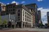 |
March 4, 2014 (#14000041) |
Bounded by Gay, Wall, and High Sts., and Pearl, Lynn, and Elm Alleys 39°57′48″N 83°00′03″W / 39.963333°N 83.000833°W |
|
| 68 | Holy Cross Church, Rectory and School | 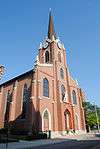 |
April 26, 1979 (#79001837) |
212 S. 5th St. 39°57′29″N 82°59′35″W / 39.958056°N 82.993056°W |
|
| 69 | House at 753 East Broad Street | 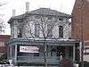 |
December 17, 1986 (#86003425) |
753 E. Broad St. 39°57′51″N 82°58′50″W / 39.964167°N 82.980556°W |
|
| 70 | Indianola Junior High School | 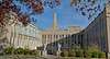 |
June 30, 1980 (#80003000) |
420 E. 19th Ave. 40°00′14″N 82°59′50″W / 40.0038°N 82.9971°W |
|
| 71 | Iuka Ravine Historic District |  |
May 8, 1986 (#86001023) |
Roughly bounded by E. Lane and E. Northwood., N. 4th, 20th and E. 19th, and Indianola Aves. 40°00′18″N 83°00′06″W / 40.005°N 83.001667°W |
|
| 72 | Felix A. Jacobs House |  |
December 19, 1986 (#86003434) |
1421 Hamlet St. 39°59′40″N 83°00′02″W / 39.994444°N 83.000556°W |
|
| 73 | Jaeger Machine Company Office Building |  |
June 16, 1983 (#83001969) |
550 W. Spring St. 39°58′00″N 83°01′00″W / 39.966667°N 83.016667°W |
|
| 74 | Jefferson Avenue Historic District |  |
December 2, 1982 (#82001459) |
Roughly bounded by Interstate 71, E. Broad, 11th, and Long Sts. 39°57′56″N 82°59′06″W / 39.965556°N 82.985°W |
|
| 75 | Jeffrey Manufacturing Company Office Building |  |
April 12, 2001 (#01000379) |
224 E. 1st Ave., 883 and 895 N. 6th St. 39°58′51″N 82°59′52″W / 39.980833°N 82.997778°W |
|
| 76 | Johnson-Campbell House |  |
December 17, 1986 (#86003414) |
1203 E. Broad St. 39°57′56″N 82°58′07″W / 39.965556°N 82.968611°W |
|
| 77 | W.H. Jones Mansion |  |
October 2, 1978 (#78002065) |
731 E. Broad St. 39°57′51″N 82°58′51″W / 39.964167°N 82.980833°W |
|
| 78 | Joseph-Cherrington House |  |
December 17, 1986 (#86003429) |
785 E. Broad St. 39°57′51″N 82°58′47″W / 39.964167°N 82.979722°W |
|
| 79 | Julian and Kokenge Company |  |
December 12, 2013 (#13000936) |
280 S. Front St. 39°57′22″N 83°00′03″W / 39.956111°N 83.000833°W |
|
| 80 | Linus B. Kauffman House |  |
December 17, 1986 (#86003410) |
906 E. Broad St. 39°57′54″N 82°58′36″W / 39.965°N 82.976667°W |
|
| 81 | Frank J. Kaufman House |  |
December 17, 1986 (#86003420) |
1231 E. Broad St. 39°57′57″N 82°58′05″W / 39.965833°N 82.968056°W |
|
| 82 | Krumm House |  |
September 30, 1982 (#82003568) |
975-979 S. High St. 39°56′32″N 82°59′50″W / 39.942222°N 82.997222°W |
|
| 83 | Samuel Landes House |  |
May 8, 1987 (#87000688) |
590 Hibbs Rd. 39°50′09″N 83°00′48″W / 39.835833°N 83.013333°W |
Vacant lot where house was |
| 84 | Soloman Levy House |  |
December 17, 1986 (#86003437) |
929 E. Broad St. 39°57′52″N 82°58′34″W / 39.964444°N 82.976111°W |
|
| 85 | Lincoln Theatre | 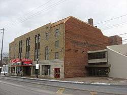 |
October 8, 1992 (#92001355) |
77 E. Long St. 39°58′01″N 82°58′52″W / 39.966944°N 82.981111°W |
|
| 86 | Long and Third Commercial Building | 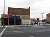 |
July 1, 1982 (#82003569) |
104-114 E. Long St. 39°57′55″N 82°59′58″W / 39.965278°N 82.999444°W |
|
| 87 | Carrie Lovejoy House | 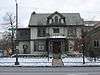 |
December 17, 1986 (#86003435) |
807 E. Broad St. 39°57′51″N 82°58′45″W / 39.964167°N 82.979167°W |
|
| 88 | The Lubal Manufacturing and Distributing Company | 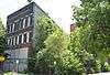 |
July 19, 2016 (#16000459) |
373-375 W. Rich St. 39°57′23″N 83°00′36″W / 39.956345°N 83.009928°W |
|
| 89 | Masonic Temple | 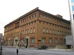 |
February 27, 1997 (#97000201) |
34 N. 4th St. 39°57′49″N 82°59′48″W / 39.963611°N 82.996667°W |
|
| 90 | McDannald Homestead |  |
February 17, 1978 (#78002066) |
Northeast of downtown Columbus at 5847 Sunbury Rd. 40°04′41″N 82°53′49″W / 40.078194°N 82.896944°W |
Demolished in 1994[8] |
| 91 | Frederick A. Miller House-Broad Gables |  |
August 8, 1985 (#85001689) |
2065 Barton Pl. and 140 Park Dr. 39°57′55″N 82°56′41″W / 39.965278°N 82.944722°W |
|
| 92 | C.E. Morris House | 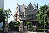 |
December 17, 1986 (#86003398) |
875 E. Broad St. 39°57′53″N 82°58′38″W / 39.964722°N 82.977222°W |
|
| 93 | Municipal Light Plant | 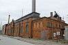 |
December 15, 2015 (#15000902) |
555 W. Nationwide Boulevard 39°58′01″N 83°01′07″W / 39.966944°N 83.018611°W |
|
| 94 | Near Northside Historic District |  |
June 4, 1980 (#80003001) |
Off State Route 315 39°59′05″N 83°00′45″W / 39.984722°N 83.012500°W |
|
| 95 | New Hayden Building |  |
June 11, 2009 (#09000413) |
16 E. Broad St. 39°57′45″N 83°00′01″W / 39.962539°N 83.000181°W |
|
| 96 | New Indianola Historic District | %2C_Columbus%2C_Franklin_County%2C_OH_HABS_OHIO%2C25-COLB%2C53-1.tif.jpg) |
April 30, 1985 (#85000947) |
Roughly bounded by Chittenden and Grant Aves., 5th St., 7th Ave., and 4th St. 39°59′42″N 82°59′52″W / 39.995000°N 82.997778°W |
|
| 97 | Jonathan Noble House |  |
December 3, 1975 (#75001400) |
5030 Westerville Rd. (State Route 3) 40°04′29″N 82°55′42″W / 40.074722°N 82.928333°W |
|
| 98 | North Columbus Commercial Historic District |  |
October 14, 2010 (#10000828) |
Roughly centered on N. High St. between Hudson and Dodridge 40°00′56″N 83°00′42″W / 40.015556°N 83.011667°W |
|
| 99 | North High School | 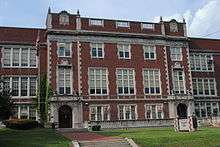 |
July 2, 1987 (#87000984) |
100 Arcadia Ave. 40°01′05″N 83°00′31″W / 40.018056°N 83.008611°W |
|
| 100 | North Market Historic District | 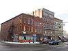 |
December 30, 1982 (#82001460) |
Roughly bounded by W. Goodale, Park, High, Front and Vine Sts. 39°58′18″N 83°00′13″W / 39.971667°N 83.003611°W |
|
| 101 | Ohio Asylum for the Blind | 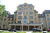 |
July 26, 1973 (#73001436) |
240 Parsons Ave. 39°57′33″N 82°58′52″W / 39.959167°N 82.981111°W |
|
| 102 | Ohio Farm Bureau Federation Offices | 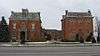 |
March 13, 1987 (#87000466) |
620 and 630 E. Broad St. 39°57′51″N 82°59′04″W / 39.964167°N 82.984444°W |
|
| 103 | Ohio Finance Building | 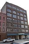 |
December 2, 2014 (#14000994) |
39-47 W. Long St. 39°57′52″N 83°00′09″W / 39.964583°N 83.002500°W |
|
| 104 | Ohio Institution for the Education of the Deaf and Dumb |  |
October 25, 1984 (#84000107) |
408 E. Town St. 39°57′38″N 82°59′20″W / 39.960556°N 82.988889°W |
|
| 105 | Ohio Moline Plow Company Building | 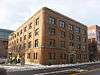 |
June 10, 1999 (#99000701) |
343 Front St. 39°58′09″N 83°00′15″W / 39.969167°N 83.004167°W |
|
| 106 | Ohio National Bank | 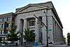 |
November 26, 1980 (#80003002) |
167 S. High St. 39°57′30″N 82°59′59″W / 39.958333°N 82.999722°W |
|
| 107 | Ohio Stadium | 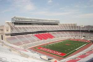 |
March 22, 1974 (#74001494) |
404 W. 17th Ave. 40°00′06″N 83°01′11″W / 40.001639°N 83.01975°W |
|
| 108 | Ohio State Arsenal | 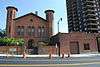 |
July 18, 1974 (#74001495) |
139 W. Main St. 39°57′19″N 83°00′11″W / 39.955278°N 83.003056°W |
|
| 109 | Ohio State Office Building | 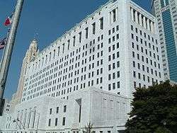 |
December 18, 1990 (#90001908) |
65 S. Front St. 39°57′37″N 82°59′55″W / 39.960278°N 82.998611°W |
Now known as the Thomas J. Moyer Ohio Judicial Center. |
| 110 | Ohio Statehouse | 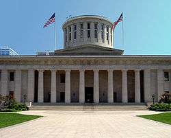 |
July 31, 1972 (#72001011) |
Southeastern corner of High and Broad Sts. 39°57′40″N 83°00′00″W / 39.961111°N 83.0°W |
|
| 111 | Ohio Theatre | 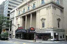 |
April 11, 1973 (#73001437) |
39 E. State St. 39°57′35″N 82°59′58″W / 39.959722°N 82.999444°W |
|
| 112 | Old Beechwold Historic District | 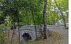 |
September 22, 1987 (#87001146) |
Roughly bounded by W. Jeffrey Pl., N. High, River Park Dr., and Olentangy Boulevard 40°03′37″N 83°01′24″W / 40.060278°N 83.023333°W |
|
| 113 | Old Governor's Mansion | 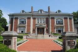 |
June 5, 1972 (#72001012) |
1234 E. Broad St. 39°57′59″N 82°57′23″W / 39.966389°N 82.956389°W |
|
| 114 | Old North End Historic District | 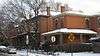 |
August 30, 1996 (#96000964) |
Roughly bounded by Interstate 670, Pearl St., E. 2nd Ave., and N. 4th St.; also roughly bounded by W. 1st and E. 2nd Ave., N. Pearl St., E. 5th Ave., Summit St., and Beacon Alley 39°58′44″N 83°00′03″W / 39.978889°N 83.000833°W |
Second set of boundaries represents a boundary increase of June 10, 1999 |
| 115 | Old Ohio Union | 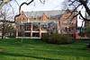 |
April 20, 1979 (#79001838) |
154 W. 12th Ave. 39°59′49″N 83°00′42″W / 39.996944°N 83.011667°W |
Now Hale Hall at OSU |
| 116 | Old Port Columbus Airport Control Tower | 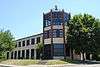 |
July 26, 1979 (#79001839) |
420 E. 5th Ave. 39°59′13″N 82°52′19″W / 39.986944°N 82.871944°W |
|
| 117 | Orton Memorial Laboratory | 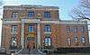 |
November 25, 1983 (#83004292) |
1445 Summit St. 39°59′32″N 83°00′07″W / 39.992222°N 83.001944°W |
Original building was built in 1929. Architect was Howard Dwight Smith. Neo-Classic revival with decorative ceramics. First wing added in 1956 (west wing). Second wing added in 1962 (east wing). |
| 118 | Elijah Pierce Properties | 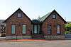 |
August 3, 1983 (#83001971) |
534 E. Long St. and 142-44 N. Everett Alley 39°58′00″N 82°59′12″W / 39.966667°N 82.986667°W |
|
| 119 | Plaza Hotel | 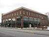 |
December 20, 1984 (#84001041) |
736-740 E. Long St. 39°58′02″N 82°58′54″W / 39.967222°N 82.981667°W |
|
| 120 | Frederick Prentiss House |  |
December 17, 1986 (#86003396) |
706 E. Broad St. 39°57′52″N 82°58′53″W / 39.964444°N 82.981389°W |
|
| 121 | Prentiss-Tulford House |  |
December 17, 1986 (#86003413) |
1074 E. Broad St. 39°57′58″N 82°58′19″W / 39.96614°N 82.97190°W |
|
| 122 | Pythian Temple and James Pythian Theater |  |
November 25, 1983 (#83004295) |
861-867 Mt. Vernon Ave. 39°58′16″N 82°58′44″W / 39.971111°N 82.978889°W |
|
| 123 | Rankin Building |  |
March 10, 1982 (#82003570) |
22 W. Gay St. 39°57′49″N 83°00′05″W / 39.963611°N 83.001389°W |
|
| 124 | Capt. Edward V. Rickenbacker House | .jpg) |
May 11, 1976 (#76001426) |
1334 E. Livingston Ave. 39°56′58″N 82°57′44″W / 39.949444°N 82.962222°W |
|
| 125 | St. Clair Hospital |  |
April 12, 2001 (#01000378) |
338-344 and 346 St. Clair Ave. 39°58′18″N 82°58′50″W / 39.971667°N 82.980556°W |
|
| 126 | Saint Paul's Episcopal Church |  |
December 17, 1986 (#86003430) |
787 E. Broad St. 39°57′51″N 82°58′46″W / 39.96425°N 82.979444°W |
|
| 127 | Schlee Brewery Historic District |  |
March 28, 1988 (#88000208) |
526, 543, 560, and rear 526 S. Front St., and the northeastern corner of Beck St. and Wall Alley 39°56′59″N 83°00′00″W / 39.949722°N 83.0°W |
|
| 128 | Schlee-Kemmler Building |  |
December 2, 1982 (#82001461) |
328 S. High St. 39°57′21″N 83°00′12″W / 39.955833°N 83.003333°W |
|
| 129 | Erwin W. Schueller House |  |
December 17, 1986 (#86003406) |
904 E. Broad St. 39°57′54″N 82°58′37″W / 39.965°N 82.976944°W |
|
| 130 | Scofield-Sanor House |  |
December 17, 1986 (#86003447) |
1031 E. Broad St. 39°57′54″N 82°58′23″W / 39.965°N 82.973056°W |
|
| 131 | Second Presbyterian Church |  |
January 11, 1983 (#83001972) |
132 S. 3rd St. 39°57′34″N 82°59′50″W / 39.959444°N 82.997222°W |
Now known as Central Presbyterian Church |
| 132 | Seneca Hotel |  |
December 29, 1983 (#83004300) |
361 E. Broad St. 39°57′46″N 82°59′27″W / 39.962778°N 82.990833°W |
|
| 133 | Sharp-Page House |  |
December 17, 1986 (#86003440) |
935 E. Broad St. 39°57′53″N 82°58′32″W / 39.96475°N 82.97565°W |
|
| 134 | Shedd-Dunn House |  |
December 17, 1986 (#86003445) |
965 E. Broad St. 39°57′54″N 82°58′28″W / 39.965°N 82.974444°W |
|
| 135 | Shiloh Baptist Church |  |
December 4, 2004 (#04001288) |
720 Mt. Vernon Ave. 39°58′13″N 82°58′55″W / 39.970278°N 82.981944°W |
|
| 136 | Short North Historic District |  |
April 19, 1990 (#90000583) |
N. High St. roughly between Poplar St. and Cedar Ave. 39°58′34″N 83°00′12″W / 39.976111°N 83.003333°W |
|
| 137 | Benjamin Smith House |  |
June 4, 1973 (#73001438) |
181 E. Broad St. 39°57′45″N 82°59′45″W / 39.962444°N 82.995889°W |
|
| 138 | South High School |  |
September 1, 2015 (#15000561) |
345 E. Deshler Ave. 39°56′25″N 82°59′13″W / 39.940278°N 82.986944°W |
Listing is for the old (1900) high school building, also known as the Charles S. Barrett Building. |
| 139 | South High Street Commercial Grouping |  |
December 29, 1983 (#83004301) |
Bounded by Pearl, Mound, Main, and High Sts. 39°57′20″N 82°59′56″W / 39.955556°N 82.998889°W |
|
| 140 | Stoddart Block |  |
March 17, 1994 (#94000237) |
260 S. 4th St. 39°57′27″N 82°59′42″W / 39.9575°N 82.995°W |
|
| 141 | Lucas Sullivant Building |  |
March 20, 1973 (#73001439) |
714 W. Gay St. 39°57′39″N 83°01′11″W / 39.960833°N 83.019722°W |
|
| 142 | Theresa Building |  |
June 8, 2015 (#15000324) |
823 E. Long St. 39°58′02″N 82°58′45″W / 39.967222°N 82.979167°W |
|
| 143 | Third Avenue and North High Historic District |  |
April 19, 1990 (#90000585) |
N. High St. in the vicinity of 2nd and 3rd 39°58′59″N 83°00′17″W / 39.983056°N 83.004722°W |
|
| 144 | James Thurber House |  |
November 8, 1979 (#79001840) |
77 Jefferson Ave. 39°57′58″N 82°59′06″W / 39.966111°N 82.985°W |
|
| 145 | Toledo and Ohio Central Railroad Station |  |
June 18, 1973 (#73001440) |
379 W. Broad St. 39°57′38″N 83°00′37″W / 39.960556°N 83.010278°W |
|
| 146 | Tosheff's Restaurant and Hotel |  |
March 2, 2001 (#01000197) |
1943-1953 Parsons Ave. 39°55′24″N 82°59′05″W / 39.923472°N 82.984722°W |
|
| 147 | Trinity Episcopal Church | 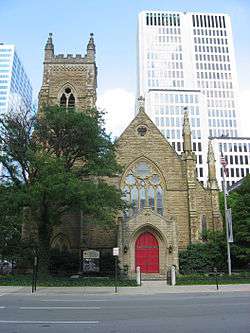 |
November 13, 1976 (#76001427) |
125 E. Broad St. 39°57′44″N 82°59′52″W / 39.962222°N 82.997778°W |
|
| 148 | Trinity German Evangelical Lutheran Church |  |
October 10, 1985 (#85003132) |
404 S. 3rd St. 39°57′15″N 82°59′47″W / 39.954167°N 82.996389°W |
|
| 149 | United States Carriage Company |  |
June 8, 2015 (#15000325) |
309-319 S. 4th St. 39°57′22″N 82°59′43″W / 39.956111°N 82.995278°W |
|
| 150 | U.S. Post Office and Courthouse |  |
April 11, 1973 (#73001441) |
121 E. State St. 39°57′36″N 82°59′50″W / 39.96°N 82.997222°W |
|
| 151 | United States Post Office and Courthouse |  |
June 6, 2012 (#12000330) |
85 Marconi Boulevard 39°57′50″N 83°00′18″W / 39.963889°N 83.005000°W |
|
| 152 | University, Hayes and Orton Halls |  |
July 16, 1970 (#70000492) |
The Oval on the Ohio State University campus 40°00′05″N 83°00′52″W / 40.001389°N 83.014444°W |
The original University Hall was demolished in 1971, and was removed from the overall National Register listing that year.[9][10] |
| 153 | Valley Dale Ballroom |  |
December 17, 1982 (#82001462) |
1590 Sunbury Rd. 40°00′08″N 82°56′14″W / 40.002222°N 82.937222°W |
|
| 154 | Welsbach Building |  |
November 27, 1984 (#84000444) |
116-118 E. Chestnut St. 39°58′06″N 82°59′55″W / 39.968333°N 82.998611°W |
|
| 155 | Welsh Presbyterian Church |  |
November 24, 1980 (#80003003) |
315 E. Long St. 39°57′56″N 82°59′33″W / 39.965556°N 82.9925°W |
|
| 156 | Westminster Church |  |
September 24, 2001 (#01001043) |
77 S. 6th St. 39°57′41″N 82°59′33″W / 39.961389°N 82.992500°W |
|
| 157 | Wyandotte Building |  |
February 23, 1972 (#72001013) |
21 W. Broad St. 39°57′43″N 83°00′05″W / 39.961944°N 83.001389°W |
|
| 158 | York Lodge No. 563 |  |
July 19, 1984 (#84003691) |
1276 N. High St. 39°59′18″N 83°00′20″W / 39.988333°N 83.005556°W |
|
| 159 | Yuster Building |  |
July 3, 2017 (#100001268) |
150 E. Broad St. 39°57′46″N 82°59′47″W / 39.962690°N 82.996499°W |
Also known as Empire Building |
| 160 | Zettler Grocery and Hardware |  |
June 27, 2014 (#14000354) |
268 S. 4th St. 39°57′26″N 82°59′42″W / 39.957222°N 82.995000°W |
Former listings
| [3] | Name on the Register | Image | Date listed | Date removed | Location | City or town | Summary |
|---|---|---|---|---|---|---|---|
| 1 | Peruna Drug Manufacturing Company Building |  |
Unavailable (#73002288) | 1974 | 115 E. Rich St. |
Demolished in 1973 | |
| 2 | Union Station Entrance | .JPG) |
Unavailable (#74002344) | 1999 | 348 N. High St. |
Demolished October 22, 1976 |
See also
| Wikimedia Commons has media related to National Register of Historic Places in Columbus, Ohio. |
References
- ↑ The latitude and longitude information provided in this table was derived originally from the National Register Information System, which has been found to be fairly accurate for about 99% of listings. For about 1% of NRIS original coordinates, experience has shown that one or both coordinates are typos or otherwise extremely far off; some corrections may have been made. A more subtle problem causes many locations to be off by up to 150 yards, depending on location in the country: most NRIS coordinates were derived from tracing out latitude and longitudes from USGS topographical quadrant maps created under the North American Datum of 1927, which differs from the current, highly accurate WGS84 GPS system used by most on-line maps. Chicago is about right, but NRIS longitudes in Washington are higher by about 4.5 seconds, and are lower by about 2.0 seconds in Maine. Latitudes differ by about 1.0 second in Florida. Some locations in this table may have been corrected to current GPS standards.
- ↑ "National Register of Historic Places: Weekly List Actions". National Park Service, United States Department of the Interior. Retrieved on October 11, 2018.
- 1 2 Numbers represent an ordering by significant words. Various colorings, defined here, differentiate National Historic Landmarks and historic districts from other NRHP buildings, structures, sites or objects.
- ↑ National Park Service (2008-04-24). "National Register Information System". National Register of Historic Places. National Park Service.
- ↑ The eight-digit number below each date is the number assigned to each location in the National Register Information System database, which can be viewed by clicking the number.
- 1 2 Location derived from its Federal Register notice; the NRIS lists the site as "Address Restricted"
- ↑ Hartley Mound and Camp Archaeological Site 33-FR-71. Columbus Metropolitan Library, 2010. Accessed 2011-07-10.
- ↑ "Marker #7-25 McDannald Pioneer Homestead". Remarkable Ohio. Ohio Historical Society. Retrieved May 29, 2011.
- ↑ OSU library archives
- ↑ 36 FR 23258


This article is issued from
Wikipedia.
The text is licensed under Creative Commons - Attribution - Sharealike.
Additional terms may apply for the media files.